Chinook
-
Posts
10,935 -
Joined
-
Last visited
Content Type
Profiles
Blogs
Forums
American Weather
Media Demo
Store
Gallery
Everything posted by Chinook
-
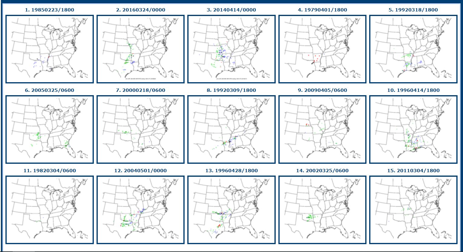
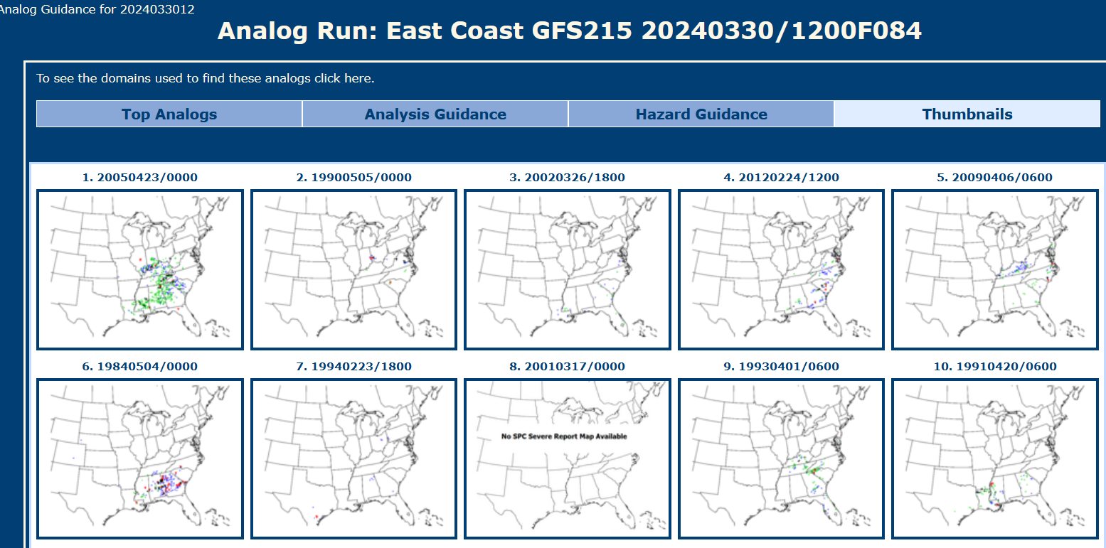
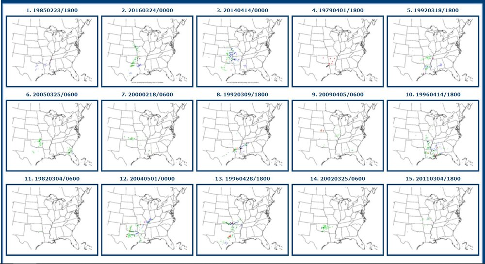
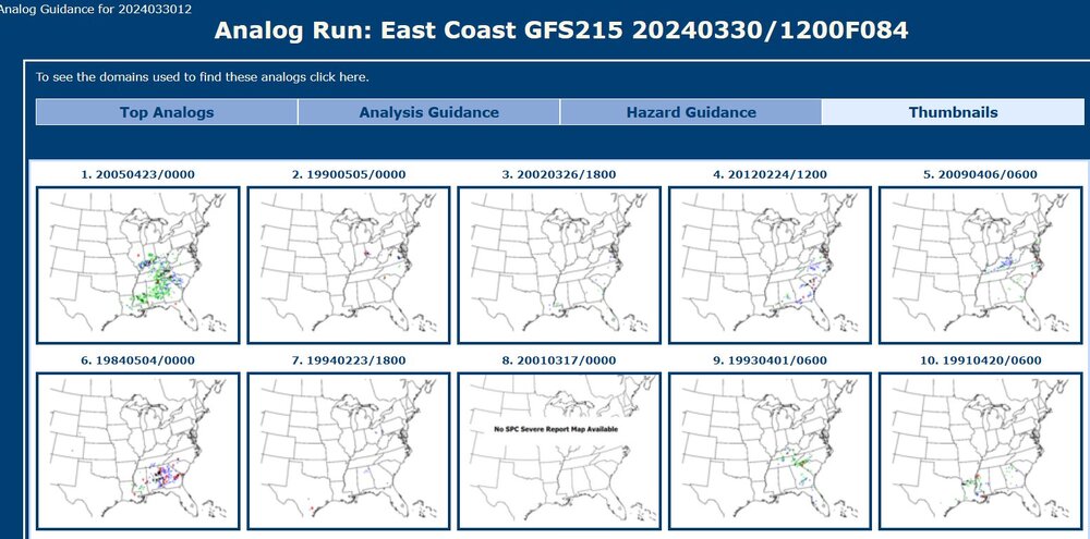
Top synoptic analogs vary greatly in severe weather coverage. Most analogs here have some severe weather reports in Arkansas. There are not necessarily a lot of tornado analogs. As for now, I am not sure what I might want to post with the models. Instability seems a bit low. 84-hours
-
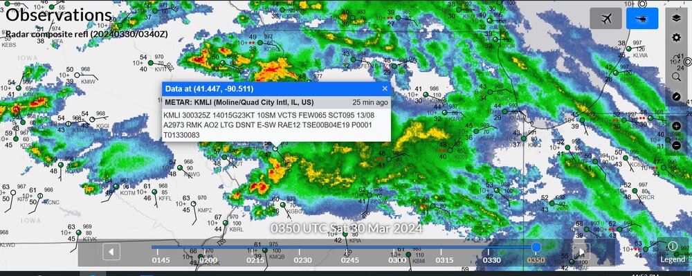
scattered thunderstorms in various areas near this warm front
-
thumbs down to this post
-
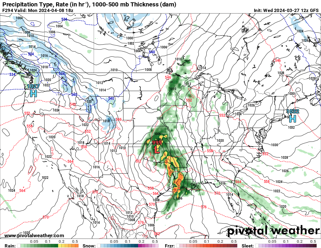
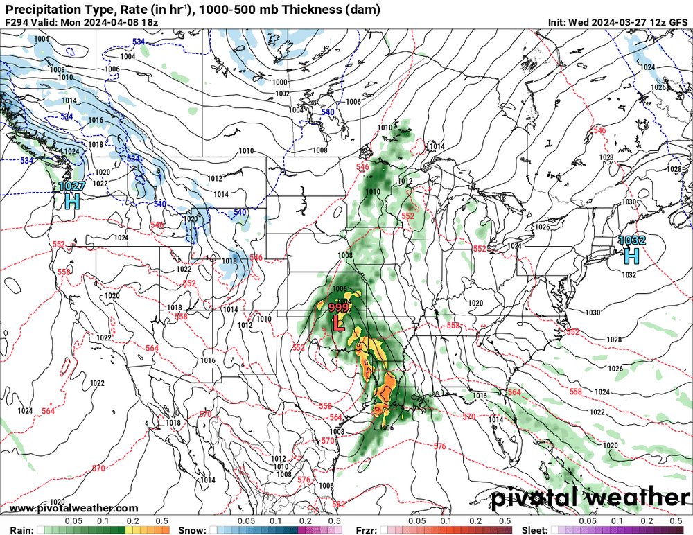
This is surely the 100% correct forecast for Monday, April 8th, the eclipse day. There seems to be a high chance of sunshine for the East, but a heavy storm for Texas and Arkansas. And when I say "surely," I mean the cloudiness forecast is absolutely uncertain at this point.
-
wasn't this supposed to be pretty insane for South Dakota into Minnesota? I absolutely remember a NWS graphic from Aberdeen that said 16"-23" for a border twn

-
maybe I will get like 4 seconds of 50mph wind

-
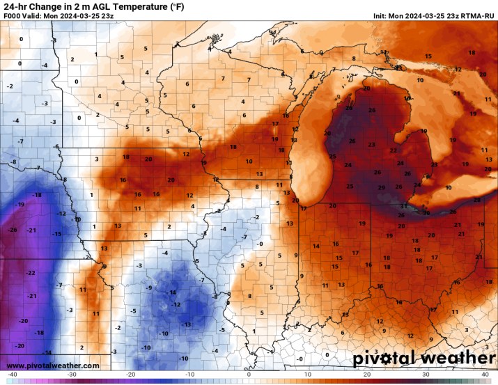
my area went from a high of 42 to a high of 71
-

Mountain West Discussion- cool season '23-24
Chinook replied to mayjawintastawm's topic in Central/Western States
looks like there was 4" in Loveland

-
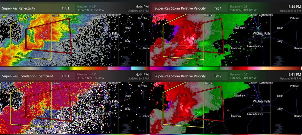
Here's a non-confirmed tornado warning that developed out of a pretty good supercell that's been going on near Wichita Falls TX
-
Mountain West Discussion- cool season '23-24
Chinook replied to mayjawintastawm's topic in Central/Western States
lightning near Denver -
There have been a couple of confirmed tornadoes today. One confirmed tornado right now is near Oakley Kansas. This is a pretty low-moisture situation today. Apparently even up to 1000 J/kg of surface based CAPE near this area in Kansas. I don't even really know if a lot of hail will happen today/tonight.
-
The Congrats Dendrite Deck Destroyer 3/23-3/25 obs discussion
Chinook replied to Ginx snewx's topic in New England
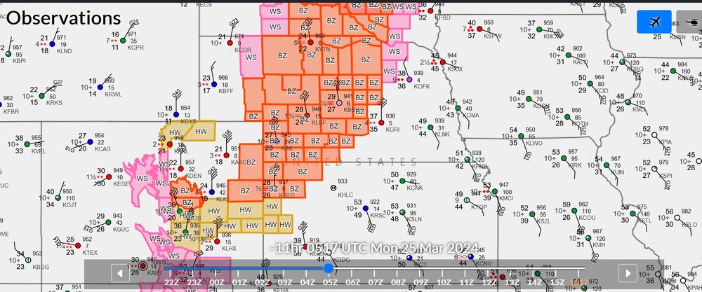
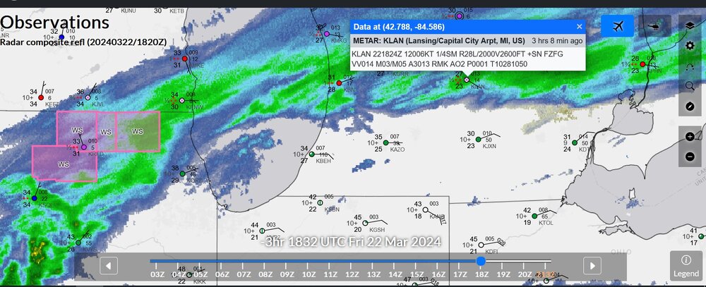
you can pretty much see the warm front with the buoy obs
-
Mountain West Discussion- cool season '23-24
Chinook replied to mayjawintastawm's topic in Central/Western States
Convection-allowing models have a rain/snow thunderstorm for you guys tomorrow
-
The Congrats Dendrite Deck Destroyer 3/23-3/25 obs discussion
Chinook replied to Ginx snewx's topic in New England
radar with a bunch of storm reports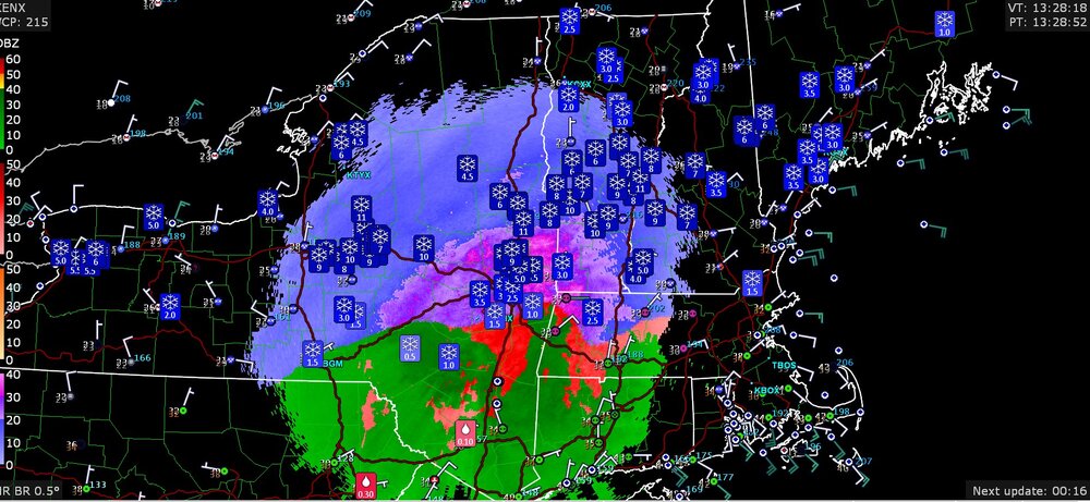
-
observations from the snow band earlier in the day
-
You know it's gotta be snowing if the SPC puts out a mesoscale discussion for snow (MSP to Wisconsin, right now)
-
Mountain West Discussion- cool season '23-24
Chinook replied to mayjawintastawm's topic in Central/Western States
classic look for Rockies and N Plains snow and S Plains severe (see day-4 outlook on the SPC)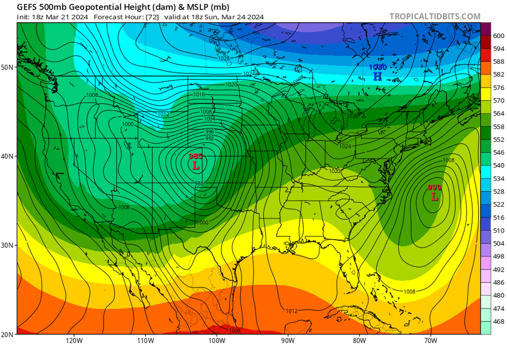
-
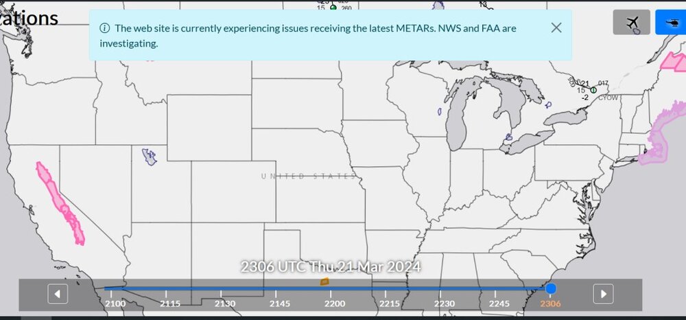
When there's a data outage of some sort at NCEP/NWS, I always tell myself that somebody tripped over the cord to the computer, and they didn't plug it back in for a few minutes. It seems like there used to be more times when the NAM/GFS were delayed. I guess nobody trips over those cords anymore.
-
Mountain West Discussion- cool season '23-24
Chinook replied to mayjawintastawm's topic in Central/Western States
The GFS and ECMWF both have 980mb in Colorado on Sunday, so that's some incredible agreement on that feature. Surely, there will be snow for a lot of high elevations, and there's a decent chance of 30mph winds the Front Range cities. I'm sure future models runs will have a better forecast for snow for the Front Range cities. -
METARs? What METARs?
-
Mountain West Discussion- cool season '23-24
Chinook replied to mayjawintastawm's topic in Central/Western States
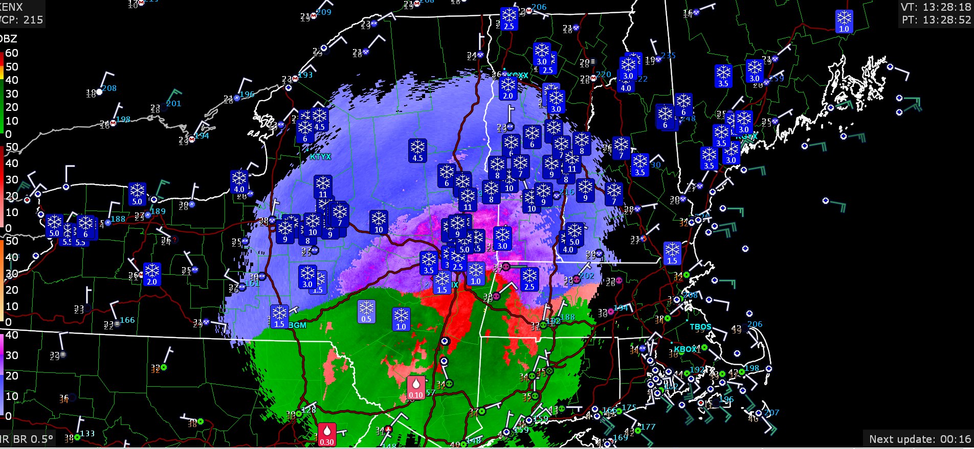
More loops https://great-lakes-salsite.web.app/Mar_13_16_2024_GFS_sfc_loop.html https://great-lakes-salsite.web.app/Mar_13_16_2024_satellite_loop.html https://great-lakes-salsite.web.app/Mar_13_16_2024_surface_loop.html https://great-lakes-salsite.web.app/Mar_13_16_2024_500mb_loop.html 06z when the snow started to go nuts for you guys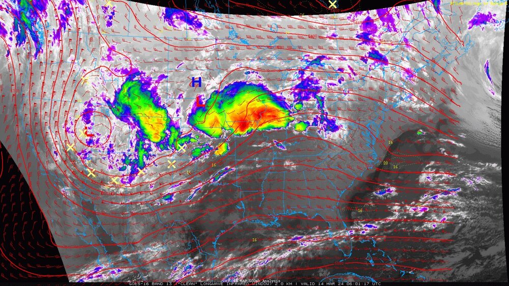
-
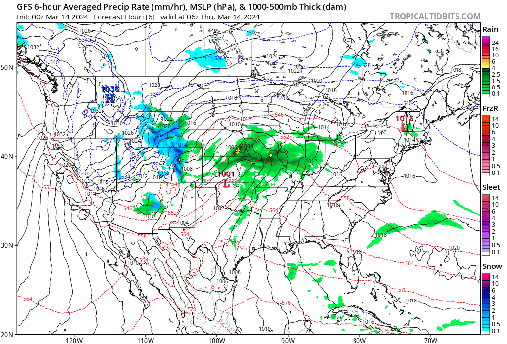
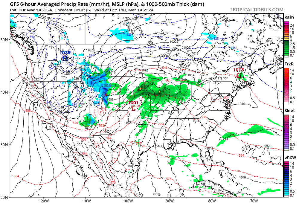
Here are my loops of the big storm system. The radar loop is for the snow in Denver. I knew this would be a big storm for Denver, so I started archiving maps. Then, a tornado almost hit my area! https://great-lakes-salsite.web.app/Mar_13_15_2024_radar_loop.html https://great-lakes-salsite.web.app/Mar_13_16_2024_surface_loop.html https://great-lakes-salsite.web.app/Mar_13_16_2024_satellite_loop.html https://great-lakes-salsite.web.app/Mar_13_16_2024_GFS_sfc_loop.html https://great-lakes-salsite.web.app/Mar_13_16_2024_500mb_loop.html
-
2024 Short/Medium Range Severe Weather Discussion
Chinook replied to Chicago Storm's topic in Lakes/Ohio Valley
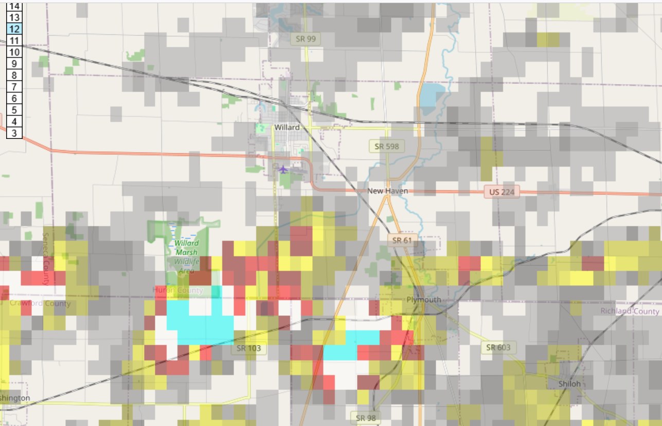
Maximum rotation at Willard/Plymouth/Plymouth Township lines up with the report that the EF-2 tornado was at Plymouth Township (Richland County/Crawford County)
-
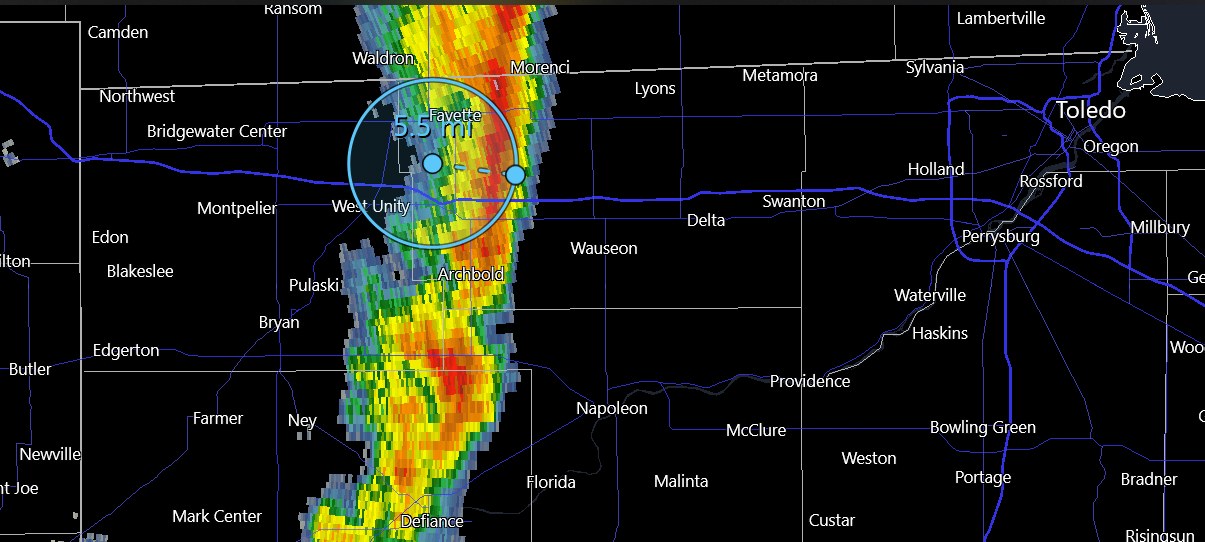
2024 Short/Medium Range Severe Weather Discussion
Chinook replied to Chicago Storm's topic in Lakes/Ohio Valley
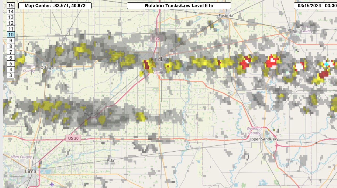
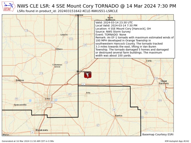
so the Hancock County tornado was southeast of Bluffton, rather than right next to Findlay or possibly towards Vanlue?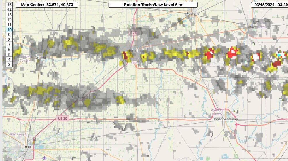
-
2024 Short/Medium Range Severe Weather Discussion
Chinook replied to Chicago Storm's topic in Lakes/Ohio Valley
My brother in law knows someone who was looking for survivors at Indian Lake. I got to see a few firsthand pictures of metal wrapped around trees and such.