Chinook
-
Posts
10,935 -
Joined
-
Last visited
Content Type
Profiles
Blogs
Forums
American Weather
Media Demo
Store
Gallery
Everything posted by Chinook
-
5"-6" of rain this month for central Indiana- central Ohio
-
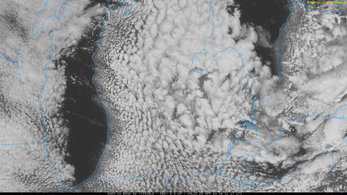
lake-effect stability

-
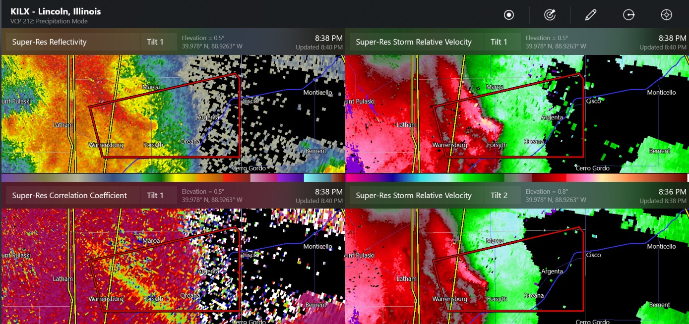
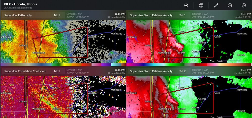
possible tornado south of Lincoln Illinois
-
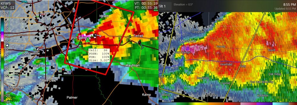
there have been multiple confirmed tornado warnings near and maybe in St Louis
-
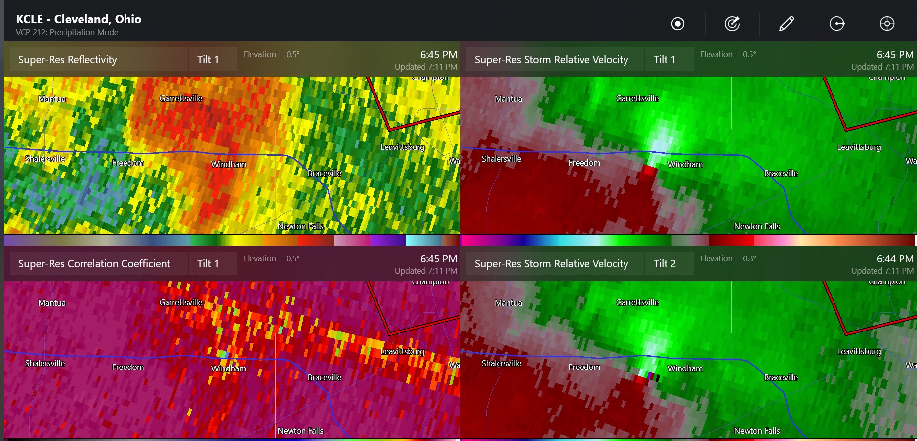
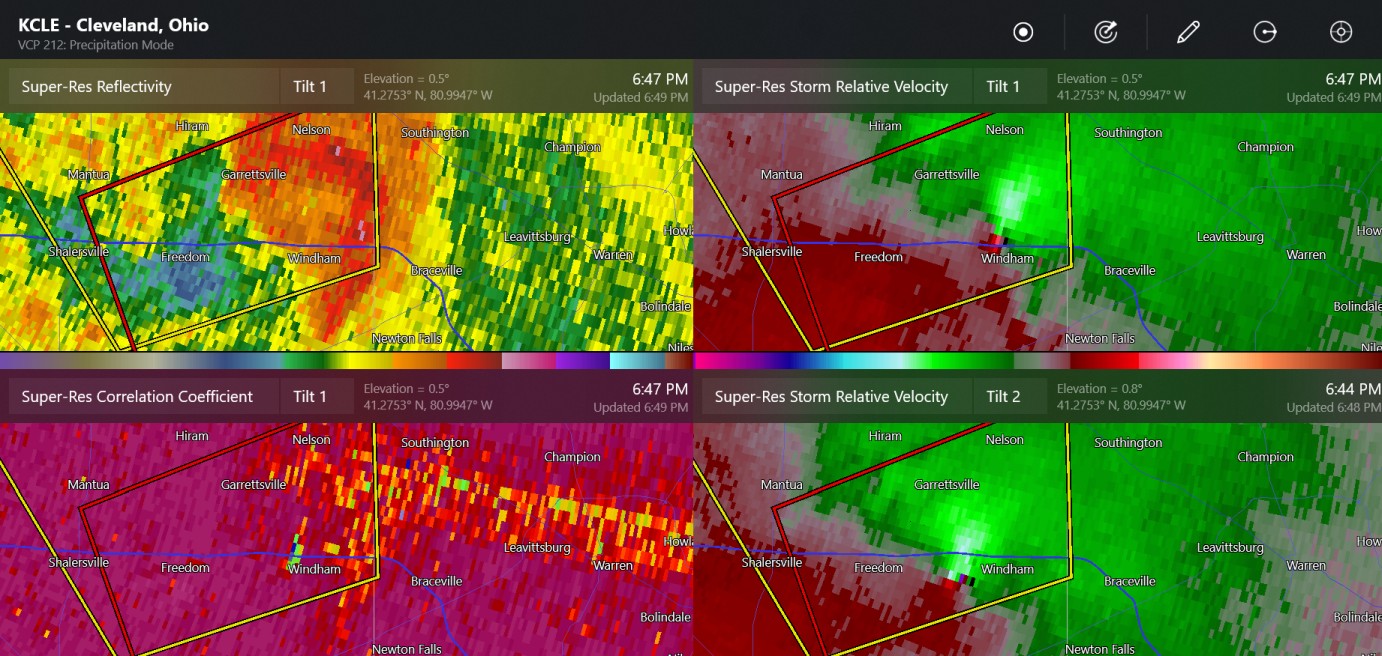
Windham Ohio, next to I-80 Marion Ohio


-
this is once again, close to my family (sort of)
-
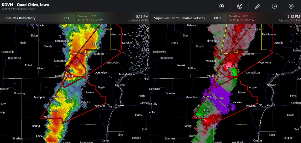
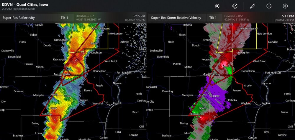
The storm chasers have seen the tornado lift, I believe, by New London Iowa but could produce a new one.
-
It's by Houghton and Salem Iowa
-
Iowa city tornado warning
-
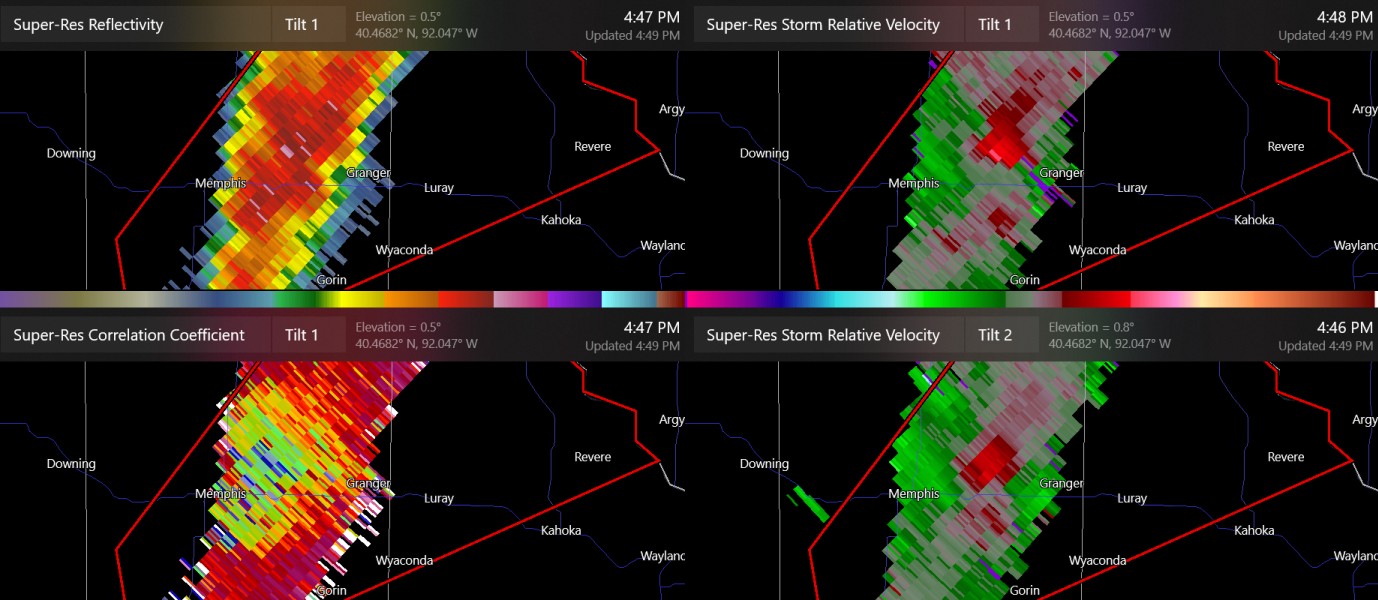
two non-confirmed tornado warnings in Iowa/Missouri (note: both storms are far from the radar)
-
this is kind of in the radar hole

-

2024 Short/Medium Range Severe Weather Discussion
Chinook replied to Chicago Storm's topic in Lakes/Ohio Valley
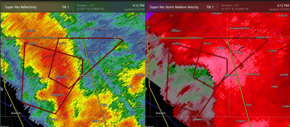
continuing tornado warning at Winthrop, Iowa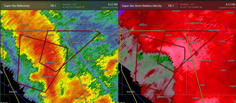
-
2024 Short/Medium Range Severe Weather Discussion
Chinook replied to Chicago Storm's topic in Lakes/Ohio Valley
We'll have to closely watch both convective lines for supercells and tornadoes, and wind gusts.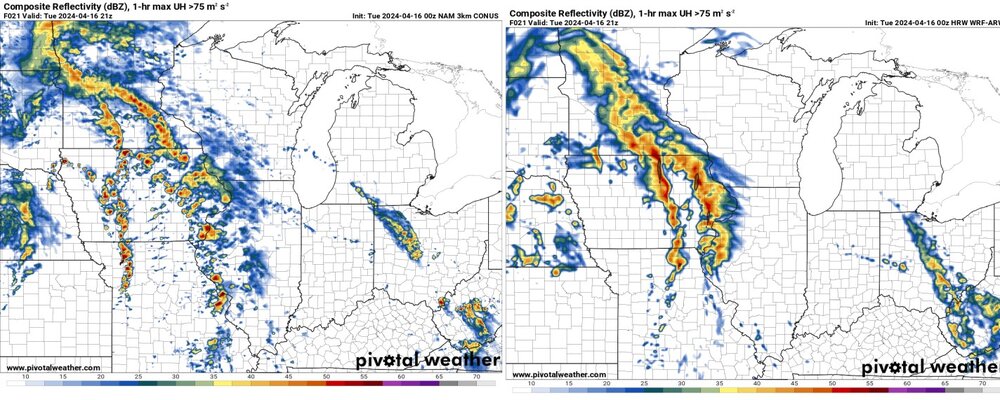
-
Sometimes the 2nd day of an expected 2-day tornado outbreak is much more interesting. Obviously we'll have storms going off in the Midwest tomorrow.
-
It's too capped in TX/OK.
-
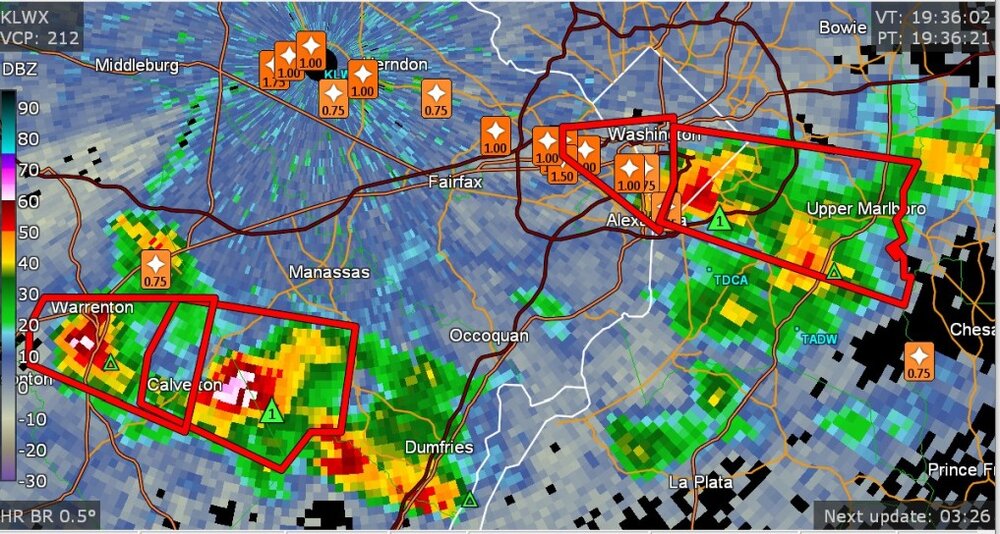
zoom in on severe (and sub-severe,) storm reports near Washington DC
- 1,696 replies
-
- 2
-

-
- severe
- thunderstorms
- (and 5 more)
-
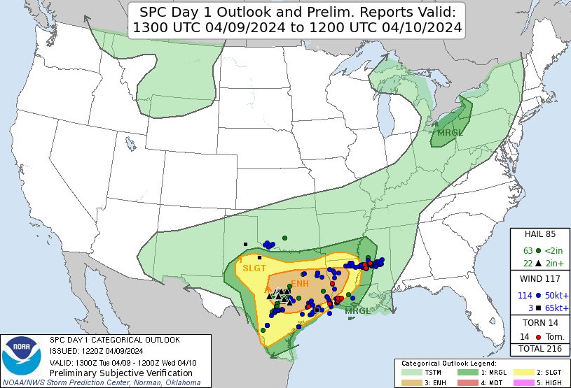
4/14/12 was 12 years ago. I'd say that was one of the biggest outbreaks since 2011.
-
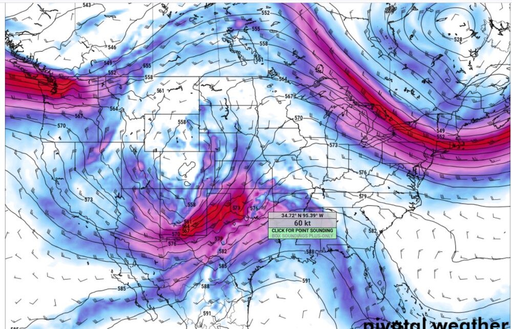
by the way: day-2 non-Midwest I didn't post much about the last few days because it was a messy system in Texas. Also note: nobody seems to care. Guess what. I'm not going to believe in a tornado outbreak until I see one. The SPC is overcooking everything. It looks like the GFS and ECMWF have a storm near Wichita Falls, Texas on Monday. 60 kt+ winds aloft where things could get going in Oklahoma on Monday night (03z)
-
dangerous tornado at Tampa
-
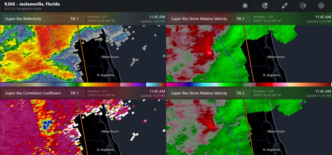
a tornado hit near the St. John's River and World Golf Village in northeast Florida

-
Non-confirmed tornado warning at the LA/TX border. It's next to Toledo Bend Reservoir, so it's near me, right?
-
There is a confirmed tornado warning near Jackson, MS. This area might be the middle of the tornado action tomorrow (Louisiana to Mississippi)
-
here it was
-
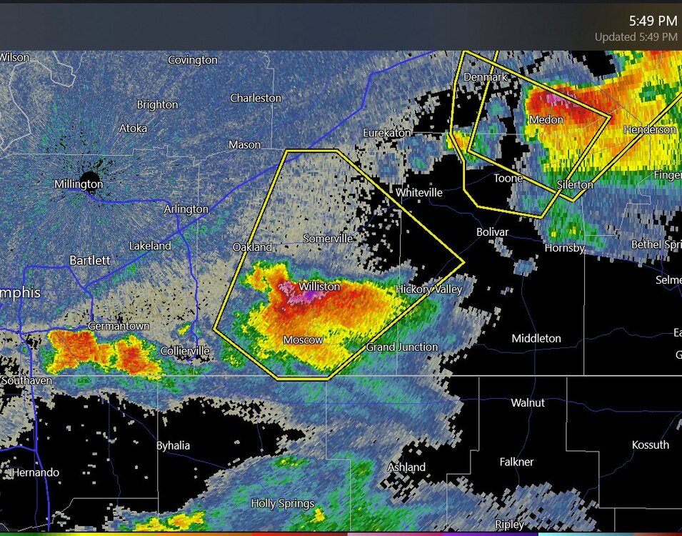
radar says this could be 4" hail near Memphis TN
-
The temperature dropped from 78 to 72 in northern Arkansas due to the lack of light, also, 82 to 77 at Little Rock