Chinook
-
Posts
10,935 -
Joined
-
Last visited
Content Type
Profiles
Blogs
Forums
American Weather
Media Demo
Store
Gallery
Everything posted by Chinook
-
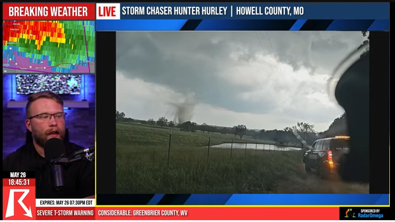
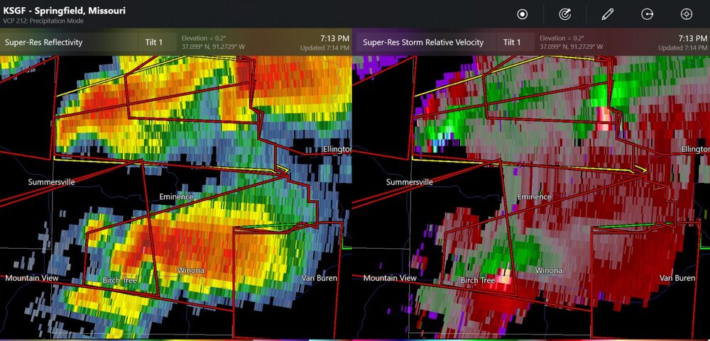
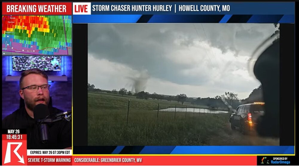
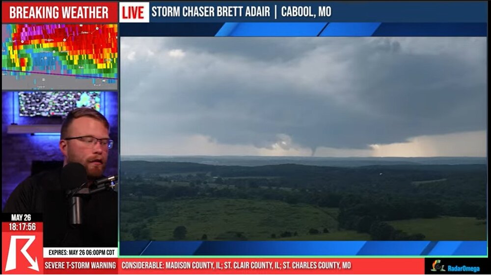
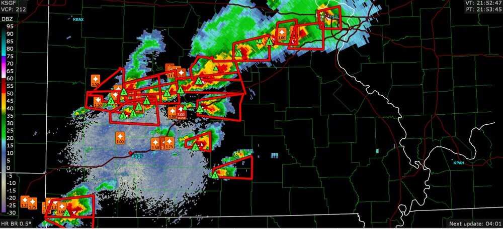
triple tornadoes possible in southern Missouri
-
tornado a few miles from St Louis
-
this started to do a lot more damage right when I made this screen capture (Mountain View Missouri)
-
incredible drone view of a tornado that just started near Houston Missouri
-
tornado warning including part of the St Louis metro area
-
there already have been a lot of 2"+ hail reports in Missouri in the last couple of hours
-
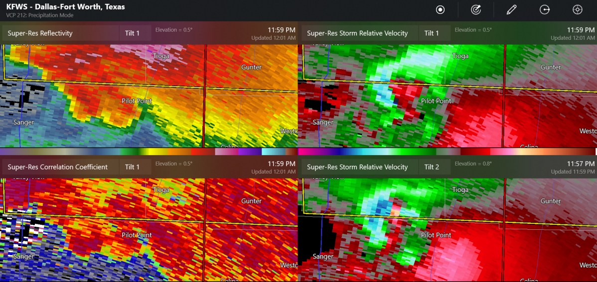
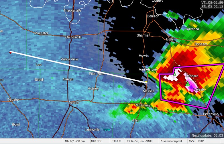
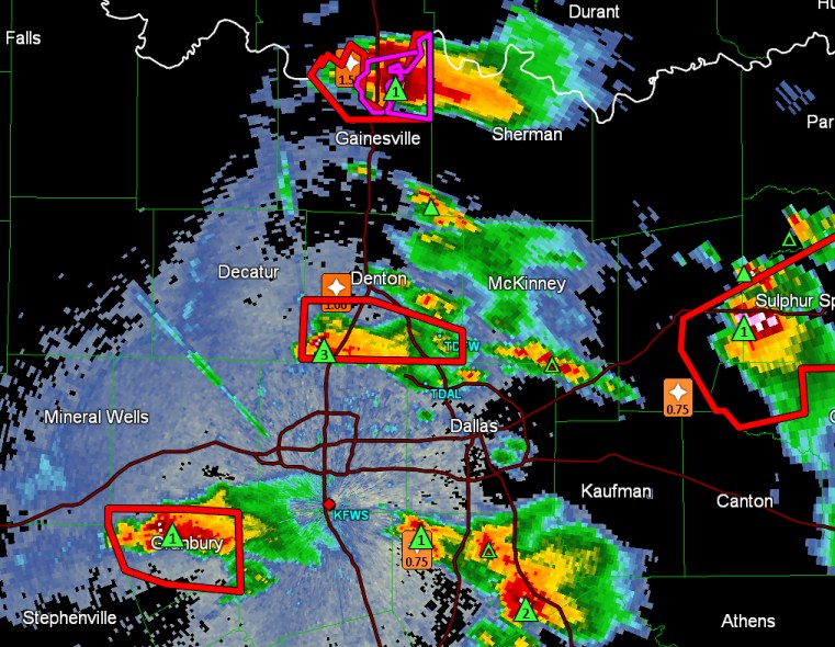
possibly up to a 60 mile long tornado track north of Dallas
-
Melissa, Texas- confirmed tornado, chasers see wedge on the ground
-
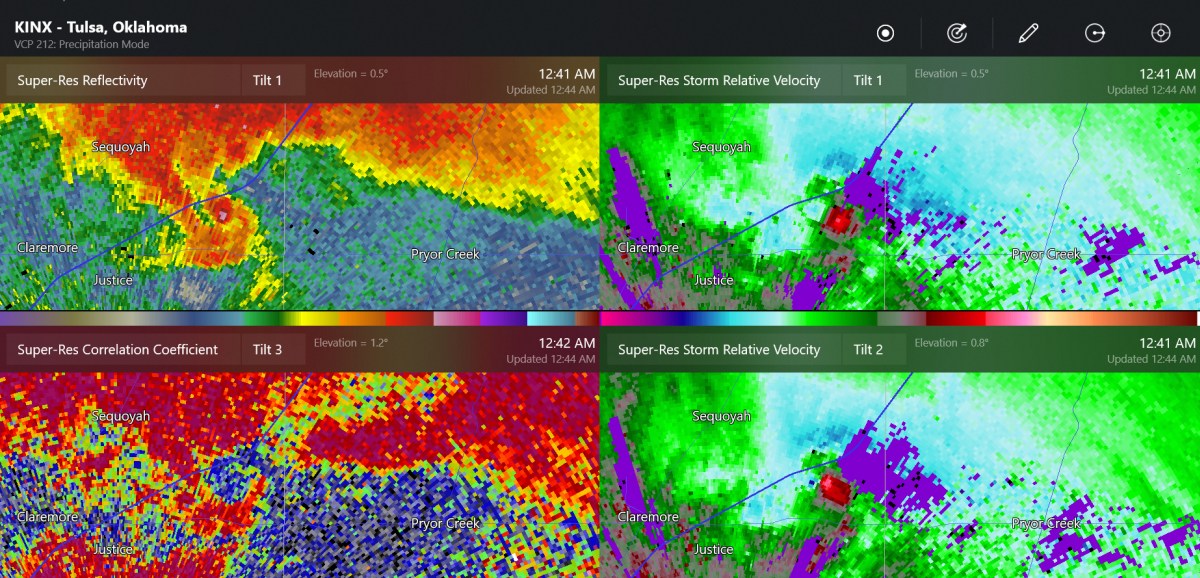
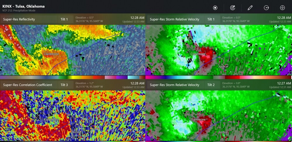
very large debris signature/debris ball

-
The TDS showed up the CC (tilt-3) since it was so close to the radar, just as it went into Claremore
-
storm chaser in Claremore saw power flashes (I think) right in front of his car
-
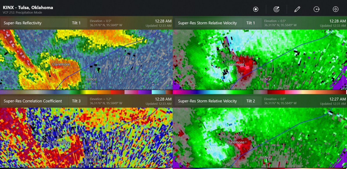
It was confirmed tornado warning at 10:48 (11:48Eastern). It's possible that a tornado tracked 35-37 miles but I don't know for sure.


-
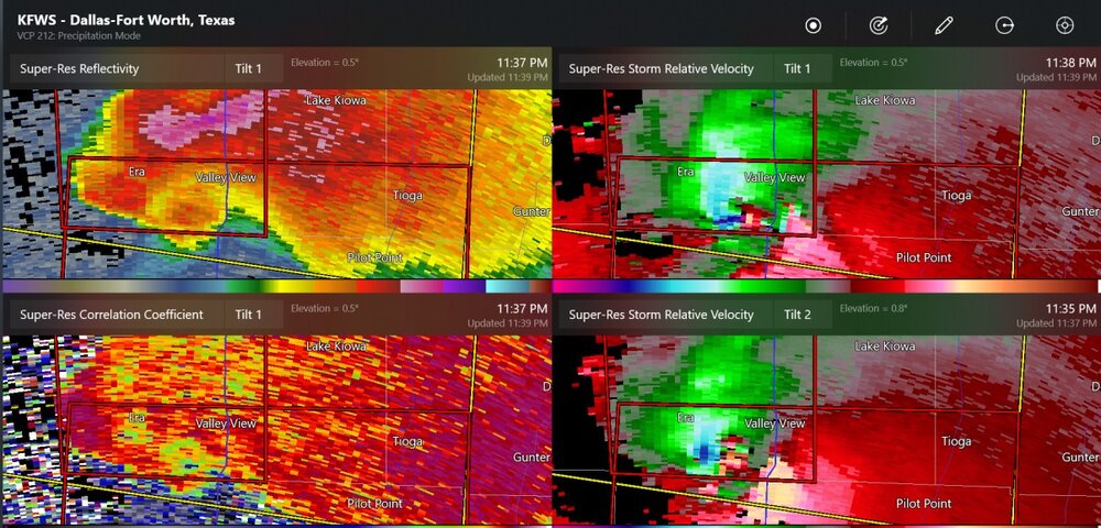
possible continuing tornado
-
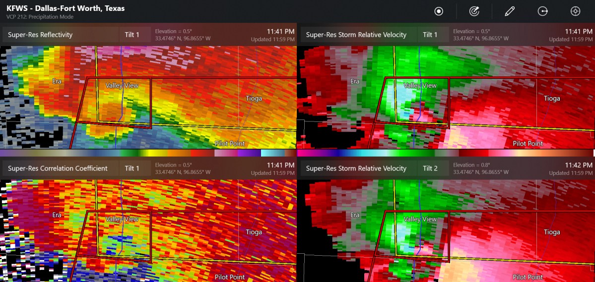
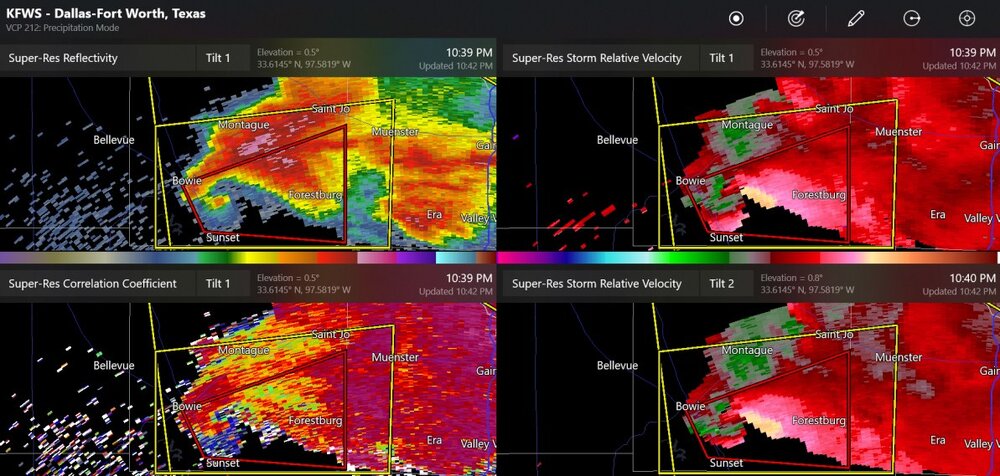
The possible tornado has moved SE of Forestburg. I think the velocity and correlation coefficient indicate it's a tornado. Unfortunately it is a bit far out from Fort Worth's radar and I have no other info from storm chasers and such.
-
Here's a non-confirmed tornado warning in North Texas, but not too close to Dallas/Fort Worth area.
-
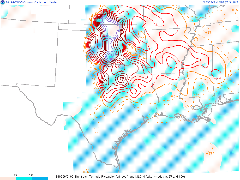
For those who love the indices, this is spectacular
-
I've partially given up on it. The tornado threat should have ramped up with the LLJ.
-
This is starting to seem somewhat like the high-risk day on Apr 27, as not too many of the tornadoes before sunset. (and that one busted in terms of concentrated tornado coverage)
-
Not a whole lot has happened with tornadoes/longer lasting tornadoes. There still could be a lot of tornado warnings to track. There was a confirmed tornado 6 miles north of Chester, Oklahoma. I believe there was a brief tornado(es) by Cross Plains, Texas a while back.
-
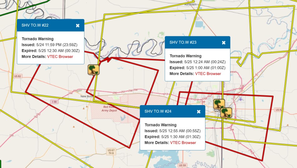
I have heard that this area around New Boston TX, along I-30, to near the Texarkana area had a tornado emergency! There has not been a tornado report on the SPC database.
-
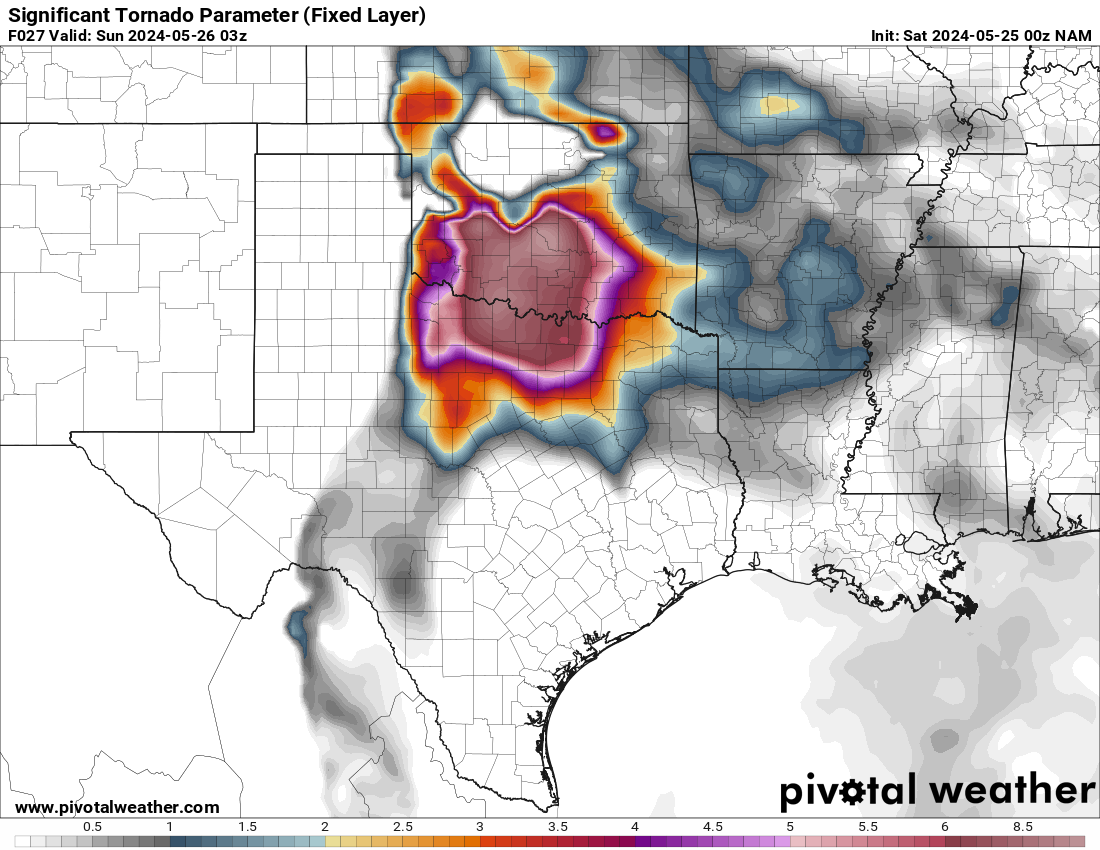
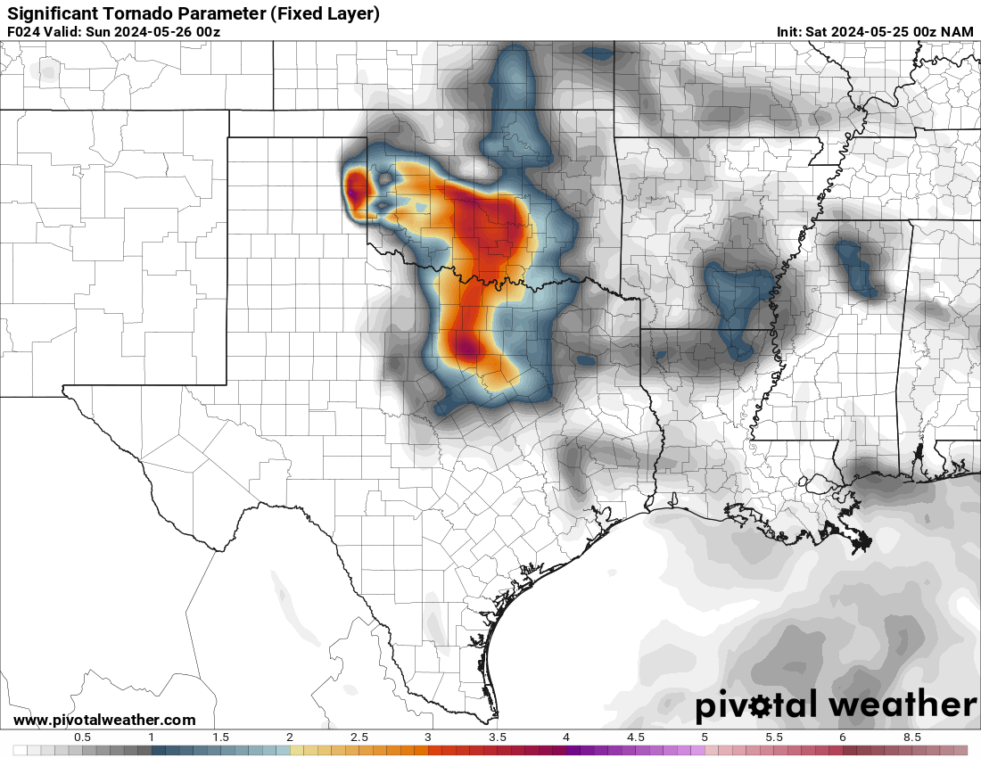
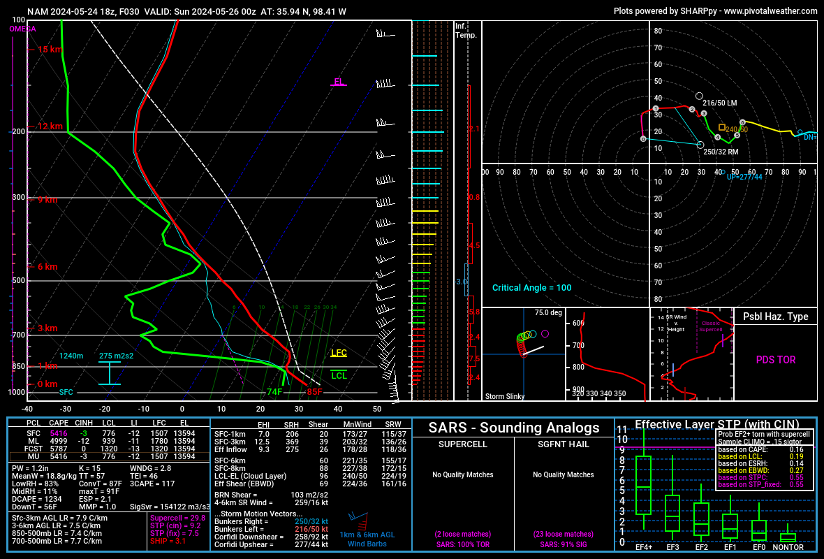
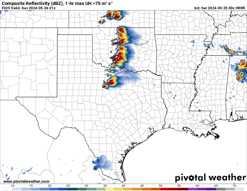
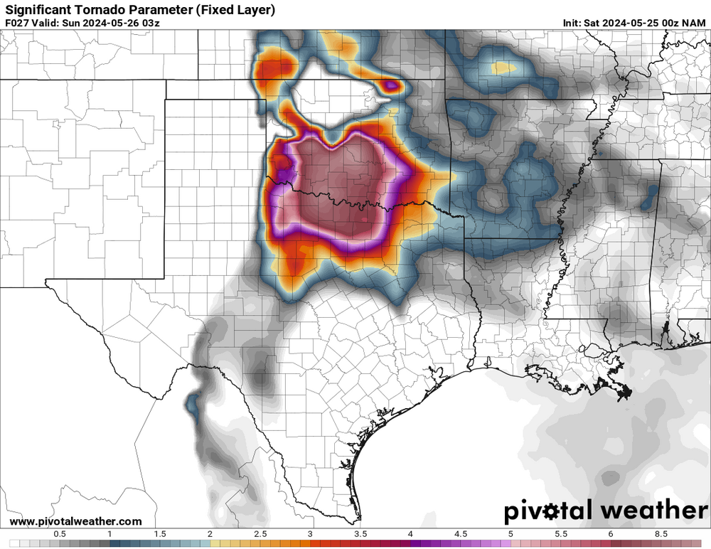
The 00z NAM 24-27 hour significant tornado parameter jumps way up in western-southern Oklahoma with the low-level jet. The higher STP values really shouldn't be confined to southern Oklahoma there. The 00z HRRR finally decides to put out dozens of storms in the warm sector! (Helping to confirm that the SPC is generally right). Other CAMs tonight keep a lot of the capping with not too many storms. I still don't believe those too much. I think the SPC will be right, with big hatched areas for tornadoes, wind, and hail (see the SPC's moderate risk discussion) this is the 18z NAM (12km) for west of Oklahoma City tomorrow

-
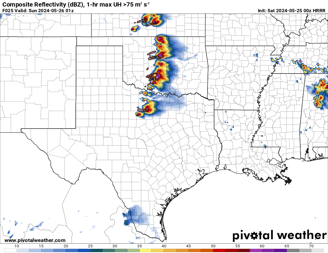
some more large hail around Dallas Fort Worth, with a tornado warning up there at the Red River
-
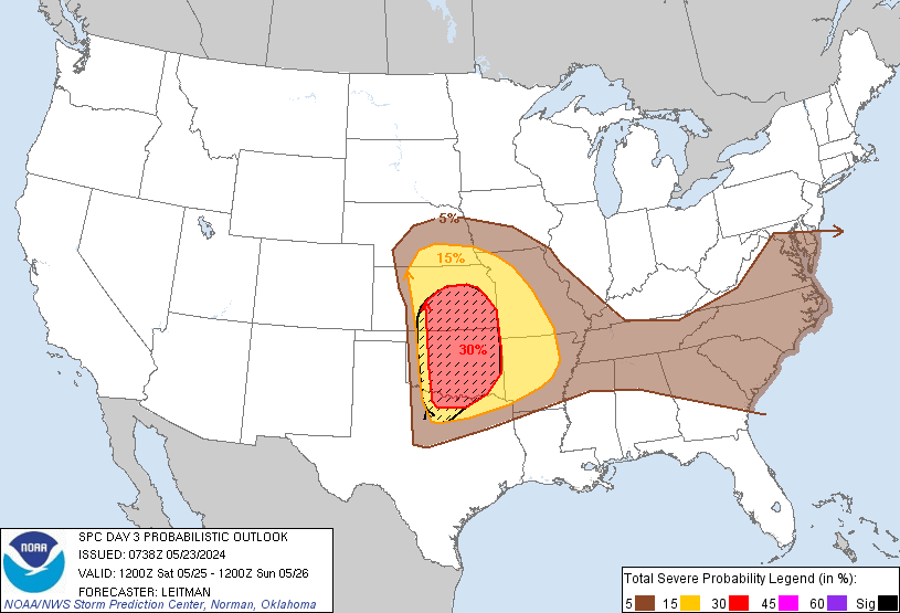
Day-3 outlook
-
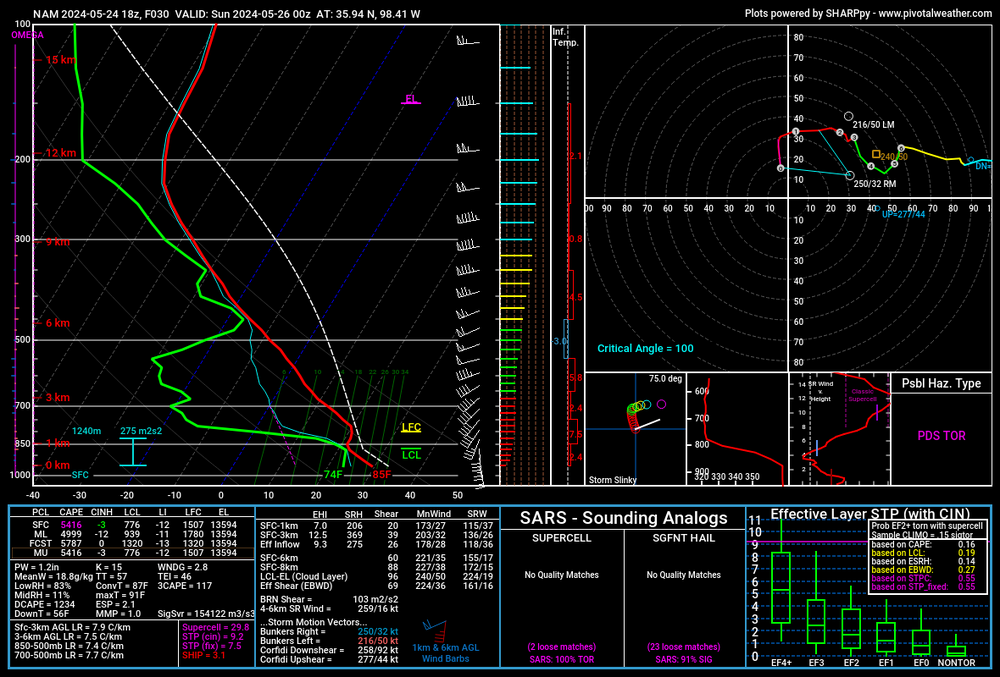
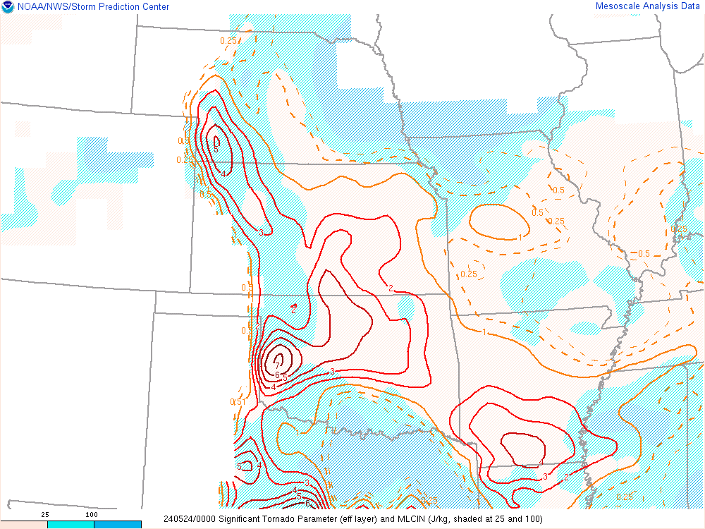
According to SPC mesoanalysis, the STP went way up, but maxed out just a little north of the storm.
-
the tornado has moved more north-northeast, going away from Olustee, possibly closer to Altus