Chinook
-
Posts
10,935 -
Joined
-
Last visited
Content Type
Profiles
Blogs
Forums
American Weather
Media Demo
Store
Gallery
Everything posted by Chinook
-

2024 Short/Medium Range Severe Weather Discussion
Chinook replied to Chicago Storm's topic in Lakes/Ohio Valley
interesting MCV -
There is a severe watch for scattered thunderstorms. There is already one strengthening storm in Denver.
-
2024 Short/Medium Range Severe Weather Discussion
Chinook replied to Chicago Storm's topic in Lakes/Ohio Valley
tornado warning that is by Cross Lake, or possibly well into the woods north of Brainerd MN -
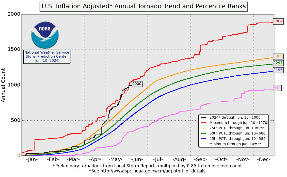
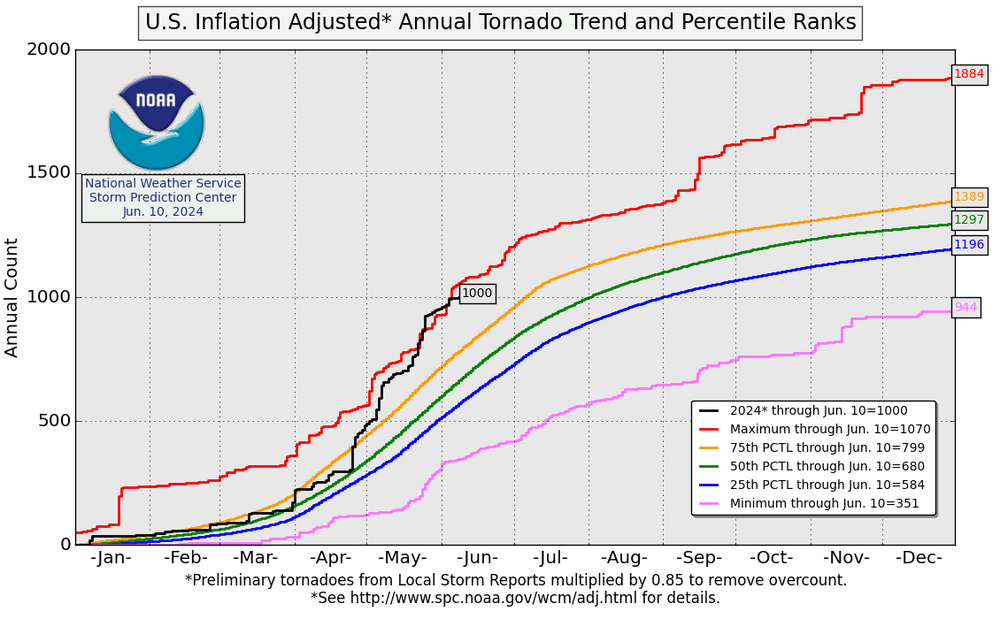
This so-called inflation-adjusted tornado count says that we have made it to 1000 tornadoes exactly after our active days of May
-
This is so nice. Maybe the temps are getting up to 50 there and melting snow fast?
-
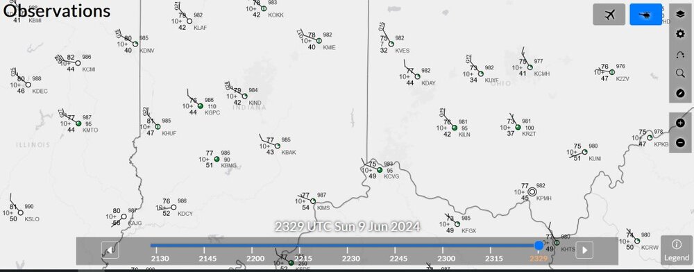
There are dew points in the low 40s down to Columbus and Indianapolis today. The climatological average dew point value for June (whole monthly average) is 59 at/north of I-70, and 63 in Louisville
-
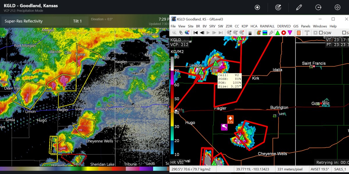
I've been kind of keeping track with it. You can probably say the Front Range is on drought-alert at some point Here's some cells that developed after the blob from earlier

-
There have been almost no storm reports in the Front Range cities this year, except for the hail you guys already discussed. That is going to change today, as slight/enhanced risk is in Colorado. Severe thunderstorm watch issued. Also notable, an area of dr&&&&t showed up on the US Dr&&&&t Monitor in Fort Collins, so obviously it has been too dry there. Otherwise, the D0 value unusual dryness is not too big.
-
did that rotation re-form northeast of Downtown?
-
2024 Short/Medium Range Severe Weather Discussion
Chinook replied to Chicago Storm's topic in Lakes/Ohio Valley
-
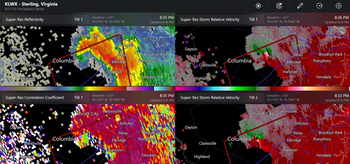
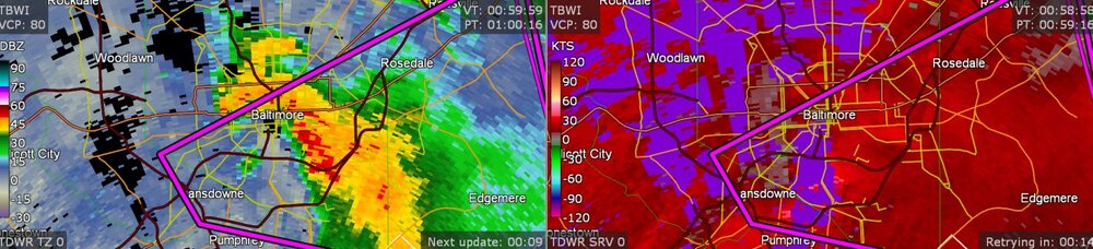
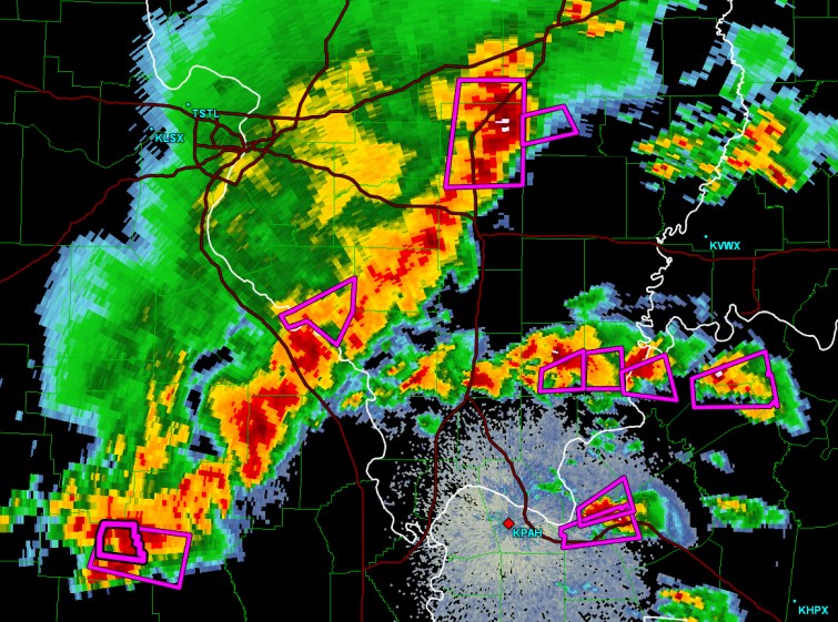
Hi-res Baltimore radar
- 1,696 replies
-
- 1
-

-
- severe
- thunderstorms
- (and 5 more)
-
rotation continuing towards Lansdowne, near Baltimore
-
not sure if this is a new tornado over Columbia or if it's just a rotation

-
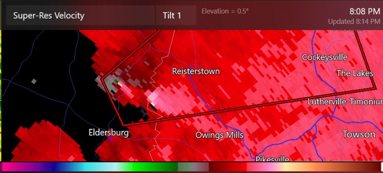
Confirmed tornado at Gamber (not from Gaithersburg cell)
- 1,696 replies
-
- 1
-
-
- severe
- thunderstorms
- (and 5 more)
-
that's kind of an all-time great.
-
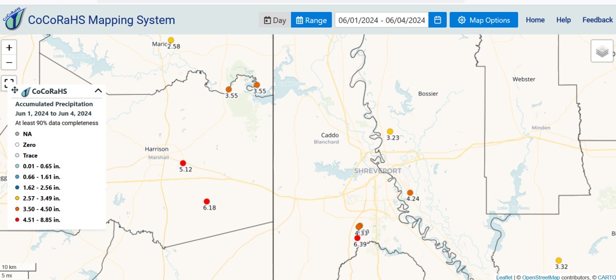
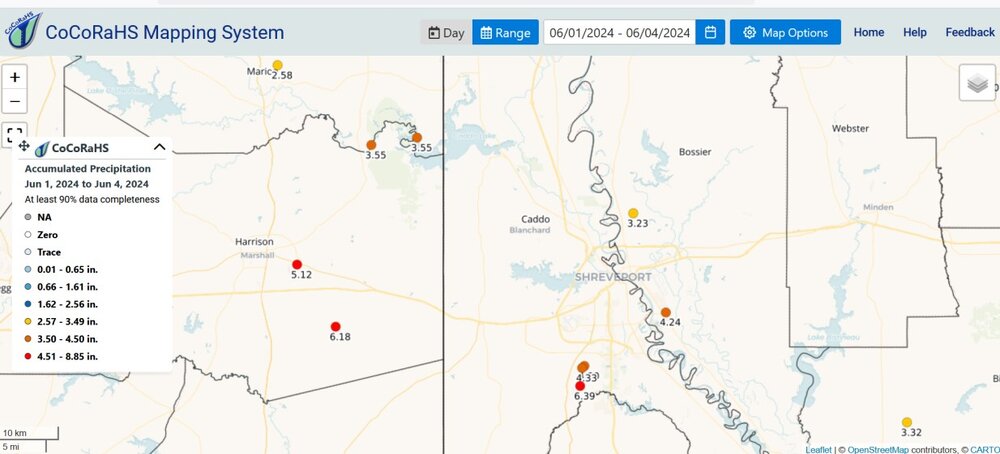
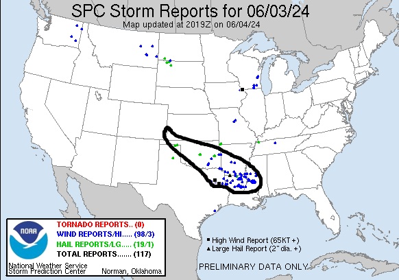
Every squall line ends up at Shreveport yesterday's nearly 24-hour long squall line produced severe weather towards Mississippi and Louisiana heavy rain
-
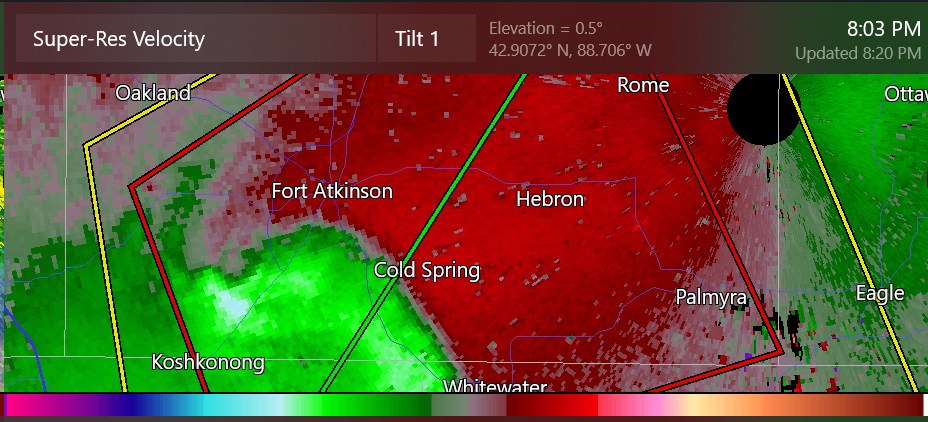
line-end vortex tornado warning near MKX a while back
-
looks like it went back to being severe warned
-
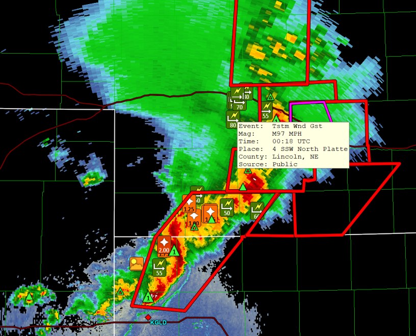
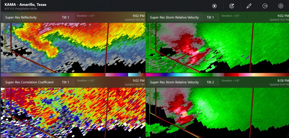
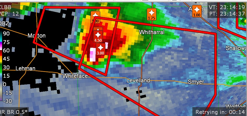
possible large tornado near Silverton TX winds up to 97mph in Nebraska
-
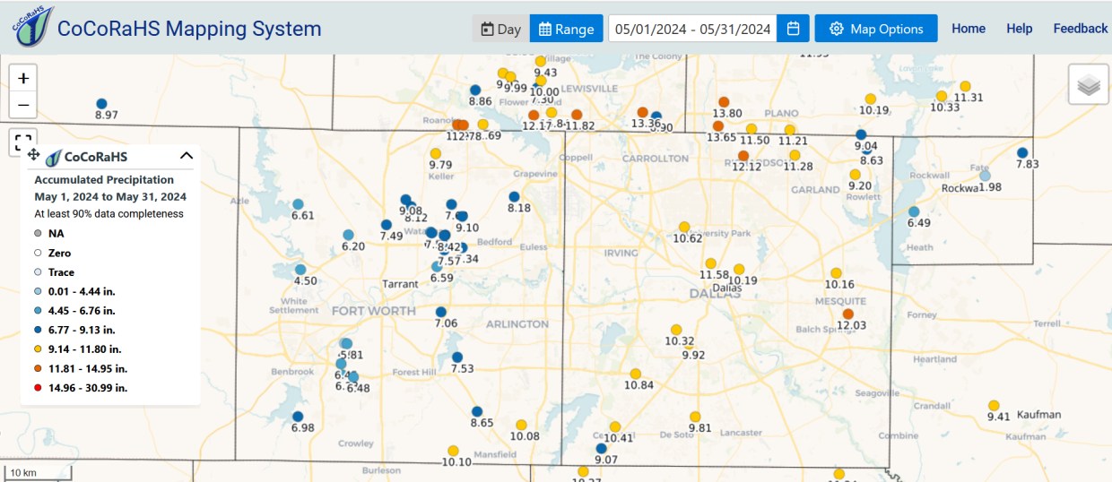
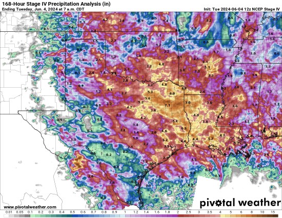
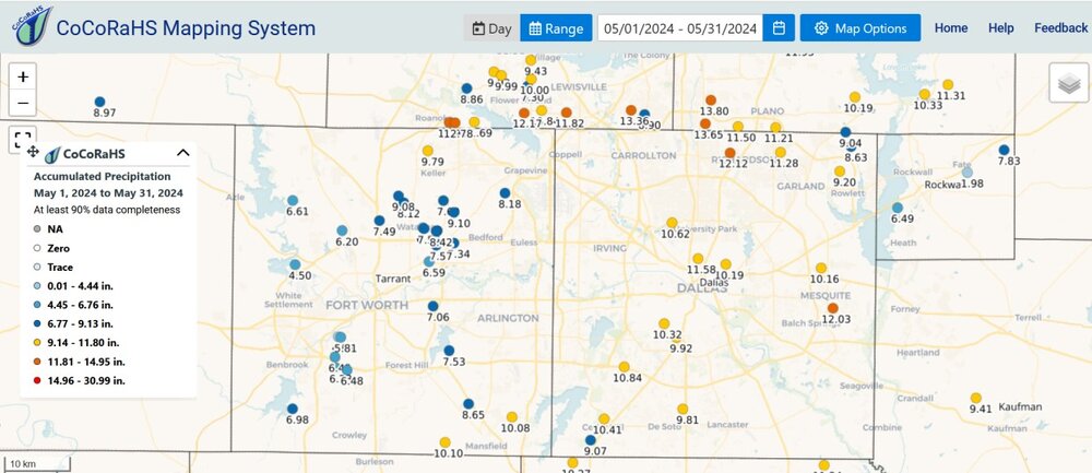
Dallas County had a foot of rain in May
-
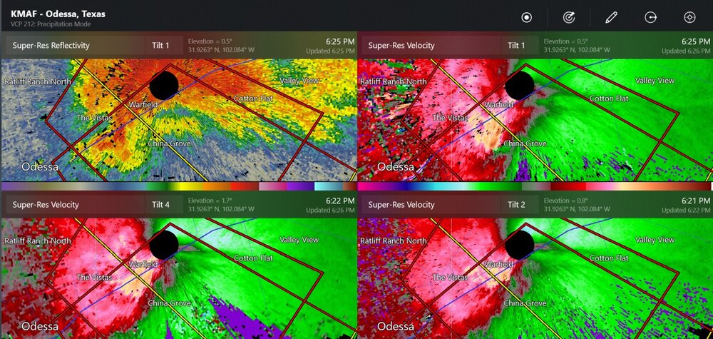
>150mph delta-v with this strong tornado
-
is Pettit in here?
-
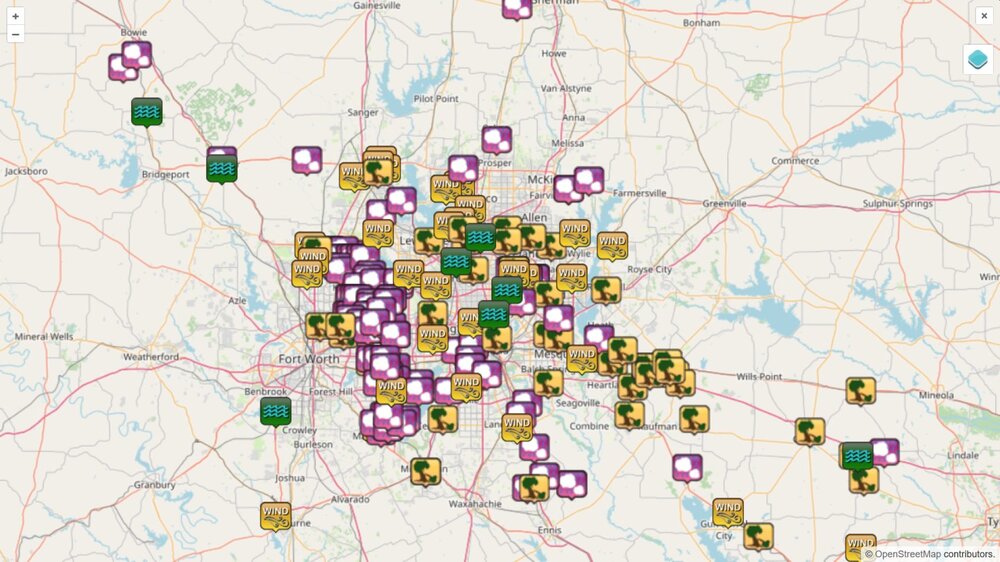
the last 48 hours of storm reports (FWD sector only)
-
There is a lot going on by the Ohio River, and nearby areas. I saw a video of a large tornado near Lake Egypt, Illinois
-
I have heard that there were double tornadoes at Winona