Chinook
-
Posts
10,935 -
Joined
-
Last visited
Content Type
Profiles
Blogs
Forums
American Weather
Media Demo
Store
Gallery
Everything posted by Chinook
-
They take into account reports from ranchers and farmers. But maybe not dudes in the suburbs.
-
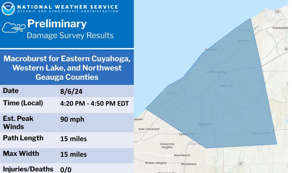
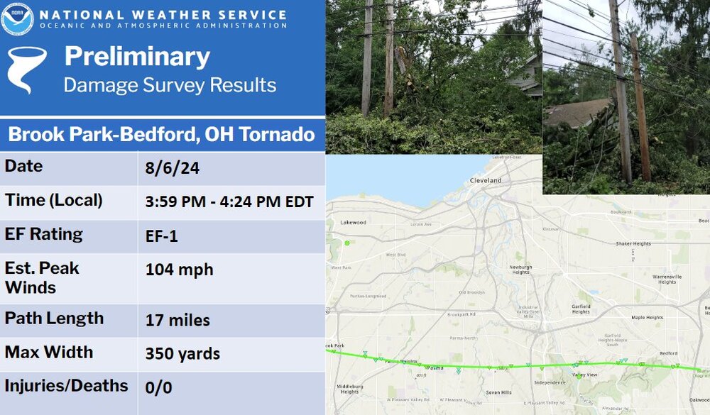
storm surveys

-
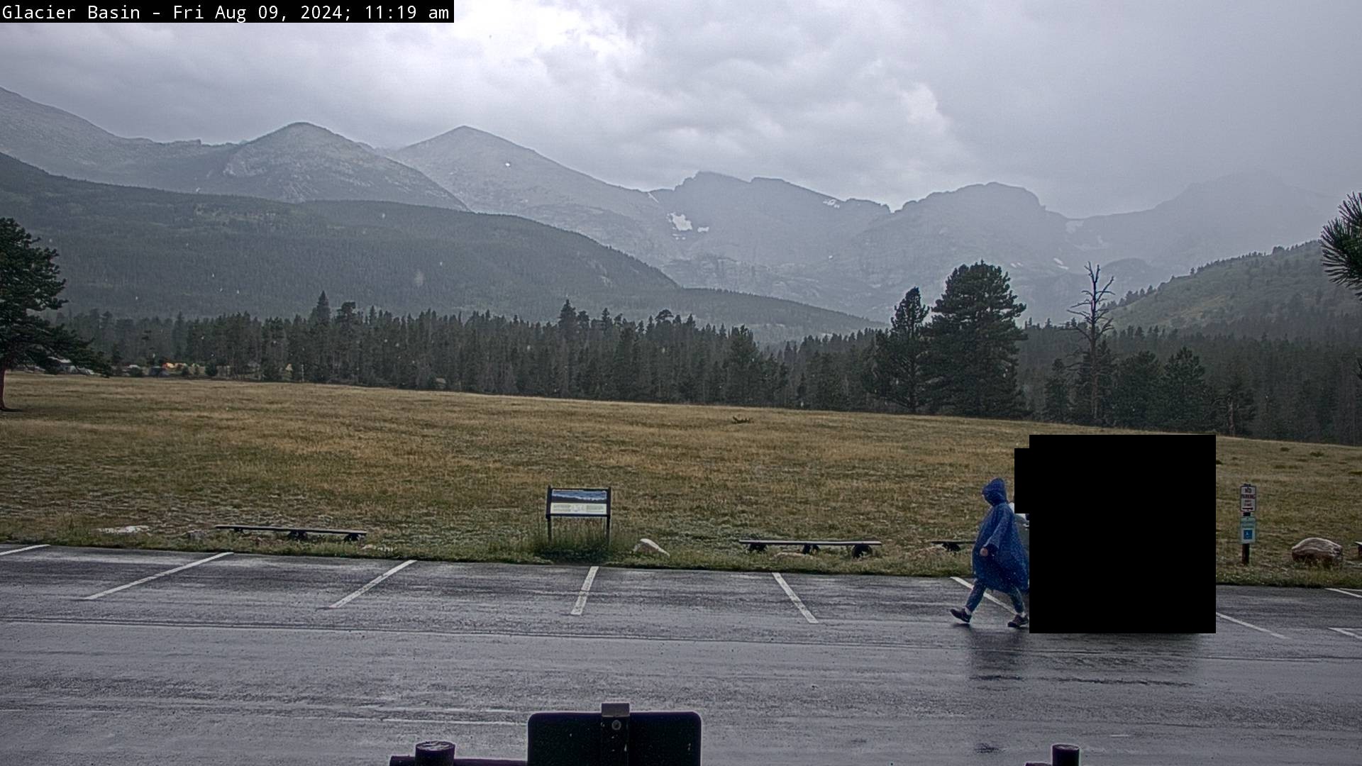
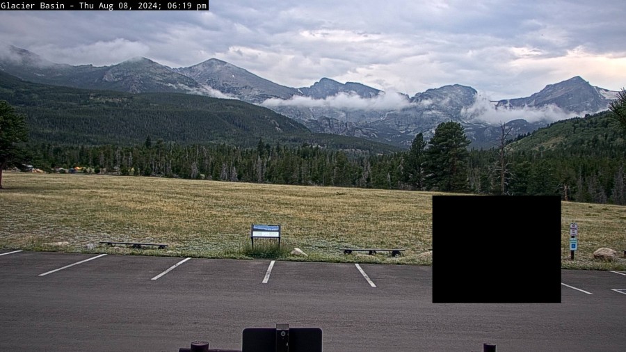
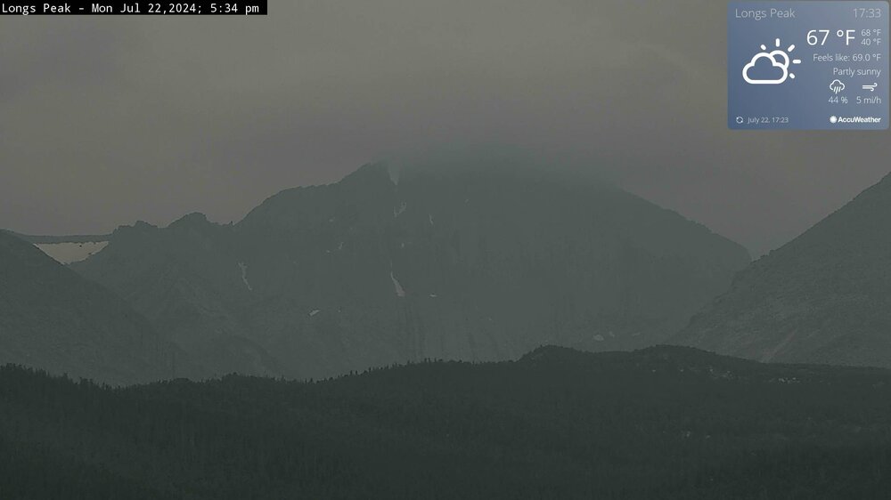
It's rainy! This is the first time I've seen a person in a poncho on the RMNP webcam. I have deleted the image of the car for privacy reasons. I assume we can say the person is pretty anonymous with the poncho over the face

-
This is pretty cool. By the way, 5-day forecasts have a fairly good amount of precipitation for Colorado
-

2024 Short/Medium Range Severe Weather Discussion
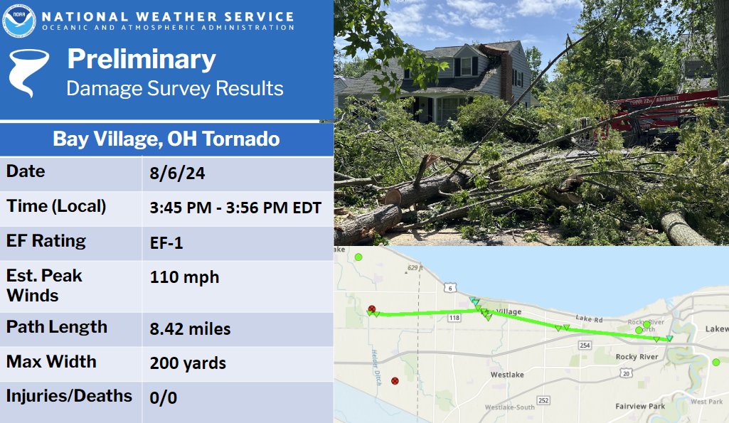
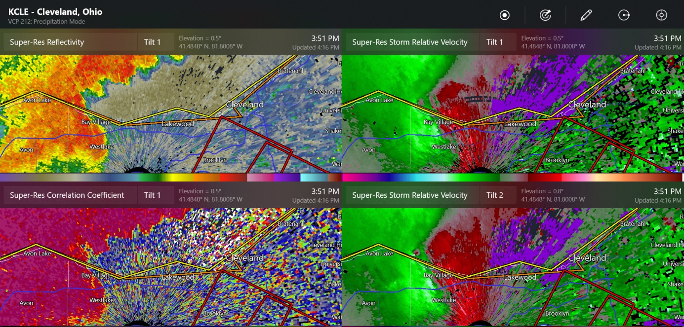
Chinook replied to Chicago Storm's topic in Lakes/Ohio Valley
confirmed tornado near Cleveland (Parma/Seven Hills) initial confirmed tornado warning was near the radar/CLE airport several minutes ago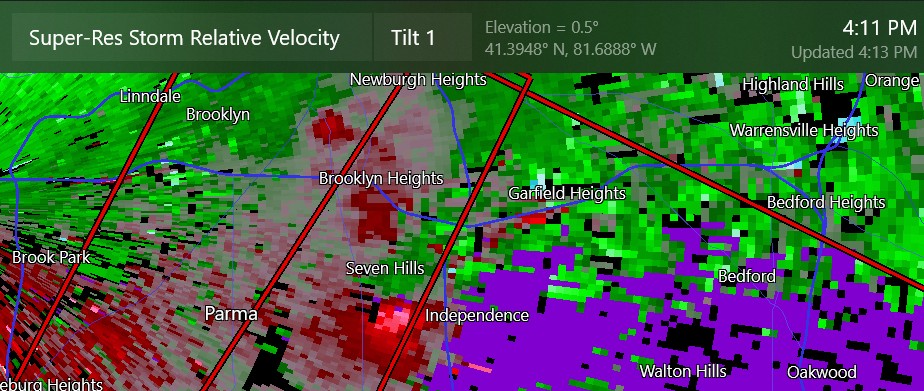
-
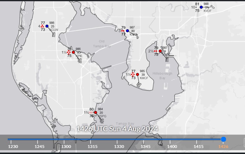
I bring it up because once every couple of years, Tampa is in the cone of uncertainty, or whatever you might call it. The storm systems have made landfall at various places. No storm has caused a large storm surge at Tampa Bay. Correct me if I am wrong. Tampa has the favorable geography for letting SW winds drive the water into the bay. St. Petersburg now has 31 kt gusting to 40 kt, with the radar picking up at least 50 kts at 2000ft above ground in the general area.
-
It seems like for the entire time that I've been watching weather, no tropical system has ever brought more than about 30-40 mph wind to Tampa. And this morning, it is 30 something mph gusts at St. Petersburg.
-
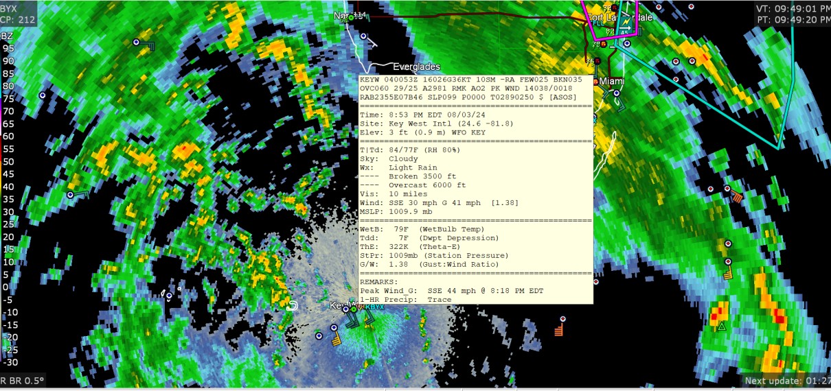
some wind gusts to 44mph, along with some briefly severe thunderstorms or tornado(es) near Ft Lauderdale

-
Lightning just kind of forgot to happen for a long time here.
-
That might be an error. I'm seeing 91/24 to 88/31 near you. Colorado has measured visibility vales of 10 miles, but it might be some decent forest fire smoke anyway.
-
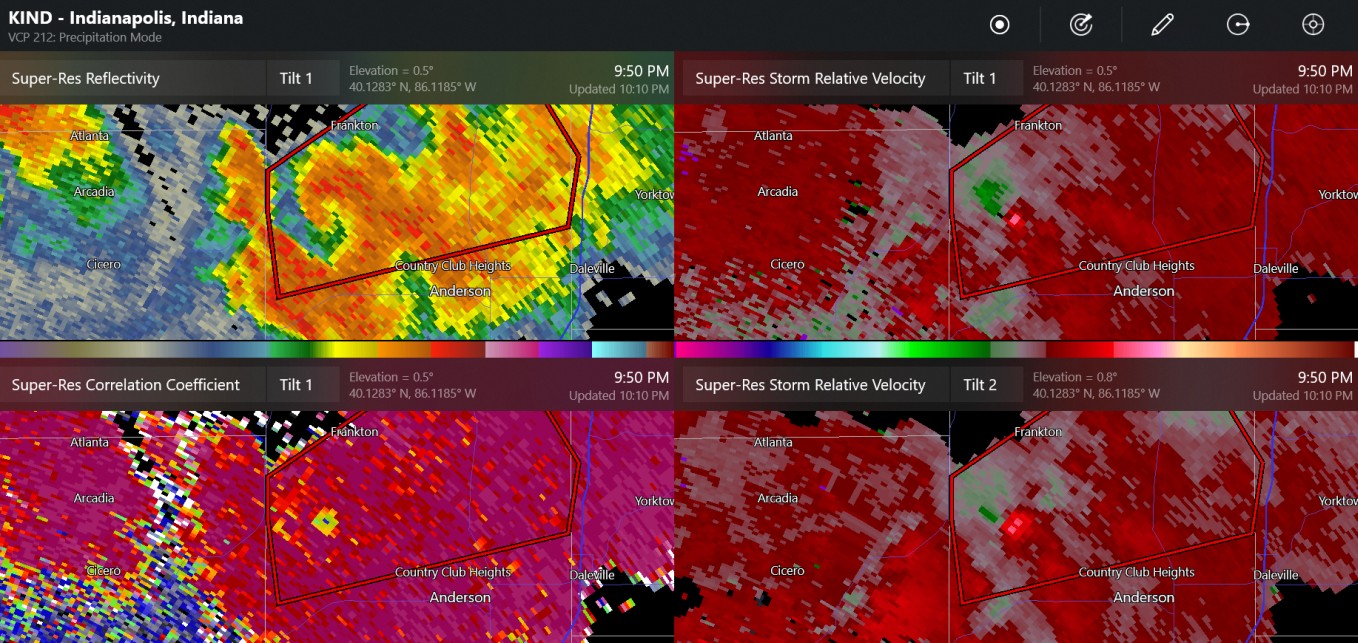
2024 Short/Medium Range Severe Weather Discussion
Chinook replied to Chicago Storm's topic in Lakes/Ohio Valley
two notable radar images from Indiana tonight (Frankton Indiana had confirmed tornado warning)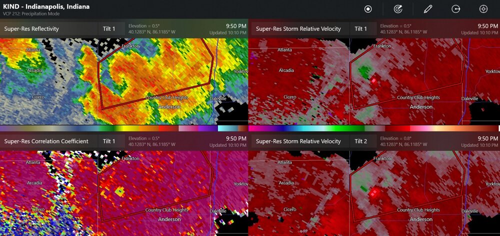
-
2024 Short/Medium Range Severe Weather Discussion
Chinook replied to Chicago Storm's topic in Lakes/Ohio Valley
Tornado warned supercells in Illinois (805pm central)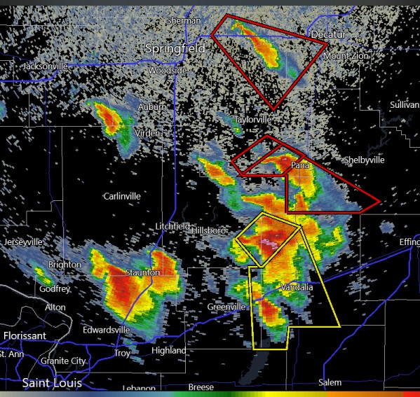
-
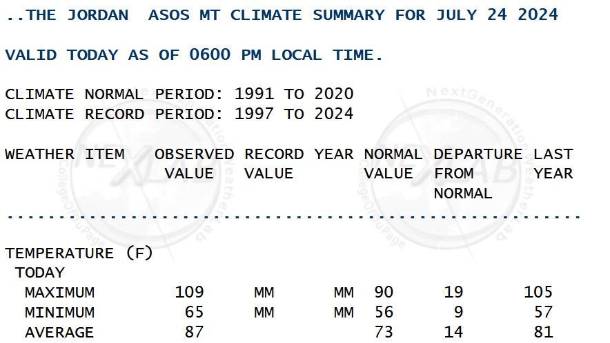
Have I ever seen 109 in Montana? I don't know. I know I've seen 105+ in South Dakota
-
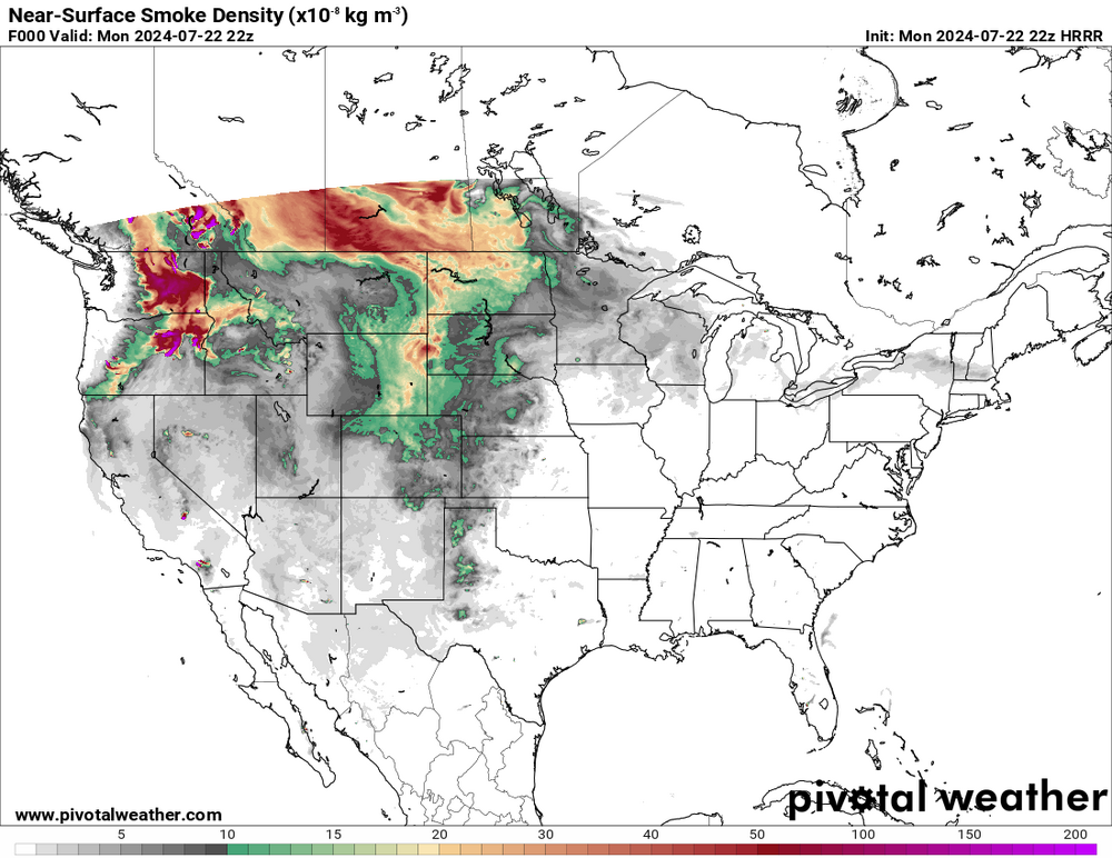
I think I'm starting to notice the forest fire smoke. Things are just a little whitish-yellow high in the sky.
-
Sorry guys. The forest fire smoke has to happen some time. At least it's not a fire in Colorado. (Not that I know of.) In the next week, the NWS says there will be just some light rains above 6000ft with the monsoon moisture, so, drought values shouldn't change much for the positive.
-
Oh here we go, new infusion of forest fire smoke from Canada. Don't know if you guys notice it. Also the NWS has air quality alert posted (not sure what the AQI is)
-
2024 Short/Medium Range Severe Weather Discussion
Chinook replied to Chicago Storm's topic in Lakes/Ohio Valley
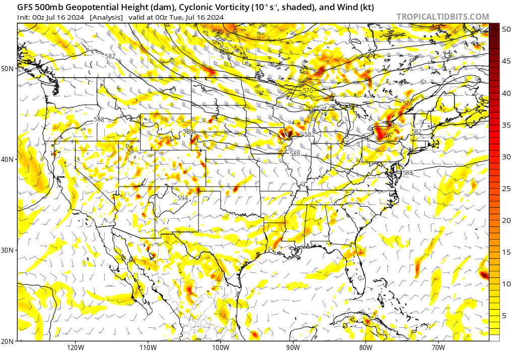
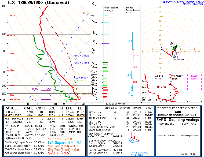
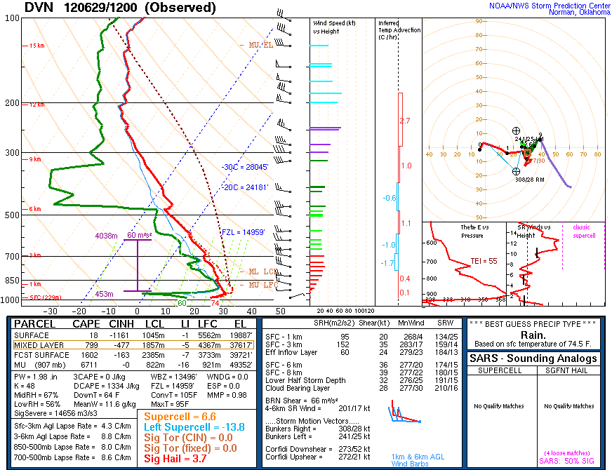
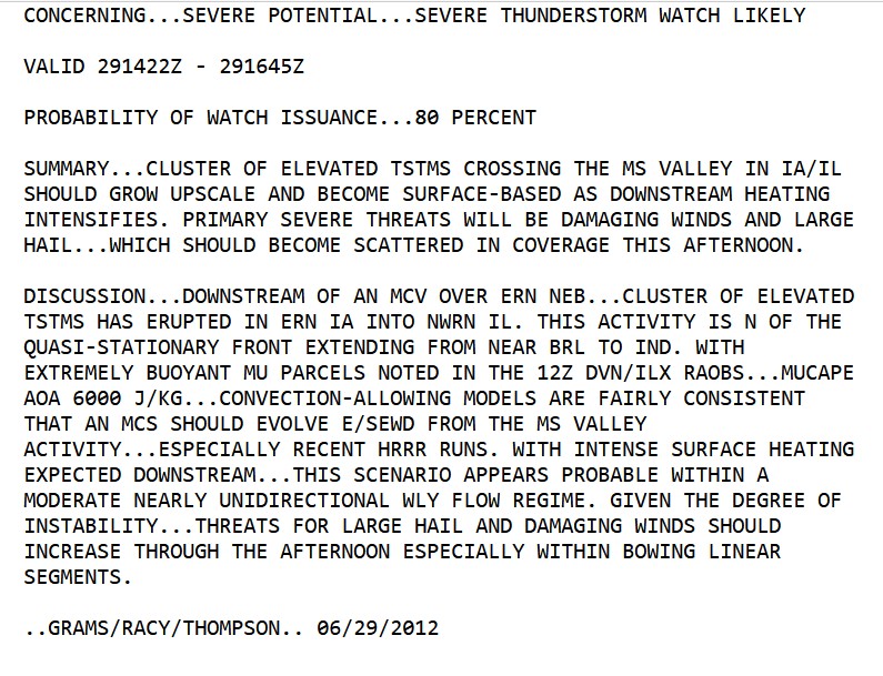
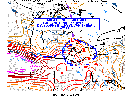
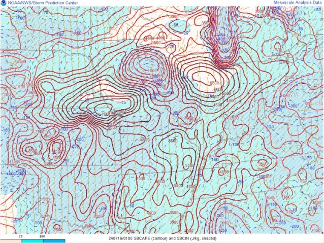
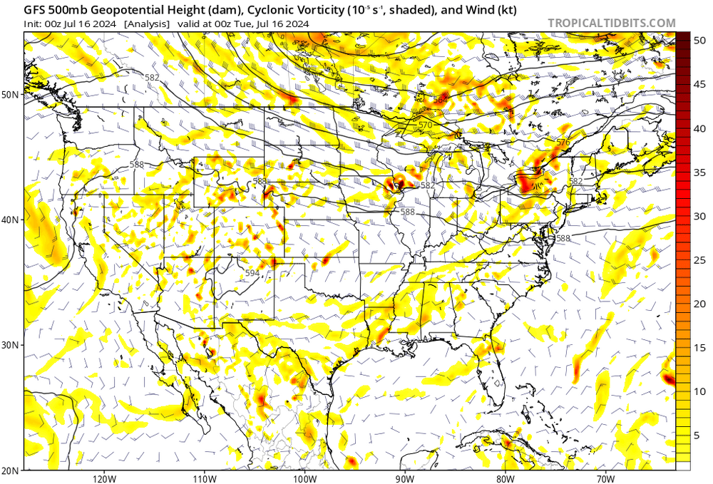
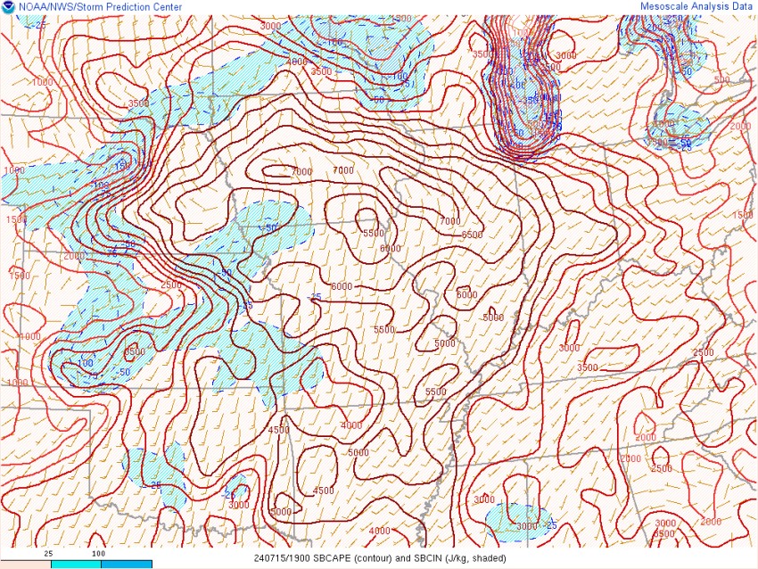
Comparisons of the Super-derecho of June 29, 2012 to the derecho/severe event of a couple days ago. Obviously, the storm of a couple days ago did not continue much toward Ohio or the East Coast. So, a huge difference there. Somewhere back in my distant memory, I think I saved a SPC mesoanalysis of 9000 J/kg of MUCAPE on the night before the super-derecho (June 29, 00z) but I can't seem to be able to prove such a high value existed. The archived ILX shows 7481 J/kg in the morning. So, yeah. Mega-CAPE Mesoscale discussion from June 29, 2012 a couple of days ago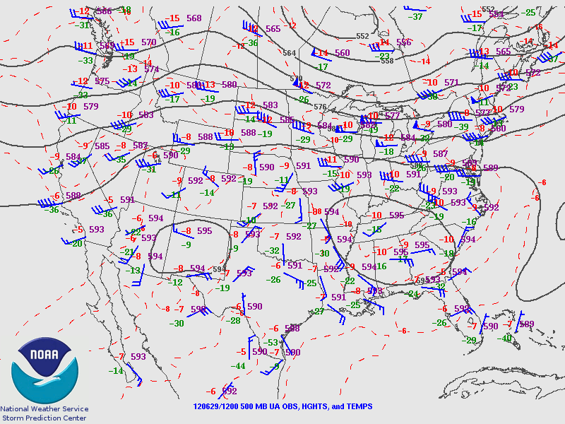
-
2024 Short/Medium Range Severe Weather Discussion
Chinook replied to Chicago Storm's topic in Lakes/Ohio Valley
so there was a hurricane gust at Chicago. Don't land any planes at O'Hare!
-
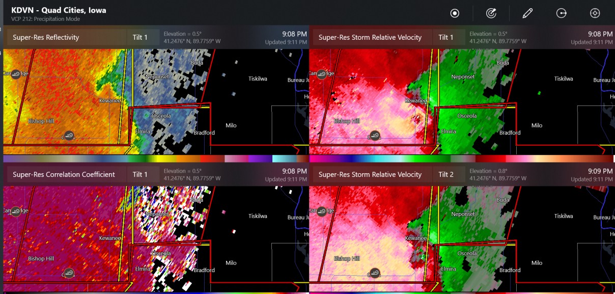
2024 Short/Medium Range Severe Weather Discussion
Chinook replied to Chicago Storm's topic in Lakes/Ohio Valley
about a dozen more storm reports just showed up on my screen in the Peoria vicinity -
2024 Short/Medium Range Severe Weather Discussion
Chinook replied to Chicago Storm's topic in Lakes/Ohio Valley
three tornado warnings for the outer metro area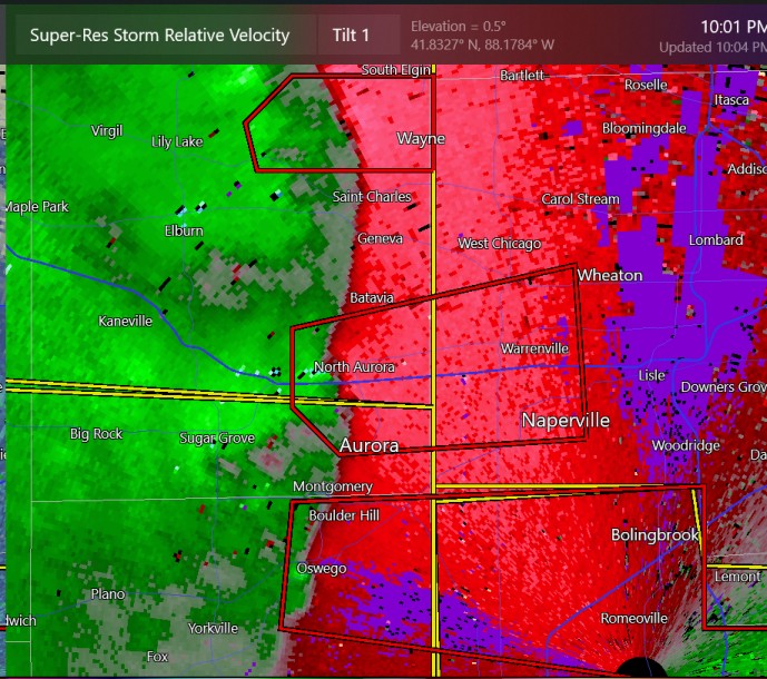
-
2024 Short/Medium Range Severe Weather Discussion
Chinook replied to Chicago Storm's topic in Lakes/Ohio Valley
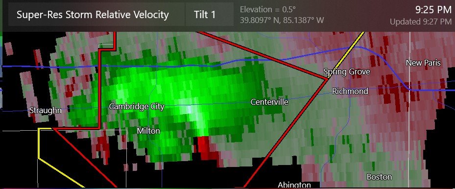
this is the craziest velocity so far. Tornado?
-
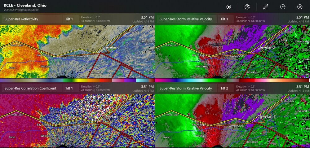
2024 Short/Medium Range Severe Weather Discussion
Chinook replied to Chicago Storm's topic in Lakes/Ohio Valley
I guess this is a tornado now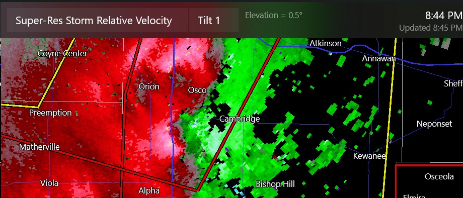
-
2024 Short/Medium Range Severe Weather Discussion
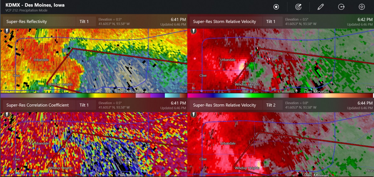
Chinook replied to Chicago Storm's topic in Lakes/Ohio Valley
brief tornado(es) in NW Des Moines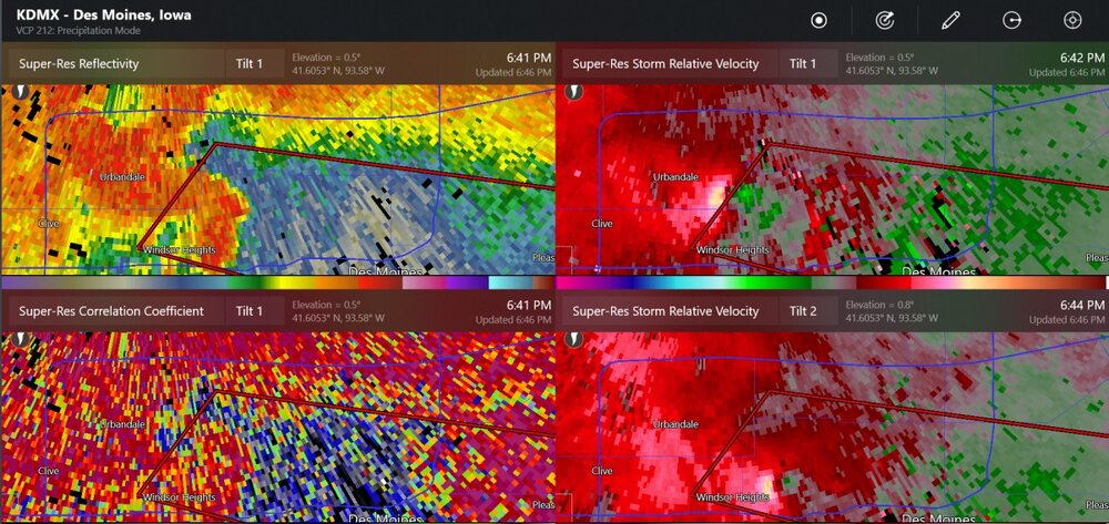
-
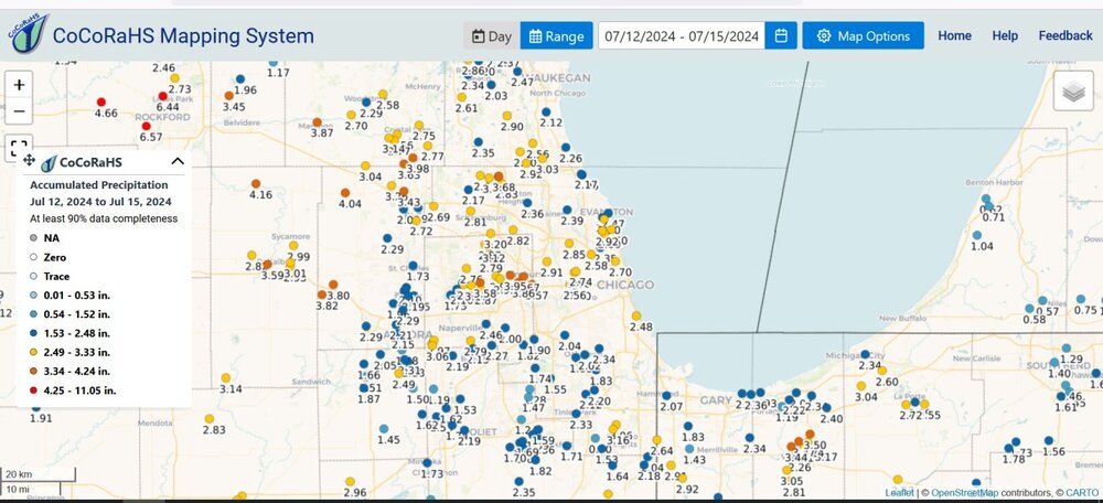
Chicago area rainfall (Jul 12-15)
-
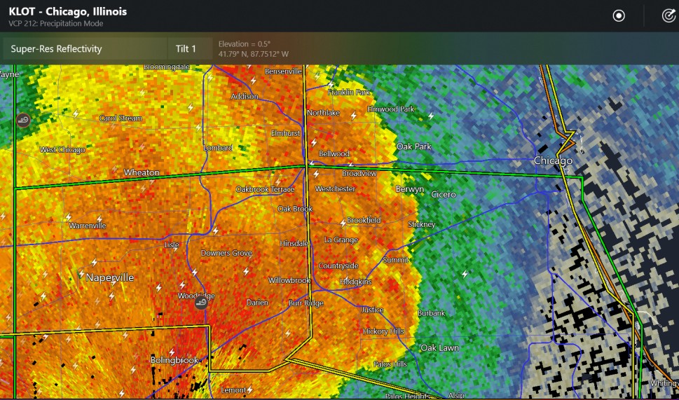
2024 Short/Medium Range Severe Weather Discussion
Chinook replied to Chicago Storm's topic in Lakes/Ohio Valley
Chicago severe-warned storm (60mph recently at Woodridge)