Chinook
-
Posts
10,935 -
Joined
-
Last visited
Content Type
Profiles
Blogs
Forums
American Weather
Media Demo
Store
Gallery
Everything posted by Chinook
-
radar now picking up 130 knots in the clouds

-
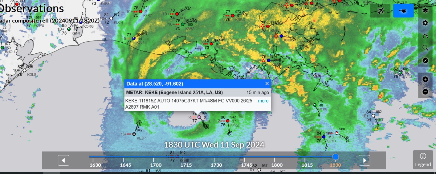
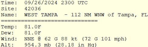
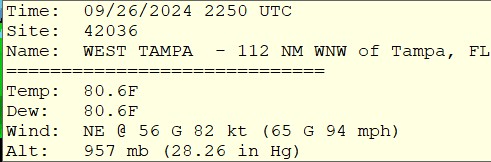
update for the buoy in the storm with over 100 mph gusts
-
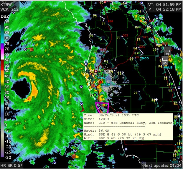
new buoy measurement in the eyewall
-
67mph wind gust at a buoy that is far from the storm
-
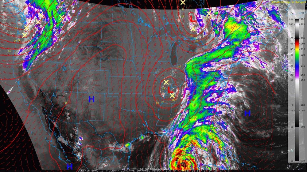
The connection of the hurricane with the USA weather system makes it look like the hurricane has a million fingers
-
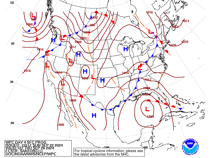
NWS-WPC has a low on the map
-
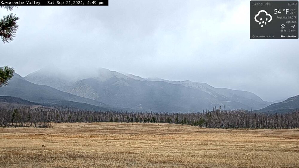
a little rainy/snowy
-
That is just great. Inspiring. Sometimes I wonder what might cause the atoms to light up in the magenta (must be red plus blue) and then the green at lower levels. Fort Collins cooled down to 47 this morning. Then it is right back to 84 right now, several degrees above average. It's almost as if the USA is in some sort of hot drought and repelling cold air.
-
the moon was a little eclipsed at 10:40PM
-
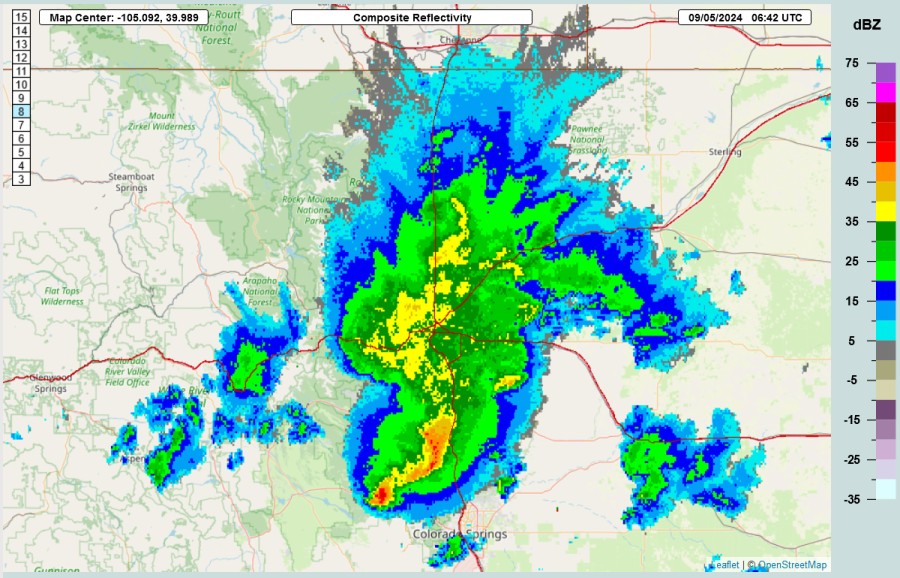
Here is a unusual late-season chance for severe storms in Colorado. There should be some weakly organized storms with strong winds.
-
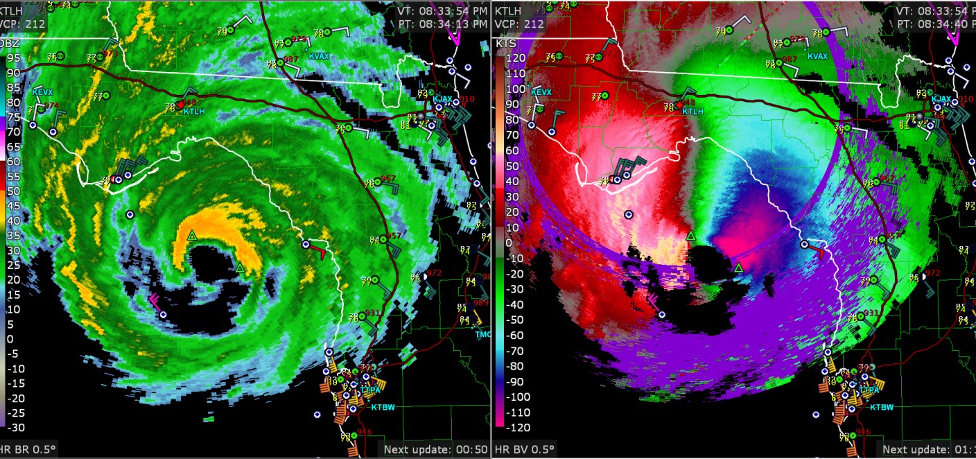
64 knots gusting to 79 knots is very close to shore now
-
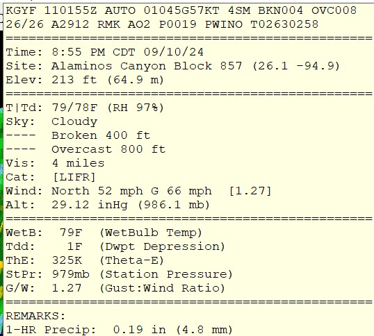
97 knots

-
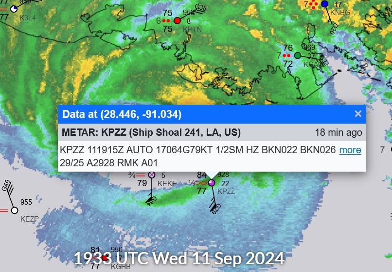
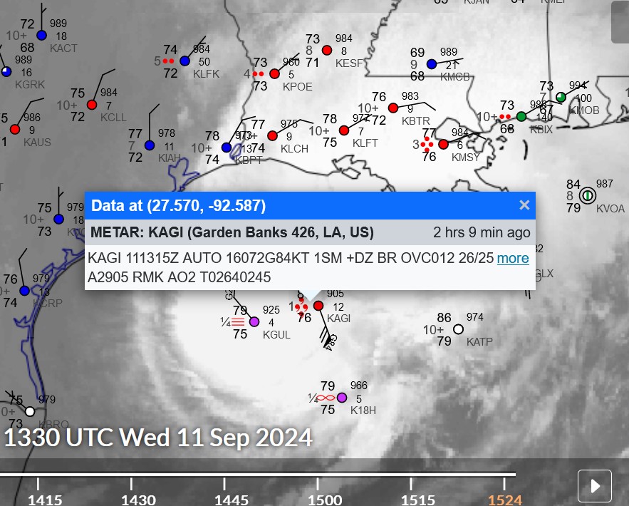
84 knot wind gust in the Gulf of Mexico
-
now 57kt gusting to 67 kt at the same station I mentioned before, over 150 miles east of Brownsville
-
wow, measured wind 45 kt gusting to 57 kt in the Gulf of Mexico, at the eyewall, probably
-
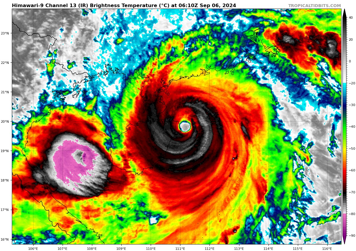
 I hadn't been paying the greatest attention to Super Typhoon Yagi, but I saved these significant images from TropicalTidbits. Wikipedia says it topped out at Category-5, 160mph, 916mb
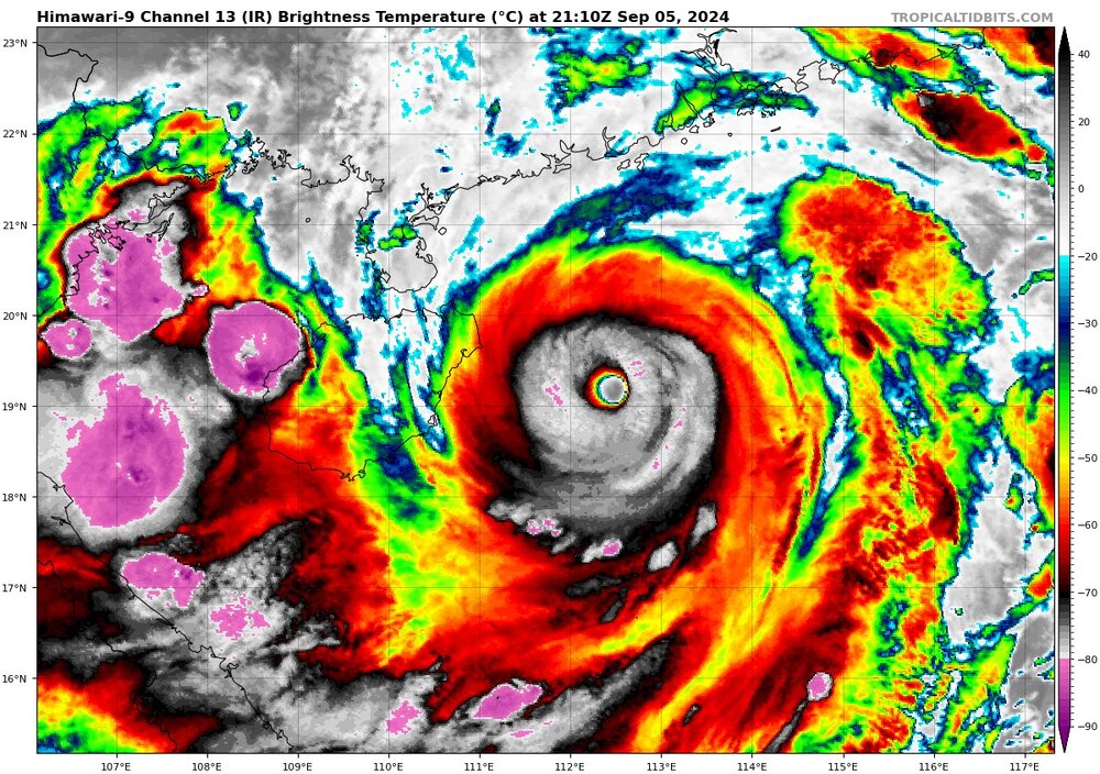

-
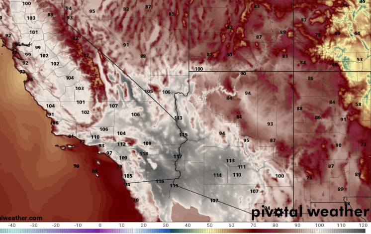
This happened today, with the Los Angeles area getting low 80's to 118 near Palm Springs. I would imagine that a few million people got high temperatures of 100 that weren't normally expecting it.
-
Denver's late-night storm? A sign that fall is coming
-
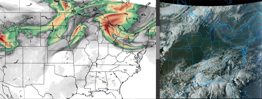
yesterday's smoke
-
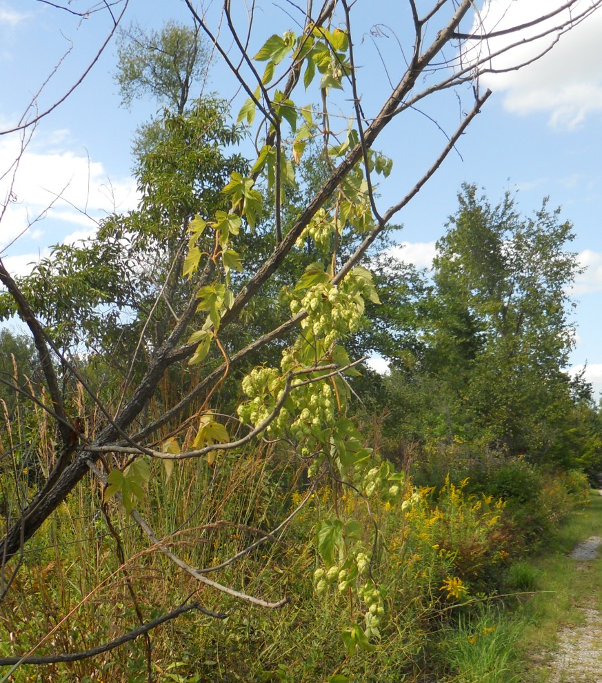
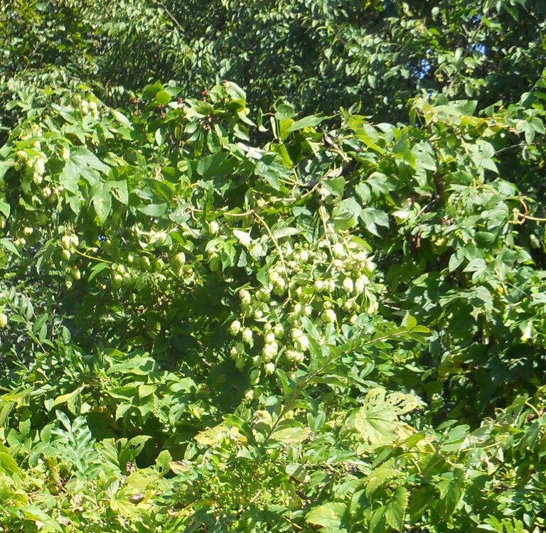
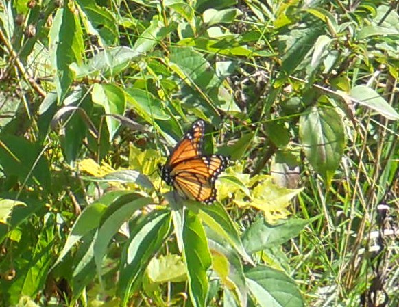
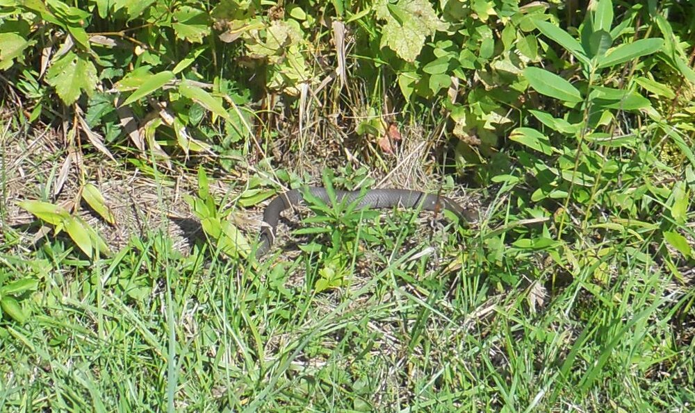
I took some pictures yesterday and I found a vine that had a pale flower that looks like oats or hops. Does anybody know what it is? thankfully, the snake I saw was a lot less dangerous than the time I almost stepped on a rattlesnake in the Rocky Mountains.

-
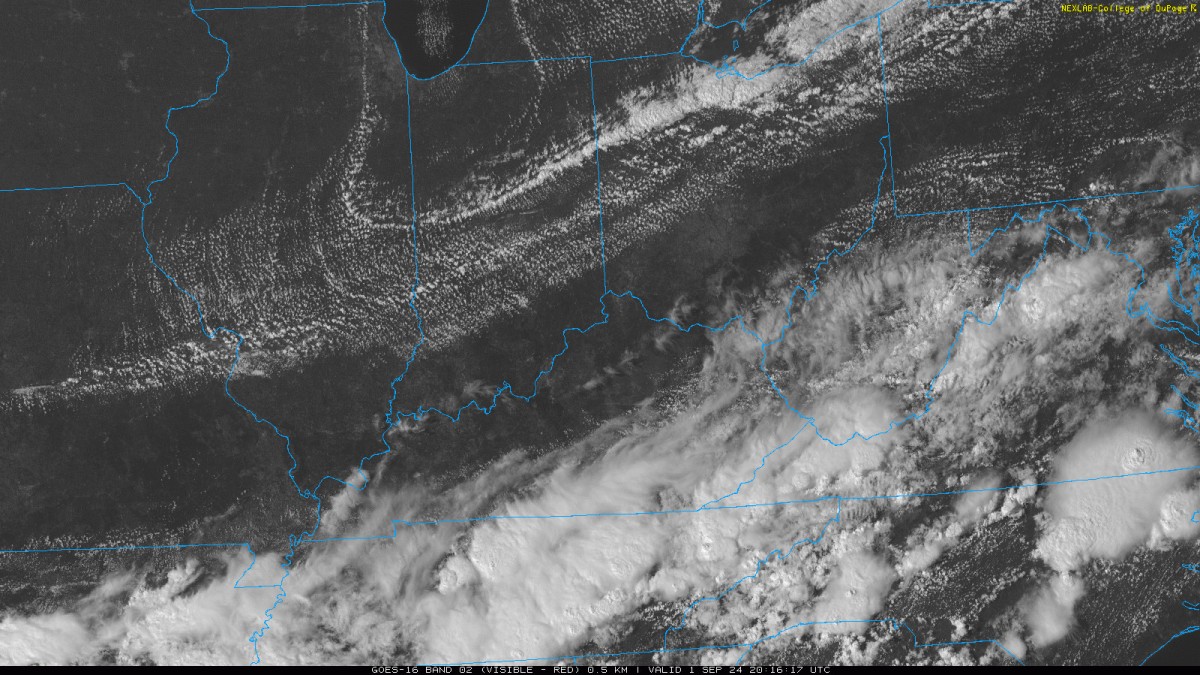
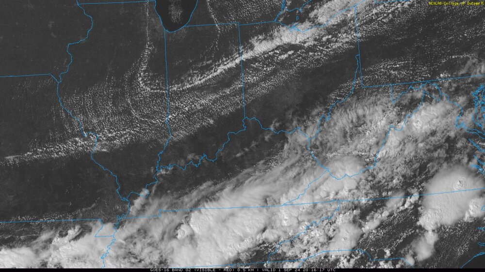
kind of a neat satellite image
-
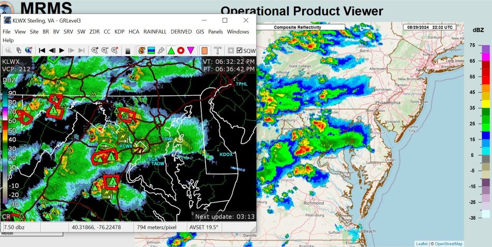
these storms have some random movement
- 1,696 replies
-
- 1
-

-
- severe
- thunderstorms
- (and 5 more)
-
2024 Short/Medium Range Severe Weather Discussion
Chinook replied to Chicago Storm's topic in Lakes/Ohio Valley
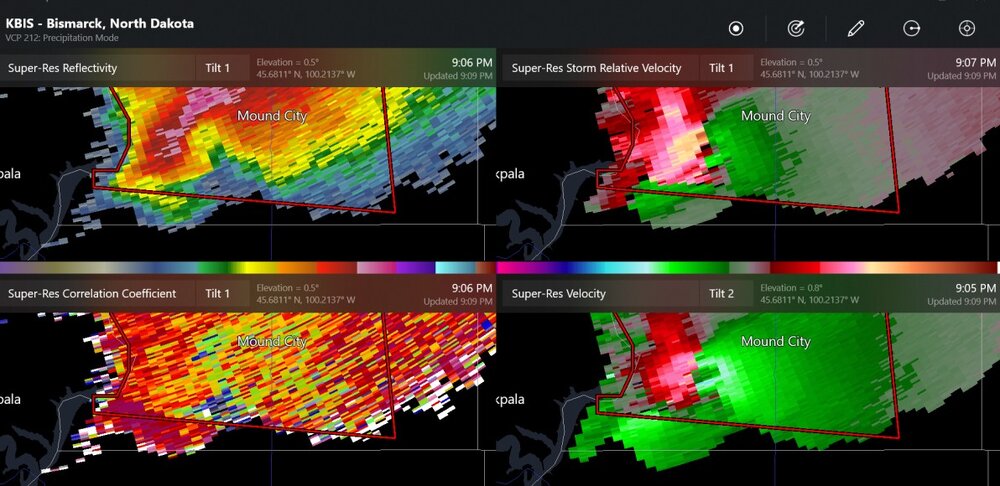
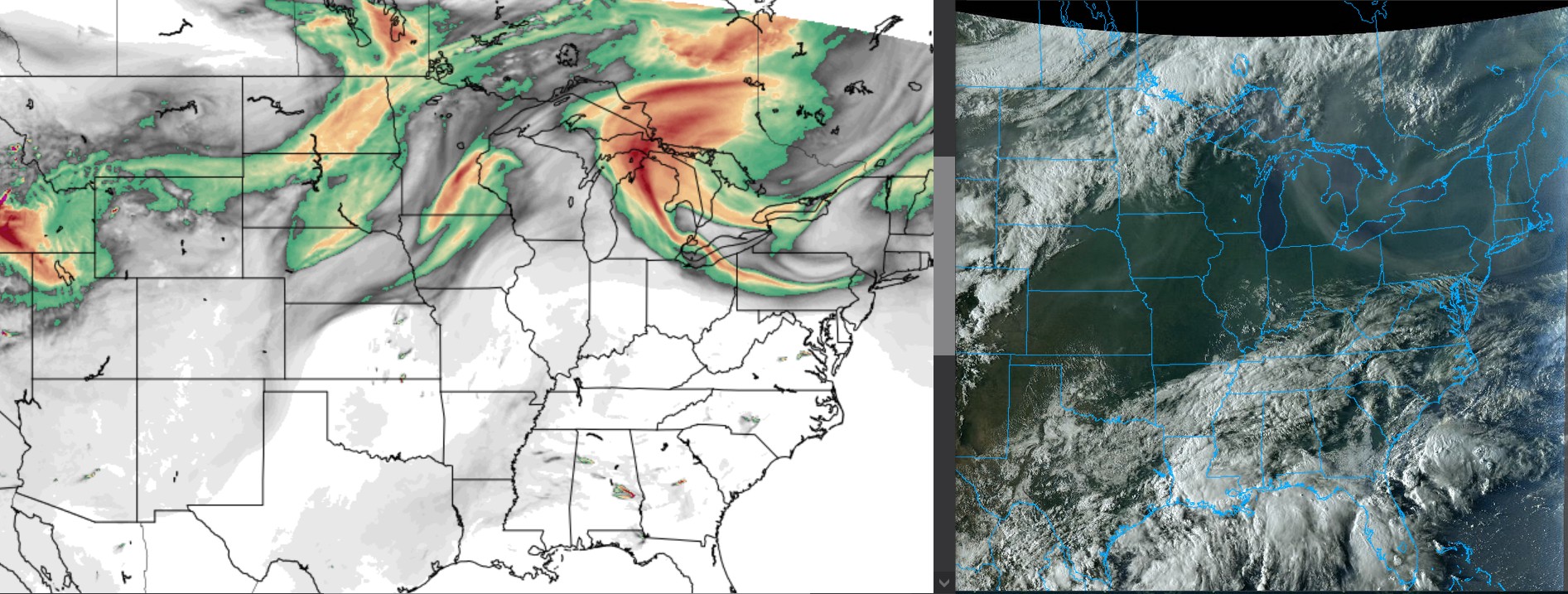
new severe storm watch for Minneapolis-St. Paul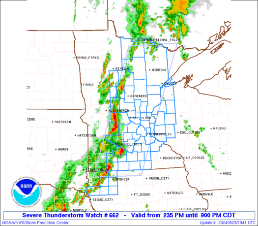
-
2024 Short/Medium Range Severe Weather Discussion
Chinook replied to Chicago Storm's topic in Lakes/Ohio Valley
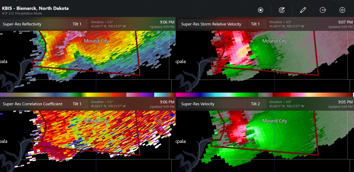
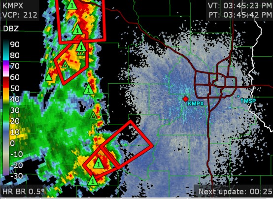
massive wall cloud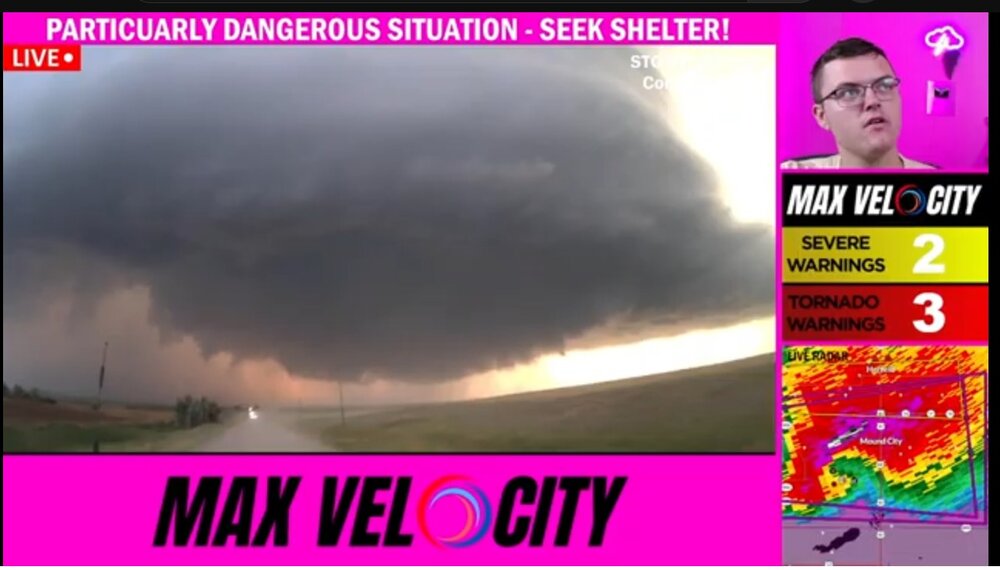
-
2024 Short/Medium Range Severe Weather Discussion
Chinook replied to Chicago Storm's topic in Lakes/Ohio Valley
confirmed tornado 20 min ago and 5 min ago. double tornado?