Chinook
-
Posts
10,935 -
Joined
-
Last visited
Content Type
Profiles
Blogs
Forums
American Weather
Media Demo
Store
Gallery
Everything posted by Chinook
-

2024 Short/Medium Range Severe Weather Discussion
Chinook replied to Chicago Storm's topic in Lakes/Ohio Valley
tornado warning near Geneva IL -
2024 Short/Medium Range Severe Weather Discussion
Chinook replied to Chicago Storm's topic in Lakes/Ohio Valley
New severe thunderstorm watch for this area, valid until 1:00 central time -
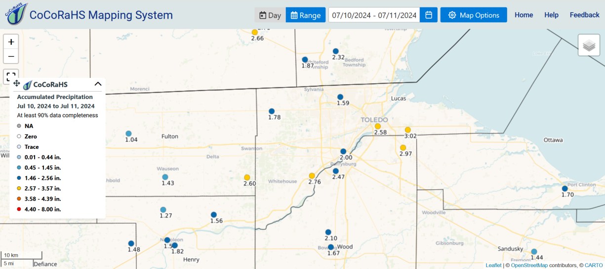
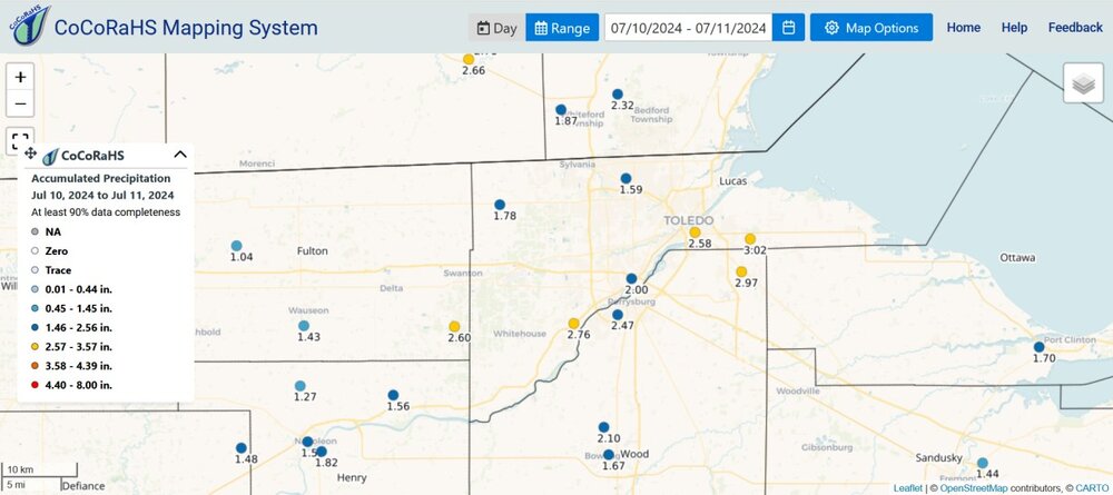
Toledo picked up quite a bit in 0400z-0900z and then got showers later. I think some of the models had predicted less than 1" just before the event, but it was wetter than that.
-
NWS says 100/100/102/98 for downtown
-
2024 Atlantic Hurricane Season
Chinook replied to Stormchaserchuck1's topic in Tropical Headquarters
Here is my loop of Hurricane Beryl (500mb) up to north Texas https://great-lakes-salsite.web.app/Hurricane_Beryl_Loop.html -
definitely a lot of supercells, but not necessarily a lot of storm reports
-
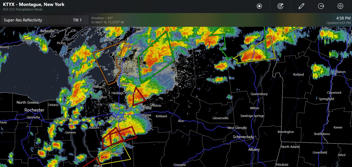
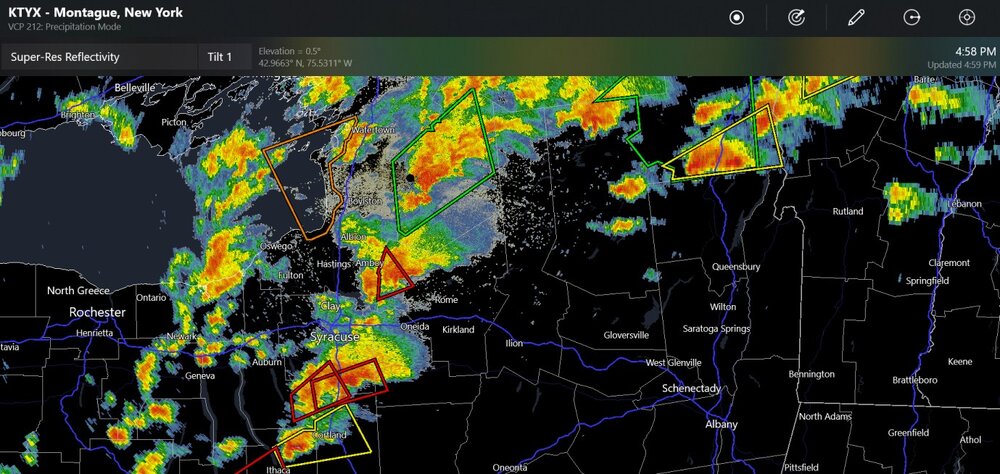
tornado warning by Syracuse (I-90 corridor)
-
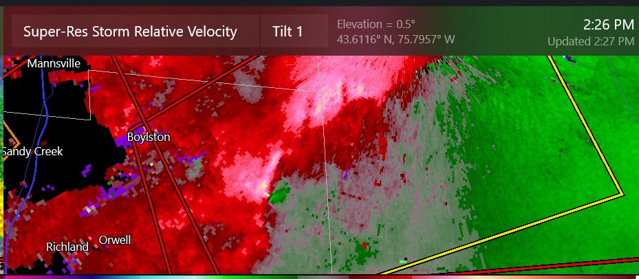
this may be a tornado way out in the woods and hills by Boylston
-
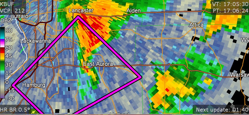
confirmed tornado warning about an hour ago, south and SE of Buffalo (East Aurora)

-
2024 Short/Medium Range Severe Weather Discussion
Chinook replied to Chicago Storm's topic in Lakes/Ohio Valley
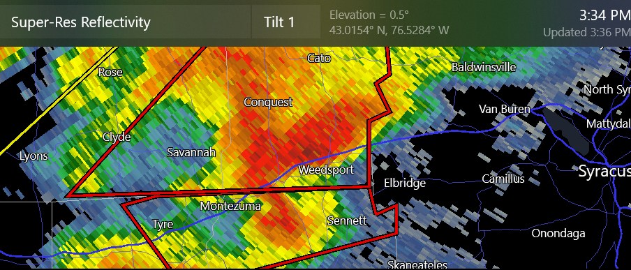
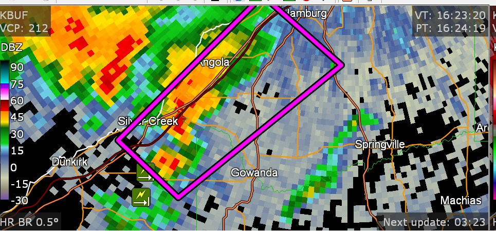
this was (one of) the large tornado(es) with debris seen quite close to the radar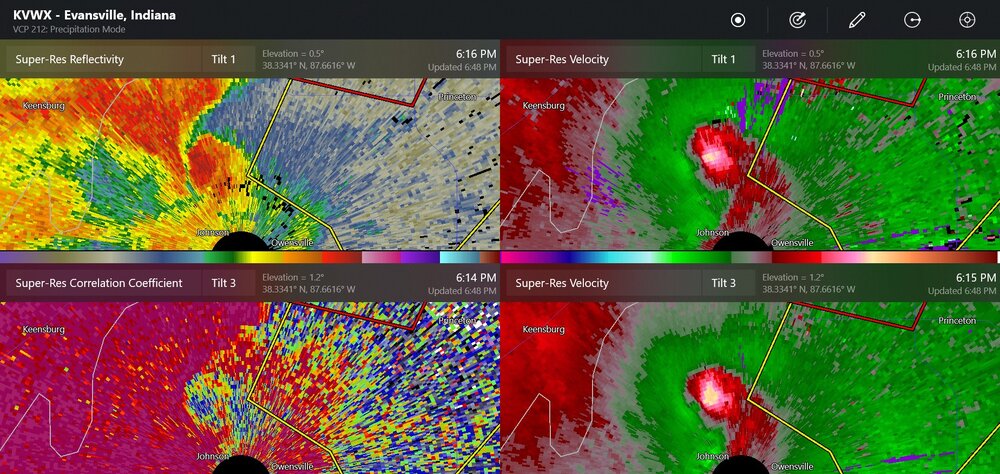
-
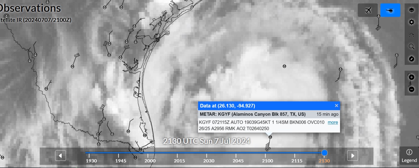
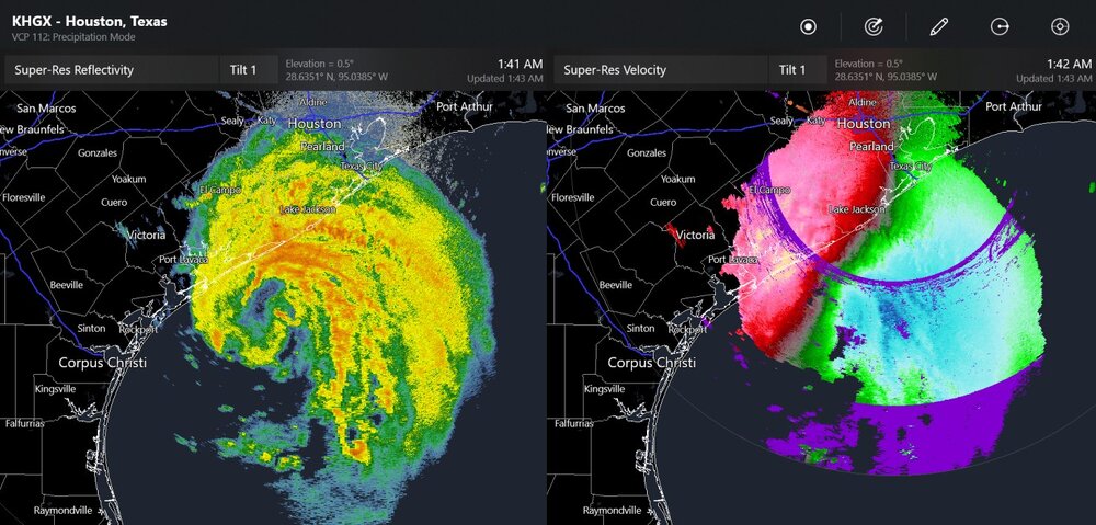
storm chasers say they may have hurricane-force winds close to Matagorda. (Buoy system reports 47mph gusting to 54mph at Matagorda Bay entrance channel)
-
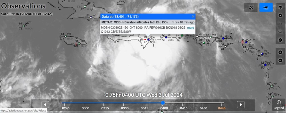
another observation from the Gulf
-
The far-West heat has been quite bad. Needles, California, had a daily high temperature record of 122 recently, beating a value of 121. I have barely ever seen that kind of temperature in a populated area. Sorry you guys had +5F for June, that is, 3 to 5.6 degrees above normal for June. Must have been rough. Actually I had my own 100 to deal with one day. Looks like Las Vegas is 118 is right now, which apparently breaks the all-time record. 1-2" hail with supercells down by Pueblo and Colorado Springs right now

-
this is out in the Gulf
-
satellite and measured winds

-
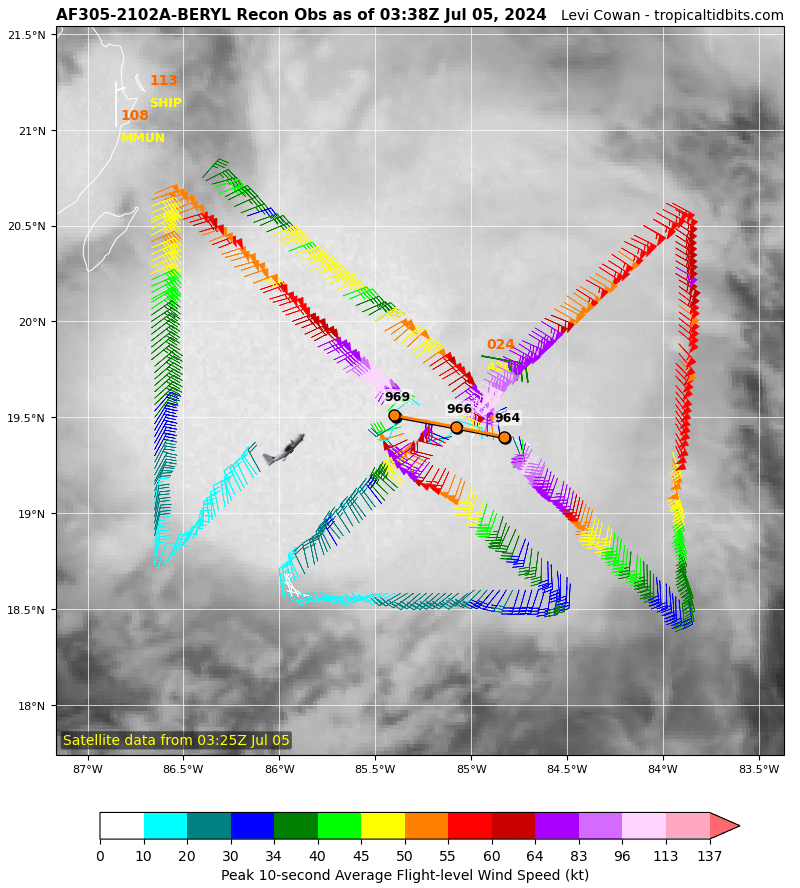
By the way, did the hurricane hunters complete a recon before landfall at 11z? I can't tell.
-
The recon just said 969mb as per this plot. I'm not sure if this means it has lost any max wind speeds in the last couple of hours?

-
Kingston- 38 kt gusting to 70 kt (just above cat-1 strength gust)
-
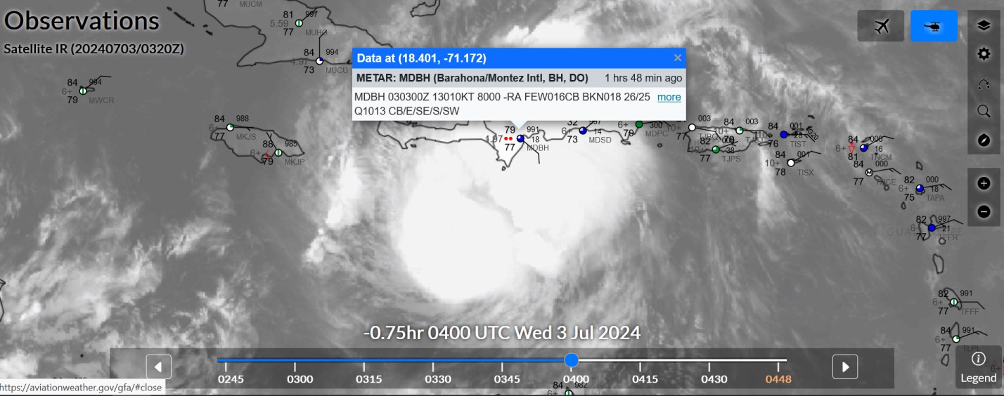
pressure seems normal. light rain. what's to worry about
-
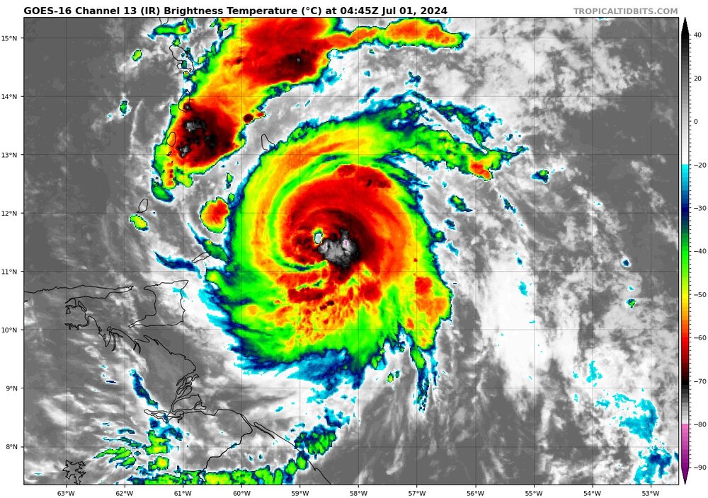
Any historians know if there has been a Cat-5 equivalent in ANY basin on July 1st of ANY year?
-
2024 Short/Medium Range Severe Weather Discussion
Chinook replied to Chicago Storm's topic in Lakes/Ohio Valley
tornadoes by Iowa City earlier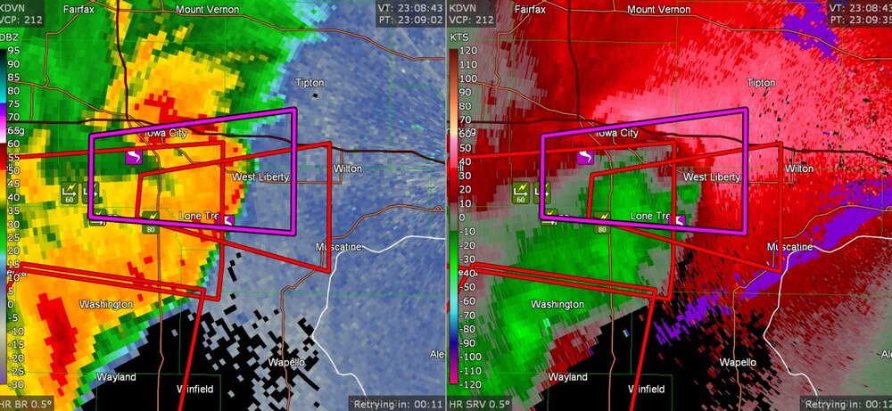
-
2024 Short/Medium Range Severe Weather Discussion
Chinook replied to Chicago Storm's topic in Lakes/Ohio Valley
Three non-confirmed tornado warnings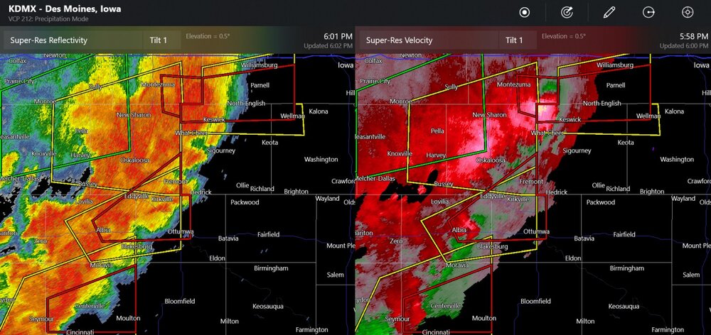
-
2024 Short/Medium Range Severe Weather Discussion
Chinook replied to Chicago Storm's topic in Lakes/Ohio Valley
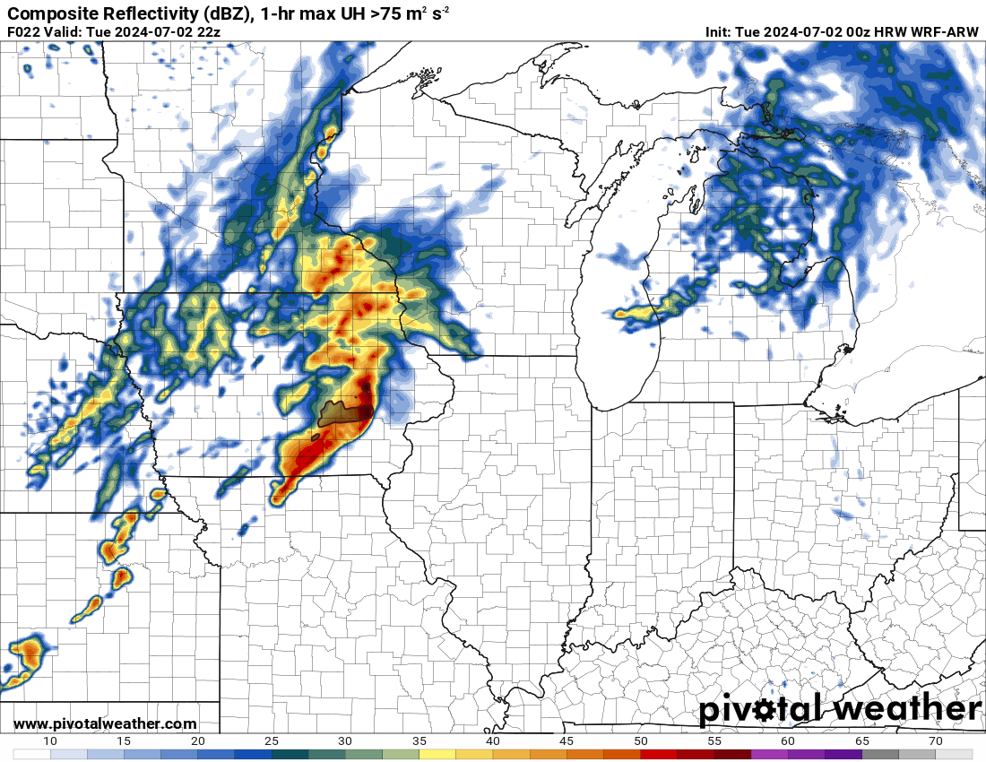
Models show that there is a high chance for a squall line, with likely some severe reports, to affect parts of Iowa and possibly Illinois. Dew points will be a balmy 75 degrees in Iowa, with some impressive deep-layer shear for July.
-
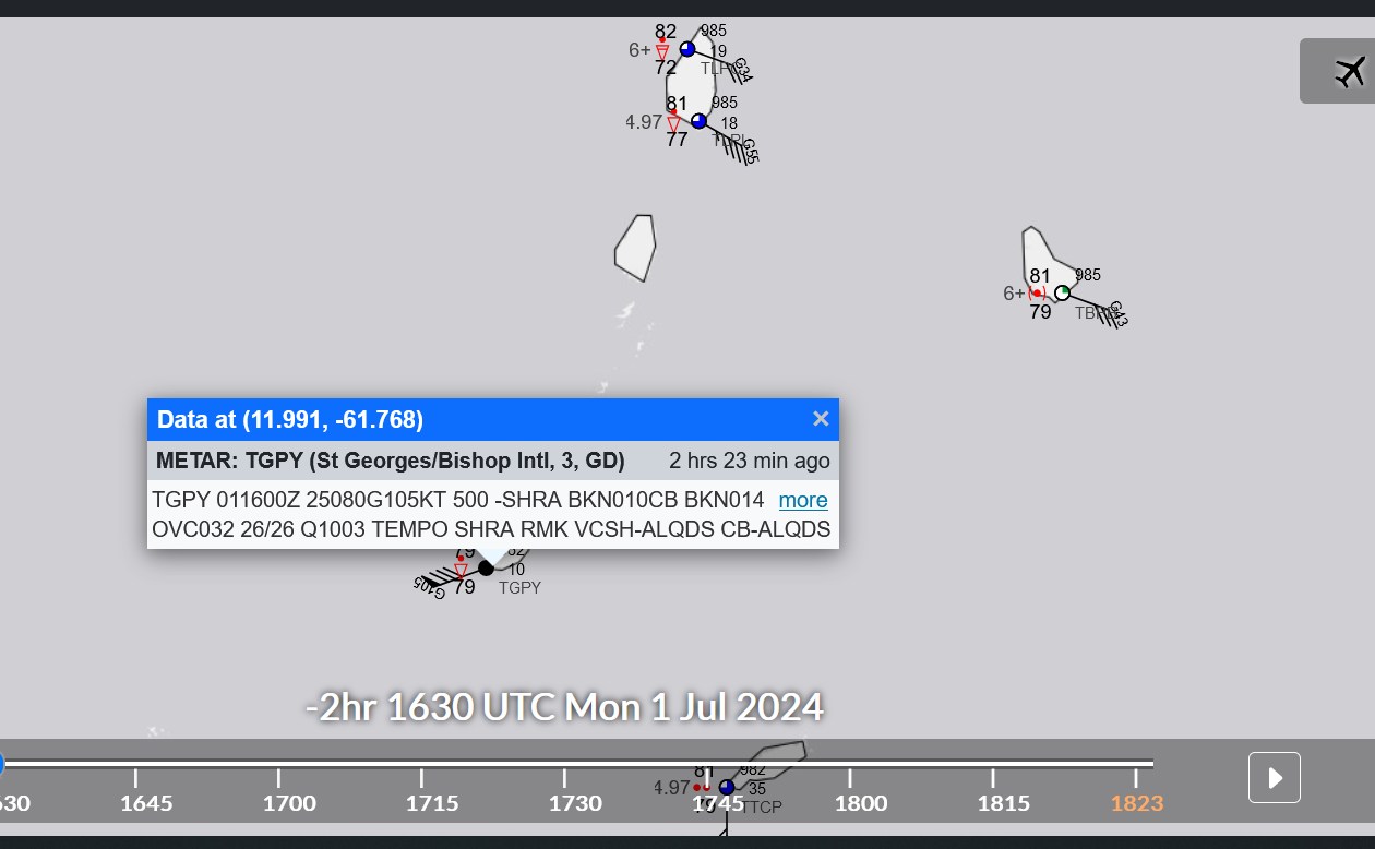
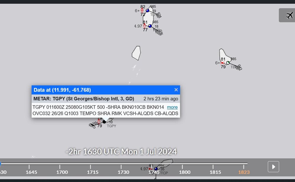
This is an incredible measurement. Not many places are close enough to a major hurricane to measure 105 knots gust.
-
sort of looks like a skull or face with its mouth open