Chinook
-
Posts
10,935 -
Joined
-
Last visited
Content Type
Profiles
Blogs
Forums
American Weather
Media Demo
Store
Gallery
Everything posted by Chinook
-
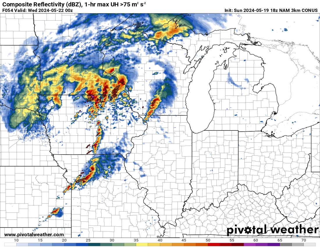
Given the day-3 information, I would guess that there is a significant chance of tornadoes with discrete cells in the Midwest on Tuesday.

-
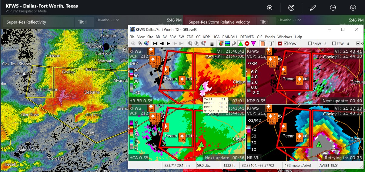
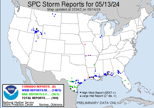
75mph wind measured near Wichita city limits, I assume that was quite possibly the same with some of the power outage areas mentioned Radar said up to 3" hail with the big tornado storm
-
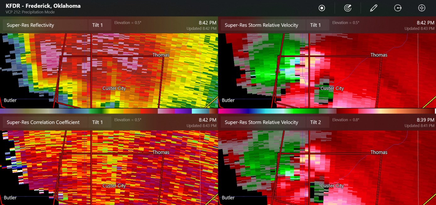
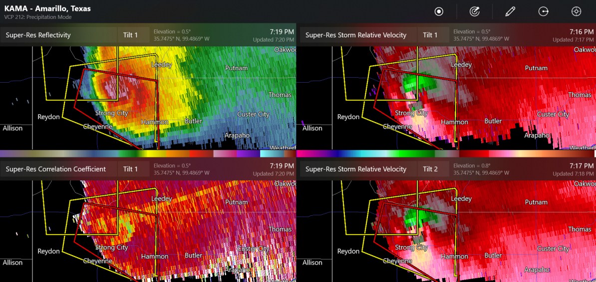
here's the view from KFDR

-
-
So far there have been many wind reports and hail reports, a 100mph wind at Salina Kansas, flood reports, one tornado warning in Oklahoma

-
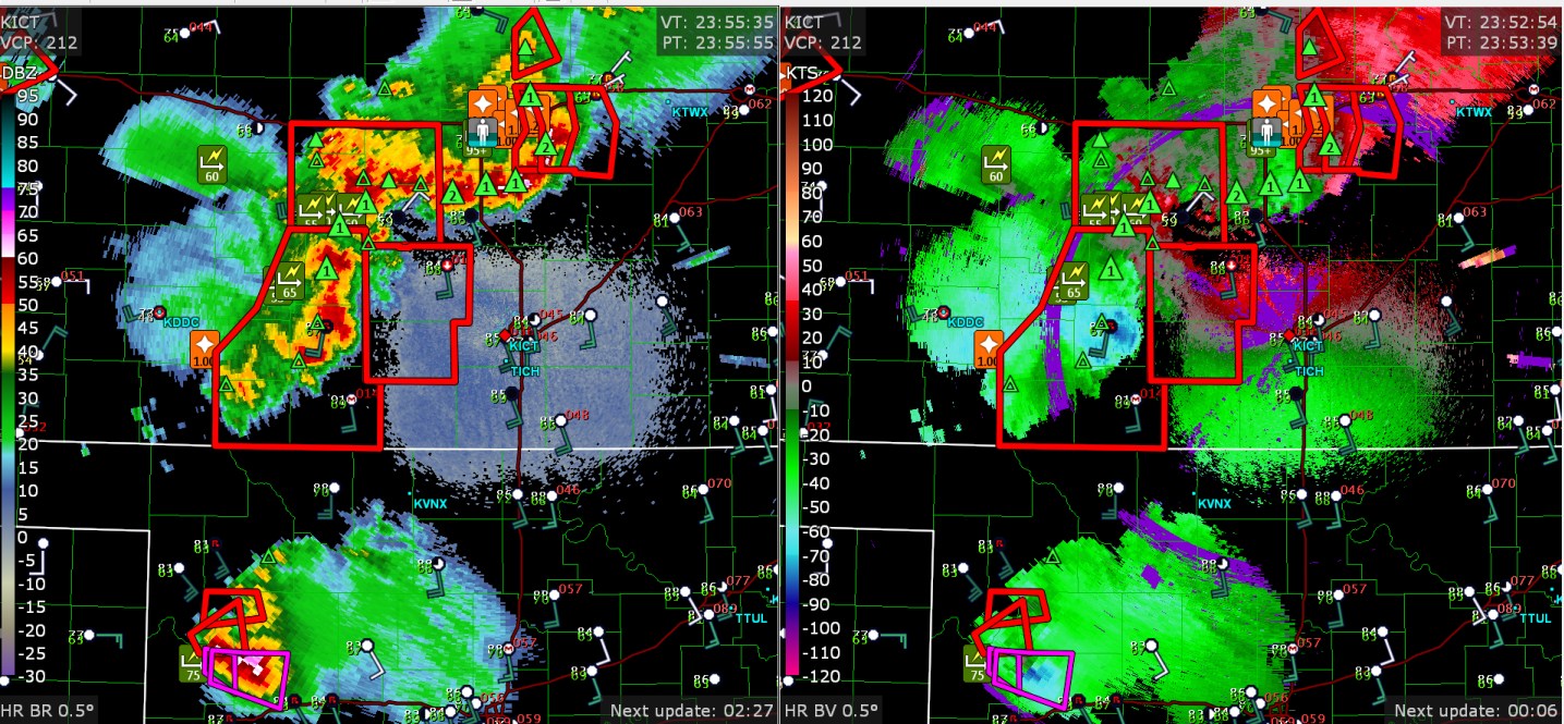
This supercell had the rear flank downdraft wrap all the way around, now there is an unconfirmed tornado warning.

-
SPC says MODERATE risk, including 45% hatched for hail and wind in similar areas. The 45% risk for wind is about twice the size of the 45% risk for hail. (but not extensive)
-
The 00z NAM already has a potent setup for the day-4 forecast (72 hours, Sunday night)
-
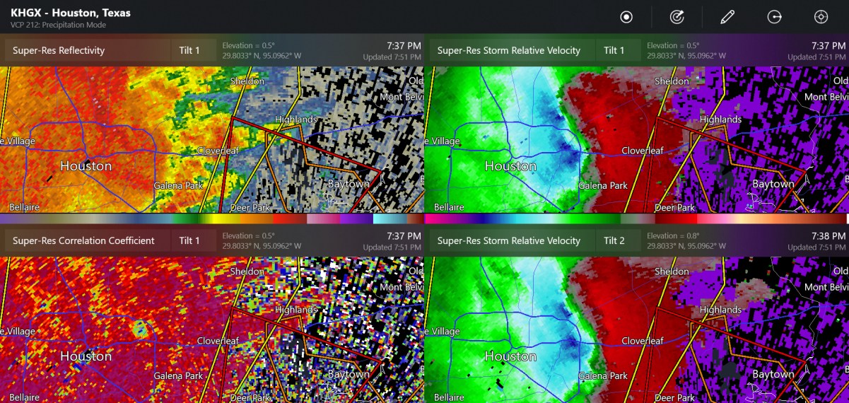
This is measured by downtown-- 62 knots ( Houston Dunn Helistop airport?)
-
I do not know if this was a TDS on the north side of Houston, but radar base velocities showed winds of 70-120mph in the rain clouds, close to the surface

-
this whole tornado warning may in fact be a nasty combo of wind and hail
-
that tornado warning on the squall line is now just 37 miles from Houston
-
There's a new tornado watch centered on Houston
-
the weather always has a lot of question marks
-
I made a loop of the upper level charts, since this was a high-impact severe weather outbreak https://great-lakes-salsite.web.app/May_5_10_2024_500mb_loop.html
-
It was kind of neat to see 4 or 5 or 6 supercells with hail lined up yesterday from Mexico to Texas to the Gulf of Mexico
-
Yesterday was a weird day with a couple of rounds of severe weather for South Texas. The first round was much earlier in the afternoon or morning. The enhanced risk seems to have been pretty good.
-
note: 5% tornado outlook
-
Already 3" to 5" have rain fall in some areas north of Houston in the last 24 hours. NWS has flood watches from the Florida Panhandle to Dallas.
-
Friday at about midnight. We probably won't see this for a long time
-
my place keeps getting rain
-
I'd say the 4.0" - 4.5" hail is the largest I've seen on a report during most years. You can easily see why that type of cell was possible based on forecast soundings/ SPC maps for significant hail parameter. (4.5" hail would be a nightmare... In fact it was a nightmare. A long time ago, someone died in Fort Collins Colorado due to a 4" hailstone.) Southern Texas had a heat index of about 120 yesterday and isolated locations in Mexico got over 110 measured temperature. Meanwhile my place here in Ohio was dreary and cold. My old favorite place in Colorado, that is, Estes Park, got snow to 8000 ft as viewed by the national park cams.
-
This storm that produced up to baseball sized hail and, more recently, golf ball sized hail.

-
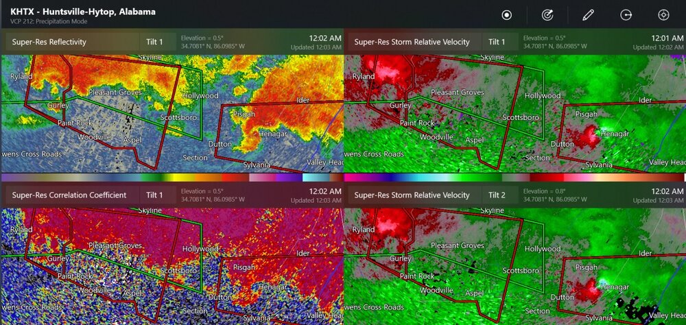
both of these are confirmed tornadoes in Alabama. It's possible that two tornadoes hit Huntsville tonight
-
tornado seen by traffic cam