Chinook
-
Posts
10,935 -
Joined
-
Last visited
Content Type
Profiles
Blogs
Forums
American Weather
Media Demo
Store
Gallery
Everything posted by Chinook
-
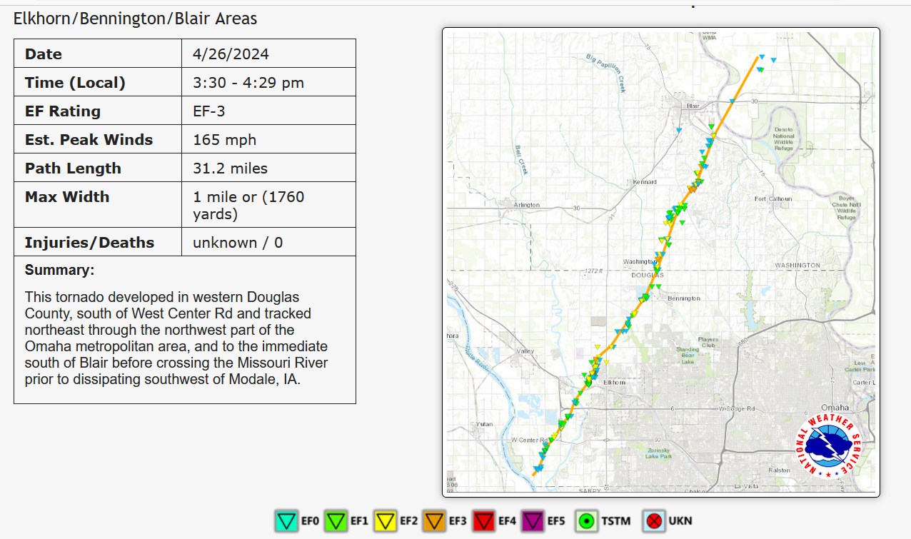
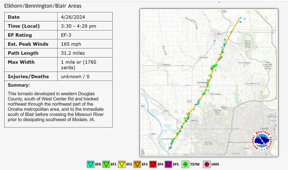
Only EF -3 for one of the largest ones near Omaha
-

Mountain West Discussion- cool season '23-24
Chinook replied to mayjawintastawm's topic in Central/Western States
heavy snow amounts of 10" to 24" at the National Park
-
Yesterday was pretty notable for the late-night redevelopment of tornadoes this is only a partial list of the later night tornadoes
-
possible tornado in Wisconsin
-
the storm by Hobart Oklahoma looks like it could get going and stay isolated
-
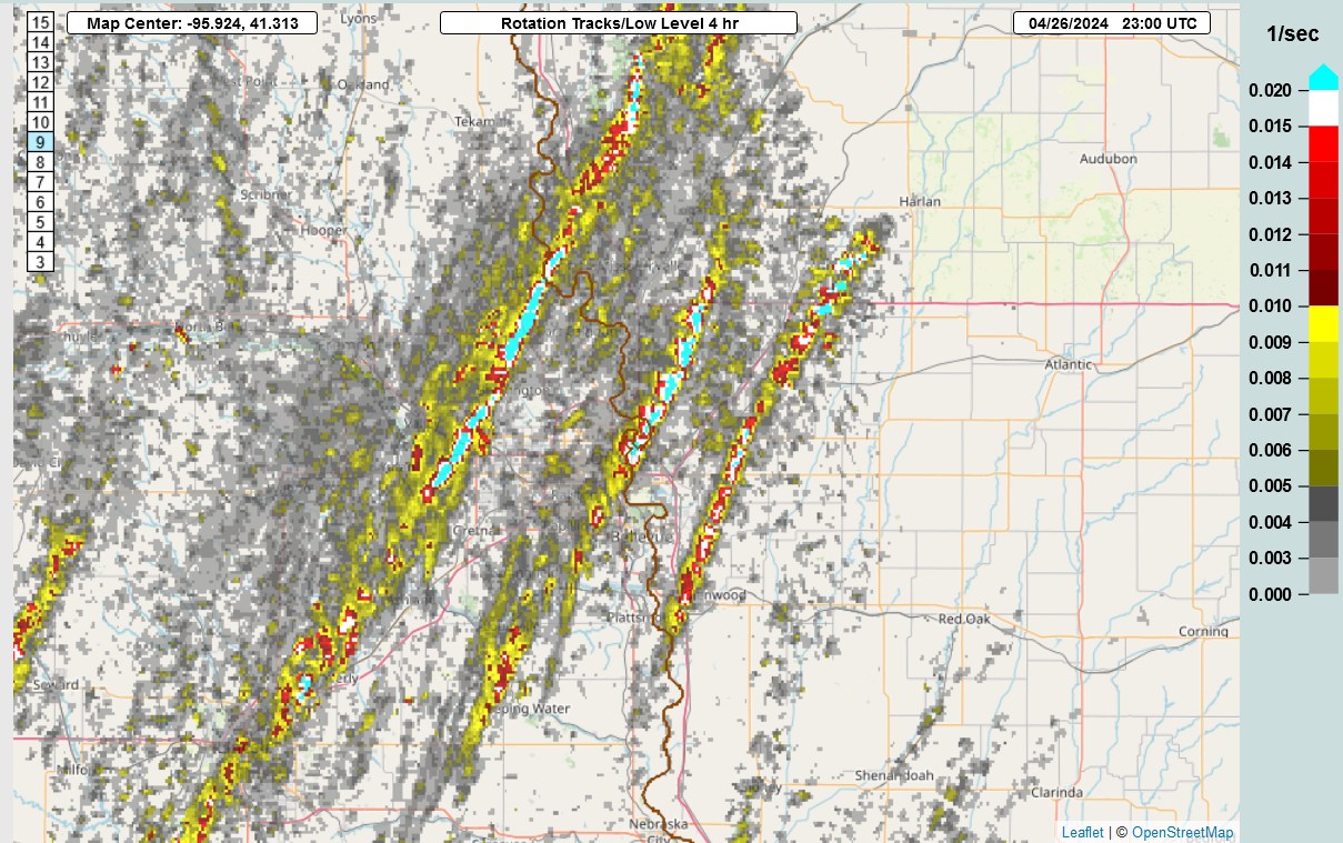
Low level rotation tracks in a 4 hour window yesterday

-
we've already got tornado warnings in W Oklahoma
-
one of the latest tornadoes tonight
-
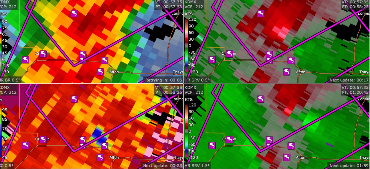
I went out tonight and I didn't look at my computer since 8:15. But I left my GRLevel3 on, and it saved data. I discovered this cluster of 7 tornadoes. (8:57PMEDT) I have no idea how 7 tornadoes happened here near Afton Iowa. And, by the way, there are 95 tornadoes on SPC storm reports.

-
Just think, there's an entirely new storm system tomorrow, with (currently) 10% hatched tornado risk in tornado alley
-
might be two tornadoes in the parent storm
-
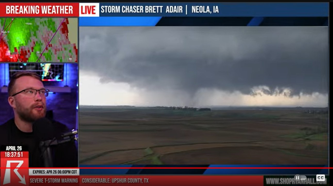
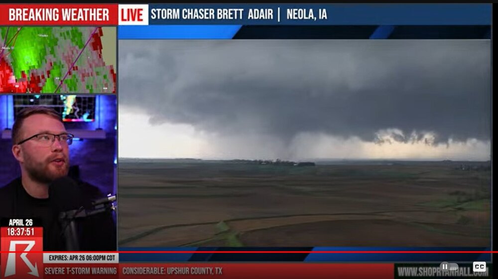
so crazy to see this drone view ( Neola)
-
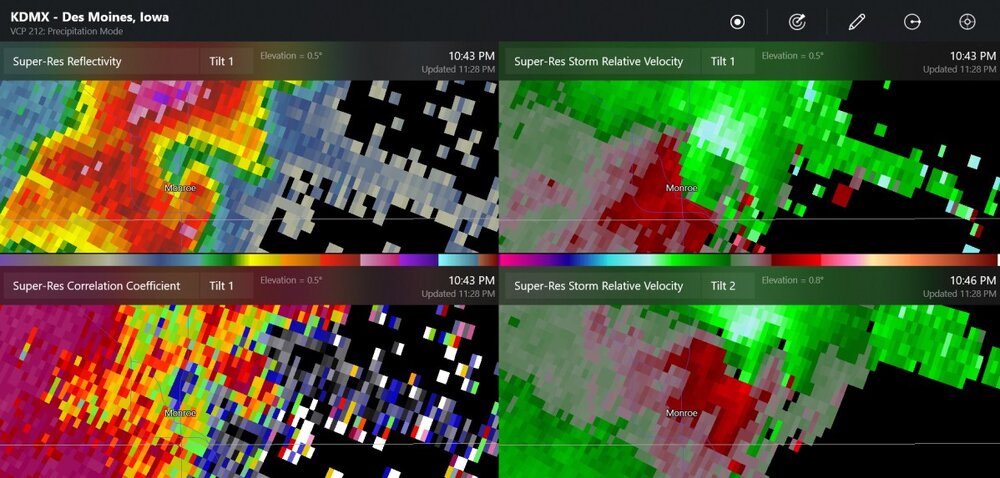
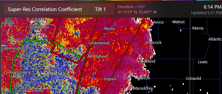
two TDSs in a small area
-
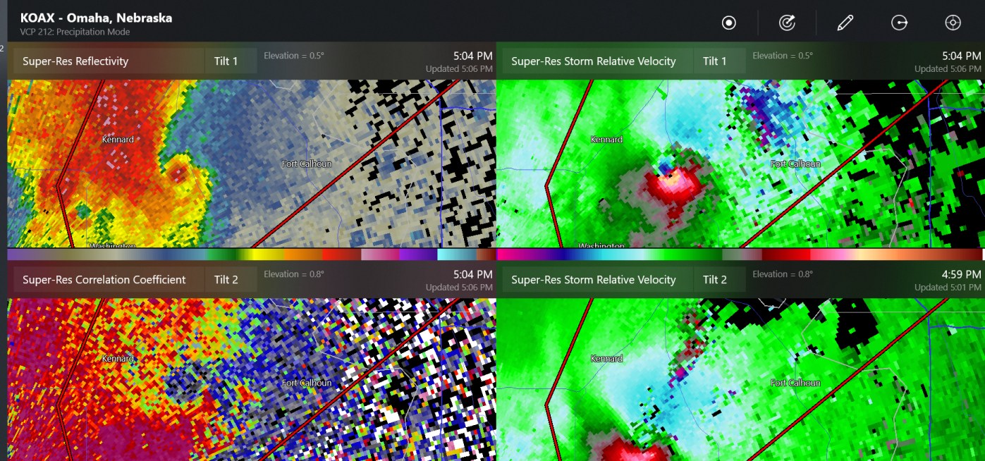
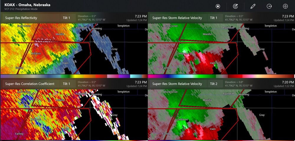
tornado damage in Omaha. Radar has a TDS over the Mississippi River. possible damage at the airport (Eppley)
-
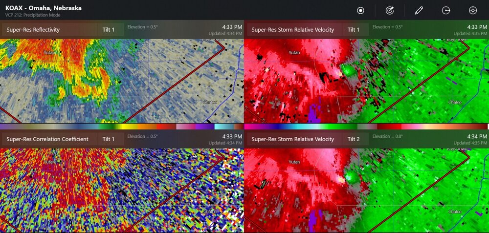
Incredible radar image of the damaging tornado from about a half hour ago. The OAX radar storm-relative velocity showed 132mph wind at one point

-
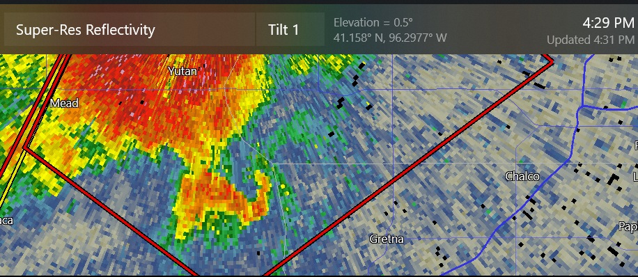
the large tornado has tracked 30 miles
-
now the velocity sees it
-
chasers are seeing a tornado, and look at this hook (west of Gretna, which is a large suburb of Omaha)
-
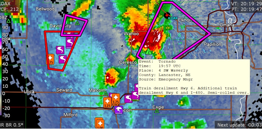
some buildings damaged at Waverly
-
this storm chaser saw rapid rotation
-
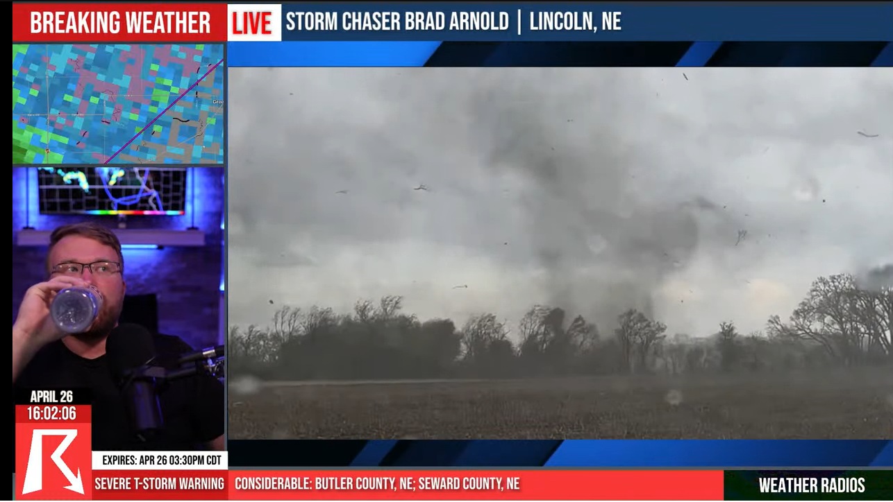
tornado is about 5 miles outside of Lincoln, seen by 3 storm chasers shown by Ryan Hall
-
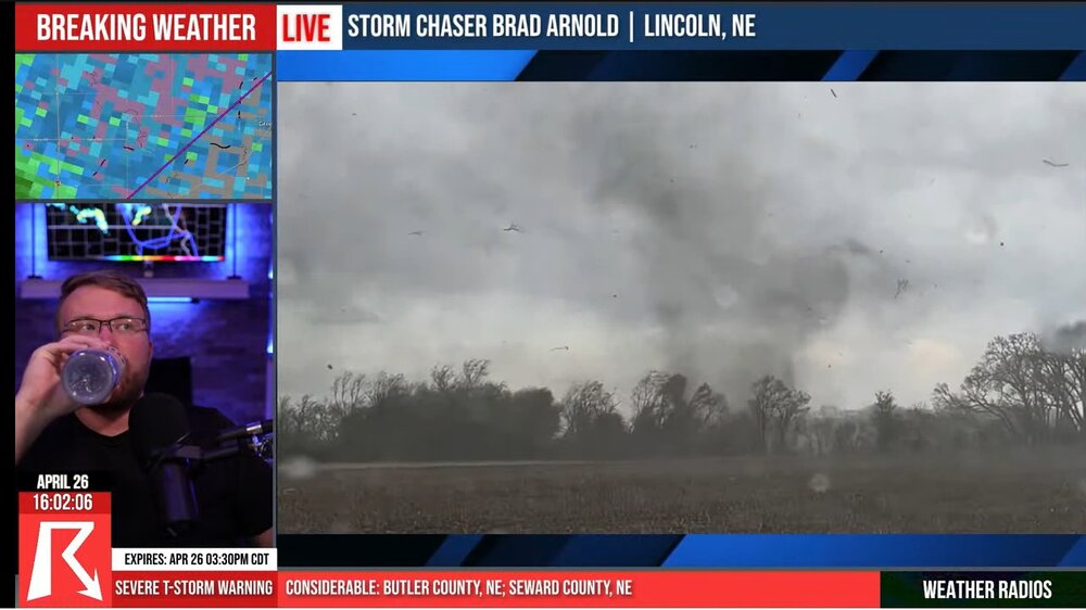
Chasers just saw a tornado at Lincoln
-
possible tornado and very dangerous situation at Lincoln Nebraska
-
We'll probably start a severe weather thread for the Thu/Fri time period.
-
There's a supercell on the Mexican foothills this evening with higher CAPE values. It's always interesting to see isolated cells with the S Texas radars if they are kind of close. For this cell, it's distant.