Chinook
-
Posts
10,935 -
Joined
-
Last visited
Content Type
Profiles
Blogs
Forums
American Weather
Media Demo
Store
Gallery
Everything posted by Chinook
-
Cyclone77 storm
-
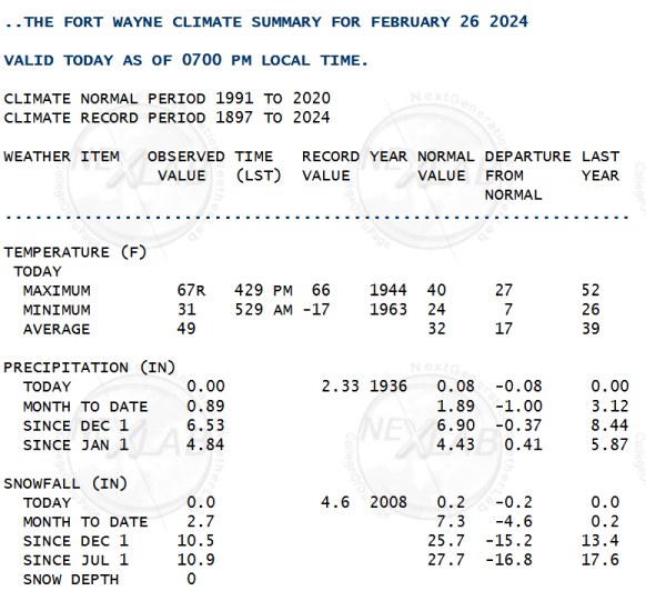
record high at Fort Wayne
-
It's 96 in Texas

-

Mountain West Discussion- cool season '23-24
Chinook replied to mayjawintastawm's topic in Central/Western States
There are lots of watches warnings, and advisories. It is snowing, windy, or on fire. Maybe half the country is on fire. We are not sure.
-
Mountain West Discussion- cool season '23-24
Chinook replied to mayjawintastawm's topic in Central/Western States
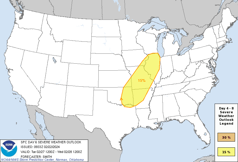
A large upper level trough will develop next week and one possibility is snow and cold temperatures in northern Colorado. The current models have a quick hit for the snow, but I suppose that could change. I think the trough may move too fast. On the severe weather side of things: The models have the 60 dew points from Texas into the Midwest. The SPC has given out an unusual Day-6 severe weather outlook, as shown. I figure the Illinois folks may eventually talk about this.
-
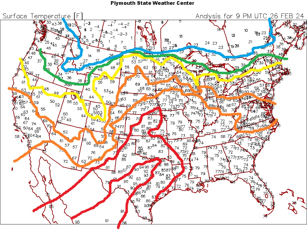
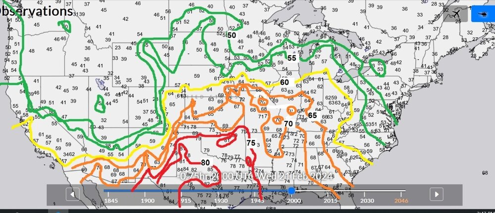
Here are the temps today at 20z, with contours from 50 to 80 highlighted. It feels nice to not be 30 and cloudy. I guess I might get cancelled by some snowlovers by saying that.
-
anybody getting cold this winter?

-
Mountain West Discussion- cool season '23-24
Chinook replied to mayjawintastawm's topic in Central/Western States
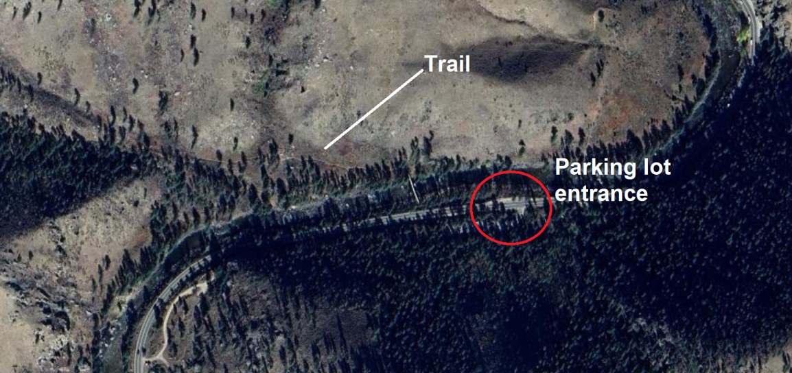
That sort of area always has an icy snowpack on the trail, as people walk on it and pack it down. I don't know if that helps. There's also another reason that I didn't go to Greyrock too much in the winter: the small parking lot has a mostly shaded area where you have to drive up a few feet. The slope may be icy. So, yes, you might get some icy stuff in exactly the places where you don't want. Hewlett Gulch has a road and parking lot that should be in the sun. Also, way less mountainous terrain at the trail. Still, might have some packed ice.
-
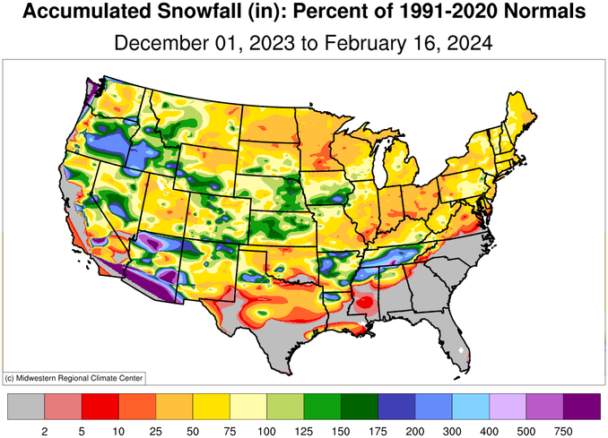
Mountain West Discussion- cool season '23-24
Chinook replied to mayjawintastawm's topic in Central/Western States
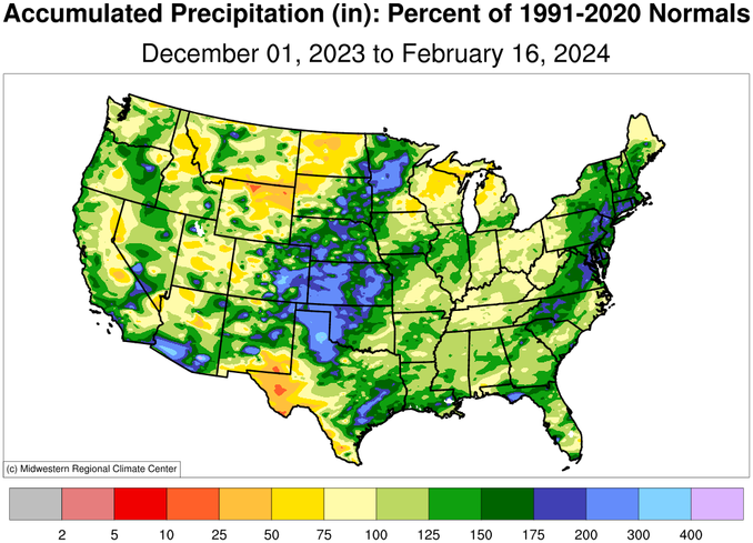
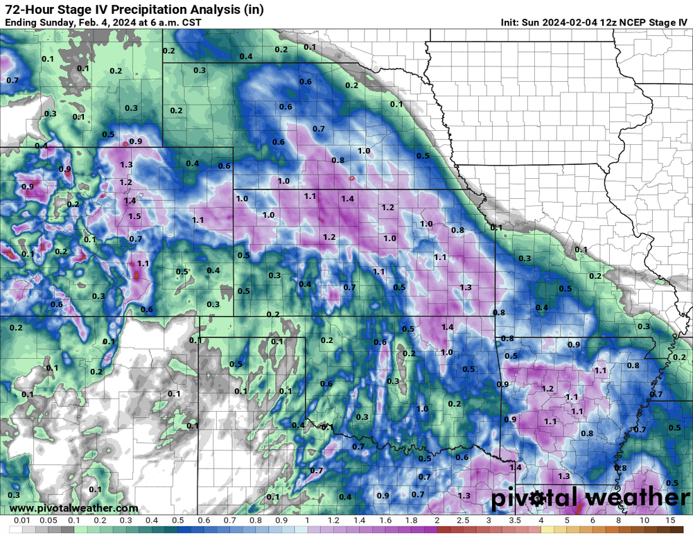
Here is the precipitation percent of normal and snowfall percent of normal since the beginning of December. From the recent storms, the snowpack snow water equivalent is above normal for the Southwest and below normal for the northern Rockies.
-
loop of 250mb, for the first 15 days of this 29 day month https://great-lakes-salsite.web.app/Feb_1_15_2024_250mb_loop.html
-
Let’s talk winter!! Ohio and surrounding states!!
Chinook replied to Steve's topic in Lakes/Ohio Valley
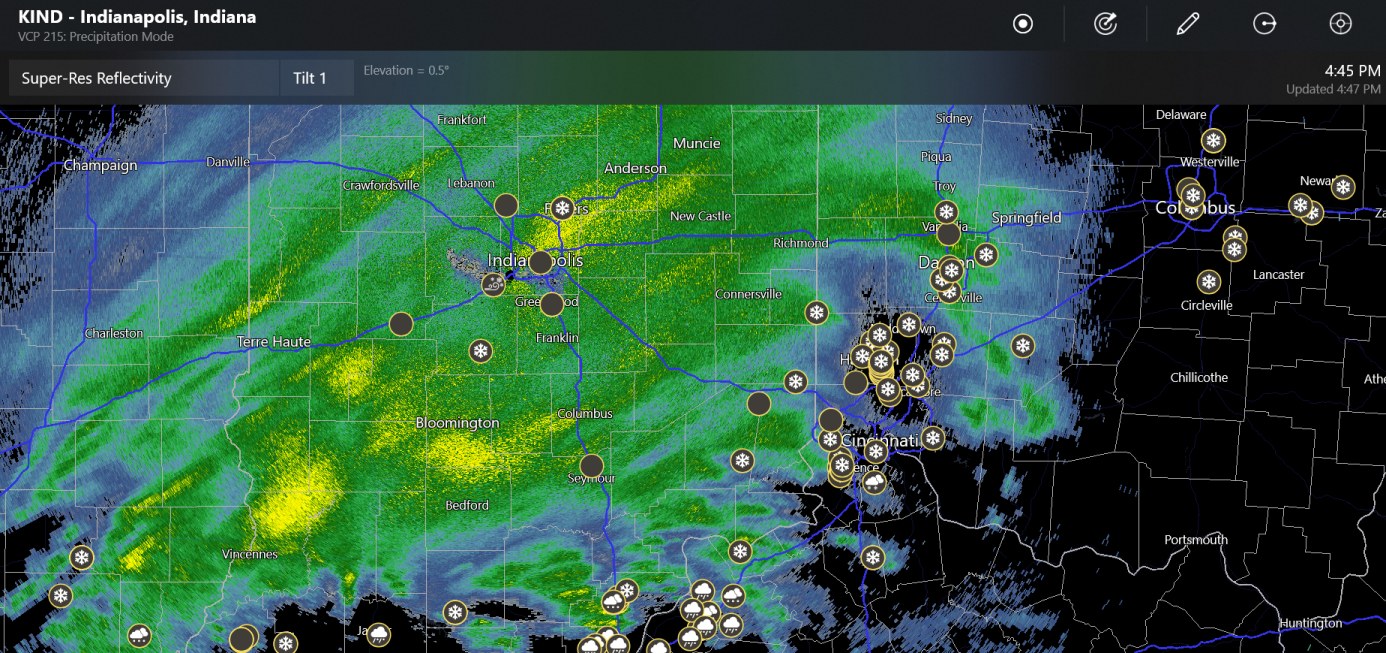
There are about 10 snowflakes near Cincinnati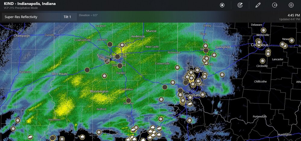
-
Let’s talk winter!! Ohio and surrounding states!!
Chinook replied to Steve's topic in Lakes/Ohio Valley
central Indiana, with reports from IL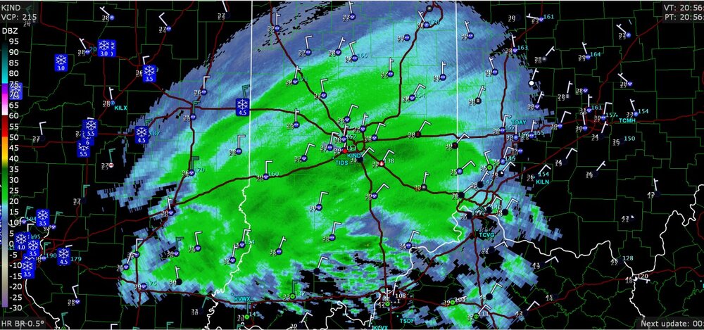
-
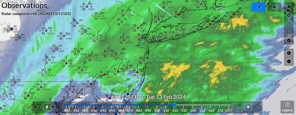
2/13 Significant/Major Winter Storm Discussion & Observations
Chinook replied to Northof78's topic in New York City Metro
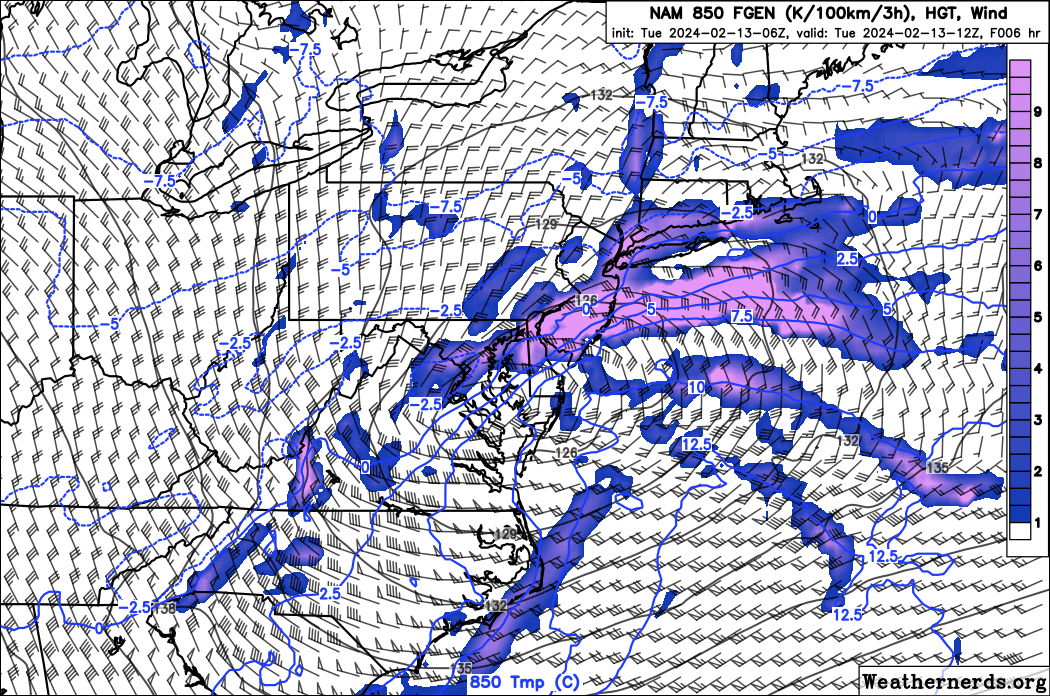
Here's the NAM 850mb frontogenesis overlaid with 850mb temperature. Also surface observations from this morning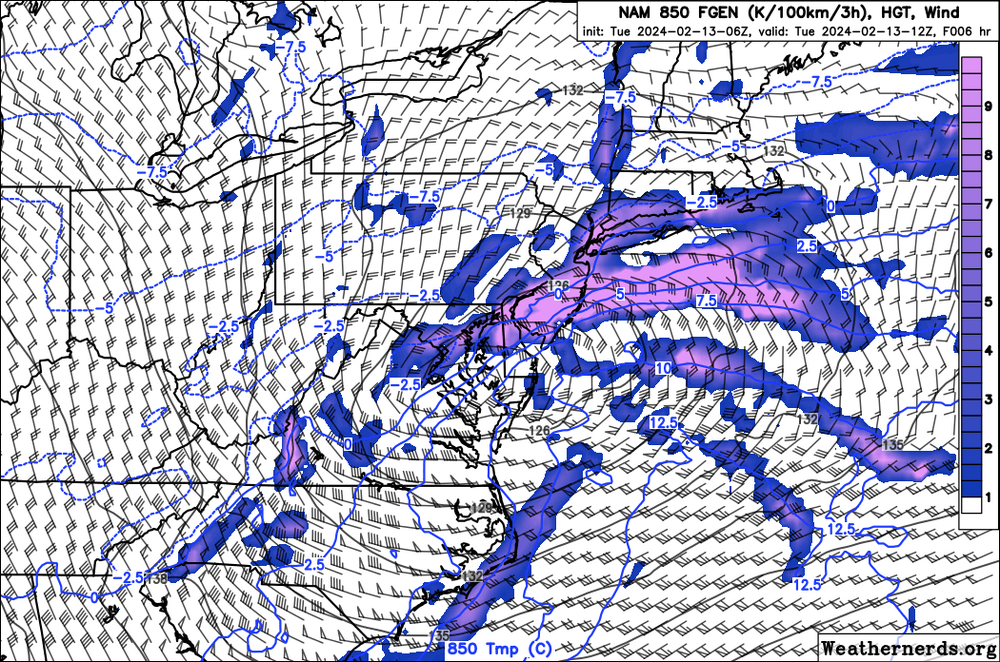
-
Mountain West Discussion- cool season '23-24
Chinook replied to mayjawintastawm's topic in Central/Western States
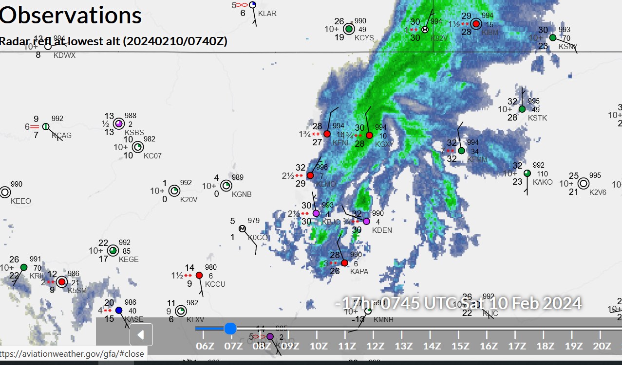
Here is the observation in the middle of the night with the heavy snow at Greeley. I would imagine some areas were getting over 1" per hour
-
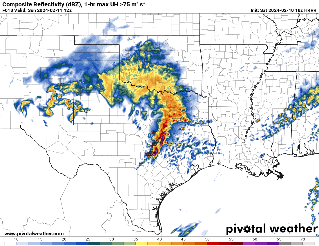
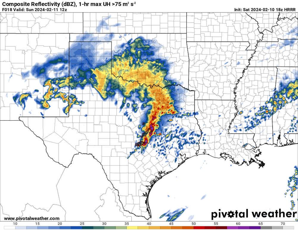
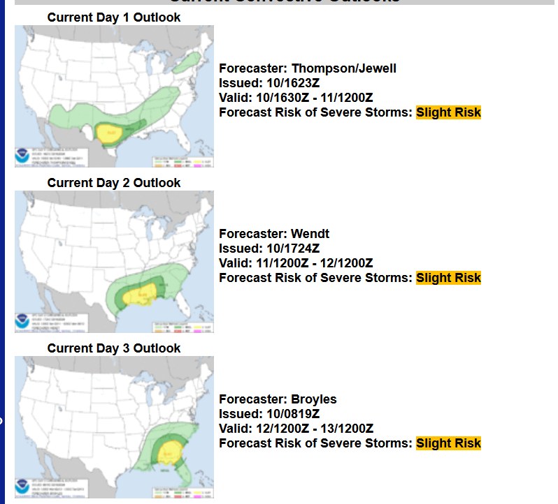
We've got three slight risks, starting today (tonight) for Texas. Here is what may be happening at 12z(6:00AM central)
-
Mountain West Discussion- cool season '23-24
Chinook replied to mayjawintastawm's topic in Central/Western States
somebody woke up to 12" and that would be somebody in Greeley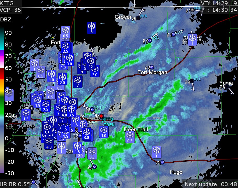
-
Mountain West Discussion- cool season '23-24
Chinook replied to mayjawintastawm's topic in Central/Western States
The NWS has a winter weather advisory for you guys. They have the 2-5" type stuff, with not any huge snowfall at 9000ft+. -
Mountain West Discussion- cool season '23-24
Chinook replied to mayjawintastawm's topic in Central/Western States
The 18z GFS is kind of splotchy with this one. It's very likely due to high lapse rates/ instability The models have all sort of zones of heavier precipitation with this. I hadn't even been looking at the models much. It looks like the surface temp could be 29.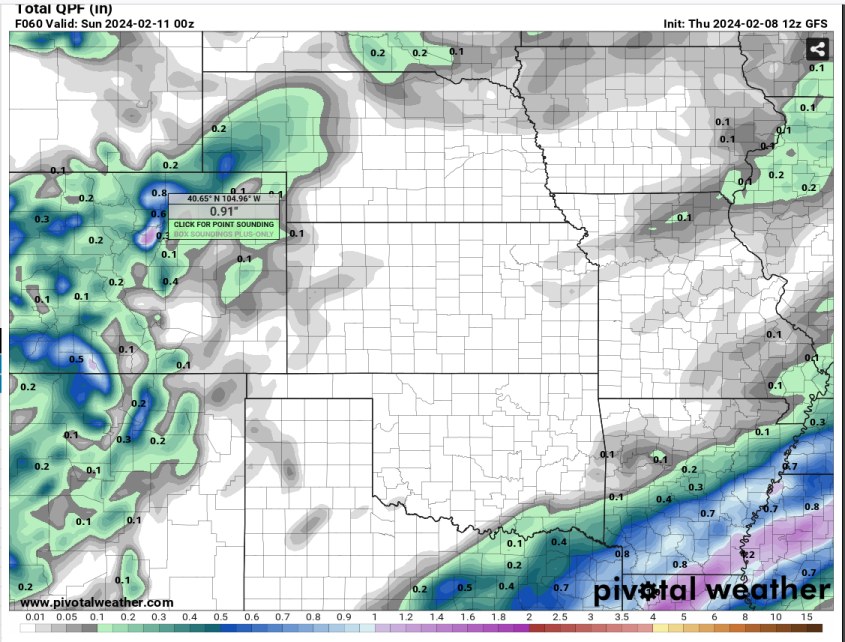
-
2024 Short/Medium Range Severe Weather Discussion
Chinook replied to Chicago Storm's topic in Lakes/Ohio Valley
pretty much a verified tornado now close to Evansville (tornado report at Albany at 5:37central)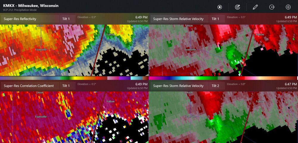
-
Mountain West Discussion- cool season '23-24
Chinook replied to mayjawintastawm's topic in Central/Western States
This is the NWS analysis of the heavy snow recently
-
Mountain West Discussion- cool season '23-24
Chinook replied to mayjawintastawm's topic in Central/Western States
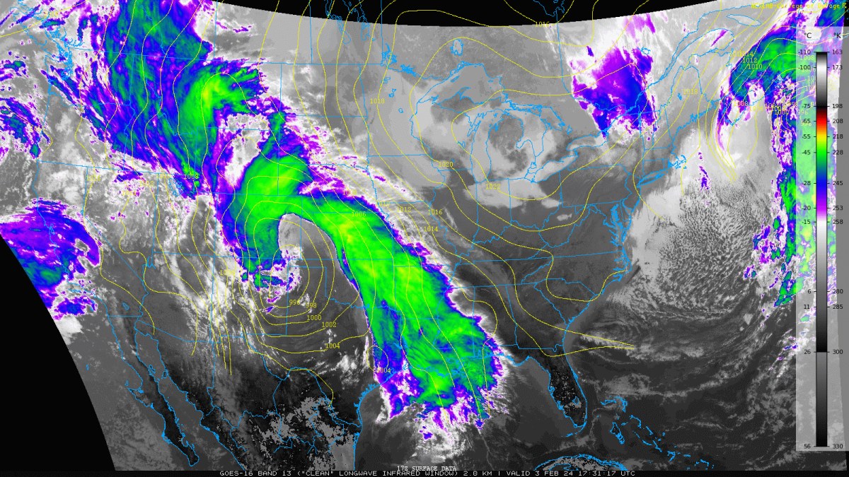
The dry slot developed quickly this afternoon. Here's a satellite picture with SLP when the rain/snow was getting going this afternoon for you guys
-
Mountain West Discussion- cool season '23-24
Chinook replied to mayjawintastawm's topic in Central/Western States
California is going to double its recent precipitation with a W Coast storm -
Mountain West Discussion- cool season '23-24
Chinook replied to mayjawintastawm's topic in Central/Western States
I was going to say that rain above 5000ft at this point of the year is nuts. but I guess it's light snow at Greeley and accumulation in Denver, so that's something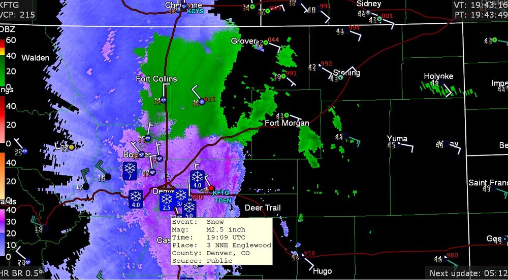
-
my new 250mb jet stream loop to end off the month https://great-lakes-salsite.web.app/Jan_17_31_2024_250mb_loop.html
-
Mountain West Discussion- cool season '23-24
Chinook replied to mayjawintastawm's topic in Central/Western States
my thinking is that Ft. Collins/Loveland/Longmont averages over 50" and Boulder was like 76" other notes: up to 61 degrees in Alberta Canada today (also 60's at Lewistown/Great Falls Montana today and yesterday) SPC slight risk near San Antonio (probably not too much discussion needed unless somehow we get a tornado watch tomorrow) Obviously dew points of 50-60 in that area are unusual at this time of year.