Chinook
-
Posts
10,934 -
Joined
-
Last visited
Content Type
Profiles
Blogs
Forums
American Weather
Media Demo
Store
Gallery
Everything posted by Chinook
-
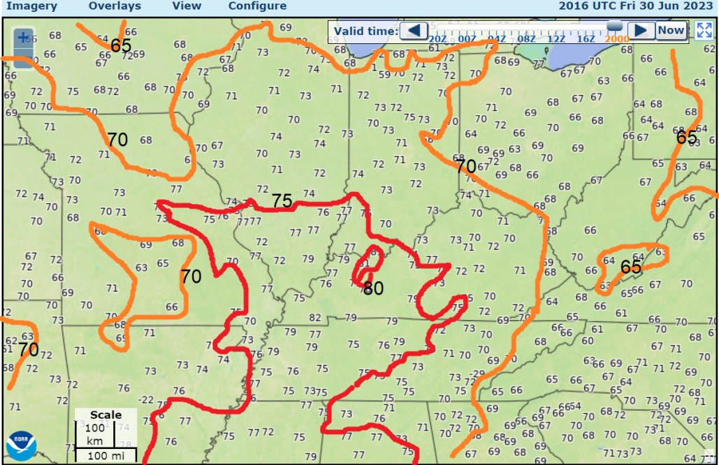
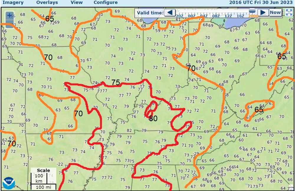
The dew points of 75-80 in lower Ohio Valley
-
Denver has a record rainfall, of a type. I checked the NOWDATA precipitation accumulation plot for April 22-June 30: 12.05" of rain at Denver, maximum of all time periods of exactly these calendar days.
-
So we finally get some rain to help the corn crops on a holiday weekend (sort of)
-
The GFS has around 45 kt of shear in Illinois for the storm development tomorrow, so that's pretty decent for general severe weather.
-
I think this is the first 68 dew point at my place in this droughty summer. Crazy.
-
And hail went right through downtown Denver again
-
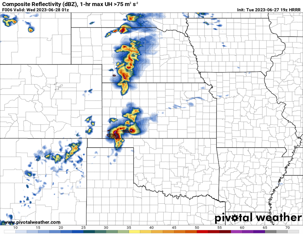
Tornado warning, and a supercell at Hooker, Oklahoma, is ahead of a line or multicells. So the HRRR had some accuracy on that particular idea. It's actually pretty amazing that the convective mode can be predicted well sometimes. other note; run a COD 96-frame or 200-frame satellite loop and overlay 500mb over the longwave IR or water vapor IR channel. It's inspiring.
-
The cap is winning right now
-
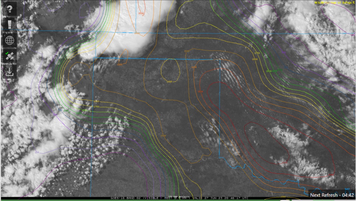
Here's a thing I don't use very much. COD satellite zoom-in with overlay of analysis (CAPE in this case). New storms approaching 3000 J/kg

-
It's possible we could have a leading supercell with a tornado threat. West of that there could be multicell group, which could be the wind threat (derecho-ish) that is expected though the next few hours, along with some possibility of large hail and tornadoes.
-
It's always interesting to see how "not much will happen" turns in to "moderate risk" when the hour gets closer. Maybe Sunday should have been moderate risk for some areas. Dew points in NW Oklahoma are now about 70, making for a SBCAPE of 3000-4500 J/kg expected in front of storms in the moderate risk. Some initial severe storms are ongoing now.
-
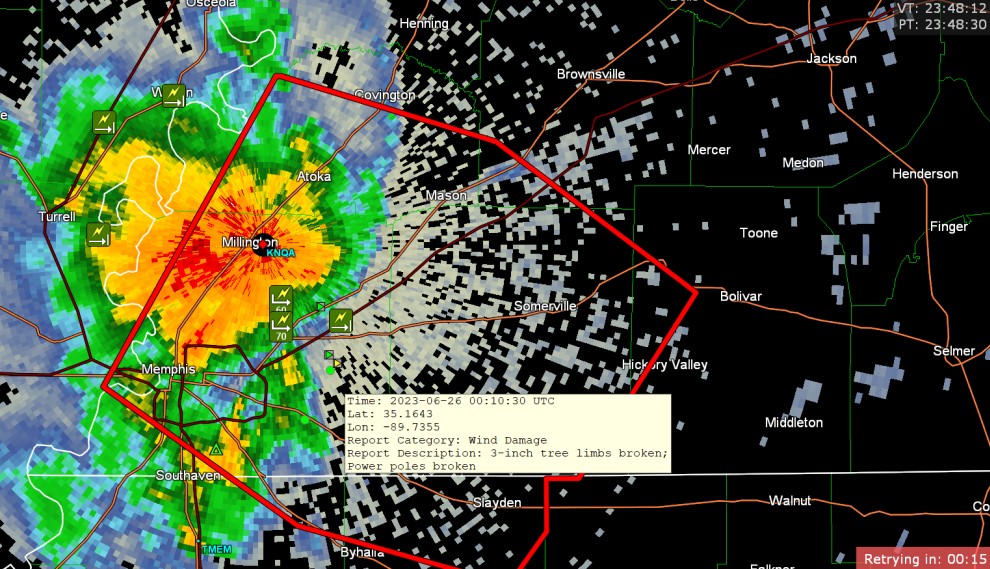
damaging storm in Tennessee
-
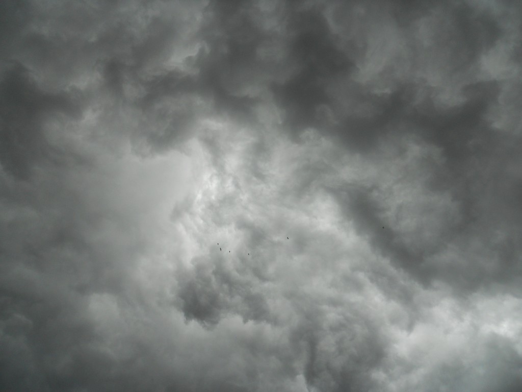
birds like shelf clouds too

-
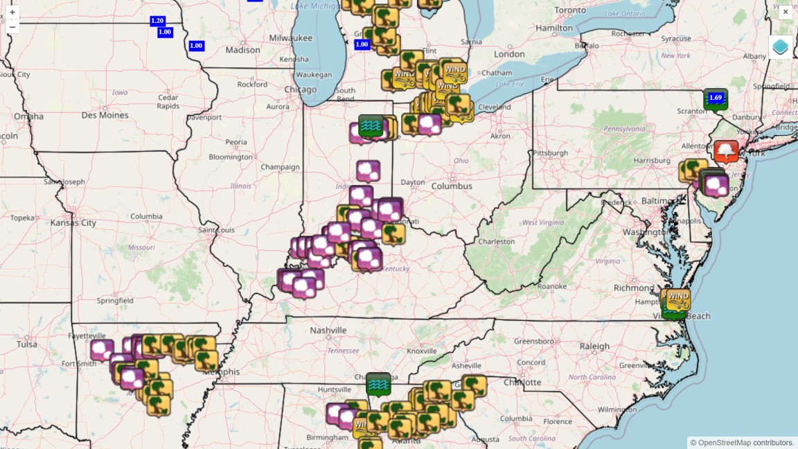
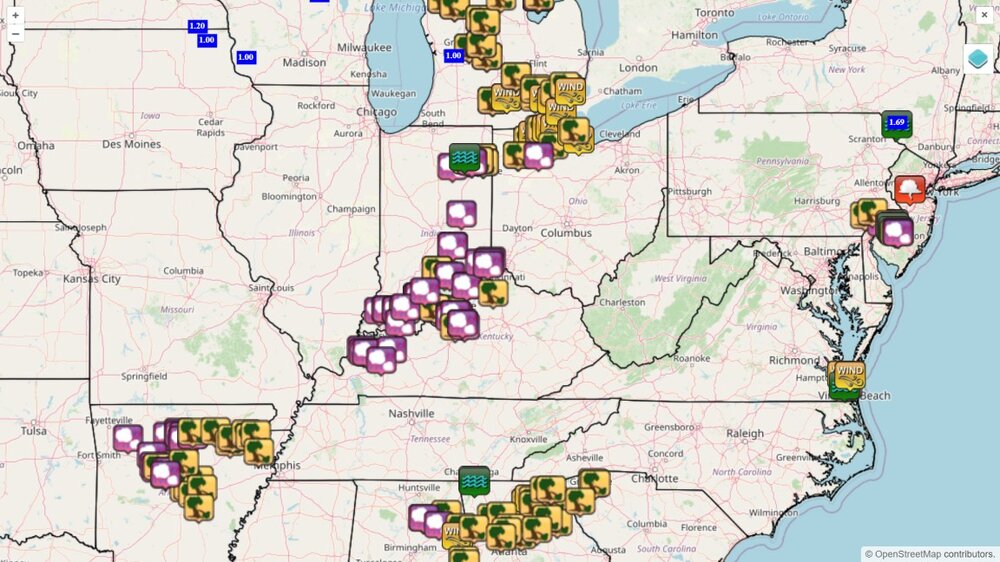
last 3 hours of reports (including sub-severe reports like 40mph wind)
-
Well, guys, at long last, it actually rained like a real thunderstorm. I got a shelf cloud, (will post pictures if you guys want.) visible changing motions in the cloud, lightning and thunder. I saw a bit of lightning, and tried to video it, but that might not have worked. I just got a rain rate of 1" per hour with 30mph gusts and constant rumbles. Some utility poles down in Toledo, as what might be considered low-end wind damage. I saw a couple of pea sized hailstones on the porch, but hailstones were not easy to see anywhere else. 53mph at Toledo 61mph at Detroit Metro just now, some more thunder, must be nearby lightning and the rain picked up
-
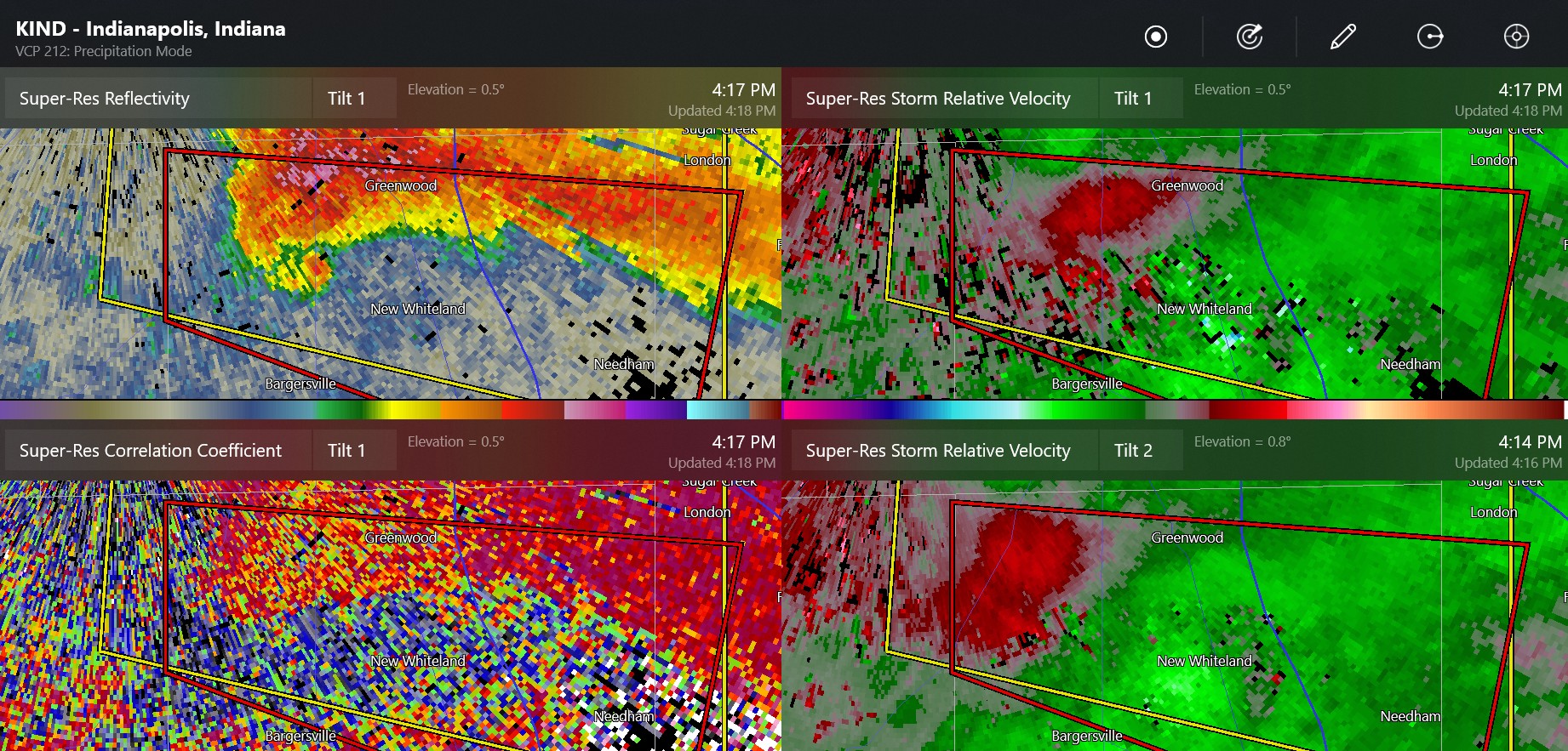
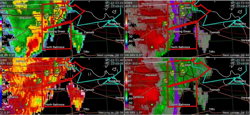
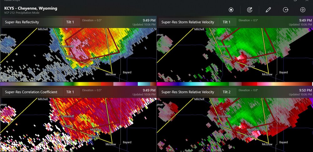
I've heard that this is a TDS from the Ryan Hall stream

-
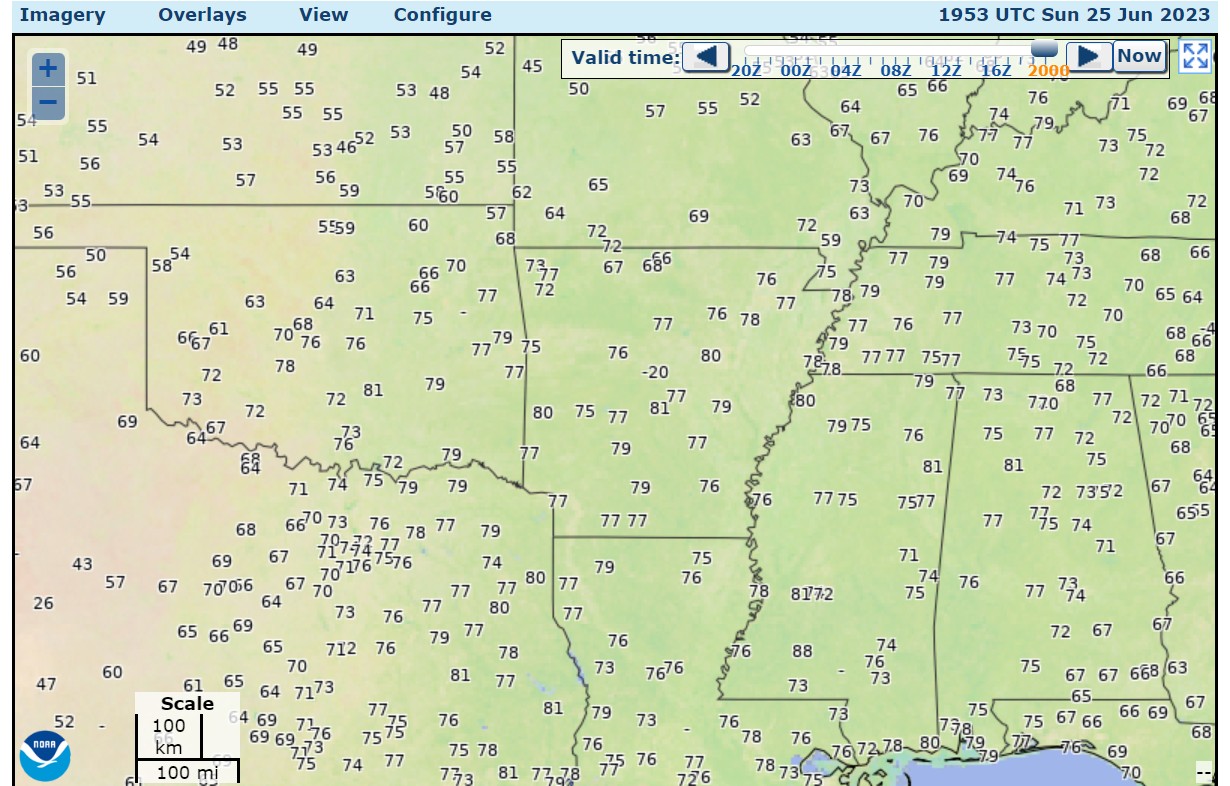
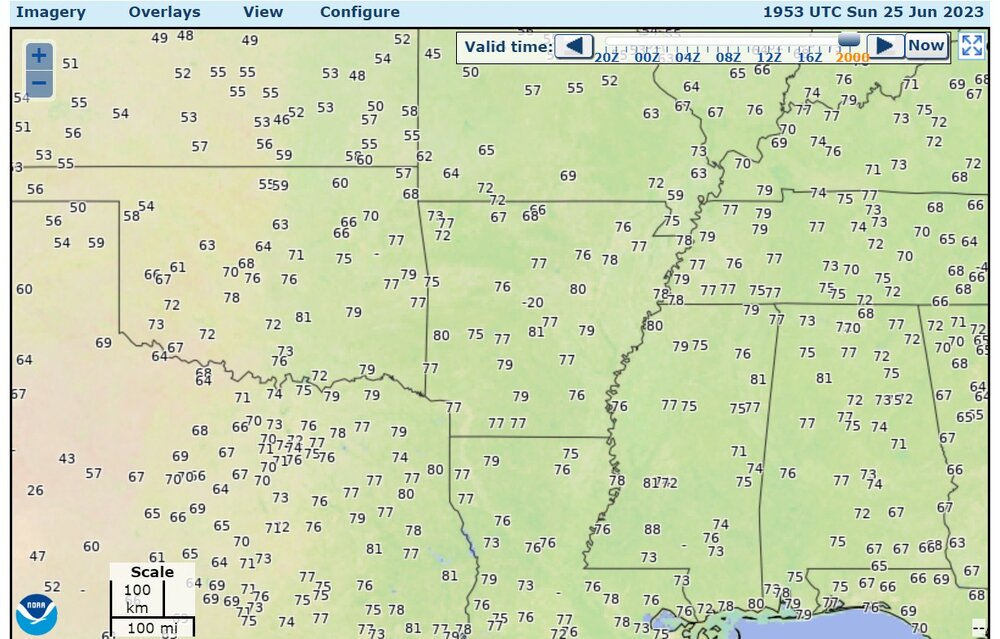
dew points of 80 in Arkansas, Texas
-

2023 Short/Medium Range Severe Weather Discussion
Chinook replied to Chicago Storm's topic in Lakes/Ohio Valley
It seems like the HRRR was a little too excited today. Still, there was 3000-4000 J/kg to work with. I wonder what will get going tomorrow. The new runs will be coming out soon. I wonder if I'll finally have some storms to track within a few miles of me. Will the HRRR runs be too excited about severe storms tomorrow? -
If I remember correctly, Twister the movie never showed the correct supercell structure like wall clouds, or clear slot, rear flank downdraft shelf, etc.
-
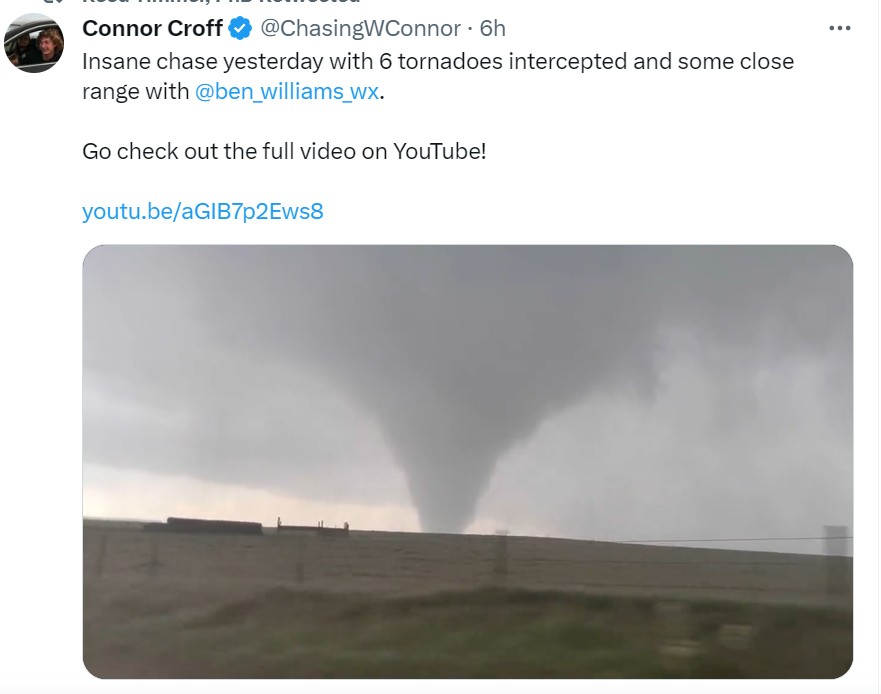
Didn't 6 tornadoes occur in the movie Twister? Hmm. Oh well, the reality is these guys had a chase of a lifetime.
-
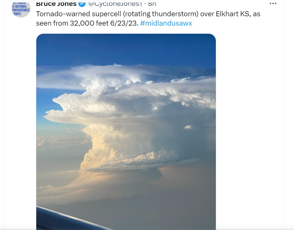
I always wished to be able to do this- take a pic of a great storm cell from a jet. I haven't flown across the country in the spring/summer very much. I did see a MCS/anvil with a storm one time, from about 10 miles+, in a jet.
-
2023 Short/Medium Range Severe Weather Discussion
Chinook replied to Chicago Storm's topic in Lakes/Ohio Valley
There are some grunge thunderstorms starting in Iowa, with maybe a couple of severe warnings in the next hour, maybe some 1" hail. It probably could get a lot worse with 50 kt of shear, later. SPC mesoanalysis says significant tornado parameter will be >1 this evening. -
2023 Short/Medium Range Severe Weather Discussion
Chinook replied to Chicago Storm's topic in Lakes/Ohio Valley
Looks like some heavy storms could pop up later today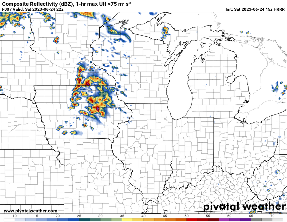
-
I think this is it. I'm watching Brandon Copic (storm chaser) being broadcast by Reed Timmer's youtube. May have already been a complicated situation with multiple, perhaps, short lived tornadoes
-
TORNADO EMERGENCY