Chinook
-
Posts
10,933 -
Joined
-
Last visited
Content Type
Profiles
Blogs
Forums
American Weather
Media Demo
Store
Gallery
Everything posted by Chinook
-
I hadn't seen 80 kt of effective shear at any time in June except for Nebraska a few years ago.
-
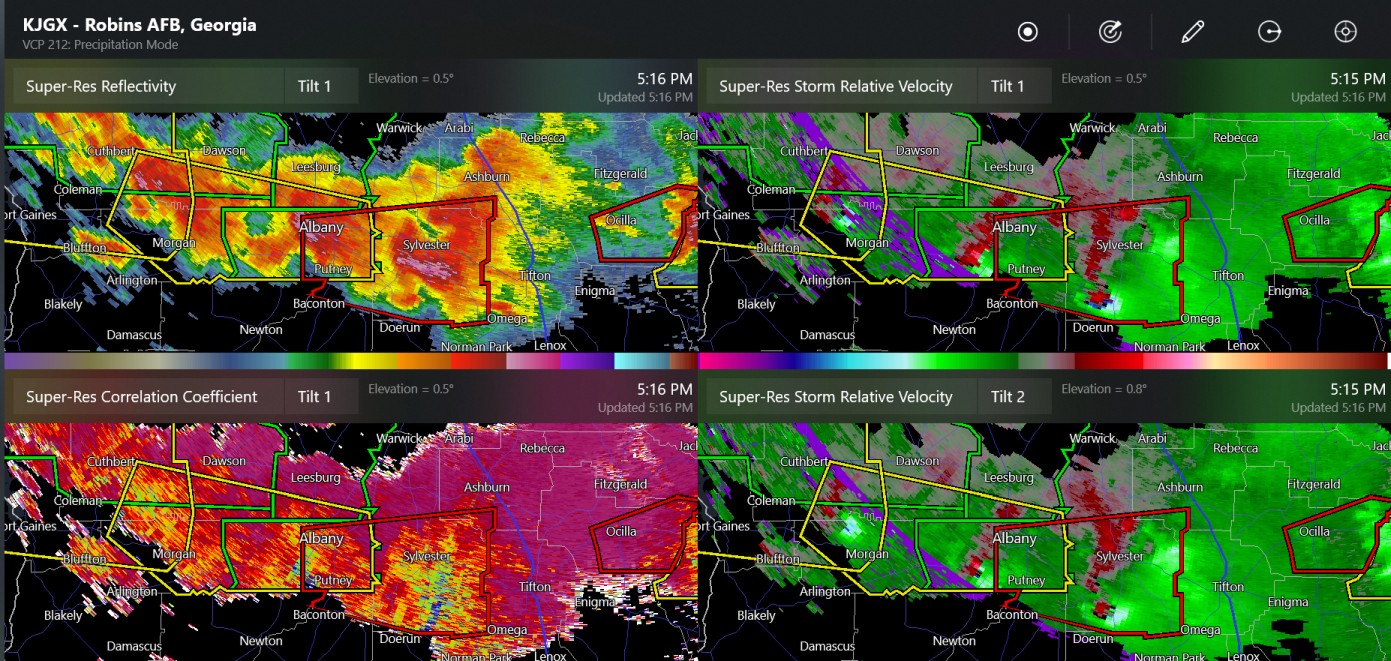
I haven't seen this level of shear in June in the southeast states, and also apparently the 10% SPC tornado contour just simply hasn't been issued this far south for a very long time, possibly Triple supercells, two tornado warnings
-
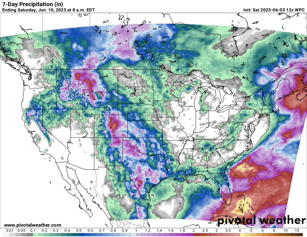
tornado reported at Ashburn Georgia

-
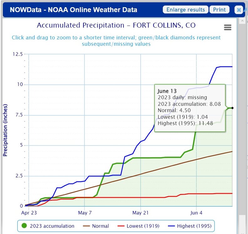
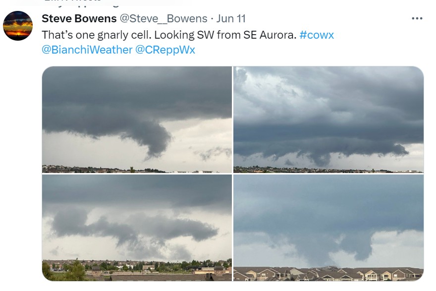
I leave Fort Collins and this happens
-
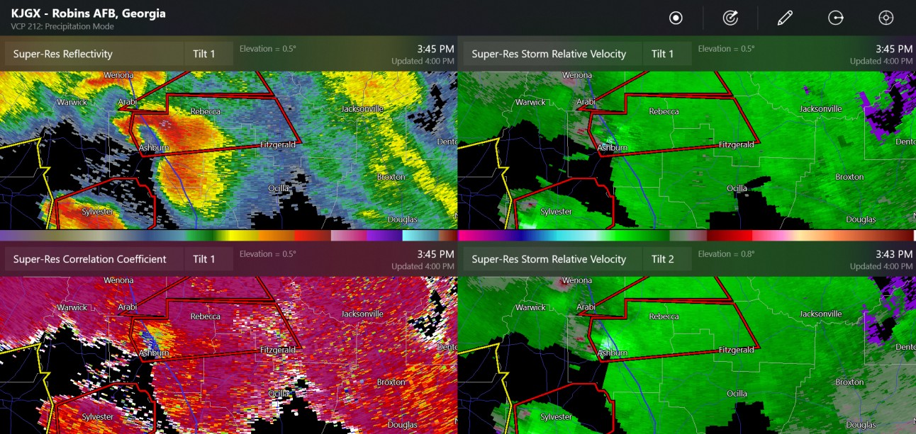
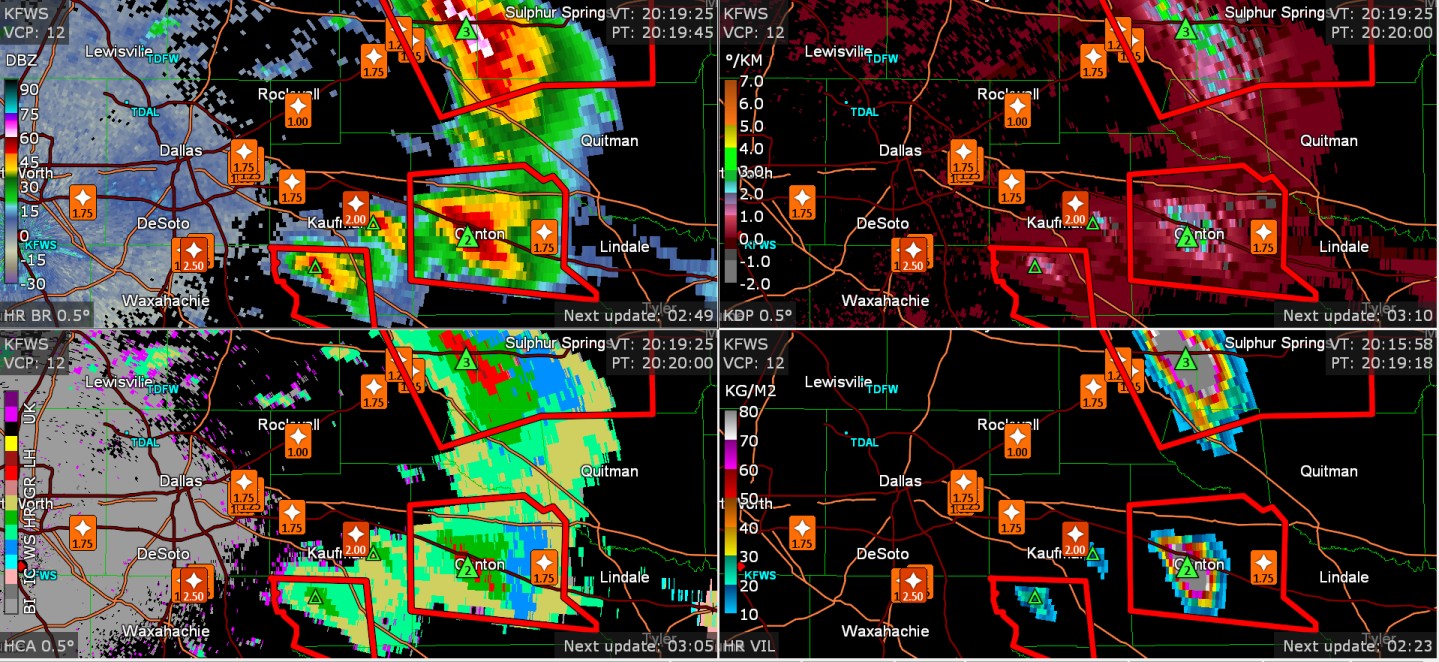
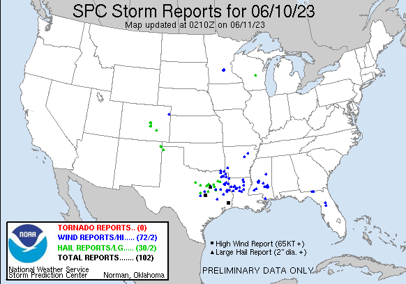
There have been many hail reports in some areas of North Texas.
.gif.4b94ad2a20d0d497d1b96890bfe6c74c.gif)
-
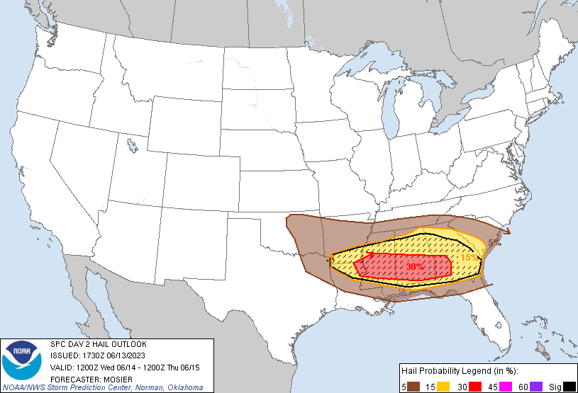
Tomorrow, the SPC has 30% for hail/wind in the Southeast. Here is the severe hail probability chart. The severe wind probability shows nearly the exact same thing without the hatching (significant severe indicator)
-
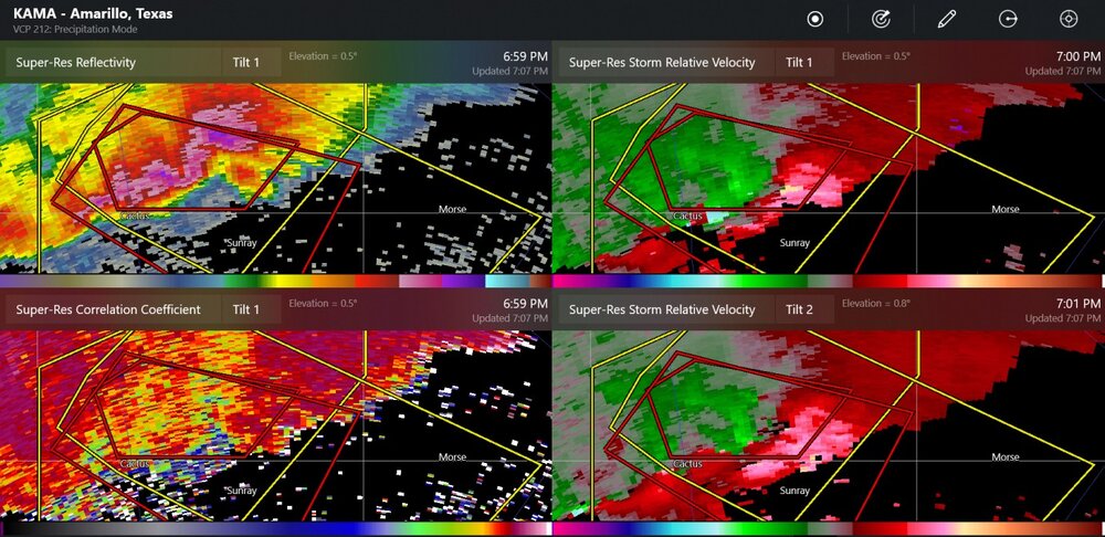
there was a tornado confirmed at Conlen, TX. This large supercell/squall combination has been producing large hail, and there have been other unconfirmed tornado warnings
-
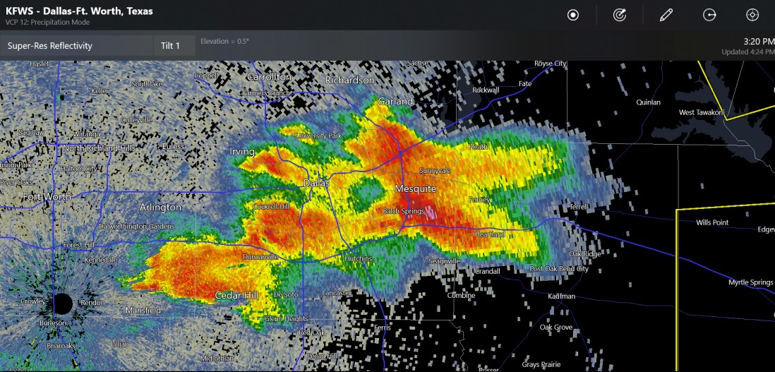
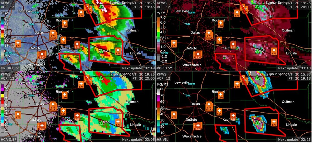
new Dallas area storm reports

-
maybe a series of scud clouds or wall cloud development yesterday.
-
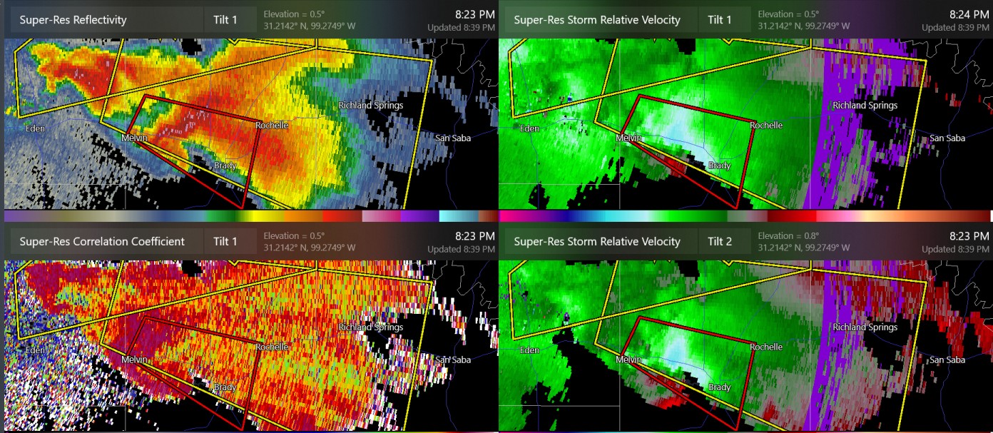
Tornado warned cell and two large severe warned cells near Brady TX (San Angelo radar)

-
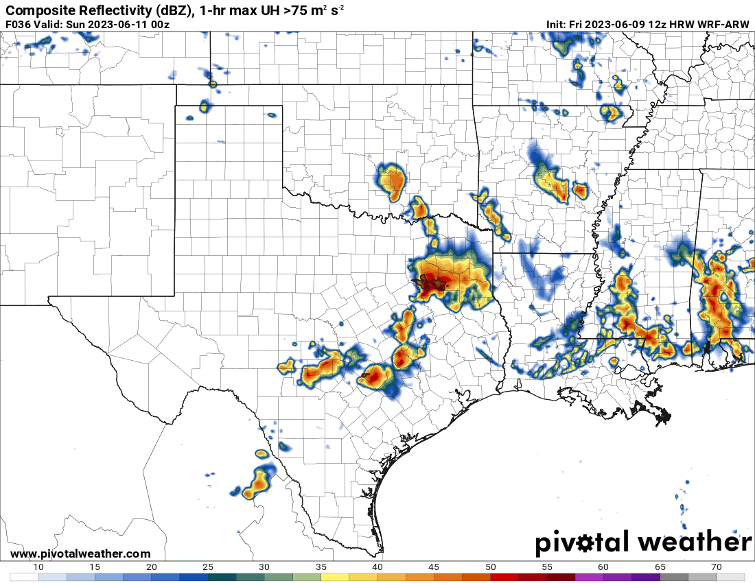
HRRR has some storms 03z to 12z near Dallas, with effective helicity/effective shear very favorable for supercells. The surface based updrafts may not happen at all overnight (should be weaker effective helicity)
-
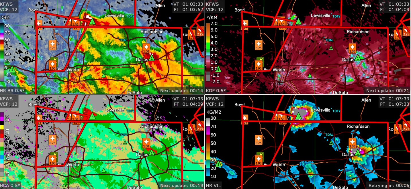
There was 3" hail where GRLevel3 said 3" hail north of Fort Worth

-
This is the first rain in Toledo since May 19-20 when 0.3" to 0.5" fell. Also, first 50 degree dew point in Toledo for quite some time. Such an odd time. I feel like somehow I dragged the high plains droughty Fort Collins weather with me, with approximately 22 days without rain, persistent and concentrated wildfire smoke, and frequent dew points in the 40's. The opposite thing seemed to have happened earlier this year. My place got soaking rain with temps of 33-50 degrees all the time in January and February, which is very opposite to the western weather, that is, no rain on the high plains, either sun or snow.
-
Some actual severe storm reports. You could call this a decently organized slight/enhanced sort of day. For once in the last several weeks.
-
It's June 10 and the nearest 50 dew point to me is Farmington, Missouri or Pittsfield, Illinois. It should be all 60-70 across the board.
-
Ryan Hall said: It's the 4th consecutive May without a violent tornado There was not a single report of wind, hail, or tornado in New York or Pennsylvania in May

-
I wish I could see any raindrops. As per the 12z convection-allowing models, there should be a few storms in E Texas at 18z that will fall apart and leave behind some form of an outflow boundary. Then, there will probably be several cells forming into an MCS south of Dallas. It seems like there may be a corridor of over 200 m2/s2 of storm relative helicity and 30kt to possibly 40kt of shear powering up these cells. Also, as you may have seen in Ed's post (the previous post,) the forecast sounding has high SHIP (sig hail parameter) and so forth. So, hail of 1"-2" should be quite likely, with maximum hail over 2" possible. As per Ed (previous post) I wouldn't be surprised if the MCS continues more eastward or southward towards Houston than today's 12z models are showing.

-
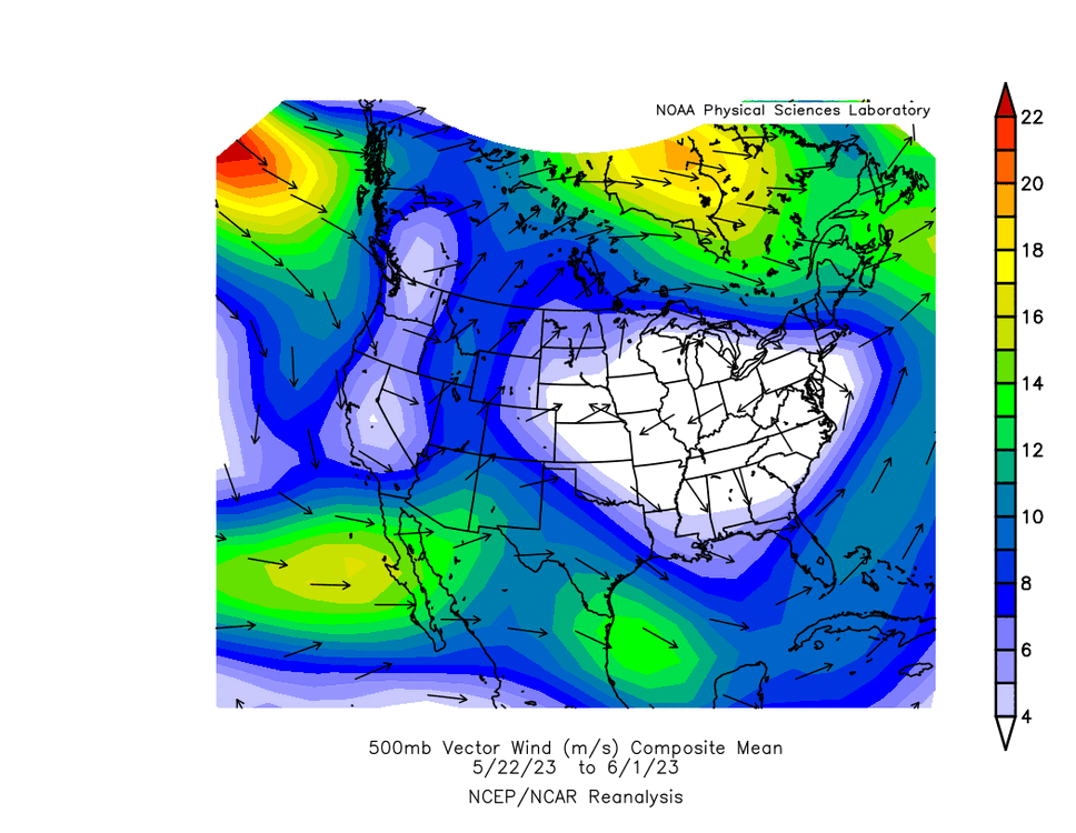
This plot shows that the 500mb wind averaged to be zero over the lower Great Lakes over this specific 11-day period
-
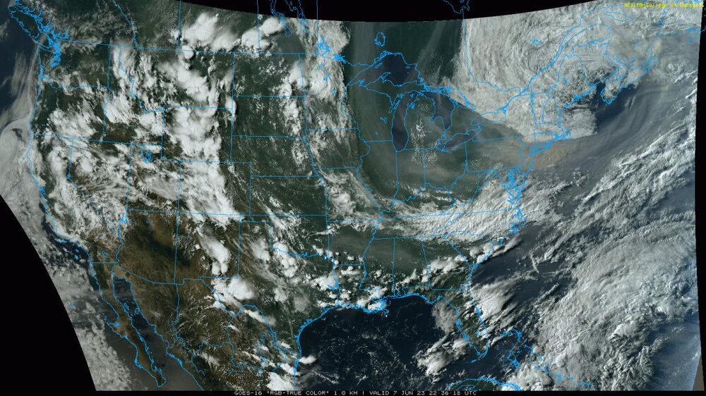
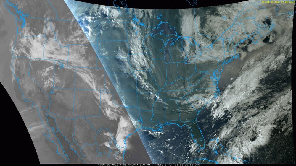
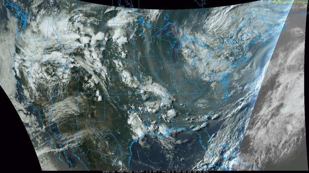
some ugly visible satellite images, and you can see that typically the high smoke concentration shows up better on visible satellite closer to sunrise and sunset
-
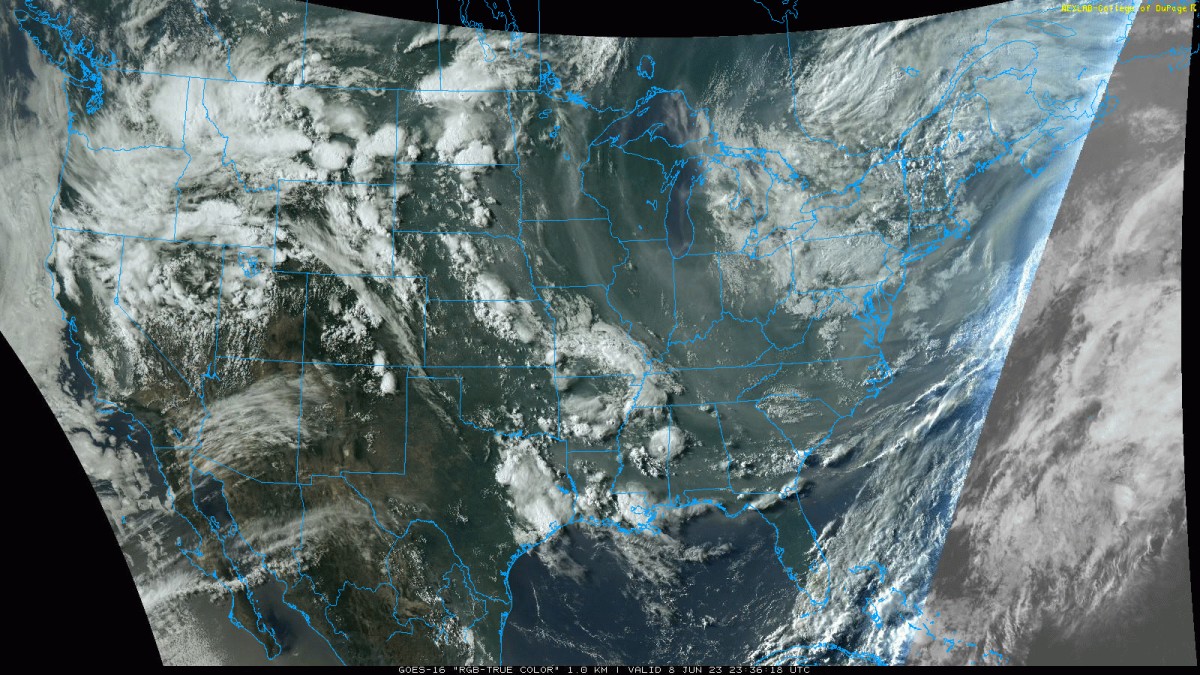
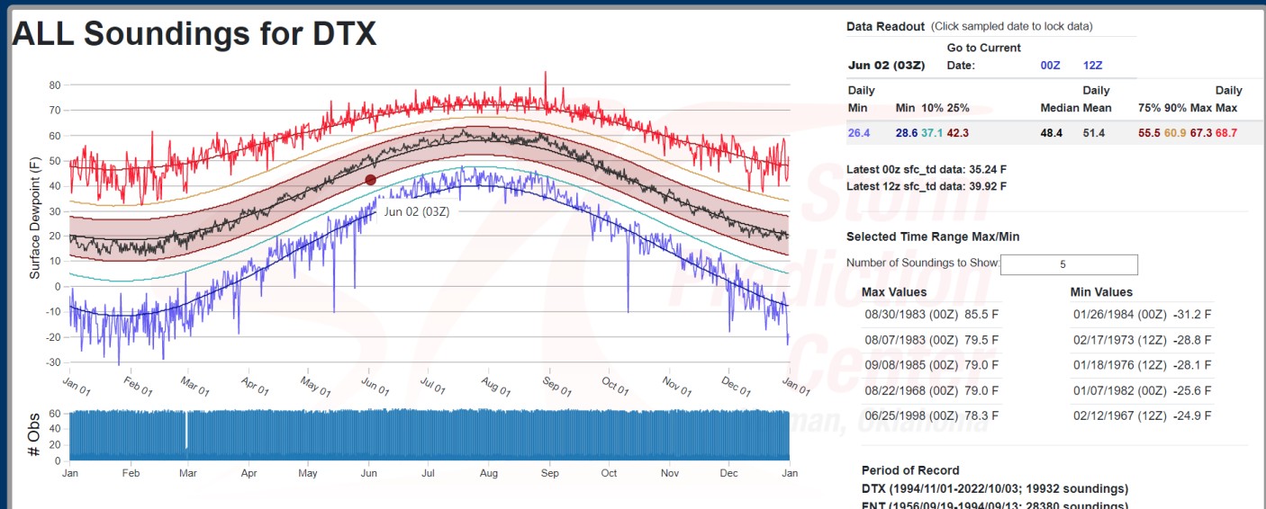
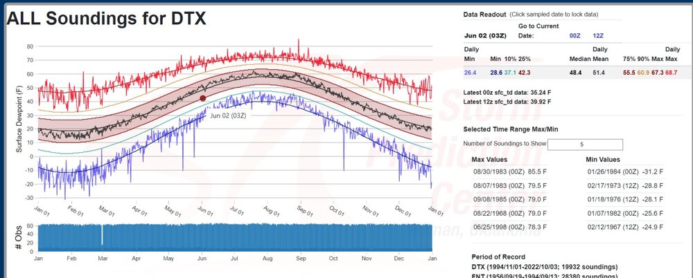
I don't think I've seen a 36 dew point in Toledo in June, other than today. And what a firey day it is, with higher surface smoke concentrations. It does appear that dew points of upper 20's to lower 30's have happened at a combination of FNT and DTX sounding locations at some past time
-
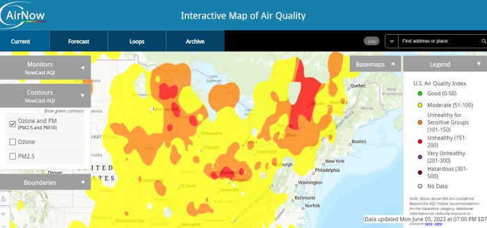
This map says it's unhealthy for sensitive groups in Wisconsin, Ohio, Iowa
-
Today was some of the haziest weather I have seen without being close to a wildfire. I drove to work after sunrise and the sun was red. I smelled smoke briefly yesterday, I think a couple of times. When I lived out West, I smelled smoke from -distant- fires on several days over the course of several years. And then there were the close wild fires in Colorado, and that is not necessarily something I need to compare to weather today in Ohio. Finally, the HRRR shows integrated smoke density and surface smoke density correctly. Both values are very high over my area. I'm not sure what happened at NCEP before but it didn't correctly have these variables over a week ago.
-
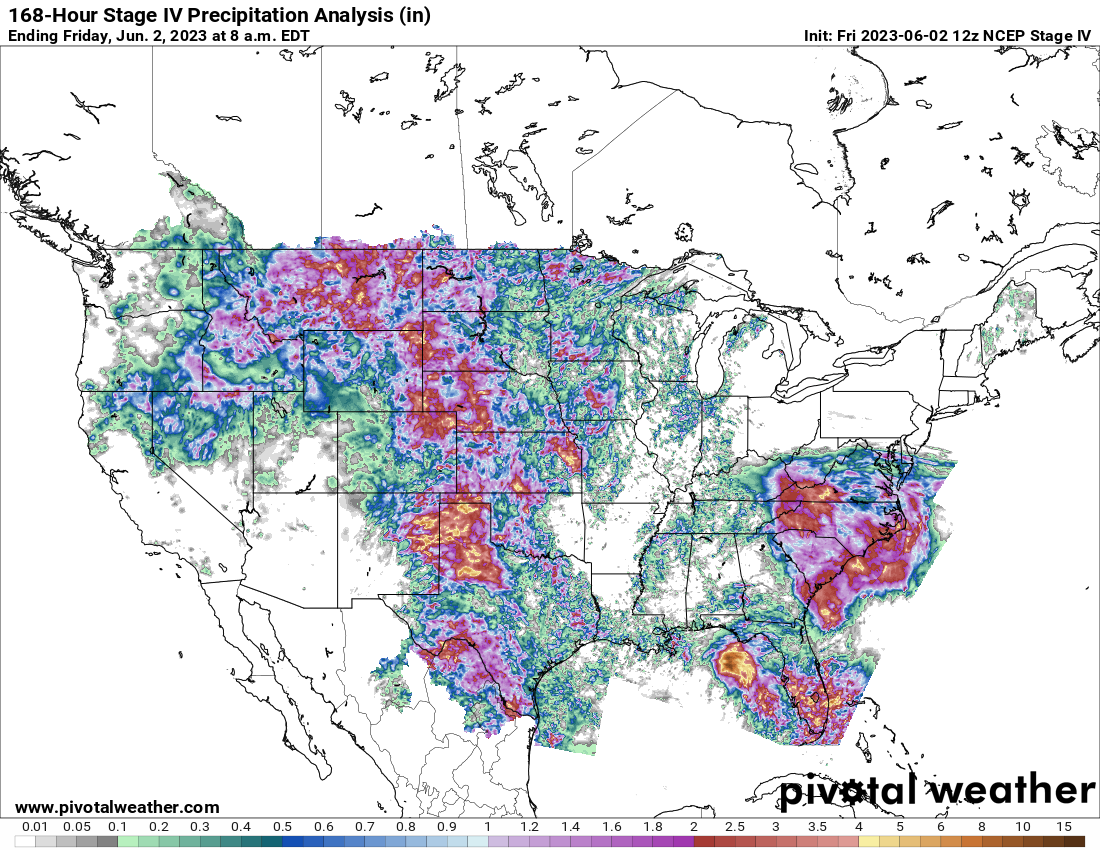
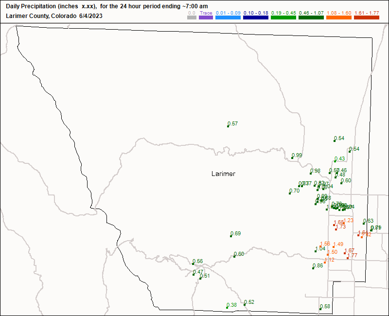
My place in Ohio could badly use the 1" that fell on Loveland.
-
I forgot what westerly winds feel like. There haven't seen a westerly winds for a week. And honestly it was kind of nice. 90 degrees with dew point of 50 or degrees even lower reminds me of Denver. But then again, the grass in everybody's front yard is starting to look like the prairie grass. The natural prairie grass in Colorado dries out as soon as you hit 90 or 95 on the high plain.
-
hey this is fun