Chinook
-
Posts
10,933 -
Joined
-
Last visited
Content Type
Profiles
Blogs
Forums
American Weather
Media Demo
Store
Gallery
Everything posted by Chinook
-
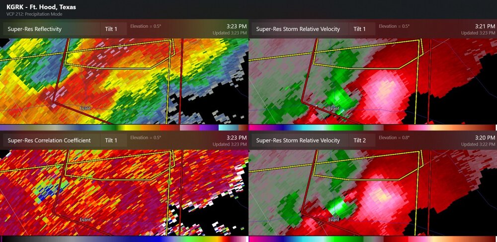
Pidcoke had a tornado warning two days ago, now this one is hopefully not next to populated areas.
-
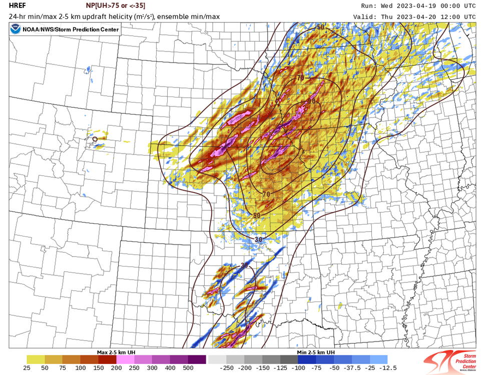
This might be the main show of the day, as mainly linear storms could be coming up in the next few hours.
-
The blue part on the CC is not tornado damage here, and probably doesn't represent damage from the confirmed tornado, which is apparently already over
-
The 18z HRRR today has a supercell starting up over Fort Worth tomorrow. Other CAM models seem to agree on a squall line forming at some point, before 00z, with the cold front. 18z models have some 3500J/kg-4500 J/kg before the front. The NAM-12km shows shear values of 30-40 kt but there's some disagreement on that. Storm relative helicity may be increasing, even without any really high winds at 850mb.
-
I hope these storms don't hit anybody, or a launchpad

-
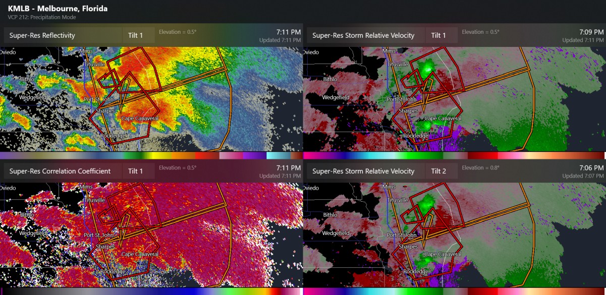
we have a NASA tornado warning going on. supercell FFD over Cape Canaveral
-
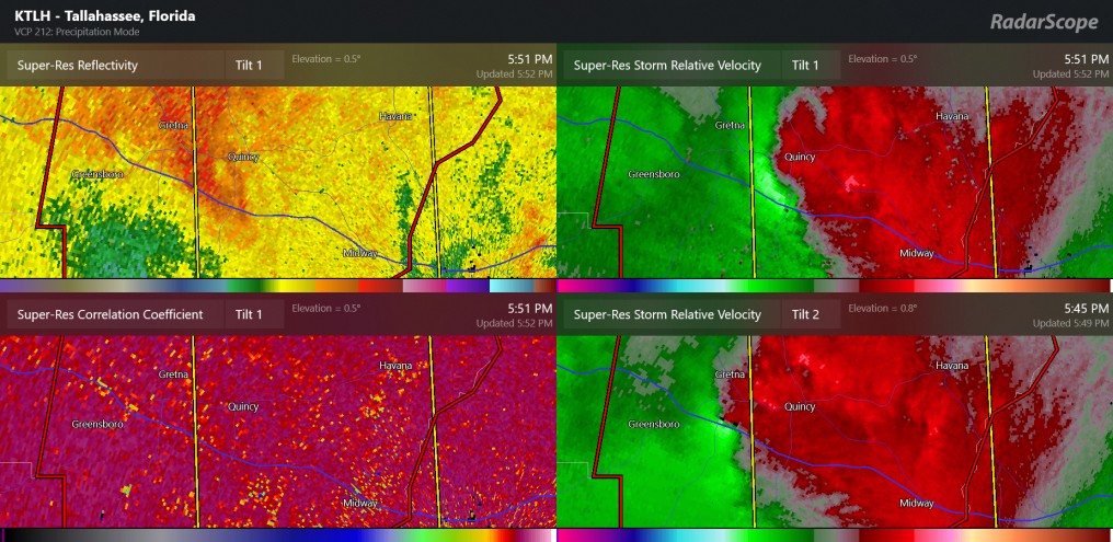
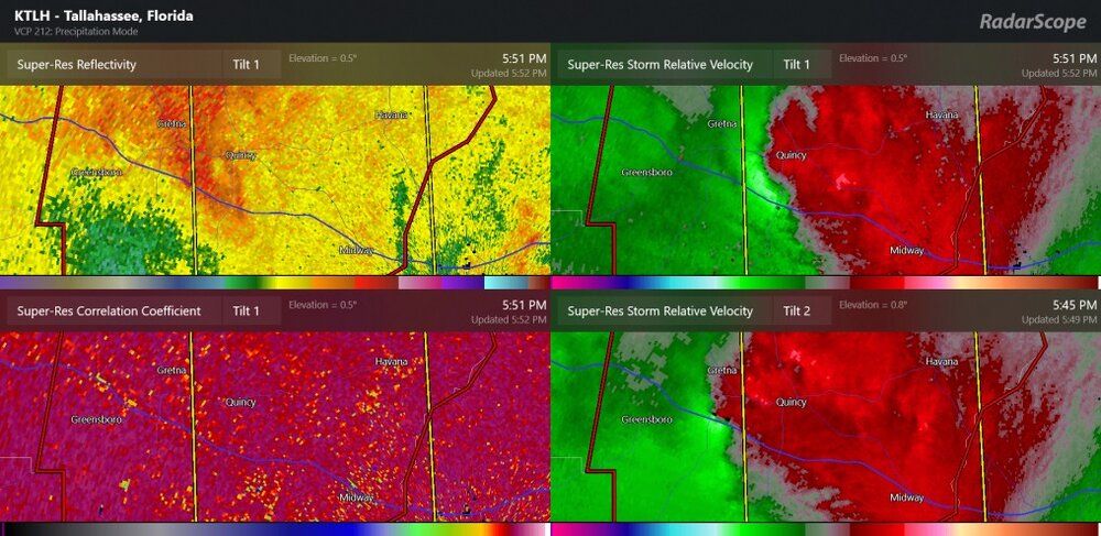
the tornado was confirmed near Havana, which is near Quincy
-
This one is just for Quincy, our resident storm chaser- tornado warning for Quincy, Florida
-
they could see it from the airport, and apparently it lasted 9 minutes from 49 past the hour to 58 past the hour.
-
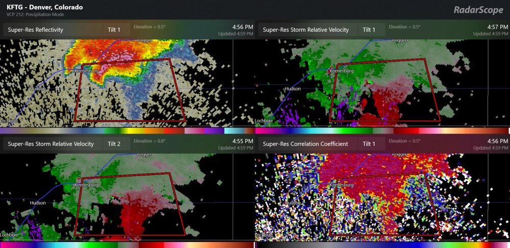
of course this is just before a snowstorm, because weather makes no sense
-
Today is exactly why I want to drive or fly to Texas for the total eclipse next year, which will go through Ohio. There's like an 85% chance of clouds.
-
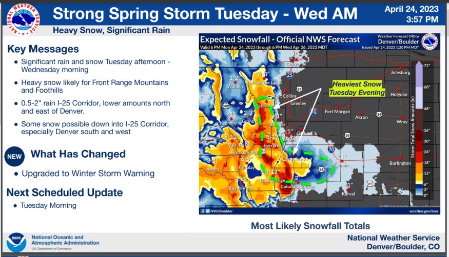
Here is the NWS update from today. (it's in a pdf format or something.) For areas below 6000ft, it's kind of what was expected, I suppose. Rain will be pretty helpful, as the high plains are still in drought. This will bring plenty of rain to eastern Colorado, Kansas, and Oklahoma over the next few days.
-
That's just awesome stuff. Glad you got to see it. I saw the lights in 2004 here in Ohio. That was a very pale green. It's something where seeing it with your own eyes is different than seeing the picture. Every once in a while I tried to look for the lights when I was in Colorado, but it was really tough. I mean I drove to the top of a small mountain next to the city to get away from the city lights, but it didn't work. It's a long way out from the auroras which might get down to Montana on a few occasions.
-
Alright, I'm complaining. 40 degrees and cloudy is stinking December. You know what else. It's just cloudy, like really cloudy. I heard there were aurora borealis all over the place because of a geomagnetic storm and it's just cloudy. Maybe I'll look on the bright side. Not too many bugs yet.
-
Got a bit more graupel/rain. low-altitude CAPE exists. In a recent video by Convective Chronicles (youtube) low-altitude CAPE analysis or short-term forecast is quite effective at identifying areas of tornadoes. And of course, the same exact thing low-altitude CAPE is the reason lake effect snow gets going, that is, adequate updrafts in the winter. (pretty much like today)
-
The NWS has issued a winter storm watch effective for many areas above 6000 ft and the Palmer Divide. Here is the text. I havent' really looked into it. I'm not sure 6000ft would be the cutoff, but they do include the Palmer Divide in the watch, just above 5500-6000ft I believe.
-
I have graupel here. It quite uncommon. I saw graupel sometimes in the winter and summer in Colorado, but not often.
-
The warm front pushed us up to 80-83, despite the fact that it sort of hates to do this with the lake. It really feels like a summer evening without the dew points (that is, a summer evening out West.)
-

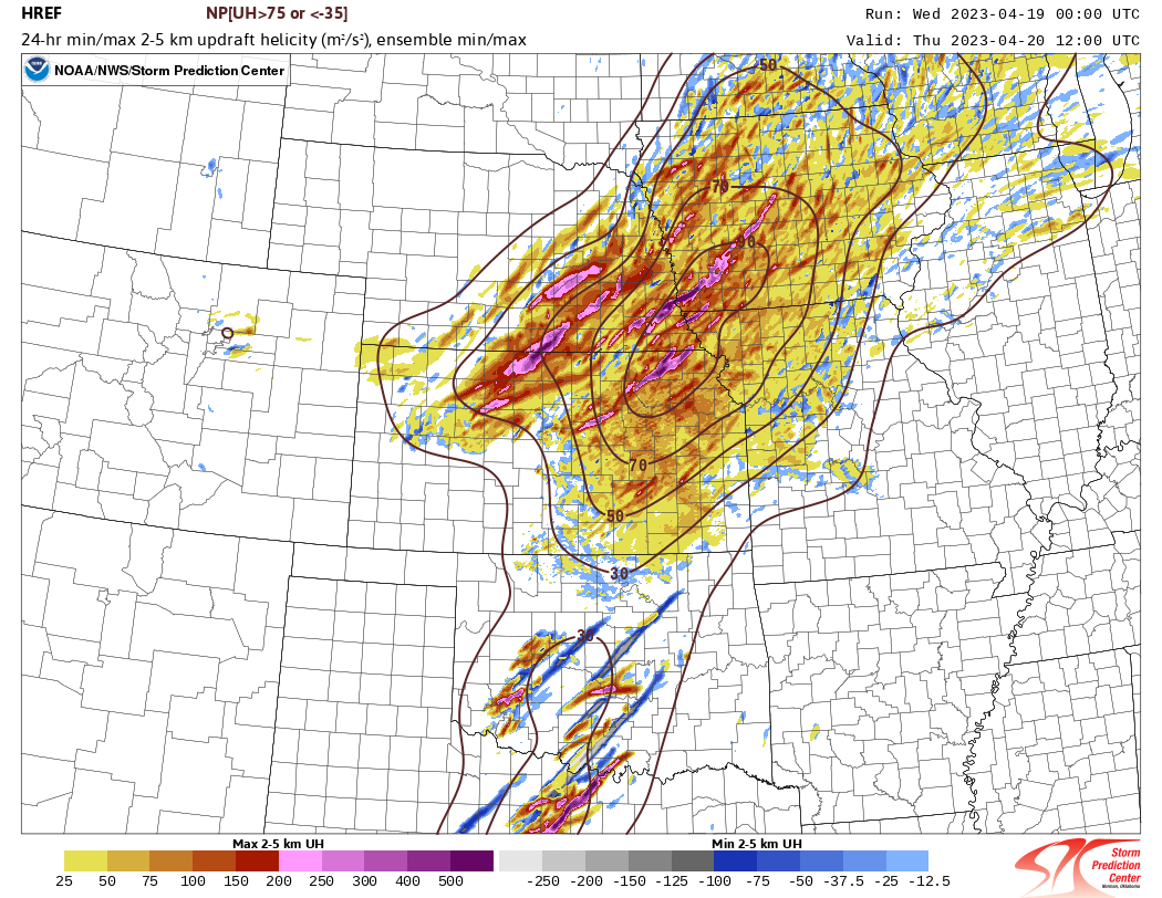
Severe Weather 4-19-23 through 4-21-23
Chinook replied to cheese007's topic in Central/Western States
Tornado report in Tyler warning text from several minutes ago -
2023 Short/Medium Range Severe Weather Discussion
Chinook replied to Chicago Storm's topic in Lakes/Ohio Valley
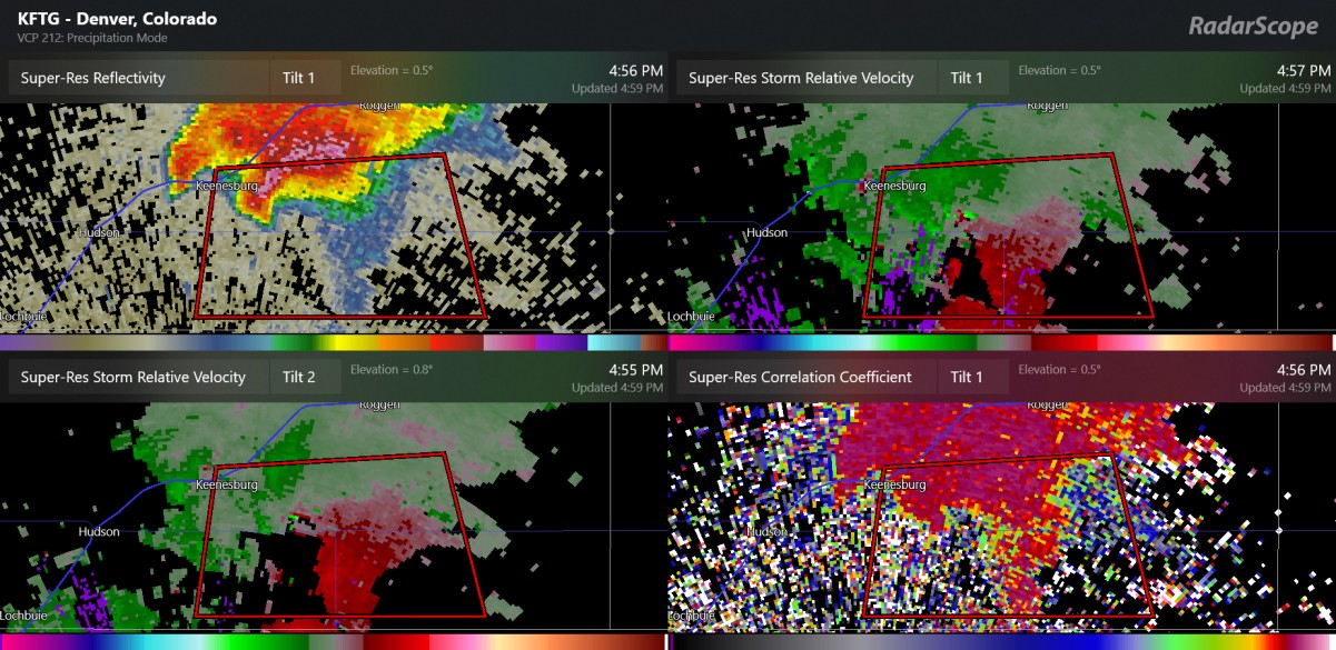
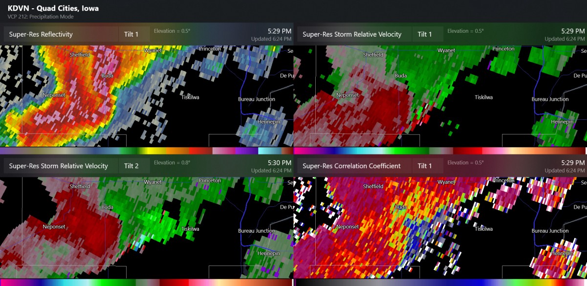
I believe this was the radar for the confirmed tornado near Princeton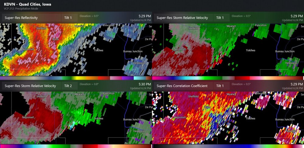
-
2023 Short/Medium Range Severe Weather Discussion
Chinook replied to Chicago Storm's topic in Lakes/Ohio Valley
Here's a storm with a recent history of hail northwest of St. Louis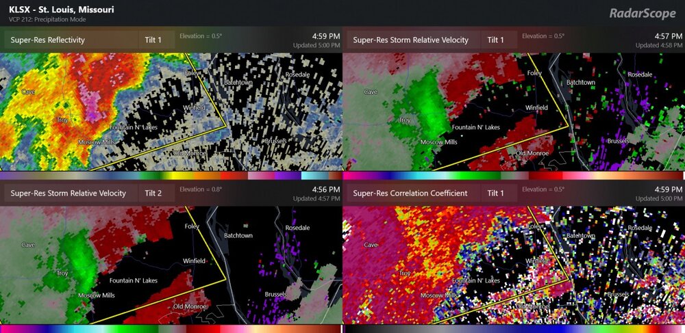
-
2023 Short/Medium Range Severe Weather Discussion
Chinook replied to Chicago Storm's topic in Lakes/Ohio Valley
two tornado warnings, west Illinois -
Severe Weather 4-19-23 through 4-21-23
Chinook replied to cheese007's topic in Central/Western States
Etowah OK, confirmed tornado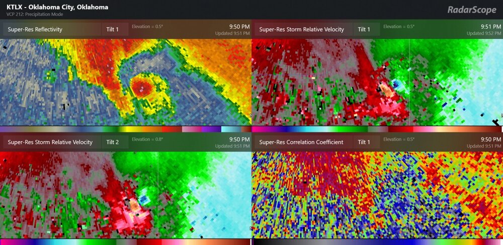
-
Severe Weather 4-19-23 through 4-21-23
Chinook replied to cheese007's topic in Central/Western States
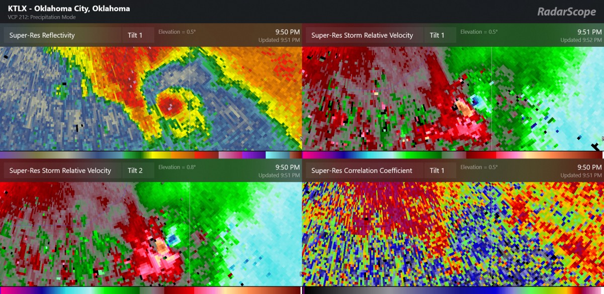
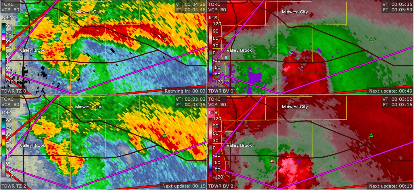
tornado confirmed near I-240 at about 7:00 central
-
Severe Weather 4-19-23 through 4-21-23
Chinook replied to cheese007's topic in Central/Western States
Honestly I still have no idea if there will be a lot of severe weather reports, but the pattern seems right for several storms, and the CAMs have varying solutions, with some storms that might be elevated, but still capable of large hail.