Chinook
-
Posts
10,933 -
Joined
-
Last visited
Content Type
Profiles
Blogs
Forums
American Weather
Media Demo
Store
Gallery
Everything posted by Chinook
-
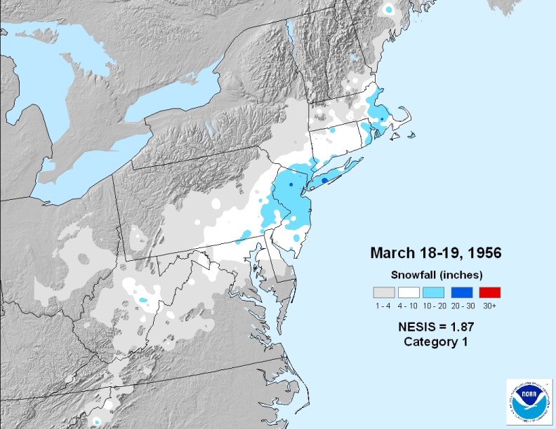
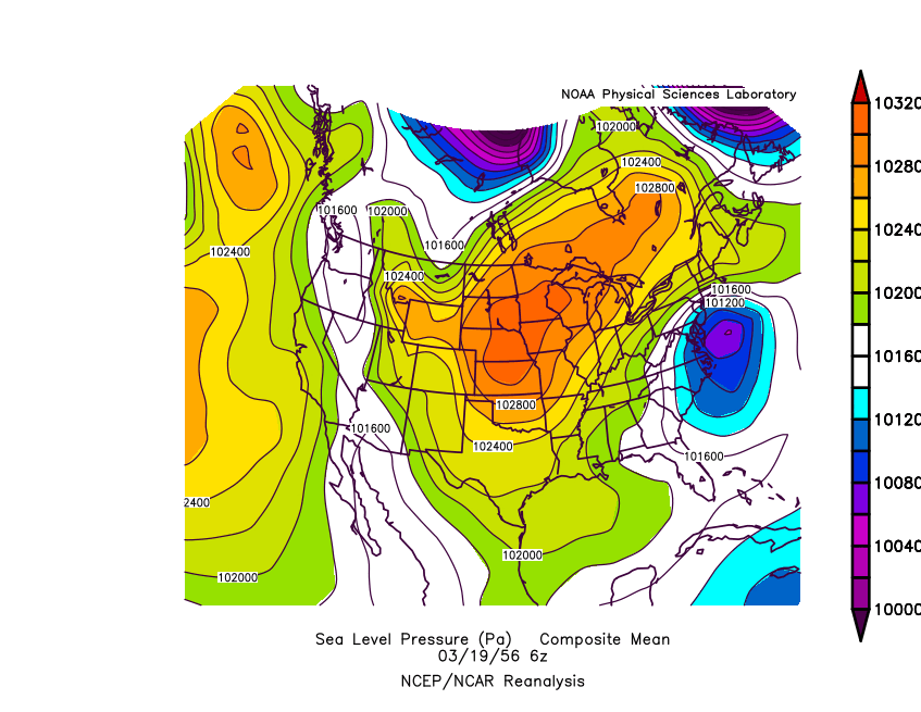
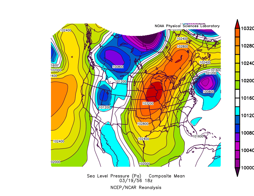
I believe once Weathafella said that he remembered this heavy NY snow storm, which happened almost on St. Patrick's Day 1956
-
I will call this the winter of A.R.N. Another Rainy Night.
-
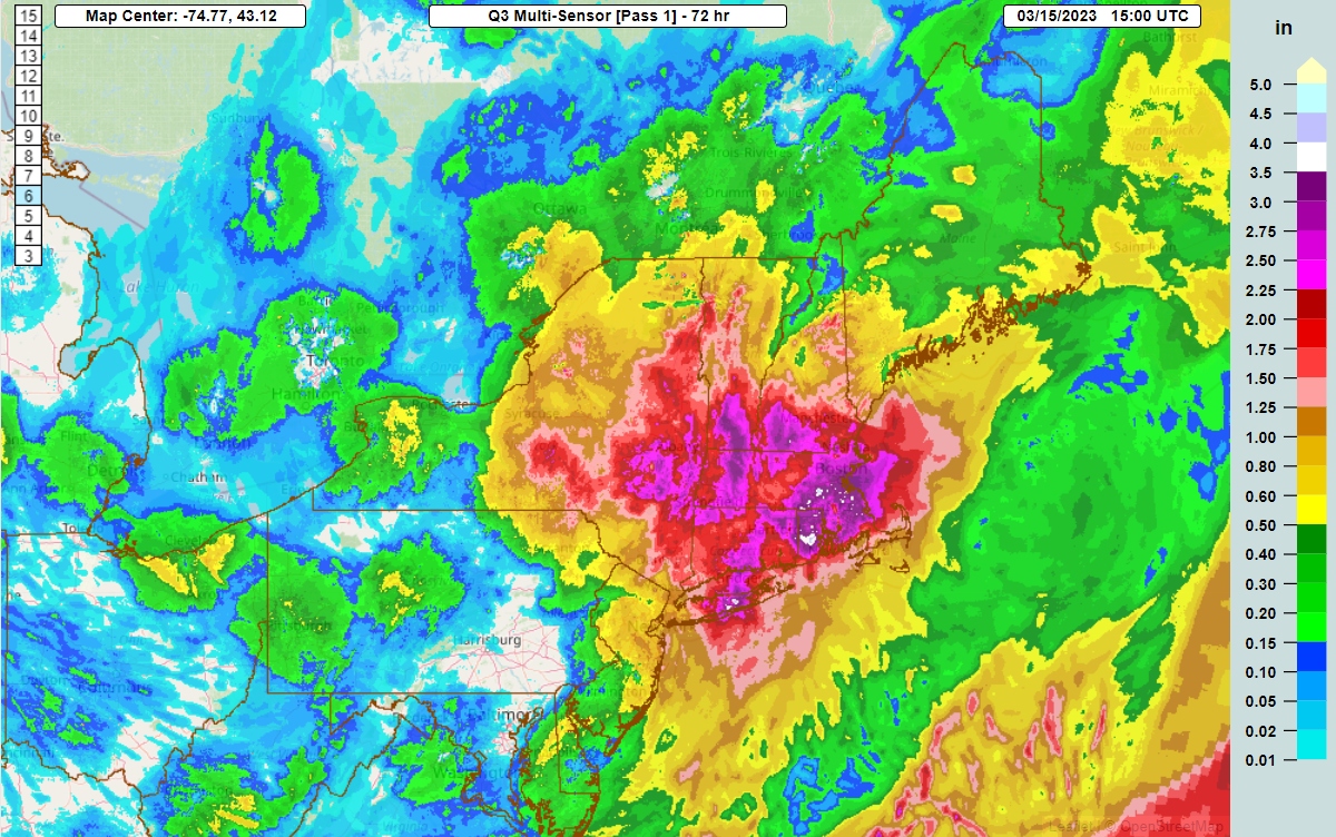
 California has gone from flood to drought to flood. Sacramento had apparently 5.12" of precipitation in January. (I added this. The NOWDATA info said the data was missing) and already 2.98" between March 1 and March 15, making for 19.46" of precipitation since November 1st. That's almost 3x higher than the 2020 calendar year.
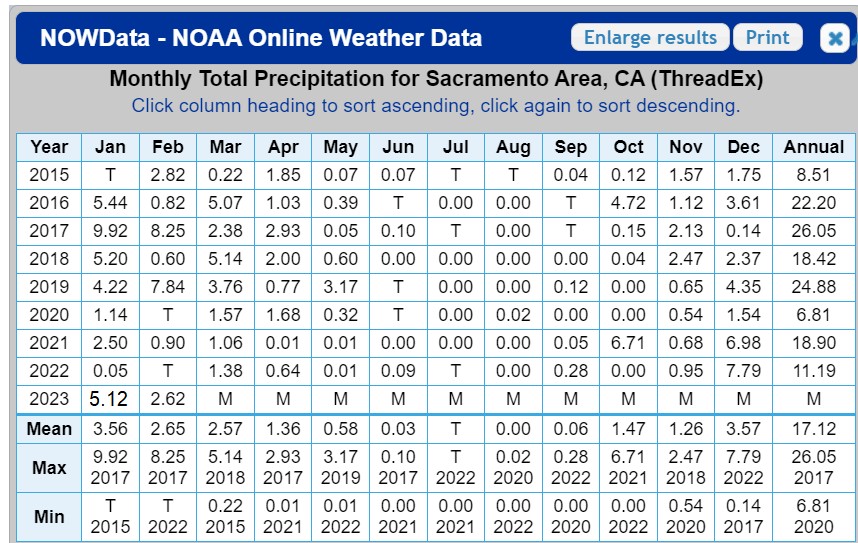
-
radar/rain gauge adjusted MRMS precipitation for the last 72 hours

-
As a non-northesterner, I still gotta say, this is quite a thing

-
hence the Six States. Yes it's weird, I remember tracking it. the storm was quite washed out by the Michigan state line. but hey. Six States. Now, with the time change, we have to wait until 10:15 PM or 10:30 PM Eastern Daylight to get the 00z 3km-NAM and similar products. Boo.
-
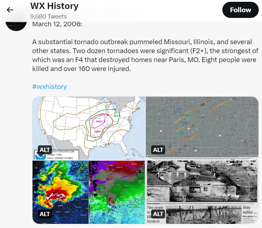
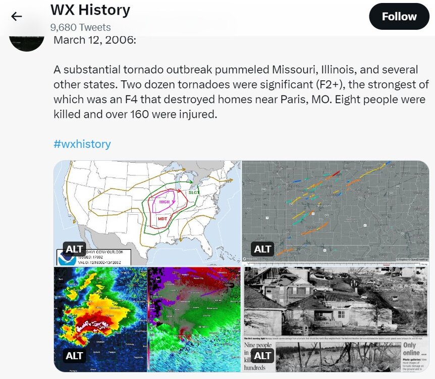
On this day in 2006, major tornado outbreak and the "Six-State Supercell," the supercell that brought the 66-mile tornado track that damaged Springfield IL (EF2). According to Wikipedia, 99 tornadoes confirmed from March 9 to March 13.
-
It has been two years since the Big One.
-
I got about 1" which was kind of generally expected. The overall situation was much like Friday, with the snow melting on pavement. northern Minnie today
-
Blizzard (1/4 mile visibility, snow, peak wind gusts to 40kt at this moment) with easterlies. Hard to do with easterlies.
-
This winter compared to my 80" Loveland winters. November: 1" and dusting? maybe more December 1" and ground blizzard, maybe 1" more after Christmas. January: 7.5" February: 1" March: 2" (Today... super wet at 33 degrees) total 13.5"
-
This winter sucks. There is about 1" to 2" on grass and no snow on pavement because it was so warm.
-
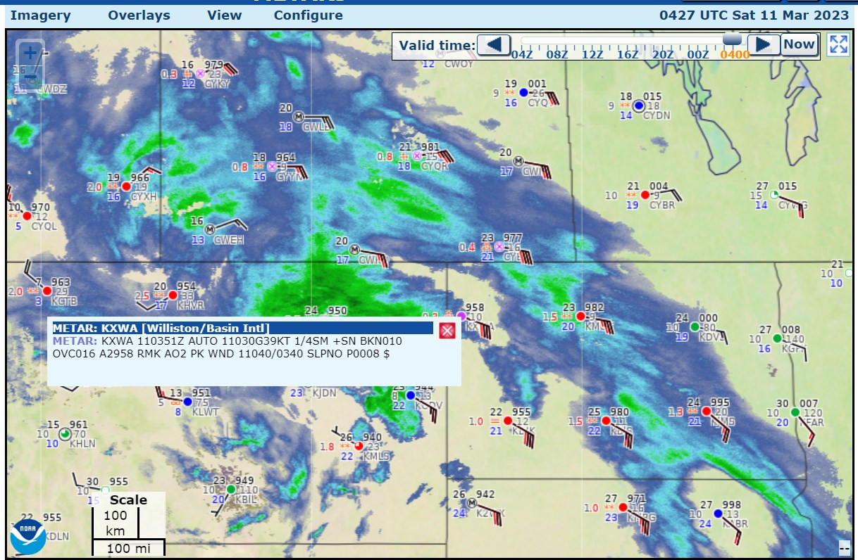
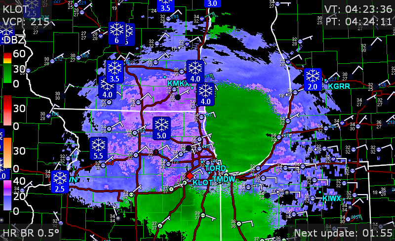
current radar and storm reports
-
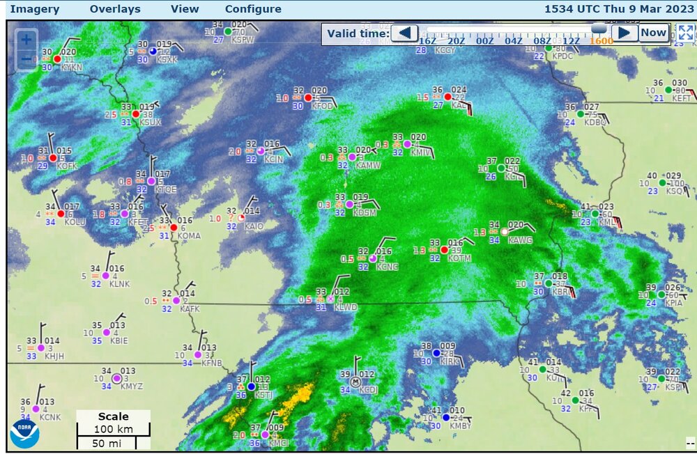
the storm is raging in Iowa. Des Moines, 1/4 mile visibility
-
70's and then snow is normal for Colorado in Oct/Nov and April.
-
This is one of the first times my place has had a north/northeasterly wind flow for a long time. Also note my area was 6 degrees above normal in February.
-
I may finally have to shovel more snow than I did in January.
-
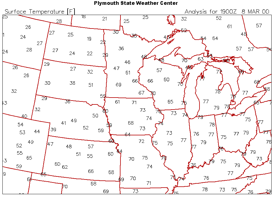
March 8, 2000? Weird. it checks out
-
Loveland Co-op, close to where I lived in Loveland: 40.1", also much better than Fort Collins. (I don't know what street that was on.)
-
Looks like the snow just isn't going to be there. Keep up the hope for more snow in March. Northern Colorado isn't doing badly on total snow for the cities (I think). The snow water equivalent is 104%/121% in the mountains. The areas well east of I-25 seem to have gotten quite a bit of snow over this winter. DIA: 41.6" Boulder: 67.3", just a bit above normal Fort Collins: 28.5", below normal Greeley: 31.1", above normal Longmont Co-op: 41.9" that seems much better than Fort Collins Walden: 60.2 (above normal for this higher elevation location)
-
actually Radarscope showed zero lightning strikes (cloud-ground)
-
south of Minneapolis
-
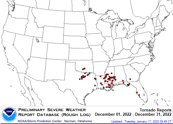
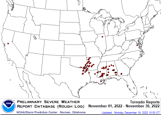
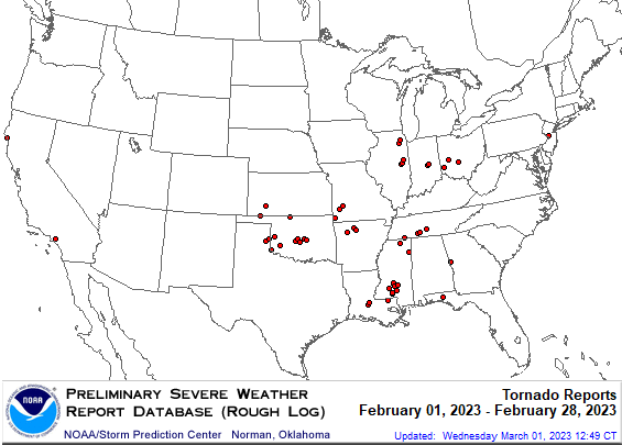
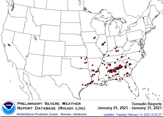
Let's look at how many confirmed tornadoes there were in the winter, counting from the end of November. (Source: Wikipedia) November 29-30, 2022 tornadoes: 25, max: EF3, fatalities: 2 December 2022 tornadoes: 70, max: EF3. There were 68 tornadoes on December 12-15, with 3 fatalities in this outbreak. One tornado occurred on Dec. 29 and one on Dec. 30. January 2023 tornadoes: 125, max: EF3. There were 41 tornadoes on January 12th, with max EF3, and 8 fatalities. On January 24th, an EF3 tornado was in the Houston metro area. February 2023 tornadoes: 53, max: EF2. On February 26th and EF2 tornado moved through Norman Oklahoma with a 27 mile track. Fatalities: I didn't see anything on this, maybe zero. March 2023 tornadoes: 22, to this date, (posting date: March 5th). max: EF2 (two of them). Some tornadoes have been recent, but most likely the NWS has completed storm surveys (?) total tornadoes: 295 number of days from November 29th to March 4th: 96 average of 3.0 tornadoes per day. I think 3.0 tornadoes per day is way above average.
- 1 reply
-
- 6
-

-

-
Looks like the new storm is moving in to Minneapolis
-
The GFS has a complicated snowy scenario for a lot of the northern Plains coming up this week, which would include northern Colorado in the snow. The ECMWF does not really have the snow.