Chinook
-
Posts
10,933 -
Joined
-
Last visited
Content Type
Profiles
Blogs
Forums
American Weather
Media Demo
Store
Gallery
Everything posted by Chinook
-
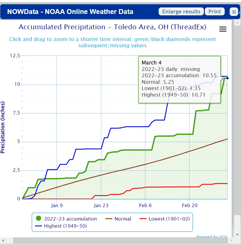
Toledo has had 2 months of soggy rainstorms since Dec 29, as shown on this chart. Relatively little of this total precipitation was snow.

-
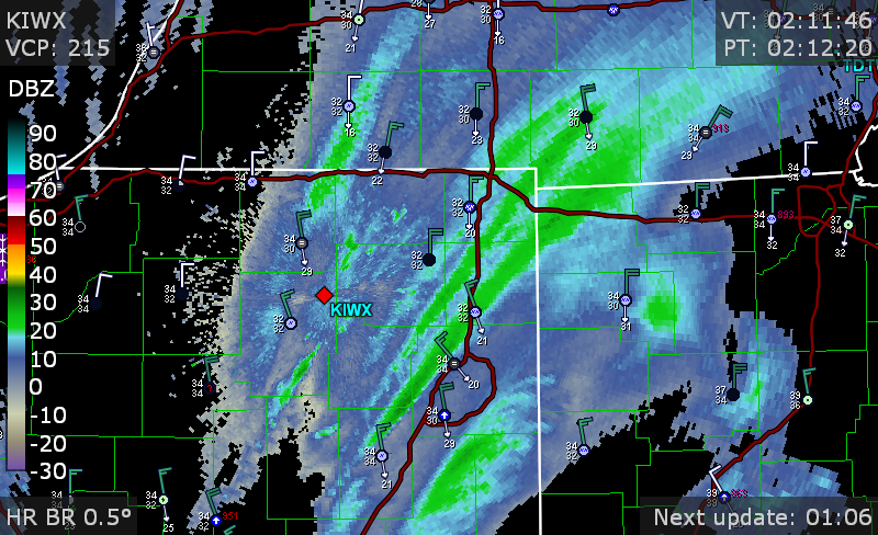
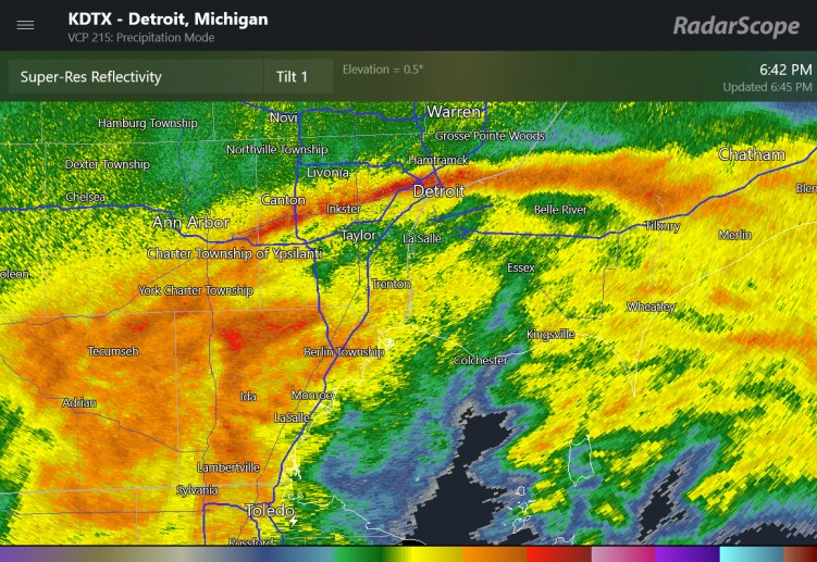
a solid zone of snow on radar has transitioned to a few localized moderate snow bands
-
preliminary storm reports are 3.5" to 6" (isolated) in northwest Detroit
-
This must be wet snowflakes that are bright banding
-
thundersnow on the radar screen as well as local airport observations at Adrian MI, Decatur IL
-
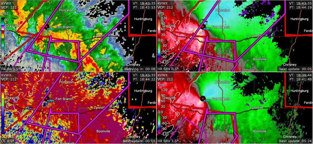
well, this is in the Ohio Valley area... apparently this was a confirmed tornado, and a few more warnings in the Evansville region
-
I found this preliminary information
-

2023 Short/Medium Range Severe Weather Discussion
Chinook replied to Chicago Storm's topic in Lakes/Ohio Valley
There have been preliminary tornado reports near Champaign, Plainfield, and Naperville -
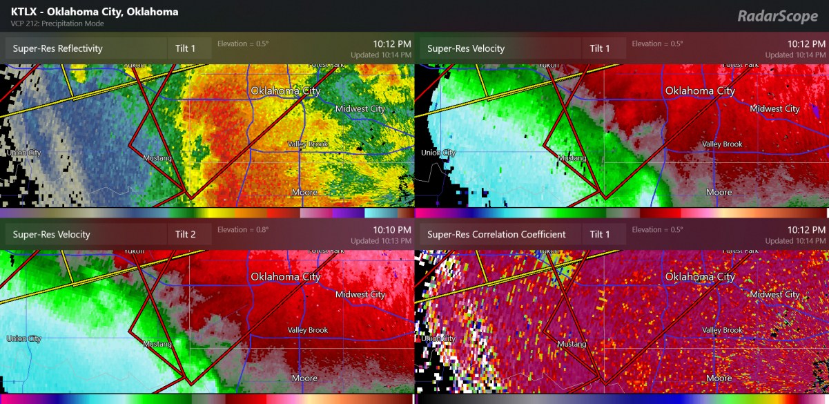
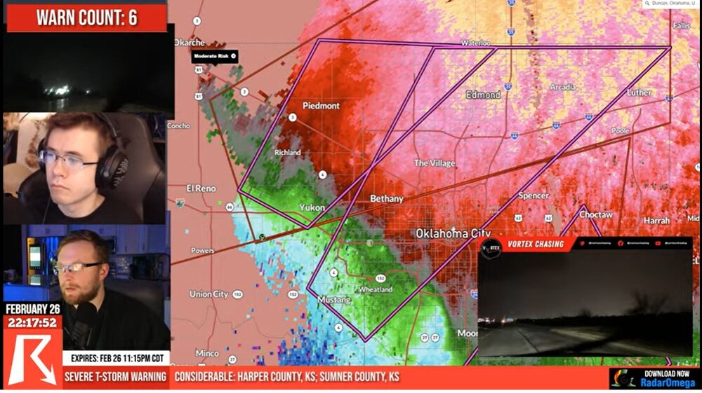
new confirmed tornado near Meeker/ Johnson about 35 miles from Oklahoma city
-
the radar's tilt-2 is doing a better job of picking up the debris as it is close to KTLX radar, and I suppose could even hit it
-
confirmed tornado passed US77 highway on the south side of Norman
-
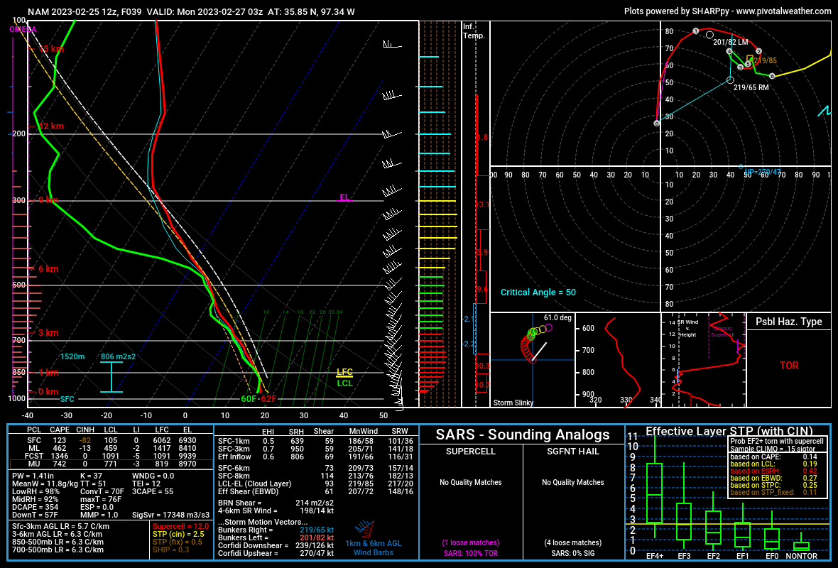
Such a strange day for February. I've honestly never seen the shear parameters we've seen today with storms. I mean, 0-6km shear of 100 kt only happens with colder air, right?
-
Oklahoma City confirmed tornado warning (I believe TDS occurred recently next to Mustang)

-
some near hurricane force wind gusts
-
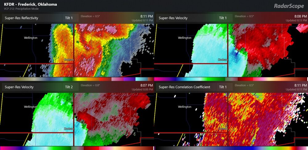
TDS popped up next to Hobart OK
-
possible tornado at the TX/OK border (same cell with the 114mph wind gust measured a while ago). The SPC mesoanalysis now has 1000 m2/s2 of 0-3km storm relative helicity here. confirmed tornado announced at 724pm central time
-
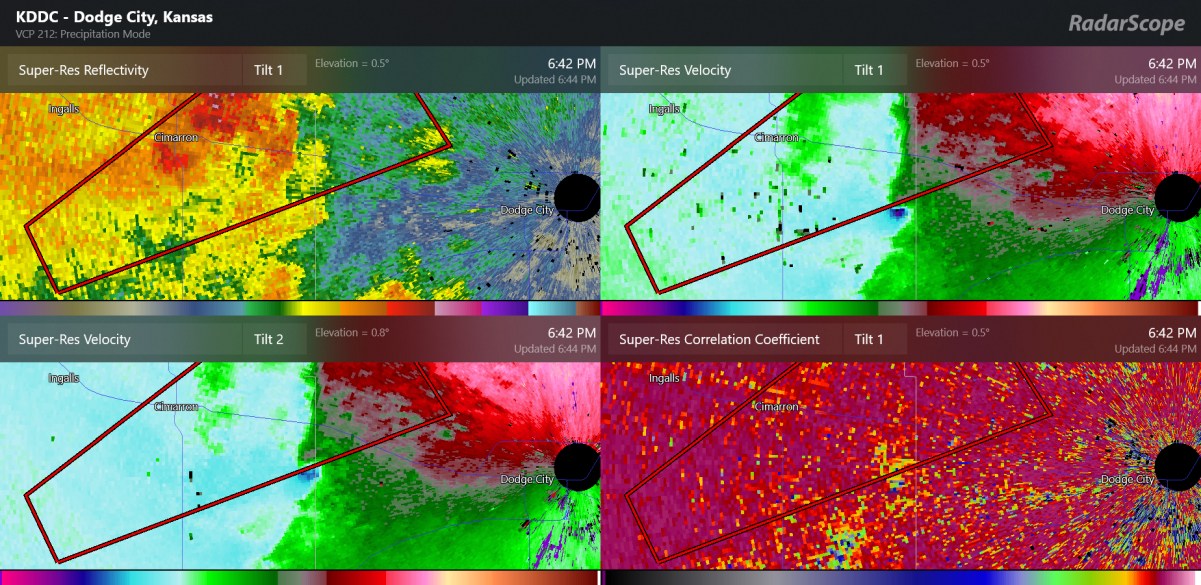
New tornado may be forming west of Dodge City

-
This tornado-warned storm is northwest of Dodge City and is on the edge of the CAPE. It's just so unusual to see severe weather so far west
-
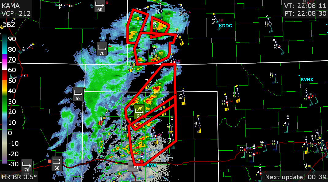
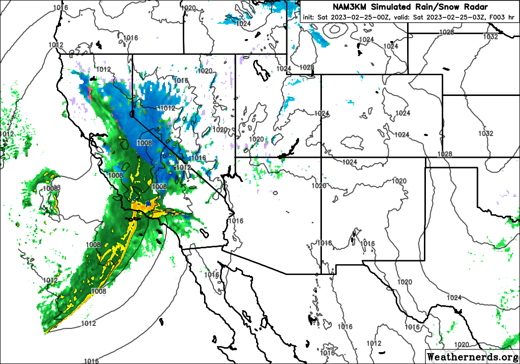
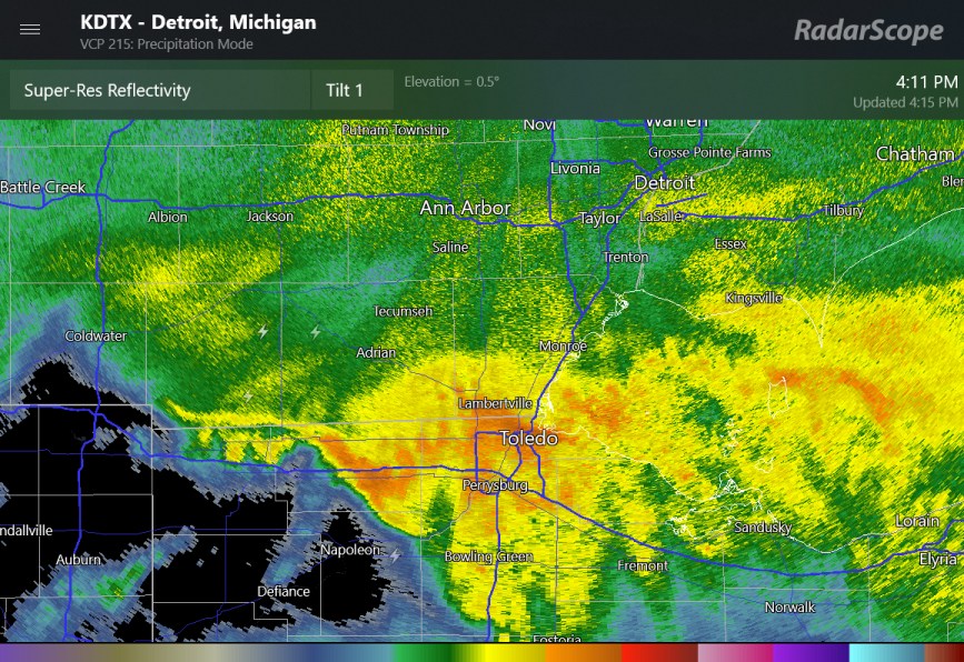
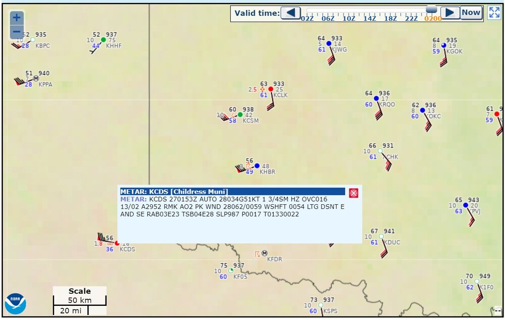
Here is radar right now, near the start of the severe weather event. Some non-thunderstorm wind gusts of 55mph-80mph have been in the region. I'm assuming some blowing dust is the reason that some stations report haze.

-
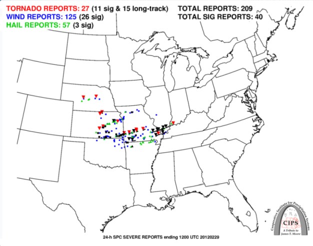
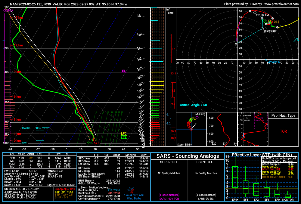
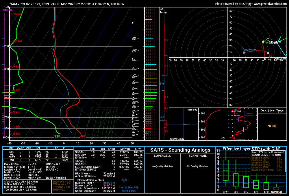
this is the first analog from CIPS (last night)
-
Behind the cold front and in front of the cold front. The colder air really does have a warmer part of the profile at 500mb that looks like a nose. It seems like winds could be 60kt-70kt just above ground in the Texas Panhandle.
-

-
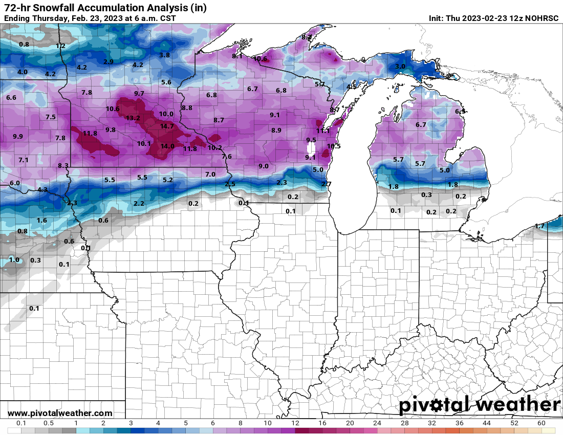
Snowfall totals, as discussed earlier in this thread

-
wow, since 2002. Crazy. Which day of 2002? Excellent pics, although I'm sorry to hear this was so damaging. They had a couple of bits about this on the news here, and even said that upwards of 68% of Lenawee County is without power (or Hillsdale)?
-
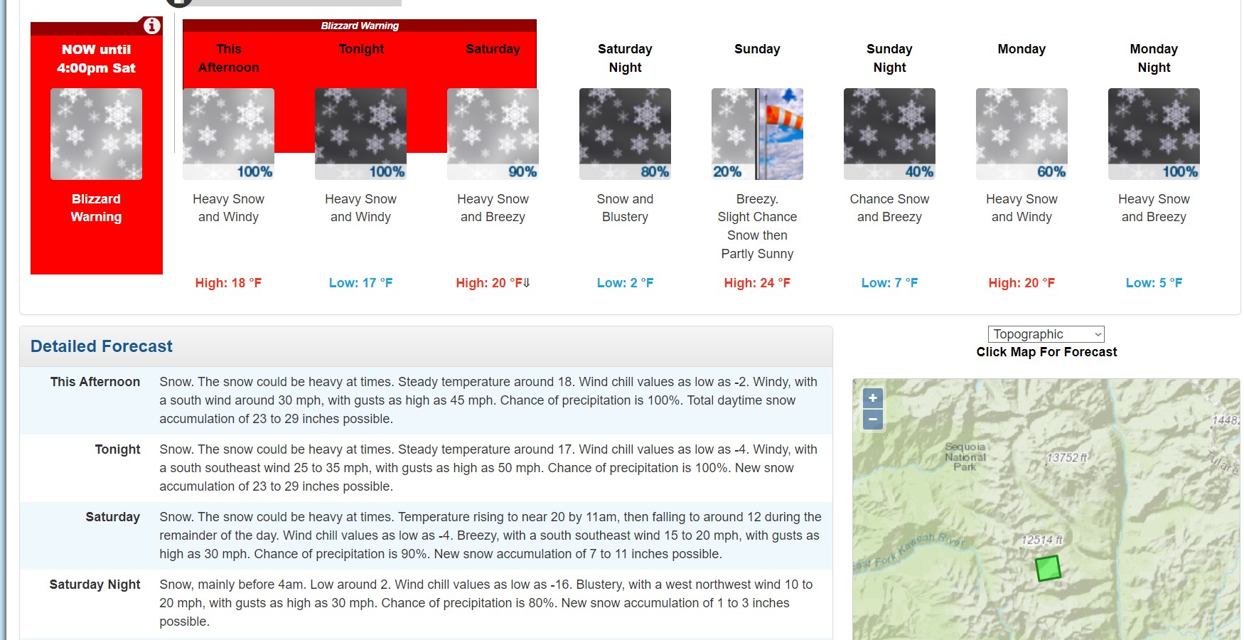
So, 58" is possible just today at Sequoia National Park. Got it.