StormchaserChuck!
-
Posts
2,274 -
Joined
-
Last visited
1 Follower

About StormchaserChuck!

Recent Profile Visitors
11,856 profile views


-
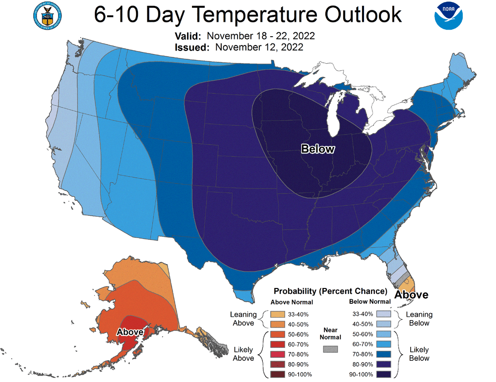
March 2012 coming up as analog if it can hold (2011 I think is #1 Dec(10)-Nov so far)
-
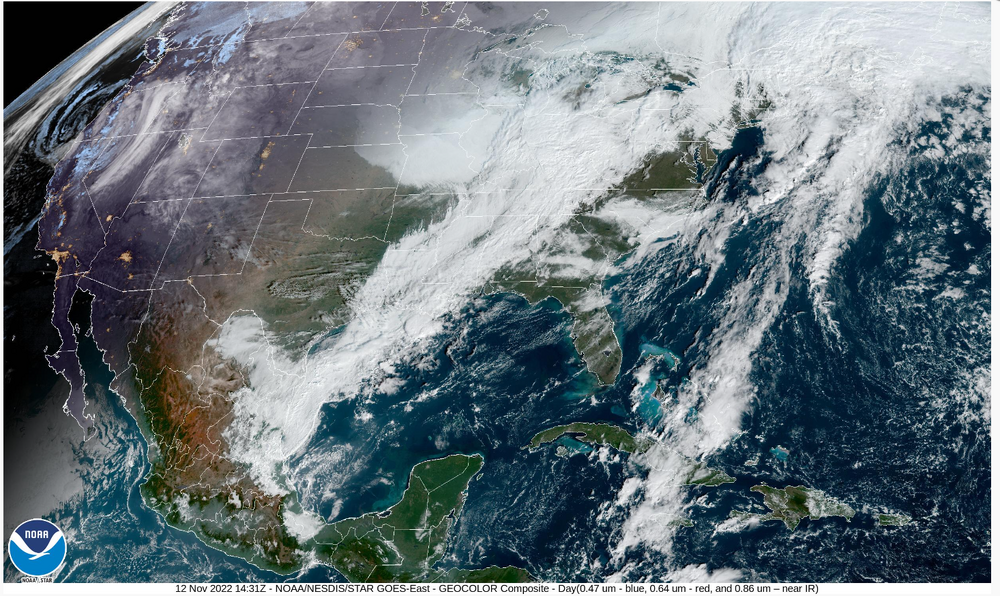
really warm-feel rain. coldest 500mb anomaly temps inthe N. Hemisphere.
-
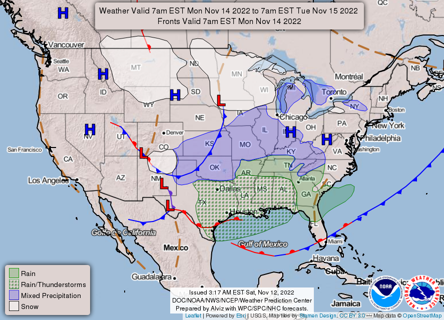
Where I live, I'm expecting 35" of snow(forecast), average is 32".
-
Love the '95 Dec analog, not Jan '96 though.
-

2021-2022 ENSO
StormchaserChuck! replied to StormchaserChuck!'s topic in Weather Forecasting and Discussion
One more https://imgur.com/a/PMELSPi (if not this year, next year) Subsurface is more warm than cold anomalies, despite Moderate La Nina at the surface, extending down to south, South America https://imgur.com/a/aOfDVWw This is going to hit +30-45 days, Dec 15-31, as impacting the N. hemisphere pattern (warm ENSO-subsurface)-probably +PNA or -NAO(EC trough). -
2021-2022 ENSO
StormchaserChuck! replied to StormchaserChuck!'s topic in Weather Forecasting and Discussion
Love it raindancewx. US is the superstition to lead, but beneath all the depths is real primary. Dec 2010 was the only Dec that matched 2021 by 1.5x #2. This correlation has carried us through the year, and I think should continue to match 11-12 as a winter analog. We have also be reversing 500mb anomalies for the last 2 years. Put those 2 together and you have a nice forecast position. https://imgur.com/a/5AToS86 https://imgur.com/a/R2UC3k7 (hopefully everyone can see this) -
Wow what a +NAO
StormchaserChuck! replied to StormchaserChuck!'s topic in Weather Forecasting and Discussion
Holy +NAO https://imgur.com/a/NlbGv2s -
+3SD https://imgur.com/a/0P4MnCm What I find interesting, is there is more blue(cold) than warm on the map [which is rare]. +NAO at this time strongly correlates with +PNA December (cold anomaly theme) continuum. fits what has happened since September as well.
-
Look at this.
-
flurries?
-
Jet stream is running more west->east vs south/north orientation(anomalies). 30-60N is the mass of the whole cold air mass (13-14,14-15)
-
+NAO.. why I think this Winter will be good
-
yay!
-
looks beautiful. the air is cleaner these days. snow falls more pixelated
-
High pressure