All Activity
- Past hour
-
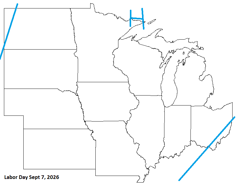
Labor Day is late this year, and looks pretty good. The weekend, tho, looks stormy.
-
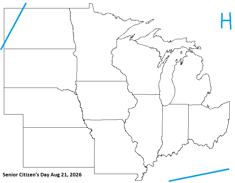
Senior Citizens Day Looks pretty decent.
-
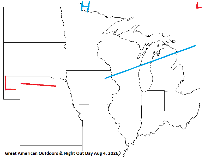
The Great American Outdoors & Night Out day will be a little wet for some. As these observances suggest, "Get your arse out of the house"
-
Fire still not contained. Breezy W wind today. They switch to a breezy ENE wind tomorrow before the rains set in sometime during the aftrn/eve. Hopefully any sparks that may blow eastward, and try to start any fires will be squashed by rain quickly. Other than that, 70's along the shore with 60's inland. Another nice May day. After this, it's back to cooler wx for a few days, but the rains will be much needed.
-

E PA/NJ/DE Spring 2026 Obs/Discussion
The Iceman replied to PhiEaglesfan712's topic in Philadelphia Region
Looks like temps will peak pretty well into the 90s for most if not all of us. Mt holly point and click has me at 95 Tuesday and 96 Wednesday. That would have to be near record breaking no? -
Worked out in the yard all morning from about 8:00 to 12:30. Started out pretty cool but once the sun hit where I was working it got warm. As somewhat gusty breeze still made it feel very pleasant. Soil is VERY DRY!
-
Gorgeous day. 77 here and sunny with a breeze.
-
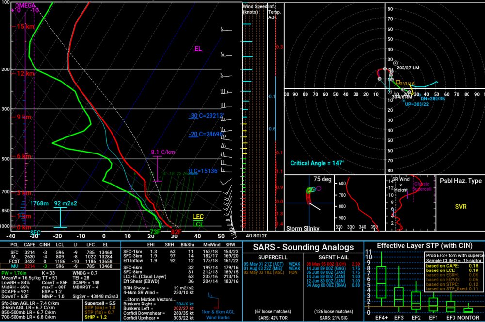
Weather or Not (Pun intended lol) I know the big talk and focus is over in Tornado Alley for the next couple of days, rightfully so. Since I know there are people not able to chase this week, like myself, I would figure it would be something to fun to chat about and discussed. So feel free to play along!! Hint: Definitely not in Kansas anymore!!! I also purposely left out the information from the sounding but assure enough this is not bad data or just one model suggesting this either. Date: 5/16/26
-
It was a cool over night camping trip with my daughter’s troop; hit 42 at 5:00 am. Perfect now.
-
Any met or anyone know the reasoning for the NAM decommission? It still seems more accurate than its successor and a far better tool for winter wx. I mean, it was only the NAM on Jan 25th this year which got close to accurate mixing line accounts. Just seems like a weird decision.
-
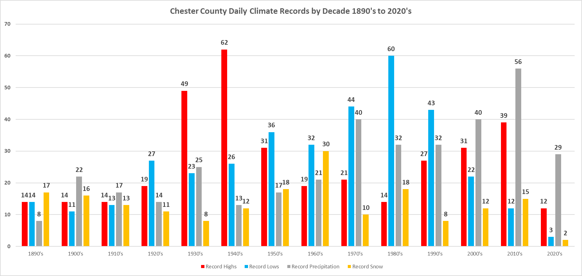
(002).thumb.png.6e3d9d46bca5fe41aab7a74871dd8af8.png) Below is an analysis of when our daily climate records have occurred in the philly burbs of Chester County PA. Temperature, Precipitation and Snow daily records. Of note the decades of the 1930's through the 1950's accounted for 39% of our record high temperature records. The most daily record highs were recorded during the 1940's. The decades of the 1970's through 1990's recorded 40% of all of our daily record low temperatures across the county. With the 1980's recording the most daily record low temperatures. Precipitation wise the 2010's saw the most daily record precipitation records while the 1960's saw the greatest number of daily snow records.
Below is an analysis of when our daily climate records have occurred in the philly burbs of Chester County PA. Temperature, Precipitation and Snow daily records. Of note the decades of the 1930's through the 1950's accounted for 39% of our record high temperature records. The most daily record highs were recorded during the 1940's. The decades of the 1970's through 1990's recorded 40% of all of our daily record low temperatures across the county. With the 1980's recording the most daily record low temperatures. Precipitation wise the 2010's saw the most daily record precipitation records while the 1960's saw the greatest number of daily snow records.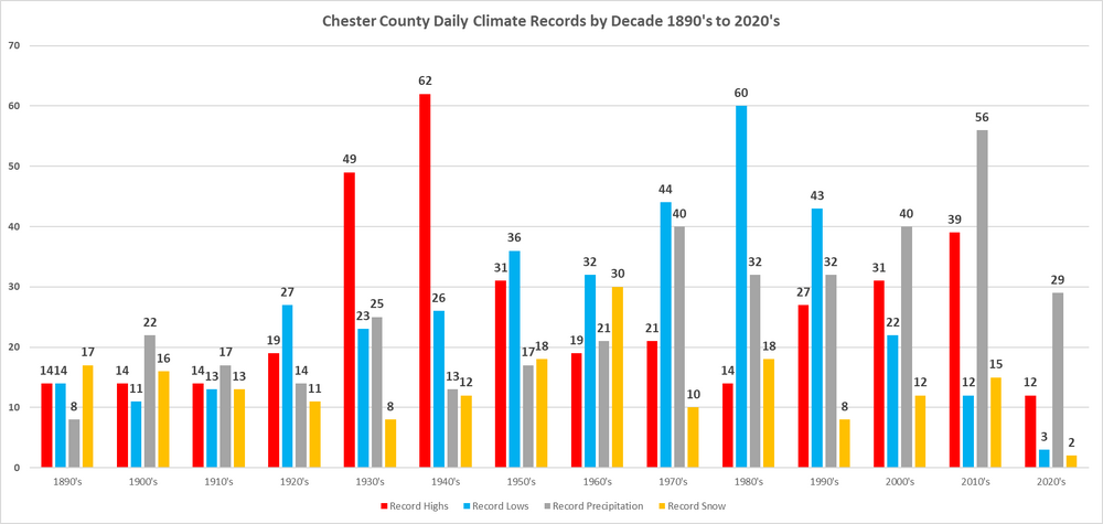
- Today
-
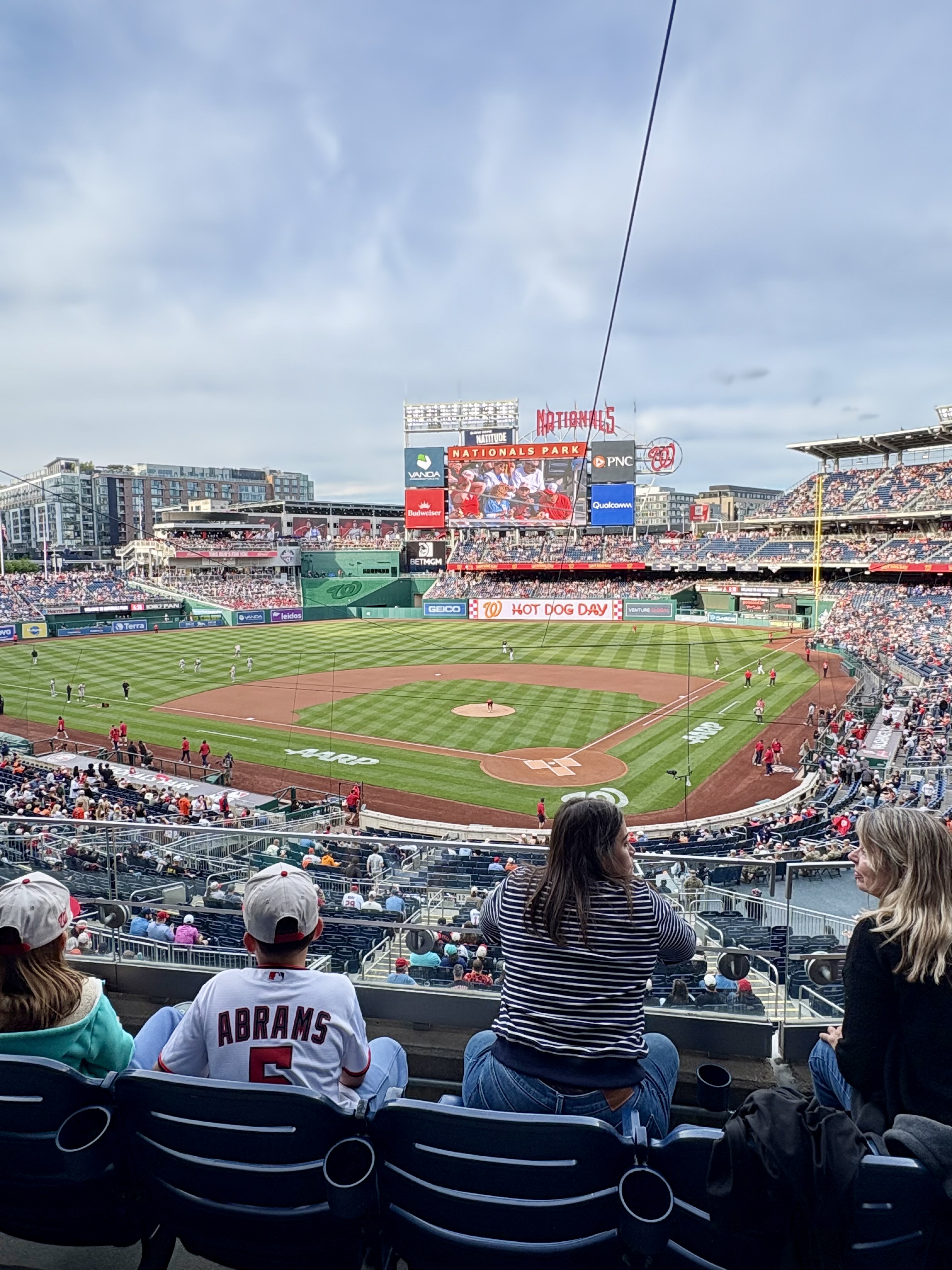
Went to the Os/Nats game last night. Beautiful night for baseball, but obviously a terrible night for guys trying to hit with RISP. Orioles are toast. It's actually one of the more pathetic showings of talent I've seen in awhile. They have a clutch factor of -100. Sad. Despite the outcome for myself, the atmosphere and the time at the game were incredible. Sat club behind home plate which was a phenomenal seat. The Nationals have a great ballpark. Next game will be at Camden Yards, so I'm looking forward to going and staking claim on a good seat with some Boogs and Stuggy's in my facehole
-
He’s coming to hit hard

-
Gonna be a tough week
-
-
What warehouse is this that you speak of? I literally don't work in one lol
-
Just finished mowing #5 this morning. Certainly not hot and humid yet but did some sweating regardless. Temps up into low 70s now.
-
While it would nice to pick up some soaking rains with the sharp cold front following the near to record heat this week, these fronts have had a tendency to dry out crossing the mountains before reaching the coast.
-
The usual doubts apply but mentioning it anyway: KEY MESSAGE 3...Strong to severe thunderstorms possible by Tue with perhaps a better potential by Wed but a lot needs to be sorted out. Quite the ways out there...especially for a convective forecast. That being said...there are some signals for potentially strong to severe thunderstorms later Tue and perhaps a better chance by Wed. This will be dependent upon the timing of a cold front...but given anomalous/near record warmth the potential is there. In fact...much of our machine learning guidance indicates some modest severe weather probabilities for a Day 4-5 forecast...so this is certainly something to watch.
-
Perfect day
-
We take and enjoy. I’m glad the big heat isn’t going to be more than two days…save that for late June, July and August.
-

2026-2027 Strong/Super El Nino
bluewave replied to Stormchaserchuck1's topic in Weather Forecasting and Discussion
The developing El Niño isn’t the only thing going on now. The early month pattern with the more +PNA was closer to what we typically see with the May correlation. But this coming heatwave is more related to the MJO 4-6 convection pumping the Southeast ridge. The +30C wam pool extends all the way back to the IO. -
90 seems possible there (and here)
-
AN weekend (amazing today) through Monday. Then a 2 day torch. normal for a bit after.
-
And by Friday the forecast will be 30% chance of showers with the usual .10" precip with higher amounts possible in thunderstorms.


.thumb.jpg.049f4a7f726ada07e8cd30bd17e713cb.jpg)


.thumb.gif.f92b16c631a1d15d405ed77b33f0710d.gif)


