All Activity
- Past hour
-

2026 Atlantic Hurricane Season
NorthHillsWx replied to Stormchaserchuck1's topic in Tropical Headquarters
It was almost like NHC was just hoping it would go away so they didn’t have to classify it -
Hit 101.3 yesterday, 0.05 rain. Better be the last 100
-

Septorcher 2026 Discussion - Endless Summer
tamarack replied to Damage In Tolland's topic in New England
Same 36 here, but it's my wife going to FL, for her sister's 70th BD. Lots of heat there (between Ocala and Gainesville) with 90/70 days for at least the first week. Saw significant (for mid-Sept) color changes on the BGR-and-back drive, white ash 50% color, red maple 10-20% (near full in the swamps), some color on birches and aspens. Seems a bit early as temps are only slightly BN this month, though the BN rain (50% of avg) since late June might be a factor. -
It will be TD 6 at 11
-

Septorcher 2026 Discussion - Endless Summer
kdxken replied to Damage In Tolland's topic in New England
Just moved my breal chair into the sun. It's over... -
Worked well here in 2022-23. Temp(+/-) SN22-23 SN avg DEC +4.0 23.3" 19.4" JAN +9.0* 29.9" 20.2" *Warmest January, POR 1999-2026 FEB +1.4 16.3" 21.7" MAR +3.0 27.9" 17.0" Ironic that the month with least AN temp had the only BN snow.
-
Low of 36 overnight here at the house. Sawyer made it to 32 which is the first freezing temp for the airport this season. Fired up the wood stove to take the chill out of the house. It's officially Fall.
-
.9 rain yesterday, two different storms, much needed Enjoy the upcoming cooler air and rain (hopefully).
-

Septorcher 2026 Discussion - Endless Summer
jbenedet replied to Damage In Tolland's topic in New England
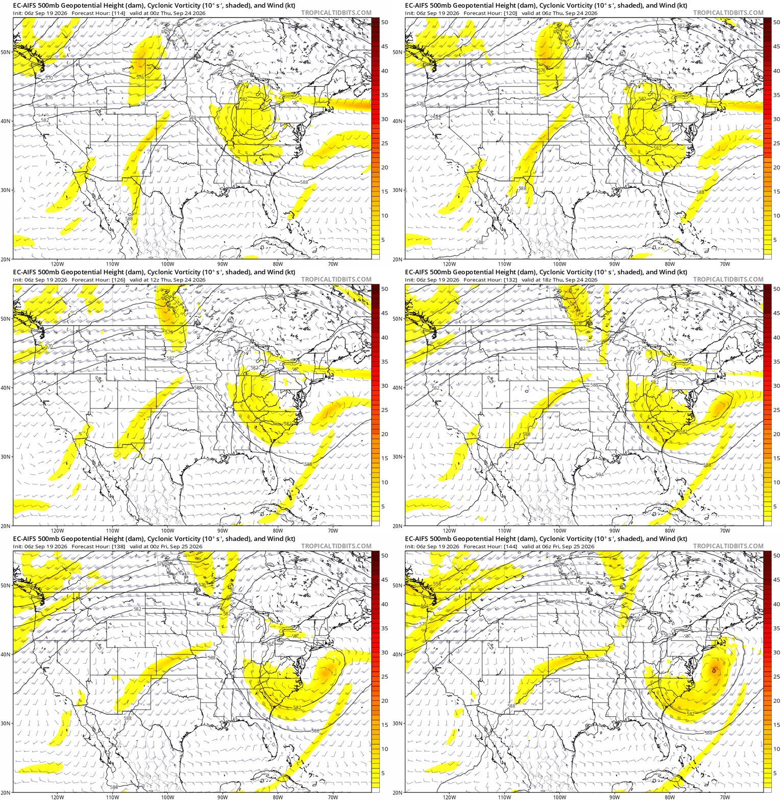
Biggest storm potential probably since March. The coastal surface reflection forms in the subtropics and phases with a mid level disturbance. We’ll have to see if we can get a named system out of this before reaches the mid latitudes. That will be the difference between run of the mill or something more unique, as advertised on the WPC output.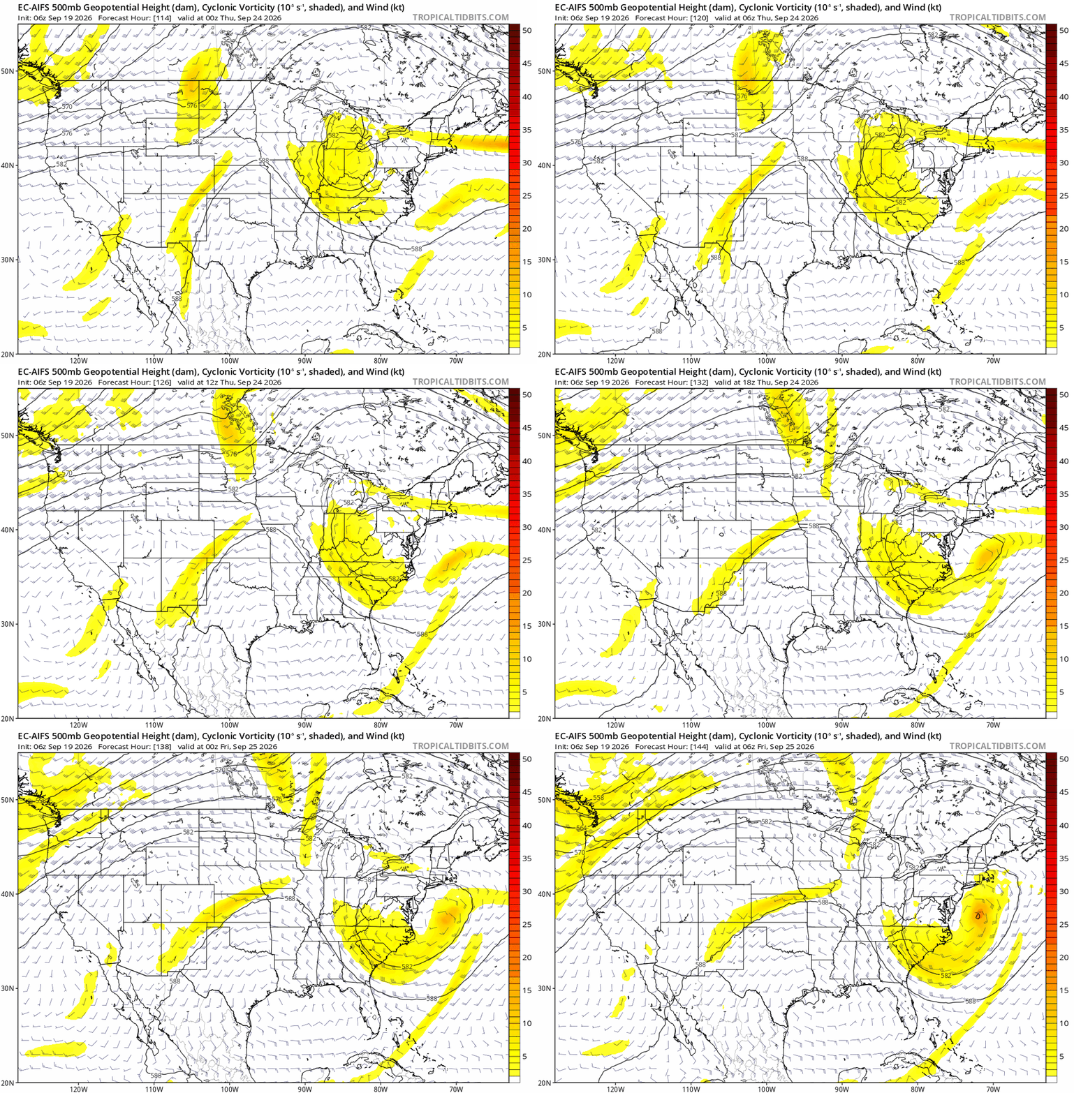
-
2026 Atlantic Hurricane Season
NorthHillsWx replied to Stormchaserchuck1's topic in Tropical Headquarters
24 hours later still wondering why 99L isn’t at least classified as a TD -
Don’t have any trees of heaven on your property? Those things love TOH (I think they might be part of their natural habitat).
-
(002).thumb.png.6e3d9d46bca5fe41aab7a74871dd8af8.png)
Central PA Summer 2026 Discussion/Obs Thread
ChescoWx replied to Voyager's topic in Upstate New York/Pennsylvania
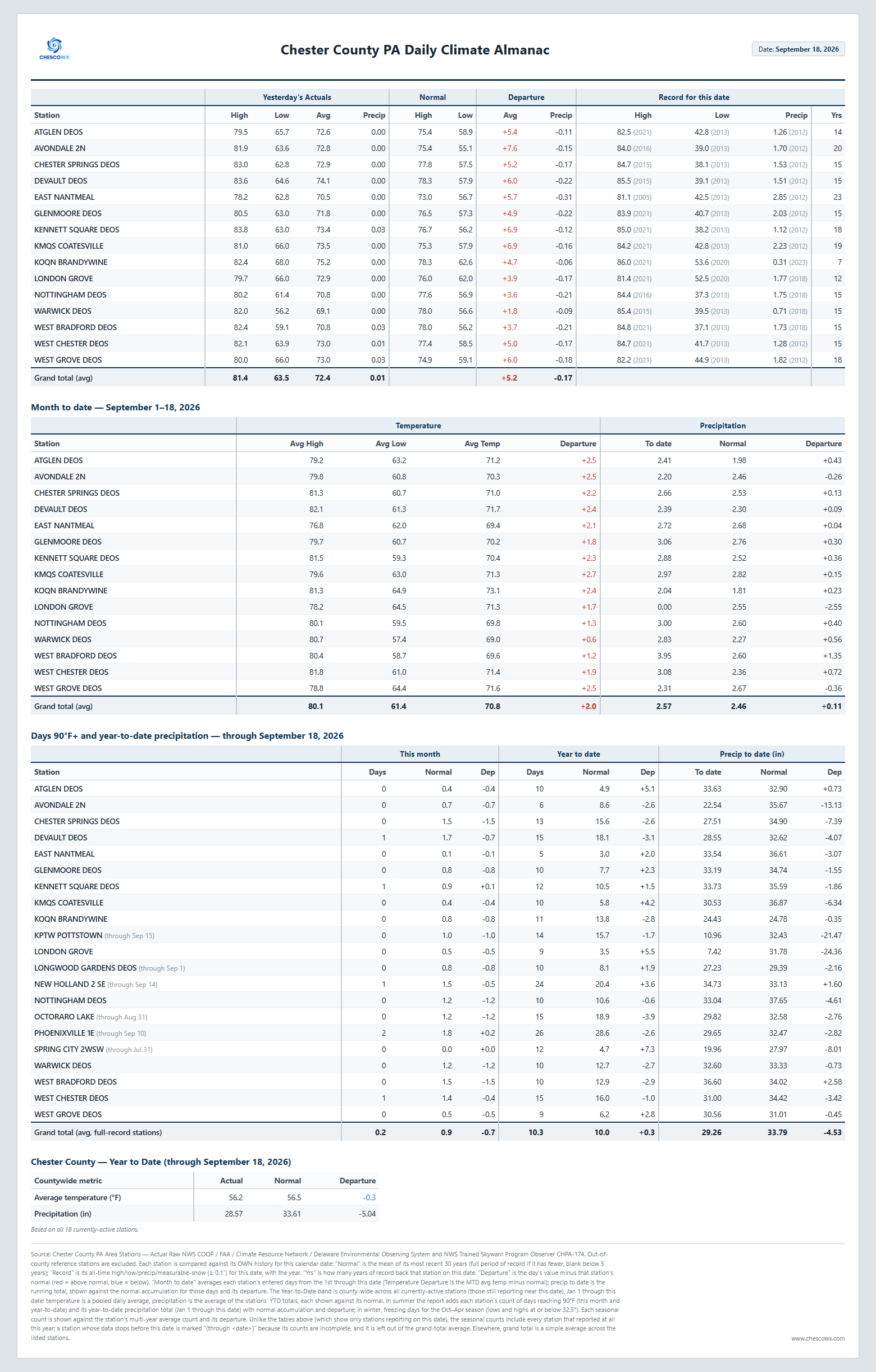
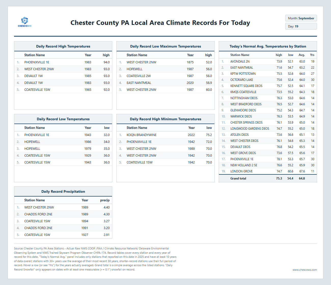
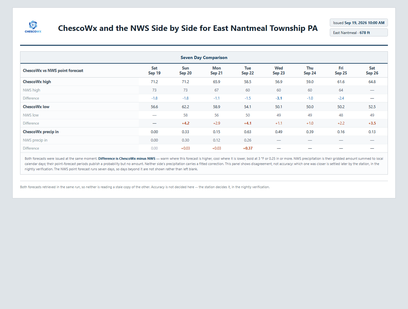
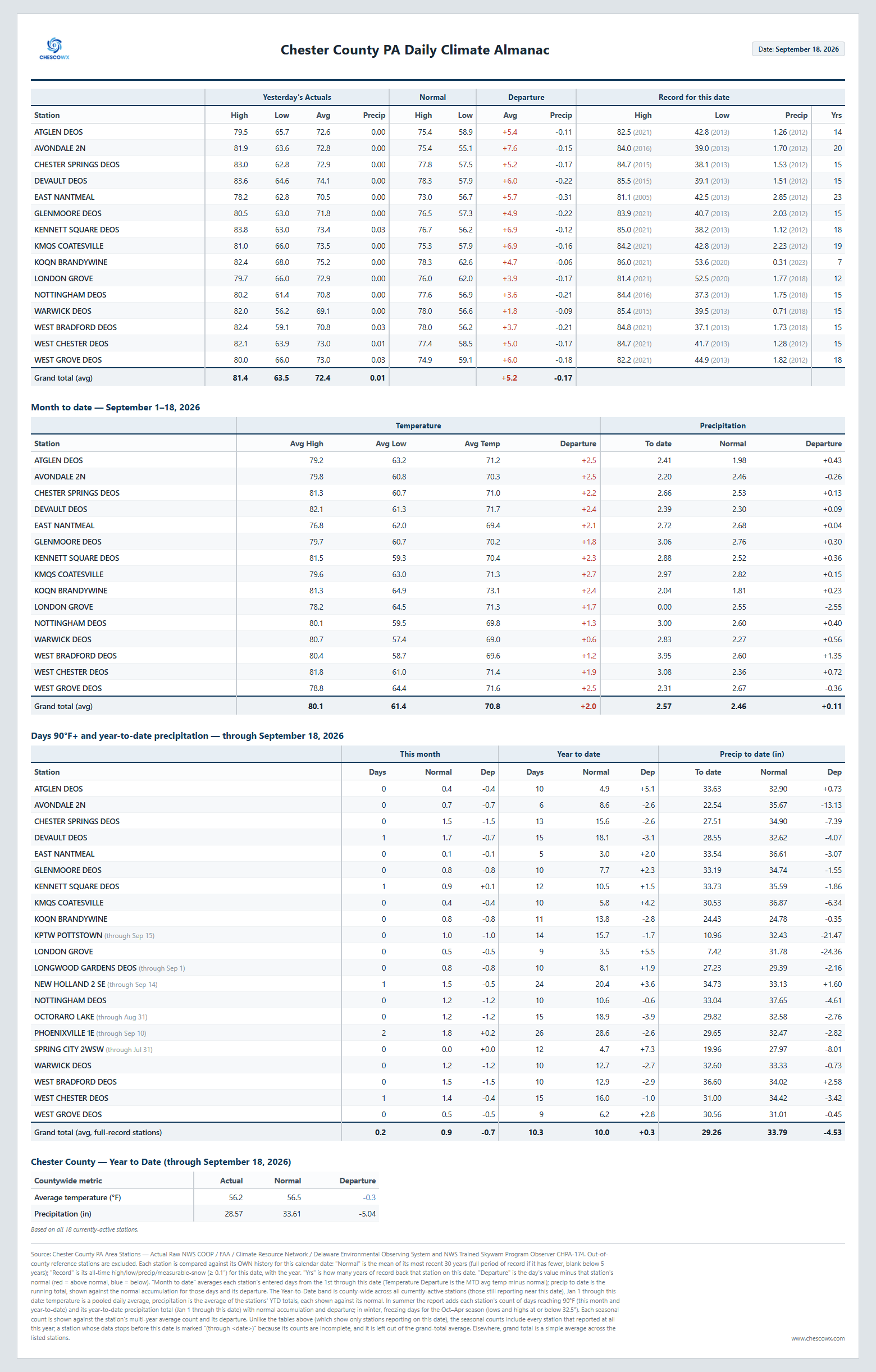
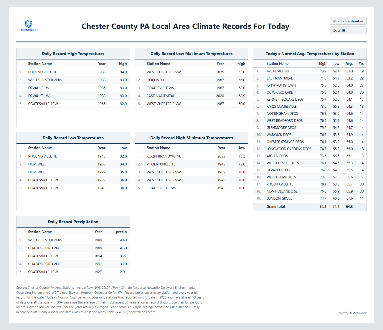
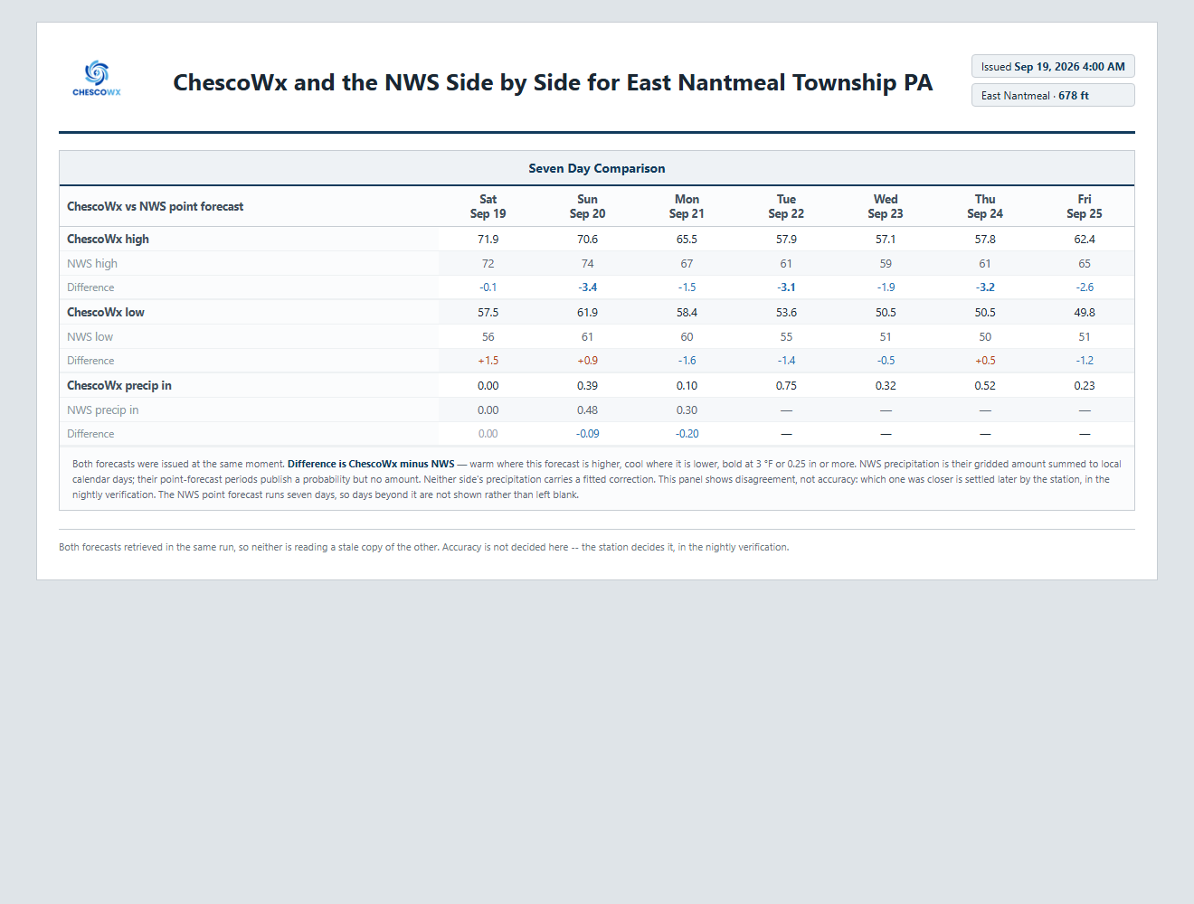
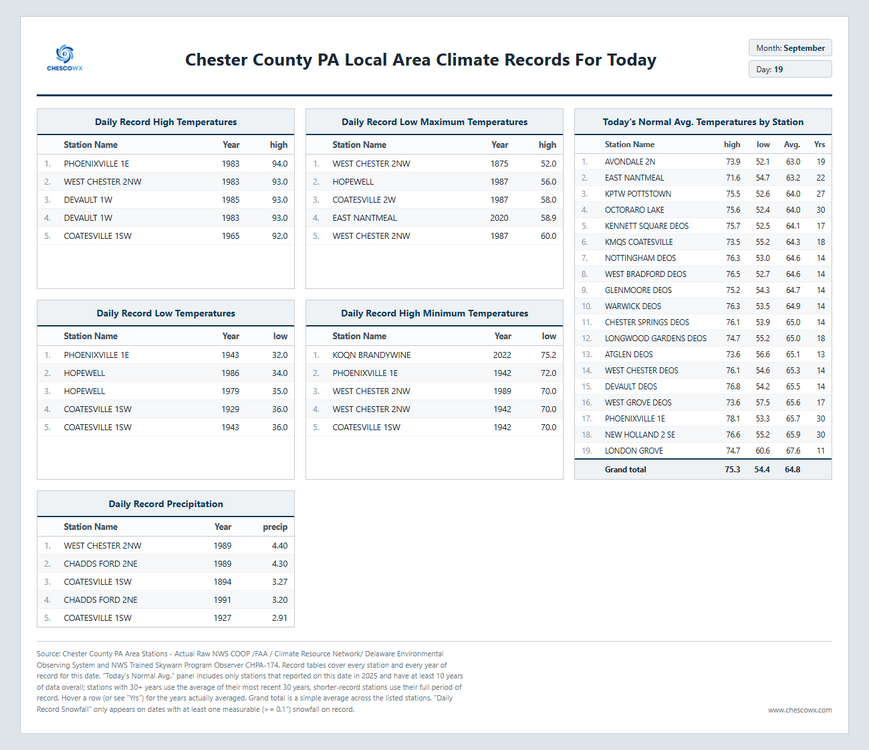
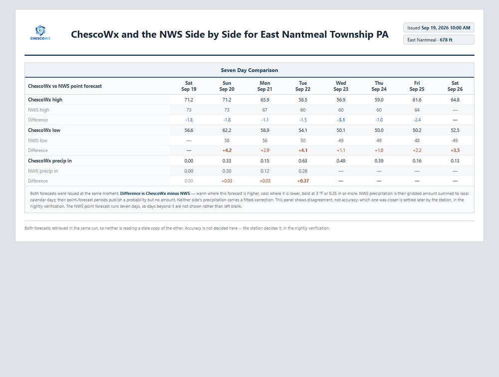
We begin a stretch today of below normal temperatures that may last through much of the remainder of September. It also looks to be a pretty wet week but with a lot of uncertainty as to how wet by later this week. The best chances of steady rain arrives tomorrow and into Sunday night. With greater chances again Tuesday. Temperature wise unseasonably chilly with highs remaining in the 50's Tuesday through Thursday with closer to 60 degrees in some of our valley locations. Overnight lows will be in the chilly upper 40's.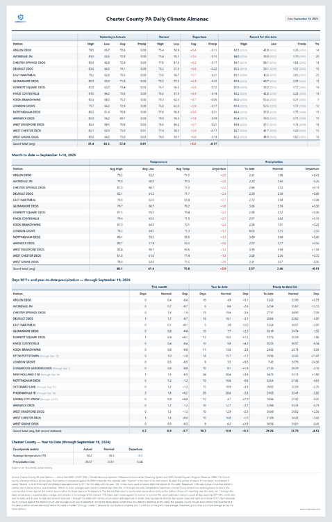
-
E PA/NJ/DE Autumn 2026 Obs/Discussion
ChescoWx replied to PhiEaglesfan712's topic in Philadelphia Region
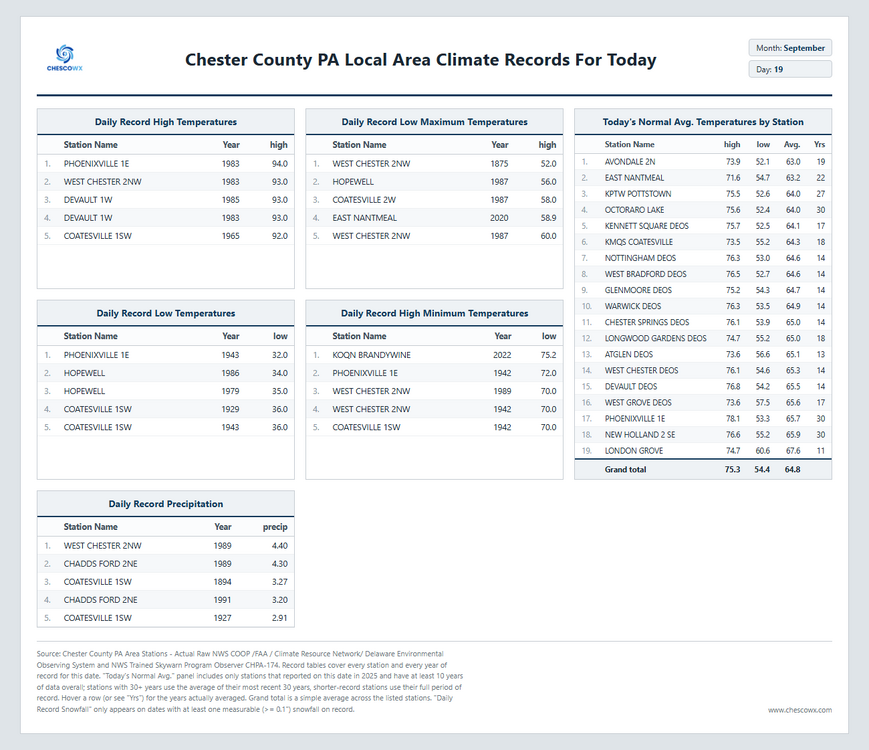
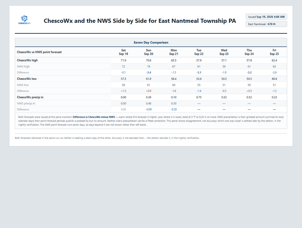
We begin a stretch today of below normal temperatures that may last through much of the remainder of September. It also looks to be a pretty wet week but with a lot of uncertainty as to how wet by later this week. The best chances of steady rain arrives tomorrow and into Sunday night. With greater chances again Tuesday. Temperature wise unseasonably chilly with highs remaining in the 50's Tuesday through Thursday with closer to 60 degrees in some of our valley locations. Overnight lows will be in the chilly upper 40's.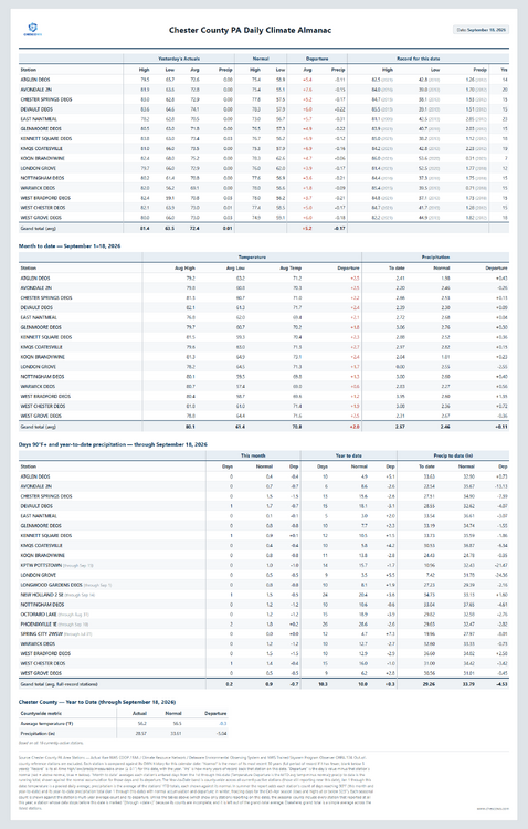
-
Wedged in 60s for highs Wednesday???
-
Septorcher 2026 Discussion - Endless Summer
kdxken replied to Damage In Tolland's topic in New England
Uninstalled back in July. Never needed it. Dud of a torch summer. -
1.18" so far early this morning to bring us over 4" for Sep. Another wave tonight/tomorrow morning looks to be on the way.
-
On it's way to the usual "less than a tenth, except higher amounts possible in thunderstorms".
- Today
-

Septorcher 2026 Discussion - Endless Summer
Chrisrotary12 replied to Damage In Tolland's topic in New England
With 60s in the forecast for the next 10 days…. We uninstalled. -
Records: Highs: EWR: 93 (1983) NYC: 94 (1983) LGA: 92 (1983) JFK: 90 (1983) Lows: EWR: 44 (1959) NYC: 44 (1929) LGA: 49 (1959) JFK: 47 (1959) Historical: 1846: The Great Gale of 1846, likely the remnants of a hurricane, hit Newfoundland, Canada with strong winds and high surf. 46 men and 11 boats were lost. (Ref. Wilson Wx. History) 1875: Boston, Massachusetts has the coolest high temperature of 49 °F for the month of September. (Ref. NOAA Boston Weather Events) 1895: Today it was 96° in Washington DC the first of five straight record high temperatures for September dates. (Ref. Washington Weather Records - KDCA) 1936: The 1936 hurricane did damage in Provincetown, MA on the 19th as it dropped 7.79 inches of rain in Provincetown, MA. 1936 Hurricane Track - Weather Underground 1947 - The eye of a hurricane passed directly over New Orleans, and the barometric pressure dipped to 28.61 inches. The hurricane killed fifty-one persons, and caused 110 million dollars damage. It produced wind gusts to 155 mph while making landfall over Fort Lauderdale FL two days earlier. (David Ludlum) (The Weather Channel) 1955: Hurricane Ione made landfall near Morehead City, NC with winds over 100 mph. 16.63 inches of rain fell at Maysville, NC. 40 blocks of New Bern, NC were underwater at one point. Seven people lost their lives and total damage was $88 million. This was the 3rd hurricane to cross eastern North Carolina in 5 weeks. (Ref. AccWeather Weather History) 1962: Torrential rain and significant amounts of hail fell from storms over northwest Oklahoma. A few locations in Ellis, Woodward, and Roger Mills Counties had hail drifts waist-deep. The next morning, some drifts were still two feet high. The storms brought up to 8 inches of rain across parts of northwest Oklahoma. (Ref. Wilson Wx. History) 1967 - Hurricane Beulah deluged Brownsville, TX, with 12.19 inches of rain in 24 hours, to establish a record for that location. Hurricane Beulah made landfall on the 20th near the mouth of the Rio Grande River, where a wind gust to 135 mph was reported by a ship in the port. (19th-20th) (The Weather Channel) 1967: Sparta, WI recorded their coldest September temperature with 19°. (Ref. Wilson Wx. History) 1980: Golfball to baseball sized hail hit St. Paul, MN. One company had 75 to 95 percent of the glass in their greenhouses smashed. (Ref. AccWeather Weather History) 1982: On this date through the 30th, Hurricane Paul first hit El Salvador and Guatemala as a tropical storm whose heavy rains kill more than 1,000 people. It then moved back over the Pacific, where it strengthened into a Category 2 hurricane with winds of 100 mph. The storm killed 8 people near Los Mochis, Mexico. (Ref. Wilson Wx. History) 1983: While the Mid-Atlantic and Northeast basked in late summer record heat, wintry weather occurred in the Rockies behind a strong cold front. Record highs in the east included: Reading, PA: 95°, New York (Central Park), NY: 94°, Wilmington, DE: 94°, Baltimore, MD: 94°-Tied, Hartford, CT: 93 °F. (Ref. Many Additional Temperatures Listed On This Link) 1983: 14 inches of snow fell just south of Great Falls, MT on this date through the 20th. 21 inches of snow fell at Nye, MT beginning the previous day through this date. Other snowfall totals: Mystic Lake, MT: 24 inches, Red Lodge, MT: 14 inches, Columbus, MT: 11 inches, Pryor, MT: 10 inches, Livingston, MT. The temperature fell to -6° at West Yellowstone, MT following the snow. The passage of a strong cold front was responsible for the wintry weather. The temperature at Denver, CO dropped from a sunny 86° to a snowy 35° in just 7 hours with the frontal passage. Kalispell and Billings, MT set record lows with 23° and 26° respectively. (Ref. Wilson Wx. History) 1987 - Cool autumn-like weather invaded the Central Rockies. Temperatures dipped into the 30s and 40s, with readings in the teens and 20s reported in the higher elevations. Gunnison CO was the cold spot in the nation with a morning low of 15 degrees. (The National Weather Summary) 1988 - Thunderstorms developing along a fast moving cold front produced severe weather in Wisconsin, Illinois, Indiana and Michigan. Eight tornadoes were reported, including five in Indiana. Thunderstorm winds gusted to 74 mph at Wabash IND. Winds associated with the cold front itself gusted to 69 mph at Kenosha WI. (The National Weather Summary) (Storm Data) 1989 - Showers and thunderstorms produced heavy rain in the Middle and Northern Atlantic Coast Region. Cape Hatteras NC was deluged with nearly 3.50 inches of rain in three hours. Syracuse NY reported 1.77 inches of rain, a record for the date, and Chatham NJ reported an all-time record of 3.45 inches in one day. Hurricane Hugo headed for the Bahamas, and Tropical Storm Iris, following close on its heels, strengthened to near hurricane force. (The National Weather Summary) 1991: An early season outbreak of Arctic air caused considerable crop damage in Iowa as temperatures fell below freezing. Temperatures fell to the mid 20s to lower 30s in most locations. Northern Iowa was the hardest hit where temperatures remained at 30 degrees or below for 8 hours. Record lows included: Valentine, NE: 17°, Timber Lake, SD: 21°, Rapid City, SD: 22°, Huron, SD: 23°, Havre, MT: 24°, Mobridge, SD: 24°, Pierre, SD: 24°, Norfolk, NE: 26°, North Platte, NE: 26°-Tied, Sioux Falls, SD: 27°, Grand Island, NE: 27°, St. Cloud, MN: 28°, Sioux City, IA: 28°, Lincoln, NE: 29°, Rochester, MN: 30°-Tied, Minneapolis, MN: 31°, Omaha, NE: 31°, Waterloo, IA: 32 °F (Ref. Many Additional Temperatures Listed On This Link) 1994: Honolulu, HI recorded its all-time high temperature of 95°. Kahului, HI tied their September record high with 96°. Lihue, HI tied their daily record high with 87°. (Ref. Wilson Wx. History)
-
67 / 48 those mostly or partly sunny forecasts currently being blocked by mostly cloudy skies. It should get to a partly cloudy day with low 70s for most. Tomorrow starts the 4-5 day period of clouds and potentially persistent onshore /easterly fetch with it comes the probability of rain / drizzle, and a cut off low bringing heavier rain. A below normal nasty period through the week b. Ridging north into Canada has weakness and cut off below and onshore overall through the 24, still unsettled but less ceertain into the 26th. Beyond there overall near normal to close the month.
-
Wow a near normal shading
-
After having been not populating a month straight of intra hour readings max/mins JFK had a day and a half of data and its back missing the last 18 hours https://forecast.weather.gov/data/obhistory/KJFK.html
-
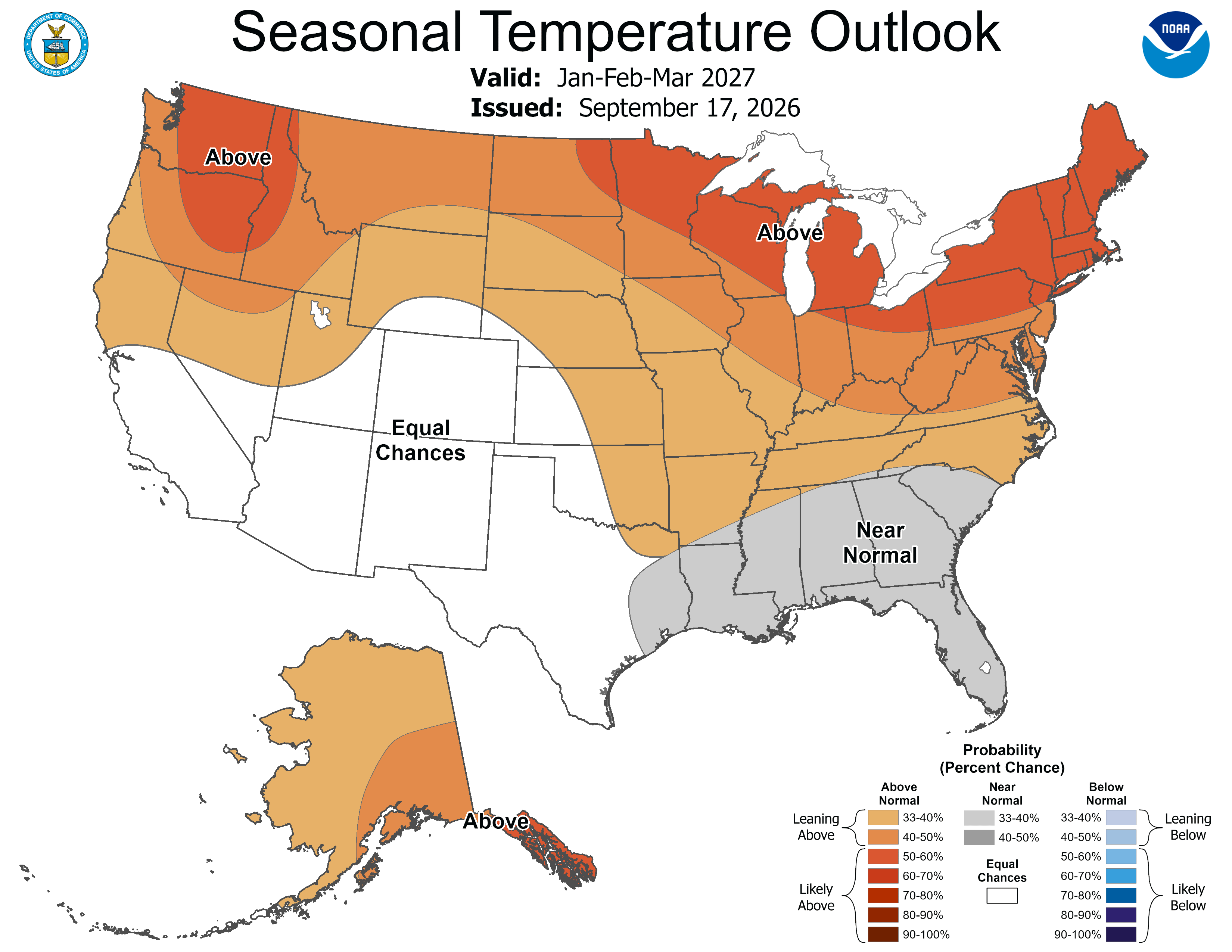
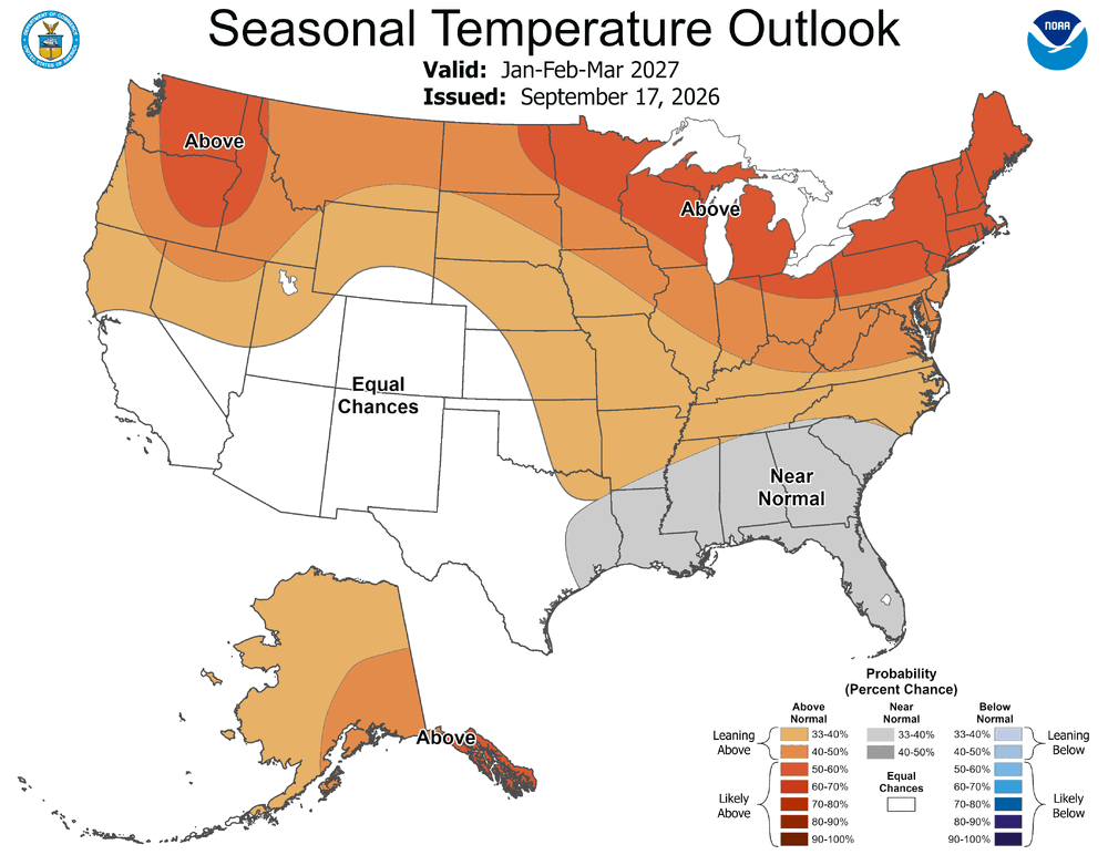
One of the easiest winter forecasts in many years due to the historic East based Nino
-
 Cialis 20mg price in USA: menon36 - buy cialis pill
 -
https://getbelvion.shop/# generic sildenafil