All Activity
- Past hour
-


-
Watches up for OKX zones now.
-
We talked about wanting to see egg on Eric Webb's face, well he's swimming in an omelets swimming pool. The annoying thing he is not even acknowledging it. He's just carrying on commenting about the ice storm as if he didn't confidently predict there was no way this was going north and implying that NE snow weenies are stupid, dishonest, or both (unless he issued a mea culpa post that I missed).
-
La Niña de-amp beginning at 0z?
-

Central PA Winter 25/26 Discussion and Obs
mahantango#1 replied to MAG5035's topic in Upstate New York/Pennsylvania
Nice summer like weather. -

“Cory’s in LA! Let’s MECS!” Jan. 24-26 Disco
Typhoon Tip replied to TheSnowman's topic in New England
I'm thinking that'll get more ironed out by the near terms, like <--48 hours... There is a ton of UVM associated with the initial ...stunningly powerful isentropic explosion moving overhead with that deep south source forced over this artic dome we're about to slab into place. And the models are developing a low pressure underneath all the rising motion as they should. But there's not a ton of actual Q-G forcing ( diffiuence mechanical/synoptic lift) so we end up with the weak low.... The problem is transitioning from that to then actually having Q-G forcing them moving into the region...It's sort of overlapping the isentropic lift region moving off... verrrrrry complex in there as the situation relays from being one mechanism, to a difference kind associated with cyclogen. The problem with the latter is that cyclogen needs the dynamics ( moisture and instability), which the leading stuff then escapes with some of that seaward ... kind of serving a plate not sufficient enough to feed the second circumstance. However, as we get closer, these two might overlap yet more... ie, consolidate... ? questions that may be better answered in the 48 hour window. -
yea there's that too lol It's just one data point...just one run of one model...but the AIFS trend is not good... 24 hours ago when it was showing what we wanted we were rightfully pointing out how good it's been and that having it on our side was a big deal...so losing it to the more amplified NW camp is not what we want. But again...it's just one piece of evidence not the whole show... if the op euro and EPS come in good that would outweigh the significance some.
-

-
Yeh, miss me with that craziness until we have full model agreement sub 72 hrs out. .
-

January 24-26: Miracle or Mirage JV/Banter Thread!
clskinsfan replied to SnowenOutThere's topic in Mid Atlantic
AI is probably 15 inches out here before the flip. For those out this way. The sleet is going to be heavy. A compacted glacier is coming. -
At least its been a more exciting winter and the forum is hopping
-

“Cory’s in LA! Let’s MECS!” Jan. 24-26 Disco
moneypitmike replied to TheSnowman's topic in New England
South of me too, FTL. -
Yeah that's not good...man I just don't wanna lose a warning level snowfall with this at the last minute. 6-10" bare minimum
-

January 24-26: Miracle or Mirage Thread 2
NorthArlington101 replied to mappy's topic in Mid Atlantic
EURO def south with the initial WAA pus, at least -

1/24-1/25 Major Winter Storm - S. IL, IN, MI and OH
Malacka11 replied to A-L-E-K's topic in Lakes/Ohio Valley
Don't get me wrong I'm not trying to be silly and I'm definitely not saying its showing GHD IIIIII. Frankly, my enthusiasm revolves solely around ChiStorm's daily-at-best check-ins, so ya know where I'm at. Just looking on TT, the Euro AI seemed to bump a bit NW while everything else this suite hasn't, which I thought would be amusingly par for course if it's reflected in the base Euro too. -
-
Tremendous storm with thundersnow. NOVA had one inch of snow in afternoon and I thought storm was a bust until lightning strike at 12:15a.m. And waking up to foot of snow and tree across the driveway.
-
Just started looking beyond our “walking on snow” system. Interesting stuff showing up next weekend to say the least.
-
I guess what’s the old rule though? It’s not the first storm, usually the 2nd?
-

Possible Record Breaking Cold + Snow Sunday 1/25 - Tuesday 1/27
Nibor replied to TriPol's topic in New York City Metro
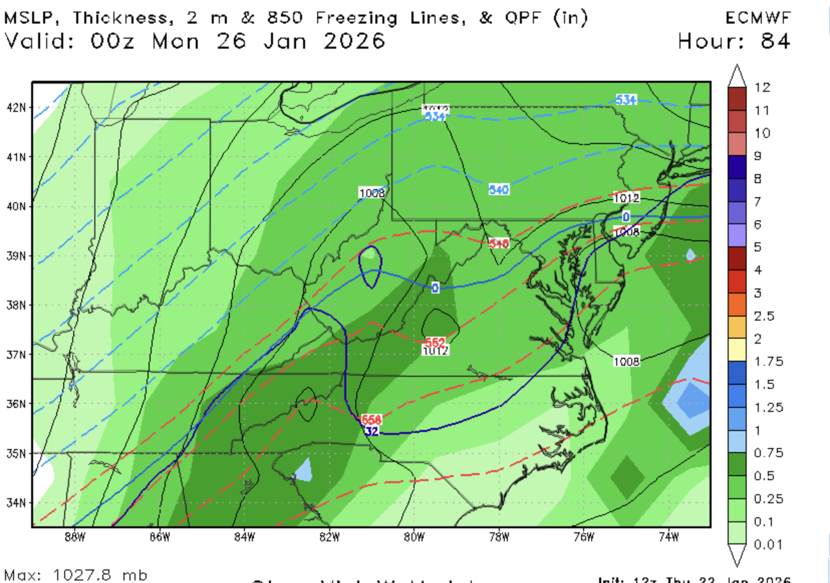
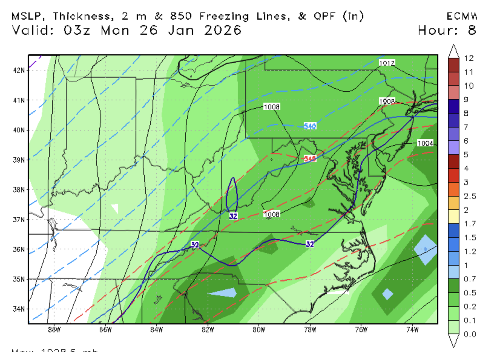
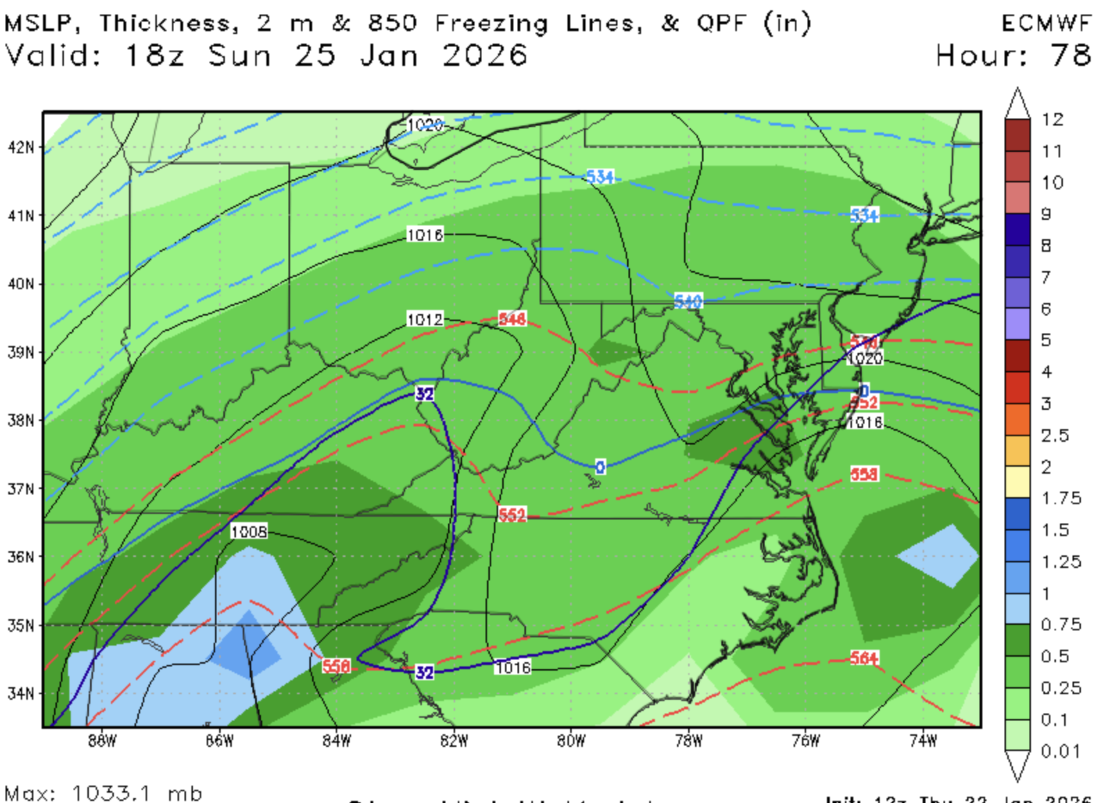
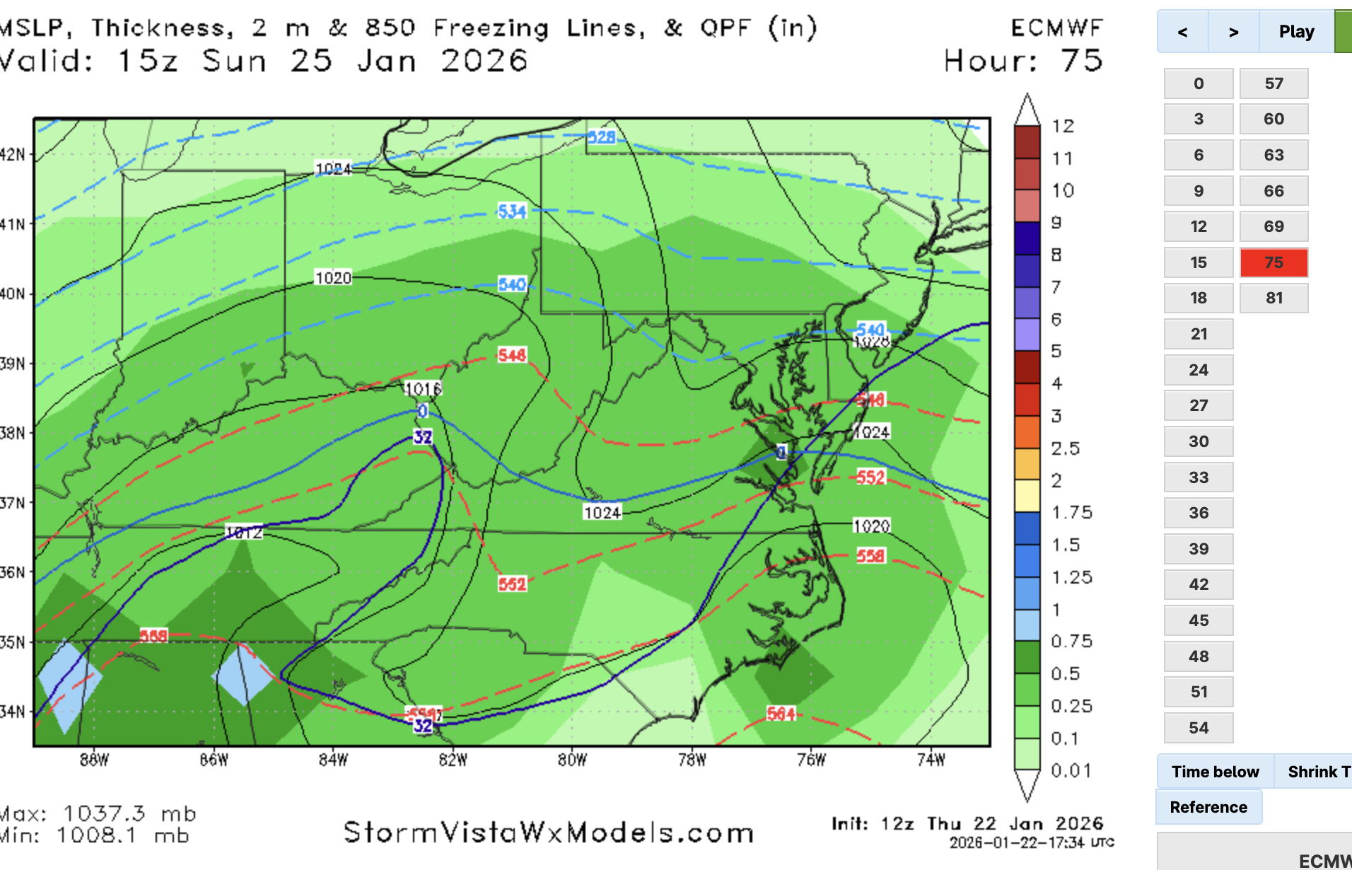
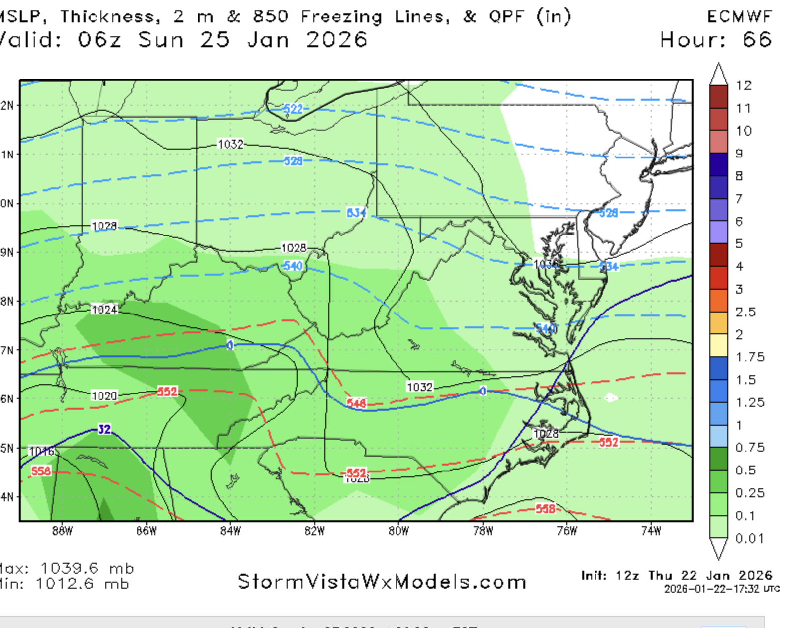
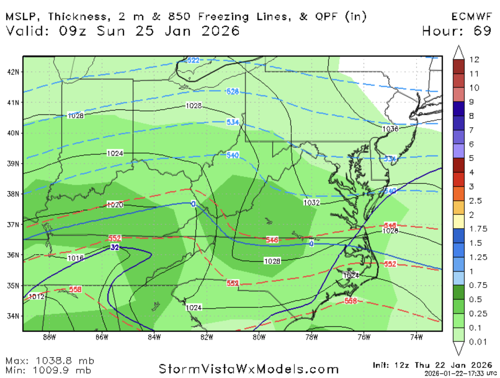
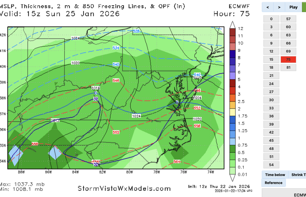
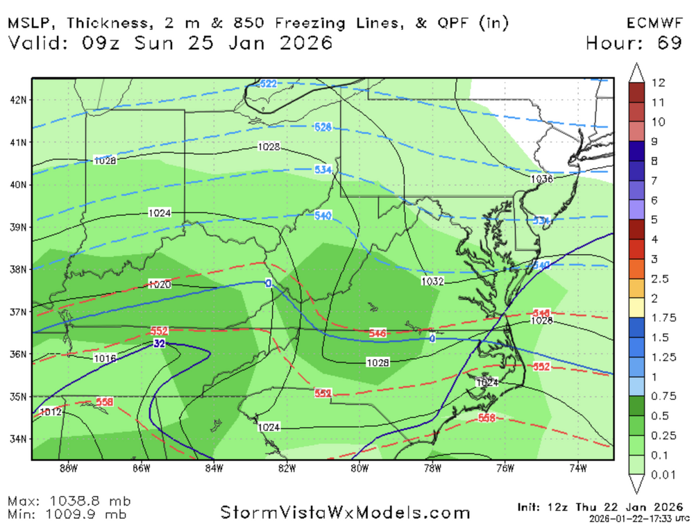
Looks like slightly less phasing on the Euro out to 66 -

Possible Record Breaking Cold + Snow Sunday 1/25 - Tuesday 1/27
NEG NAO replied to TriPol's topic in New York City Metro
lets see if those recon flights had any affect on the Euro - didn't seem to make much of a difference with the other models at 12Z -
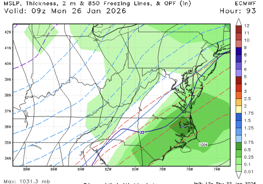
Which probably allows the confluence to leave.
-
Here she comes

-
Euro could be interesting...
-
You know good and well how this next one pans out! Actual suppression this time and a Pensacola winter dream. I don’t make the rules.