All Activity
- Past hour
-

2026-2027 Record-breaking El Nino
michsnowfreak replied to Stormchaserchuck1's topic in Weather Forecasting and Discussion
Same here. The 2020s are not nearly over, so cant count them as a complete decade. 1980s- 45.2" 1990s- 37.9" 2000s- 45.3" 2010s- 49.9" 2020s- 37.8"* -
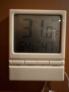
31F at 7pm on this ancient device. Both local PWS also 31F though too.
-
39F here in the valley in E CT
-
 https://indigetrx.com/# indian pharmacy store
 -

2026-2027 Record-breaking El Nino
FPizz replied to Stormchaserchuck1's topic in Weather Forecasting and Discussion
Snow wise, the 90s were the worst decade of my life even with the best season ever - Today
-
mexican pharmacy ship to usa: MexGetRx - buying prescription drugs in mexico
-
1st shot at 20s overnight.
-
Trying too hard… dial it back. It’s early, and Forky busts every winter, FYI.
-
good online mexican pharmacy and farmacia mexicana en linea mexican online pharmacy wegovy https://images.google.lu/url?sa=t&url=https://mexgetrx.com mail order mexican pharmacy or https://gikar.it/user/zvjzbxstjd/ farmacia pharmacy mexico delivery to usa [url=https://www.google.lv/url?sa=t&url=https://mexgetrx.com]farmacia pharmacy mexico[/url] mexican online pharmacy shipping and [url=http://bbs.51pinzhi.cn/home.php?mod=space&uid=8451393]best online pharmacies in mexico[/url] order antibiotics from mexico
-

2026-2027 Record-breaking El Nino
EasternLI replied to Stormchaserchuck1's topic in Weather Forecasting and Discussion
Weeklies increasingly picking up on the el nino now as we head into November. By the end of this run, which is near the end of November, it's basically the classic look we'd expect. -
39/23 Still pretty breezy.
-
A midnight high of 54.7. A daytime high of 49.1. Down to 44.8 now. GYX has me going to 25 (even BOX has Mattapoisett at 30). We'll see how much the water tempers things here.

-
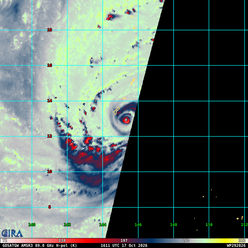
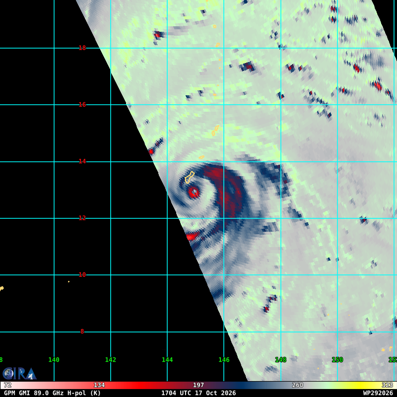
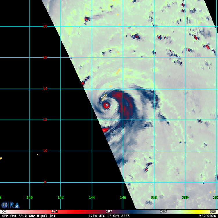
 Agreed. Huge backside feeder that is still attached and feeding into the eyewall versus being a closed off concentric feature. Champi is bombing. Very intense eyewall ongoing.
 -
What a glorious fall day. Topped out at 55 and sunny in Mt Airy. Perfect jeans and flannel day.
-
That could be a picture from August.
-
 I'm inclined to believe what we were seeing on radar in terms of a moat was just a massive feeder band rather than an outer eyewall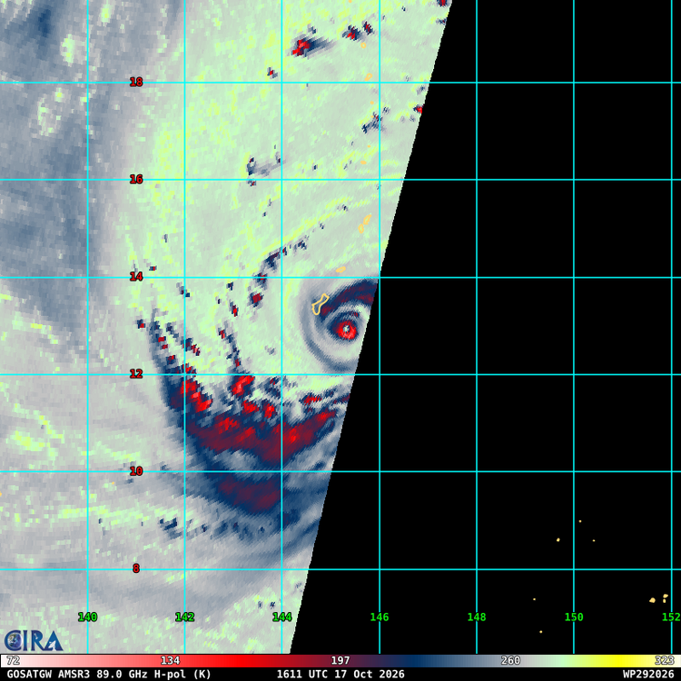
-
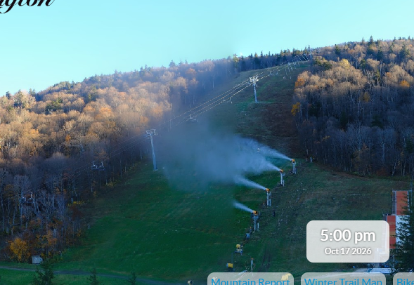
Looks like Killington fire up its guns for real. I think its a bit early but there it is. Had them going on north ridge as well.
-
canadian pharmacies shipping to usa and canadian pharmacy meds canadian pharmacy online https://www.google.bt/url?q=https://cangetrx.com legit canadian online pharmacyand http://sotoycasal.com/user/cmswvurnyi/ online canadian pharmacy [url=https://www.google.cv/url?sa=t&url=https://cangetrx.com]canadian pharmacy online[/url] reliable canadian pharmacyor [url=https://mantiseye.com/community/ulojgaabwm]canada rx pharmacy world[/url] canadian mail order pharmacy
-
Works for weather consulting firm. Weeklies are interesting.
-
https://indigetrx.com/# india pharmacy online
-
It’s too bad it was cloudy. Would be lower 50s.
-

Winter 26-27’ Speculation Thread
KakashiHatake2000 replied to Carvers Gap's topic in Tennessee Valley
https://snow.wall.cloud/?cwa=MEG&view=overview&signal=PNA&outcome=occurrence https://snow.wall.cloud/?cwa=OHX&view=overview&signal=PNA&outcome=occurrence https://snow.wall.cloud/?cwa=HUN&view=overview&signal=PNA&outcome=occurrence https://snow.wall.cloud/?cwa=MRX&view=overview&signal=PNA&outcome=occurrence Thought I would repost dr Johnathan wall snow signal cwa forcast since it’s available now for Meg ohx and hun also the majority of the cwa 157 at the moment all across the conus . -
52 and drizzle. .69" in the bucket today. Much needed rain.
-
Much cooler air moved into the region late last night. As a result, the New York City area is experiencing its coolest weekend so far this fall. Tomorrow will get off to a very chilly start. Many outlying areas will see frost. There is even a chance that the temperature could dip just below 40° in Central Park. The last time that happened this early in the season was during the 2015 El Niño. November 2015 was then much warmer than normal and some of the long-range guidance suggests that Pacific Air could begin to dominate much of the North American continent to start November. Temperatures will moderate next week with highs reaching 60° or somewhat above Tuesday through Friday. There remains uncertainty concerning rainfall potential. The ENSO Region 1+2 anomaly was +5.2°C and the Region 3.4 anomaly was +3.3°C for the week centered around October 7. For the past six weeks, the ENSO Region 1+2 anomaly has averaged +4.73°C and the ENSO Region 3.4 anomaly has averaged +3.03°C. ENSO Region 3.4 has set a new all-time record. The ongoing strong El Niño, will continue to strengthen through the mid-fall. The SOI was -28.69 today. The preliminary Arctic Oscillation (AO) was +1.489 today. Based on sensitivity analysis applied to the latest guidance, there is an implied near 61% probability that New York City will have a warmer than normal October (1991-2020 normal). October will likely finish with a mean temperature near 58.5° (0.6° above normal). Supplemental Information: The projected mean would be 1.6° above the 1981-2010 normal monthly value.
-
NHC tagging this next offshore storm as a lemon.