All Activity
- Past hour
-

E PA/NJ/DE Winter 2025-26 Obs/Discussion
zenmsav6810 replied to LVblizzard's topic in Philadelphia Region
Didn't we get a late glancing blow from a Miller A after the first two blockbusters in the 2010-11 snow season? -
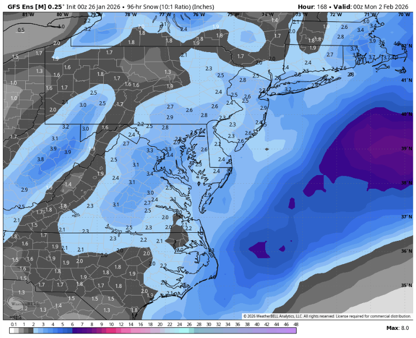
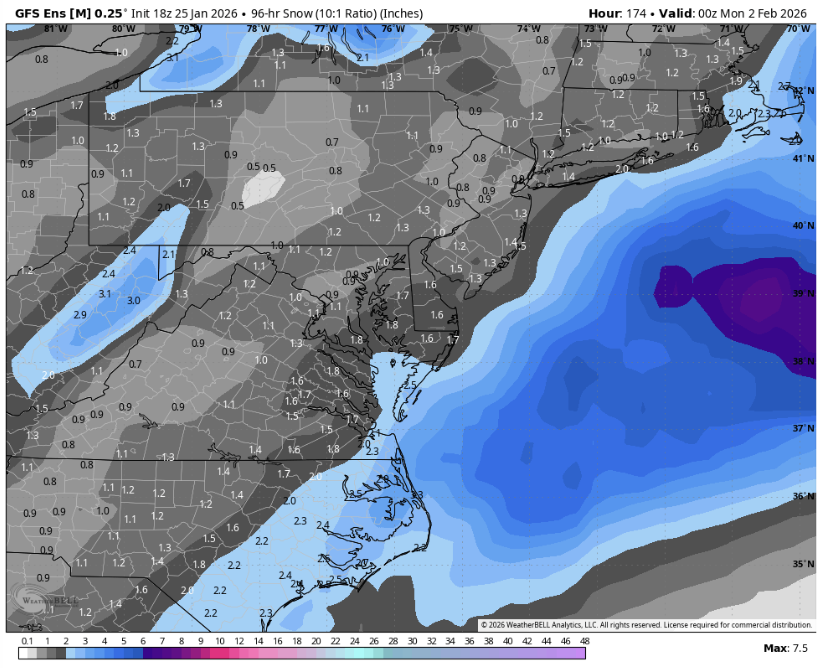
The slight double maxima over dc and the Delmarva makes me wonder if there are two main camps in the ensemble members
-
Wouldn't exactly call that the bullseye
-
 Sounds pretty similar to what I have. Definitely not purely mist now, I definitely saw a few things bounce, and a few snowflake-looking things that are blowing in the wind. Icicles starting to form on the siding of the house
 -
 Still good echoes there probably from strong 850 inflow. CF probably stalls near BOS for awhile. Hrrr tries to move it west near here tomorrow after it just barely passes east.
 -
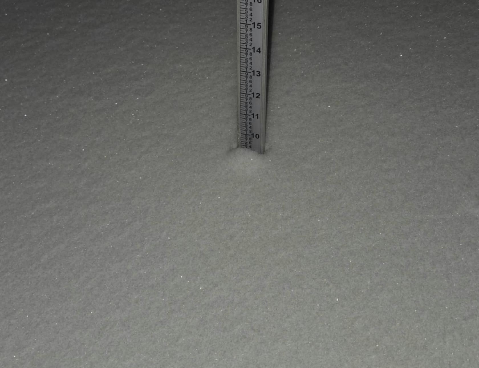
11.5
-

2025-2026 ENSO
PhiEaglesfan712 replied to 40/70 Benchmark's topic in Weather Forecasting and Discussion
The 10-year snow drought is over: https://x.com/amarkowitzWX/status/2015592086276313584 -
Also PF, I saw something where they said jan 83 was the biggest storm in Albany. Is that true. Is it only 24 hr. Because I know that area has had way bigger storms. I remember you being from albany from ne.weather on usenet
-
 Ours just went down. Wife said Comcast would be up at 2:30AM. Posted somewhere on their website. How the heck they know that lol? I’d hate to be out tonight in this mess. Those poor linemen.
 -

1/24-1/25 Major Winter Storm - S. IL, IN, and OH
michsnowfreak replied to A-L-E-K's topic in Lakes/Ohio Valley
I remember Toronto had so many down winters, even when the rest of us were getting hit good, that @Snowstorms thought Toronto just couldn't get good winters anymore. The last few years have emphatically proved that wrong. -

Richmond Metro/Hampton Roads Area Discussion
overcautionisbad replied to RIC Airport's topic in Mid Atlantic
Ok so now we just need it shift north west slowly this week on the models and smack us dead center Lets go! -
They barely went under on Kalshi! It was I believe 11.6, wow that was tighter that I expected.
-
 Here come the easterly low level ocean bands. I can see 3-4 potential bands beginning to set up over the Bay, nosing into Cape Ann, KBOS, South Shore, and Plymouth. Expect echos to begin consolidating around these features I don't expect super high ratios from these, but growth should be better given the lower level nature of the flow
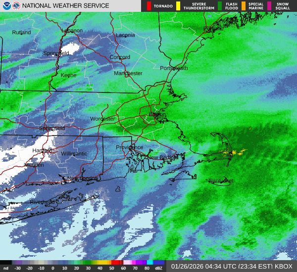
-
DC/Balt in the bullseye already , 0z vs 18z GEFS down below
-
 Just checked deck and elevated surfaces turning to slush..31.7. Heavy drizzle/micro snowflakes/mist..not sure what to call it lol
 -
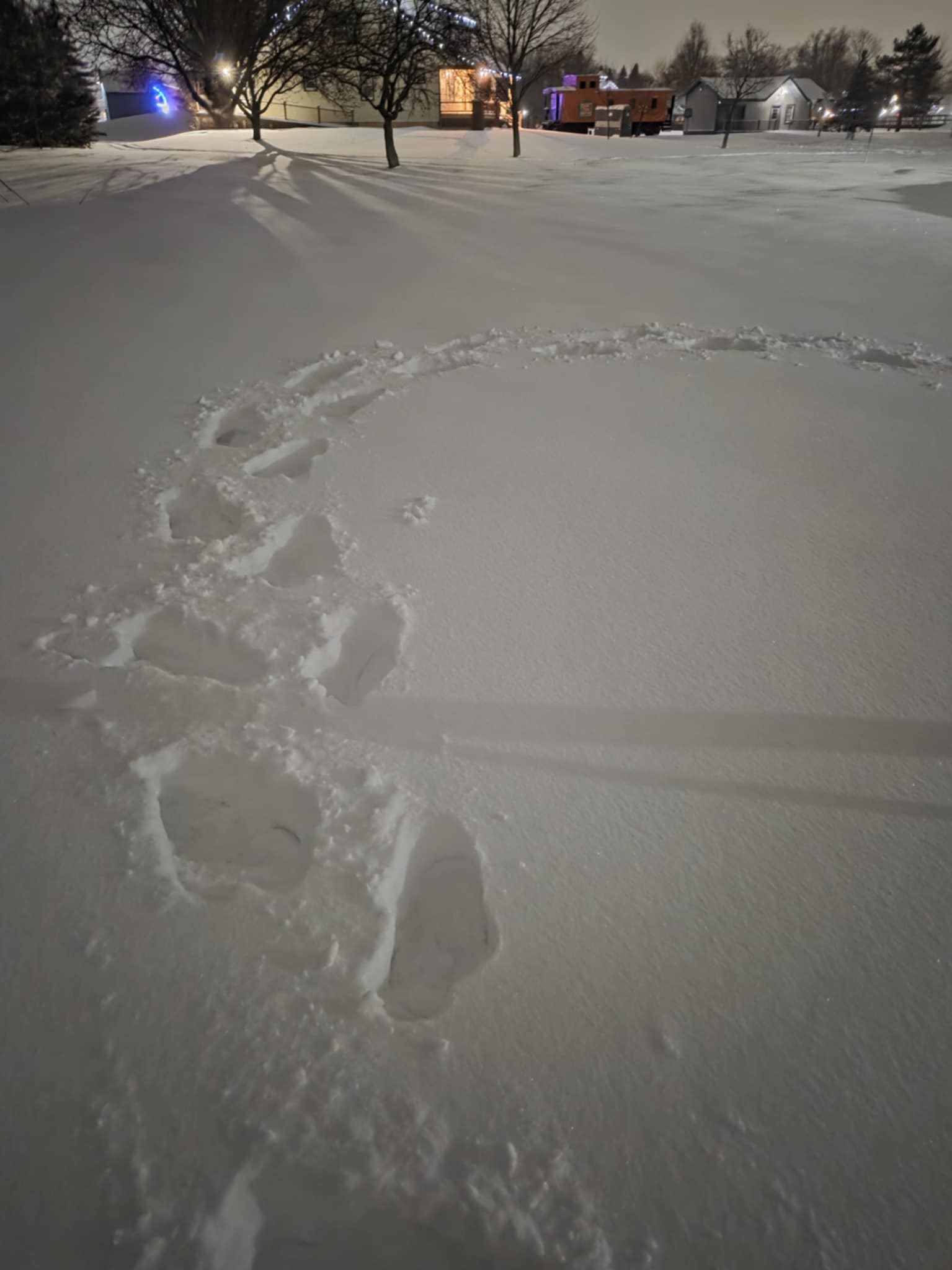
Wife and I went for a Jebwalk on Roosevelt Island. After I explained the concept of a Jebwalk to her (which she found super-endearing), we measured a 11.8” here. Solid storm in what’s turning out to be a solid winter. I continue to believe we’ve passed the nadir of craptastic winters.
-
1/24-1/25 Major Winter Storm - S. IL, IN, and OH
michsnowfreak replied to A-L-E-K's topic in Lakes/Ohio Valley
We finished with 5.2". There is 9-10" on the ground. The snow was not fluffy it was like 10-12:1 arctic powder so it had weight to it. With the existing snowpack and snowbanks there are mountains of powder everywhere...its so cold no salt is being used. It looks like pretty much the same as if it was a foot snowstorm lol. It looks fantastic outside. DTW finished with 4.9" snow on 0.41" liquid so the liquid was actually MORE than the model average forecast of 0.35". It was just pure sugar. Monroe had 6.5". Pretty much 2-4" NW of an Ann Arbor to Livonia to Port Huron line with less than 2" by the time you get to Flint. From Adrian to DTW to Mt Clemens and southeast 4-5" with 5-7" in Monroe Co. So basically...model qpf was fine...once again the assumption of cold equals fluff did not work out. It is very rare to get 20-1 ratios in a synoptic system....Lake effect, that's when you can easily get north of 25-1 ratios.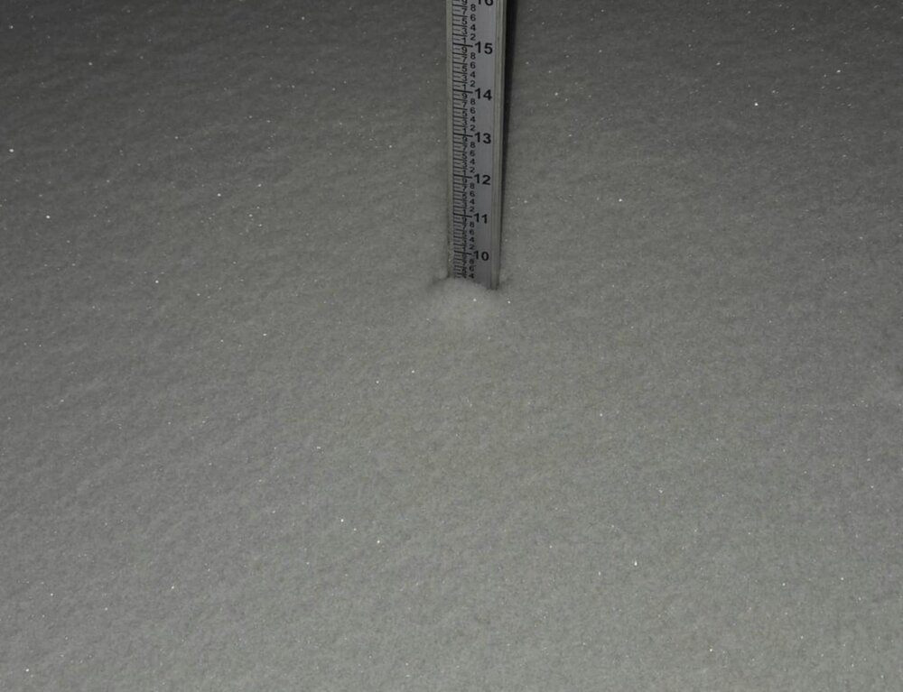
-
Almost always happens when the storm comes in aggressive and heavy that the surface never warms up the way it's modeled to.
-
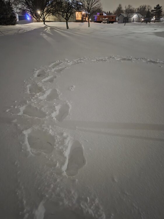
.thumb.png.4150b06c63a21f61052e47a612bf1818.png)
January 2026 regional war/obs/disco thread
HIPPYVALLEY replied to Baroclinic Zone's topic in New England
Oh how we pray. What did you end up with today in the city? -
 One last measurement and clear before bed.. 16.3", 1.53" SWE. Still ripping out there
 -
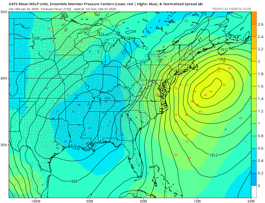
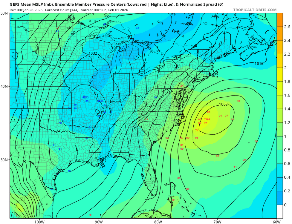
Gefs much closer
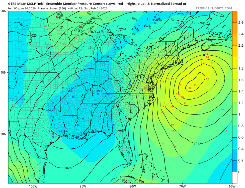
-
Gefs on board

-
A thick fog has rolled in with light snow and a current temp of 35 degrees.
-
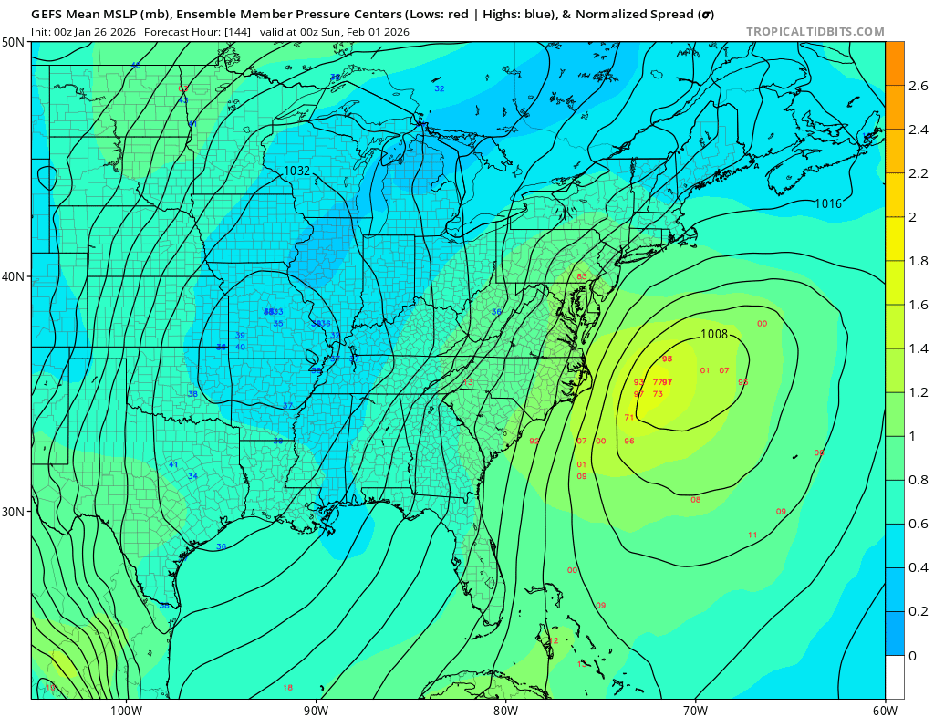
GEFS more NW


.jpg.31d8baedcba152aca3acc85a07099859.jpg)
.jpg.140c26012a521723b238e54ee653de86.jpg)