All Activity
- Past hour
-

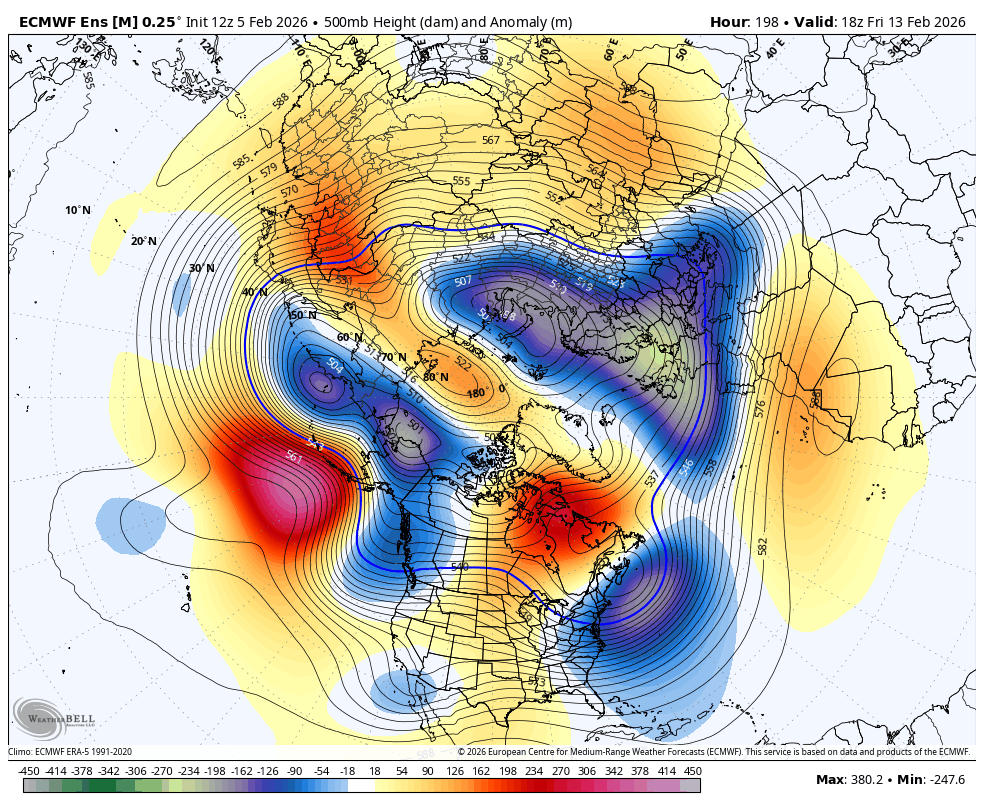
Winter 2025-26 Short Range Discussion
RogueWaves replied to SchaumburgStormer's topic in Lakes/Ohio Valley
HRRR: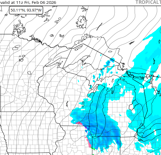
-

Friday February 6 FROPA / WINDEX small event
Sey-Mour Snow replied to HoarfrostHubb's topic in New England
I’d be pretty excited in ENE though looks like a mini Blizzard Saturday -
Aside from the light snow on Saturday, Wednesday looks like a mix storm at best with the low going west of us. Next weekend threat has vanished. Warm up ensues afterwards.
-
Friday February 6 FROPA / WINDEX small event
Sey-Mour Snow replied to HoarfrostHubb's topic in New England
It’s going to be blowing all morning , will be impossible to measure the coating to 2” around here. -
 Thanks Will
 -

Is we back? February discussion thread
Damage In Tolland replied to mahk_webstah's topic in New England
https://x.com/weatherwilly/status/2019583069028774246?s=46&t=dhcbvkjmRcyBVQtDxJ3lRg -

E PA/NJ/DE Winter 2025-26 Obs/Discussion
snowwors2 replied to LVblizzard's topic in Philadelphia Region
JUST said that to my wife this afternoon when we were out and about driving outside of our very rural area‼️ -
Low of 31, high of 35. .05" of rain after midnight. We had a major melting last night from the rain. Lots of snow still but grass showing too. Roads all clear. Had a few snow showers a few hours ago amounting to nothing.
-
What?
-
 Mdecoy knows
 -
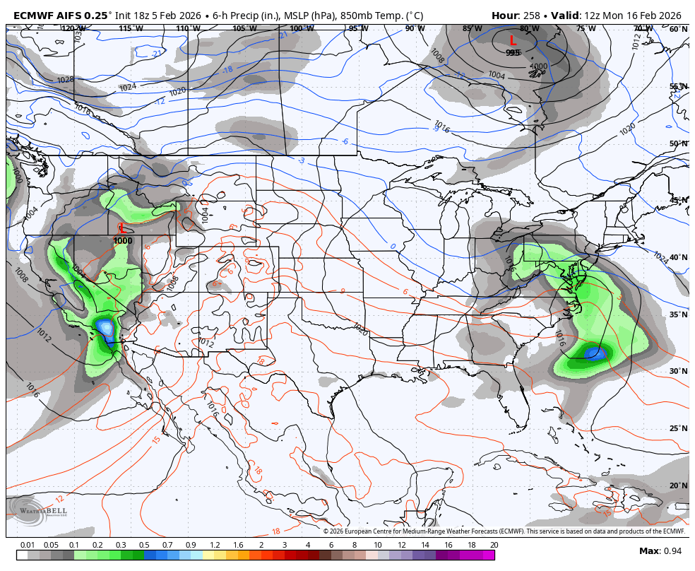
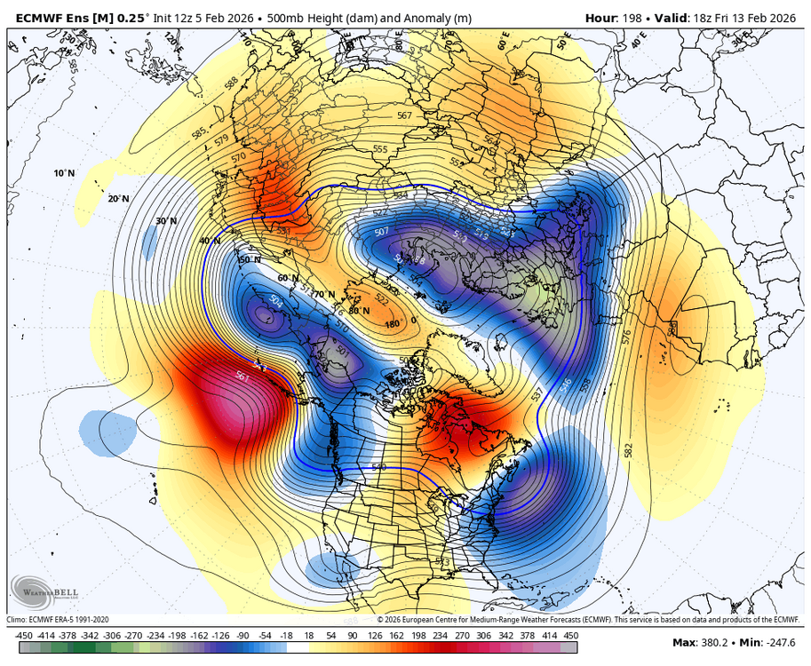
The pacific is really hostile around Feb 13-19 you’re right. But…there is a leftover cold regime and look at the Atlantic. We’re not just talking about some help. Look at that 50/50. If that Baja wave ejects into that…I don’t care what the pacific long wave pattern is that could work. Typically we’d be dead with that pac look but if that 50/50 presentation is close with the cold left over from the previous pattern this isn’t the typical setup.
-
Anything after year's modeled annihilating storm will be a disappointment.
-

February 2026 Medium/ Long Range Discussion: 150K Salary Needed to Post
CAPE replied to Weather Will's topic in Mid Atlantic
Several possibilities for sure. We just cant know yet. -
 Lucky 13 ehh?
 -
Fringed with 2 feet
-
February 2026 Medium/ Long Range Discussion: 150K Salary Needed to Post
CAPE replied to Weather Will's topic in Mid Atlantic
Root for this member from the 18z GEFS run for next weekend lol
-

Is we back? February discussion thread
40/70 Benchmark replied to mahk_webstah's topic in New England
You mean the OPs? -
Euro and EPS is leaving too much energy back in Baja and washing out what’s left. Maybe. But if that’s wrong and a stronger wave comes out…it’s actually trended better with the blocking in front. Imagine if it didn’t leave the Baja energy behind and instead attacks this Atlantic setup with a healthy wave! I think the threat still exists. It’s not likely but anytime there is a setup with big potential I’ll pay attention. Sooner or later we have to get lucky.

-

Winter 2025-26 Short Range Discussion
Chicago Storm replied to SchaumburgStormer's topic in Lakes/Ohio Valley
The clipper diving through the region later tonight on into tomorrow looks interesting. Looking at soundings, snow should be convective, and I wouldn't rule out TSSN. -

Central PA Winter 25/26 Discussion and Obs
Blizzard of 93 replied to MAG5035's topic in Upstate New York/Pennsylvania
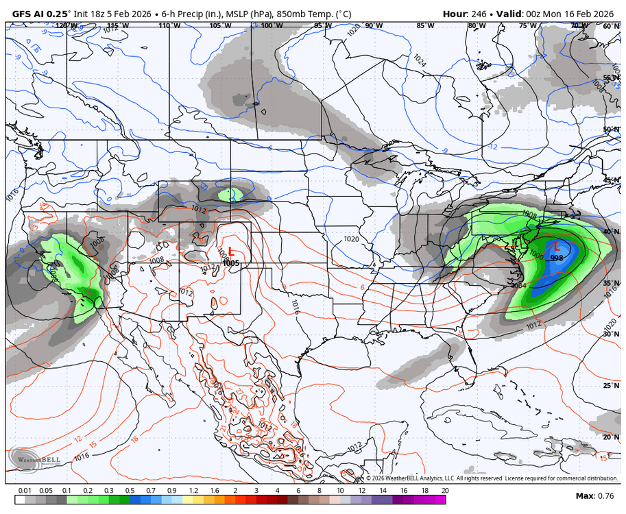
Both the 18z AI Euro & AI GFS have a potential Winter storm chance near President’s Day this run.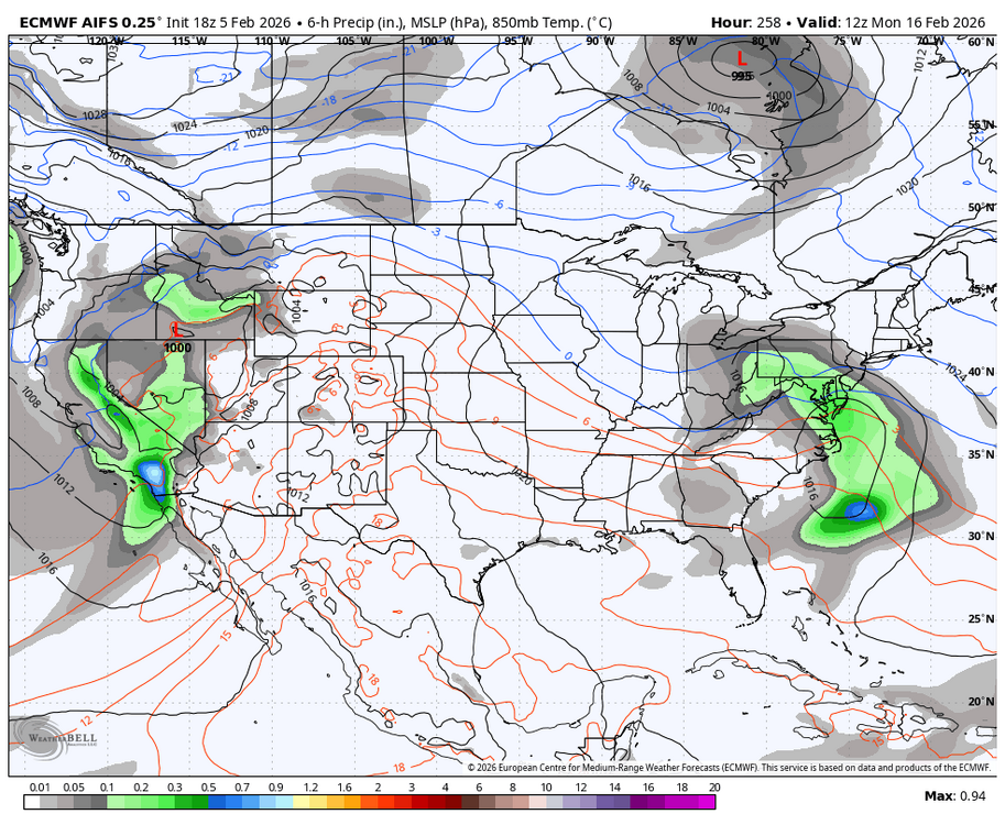
-

Friday February 6 FROPA / WINDEX small event
powderfreak replied to HoarfrostHubb's topic in New England
12z GGEM took the cake for wildest solution with 1”+ in Essex County.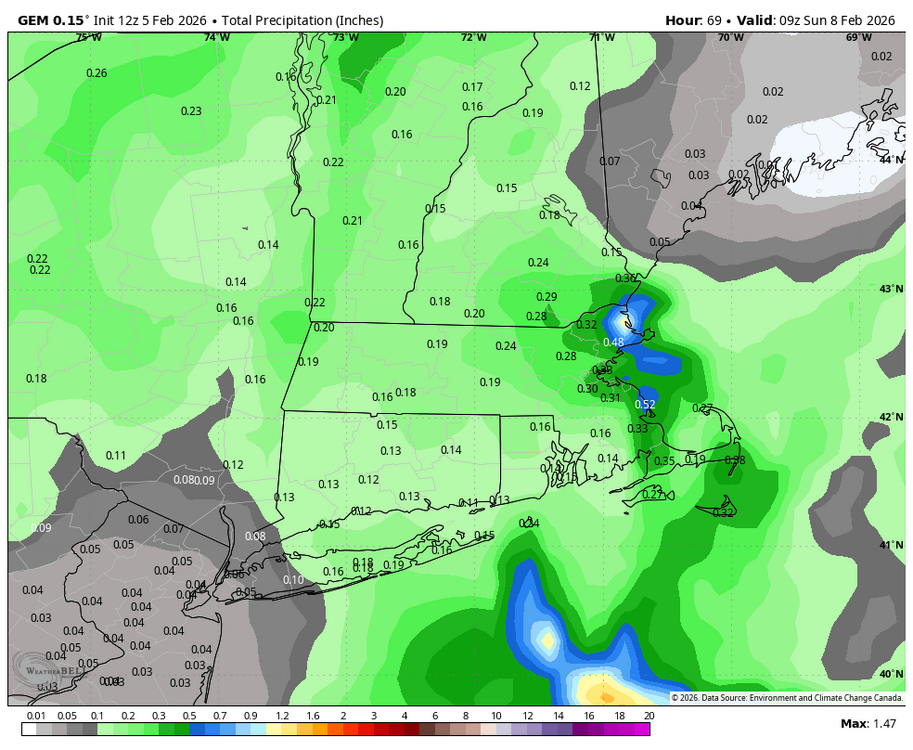
-

Friday February 6 FROPA / WINDEX small event
mahk_webstah replied to HoarfrostHubb's topic in New England
Wunderground increased here too. Now 5” -
February 2026 Medium/ Long Range Discussion: 150K Salary Needed to Post
CAPE replied to Weather Will's topic in Mid Atlantic
Just for the record the window around the 20th is mine. Yes I am looking past next weekend. It looked great at one point, but now.. maybe. Same could be said for around the 20th. Its just how it goes with guidance in the LR. -
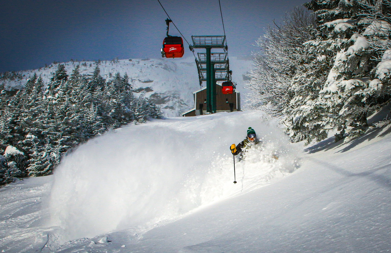
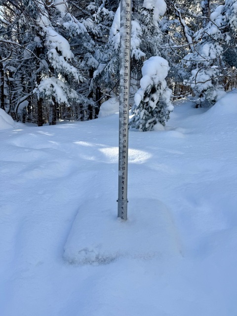
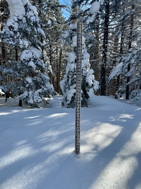
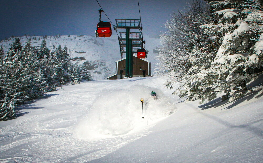
Two inches down at the snow plot overnight can be 2-3x that up high at the Cliff House lately. The plot is a good mid/upper total but some of these recent ridgeline snows have really been blowing in deep up above that 3,000ft elevation. Its obvious some of these days the upper lift terminals accumulate decently deeper fluff at times than the plot and I love it.

-
Just watched Curling earlier this evening, good day for the USA. It's St. Paddy's Day, Patty is short for Patricia I've had St Paddy's Day parties when I had to move snow banks for parking and I've had them where we all hung out on the deck. 14/8 here currently.