All Activity
- Past hour
-
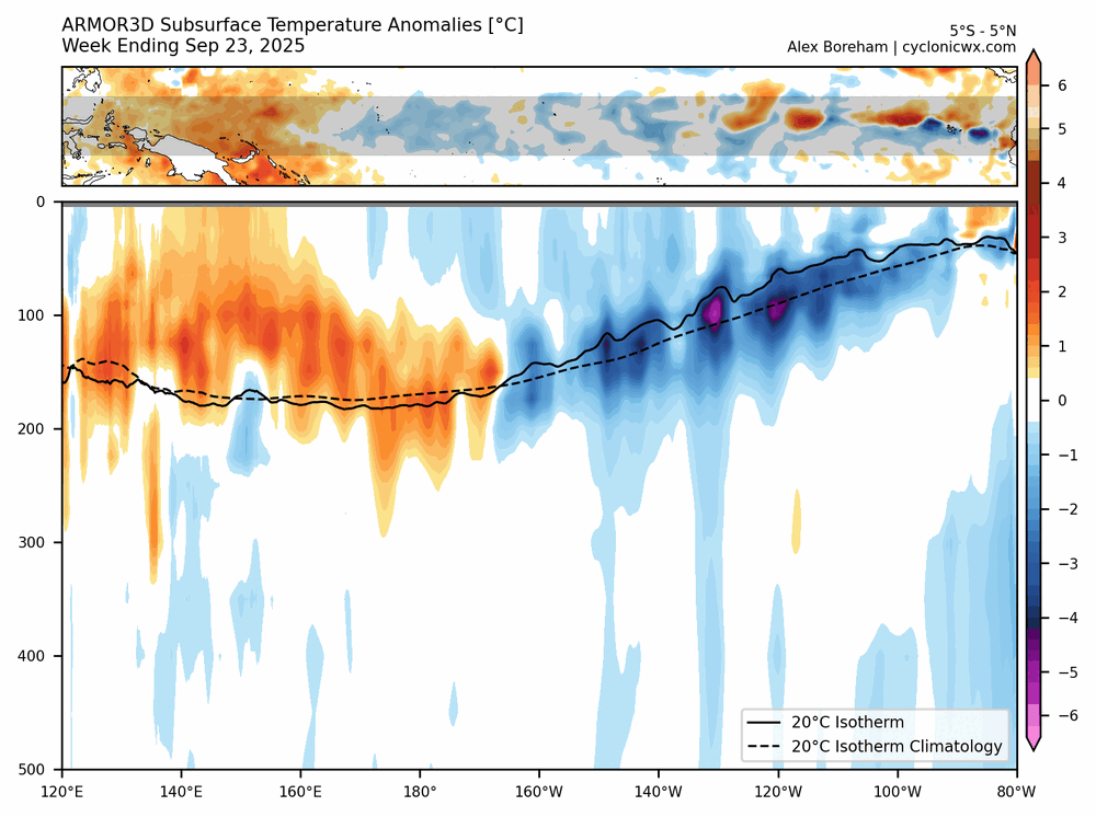
Still a NINA anyways,tho since Dec the subsurface has been pushing furthert since early Dec east of the IDL
-
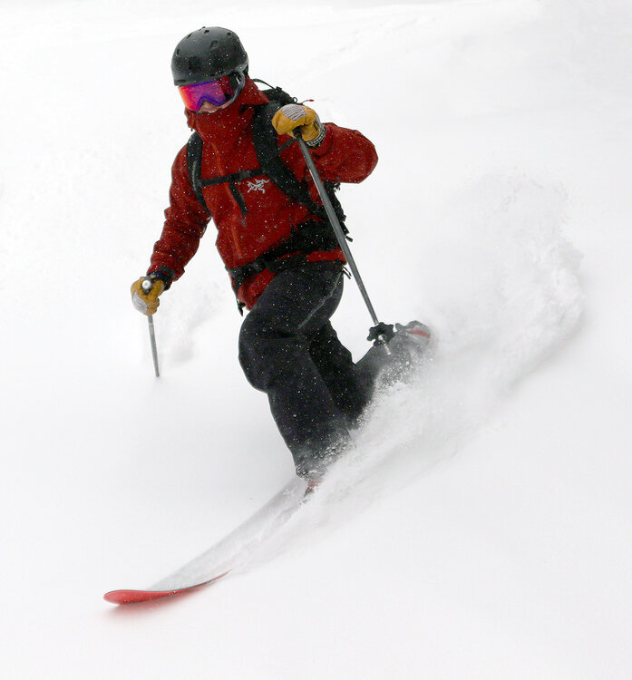
Thanks for the update PF – and well put with regard to explaining what’s out there. As you can see in my Bolton report from my post above, our experience was very much the same yesterday, but we didn’t even go near any high-angle terrain because I knew it just wasn’t really worth it. The base is clearly there, and there’s plenty of terrain available, but we’re going to need a solid resurfacing to get back to the generally excellent conditions we’ve seen over the past several weeks. That will require a solid large storm cycle, or a good number of bread and butter systems based on the subsurfaces I’ve encountered. We’ll need a system or two with some meat in them. There are some storms out there in the models, but it doesn’t look like a real slam dunk bread and butter pattern for the next couple of weeks as far as I can see, so it might be a little while before the mountains get back to pleasant surfaces. I’m OK with a bit of a slow down in conditions though – looking at my records I see that I’ve had almost 30 ski outings so far this season, and that’s a lot to pack into a couple of months with everything else going on in life. That’s well ahead of my typical November/December pace, since the seasons don’t always take off quite this fast with such prodigious snowpack. It’s easy to get out during the holiday period but packing it during the fall takes a lot of planning. We’ll roll with whatever Mother Nature decides to give us though, and having that fantastic snowpack in place means that conditions should be good to go as soon as that liquid equivalent comes along.
-
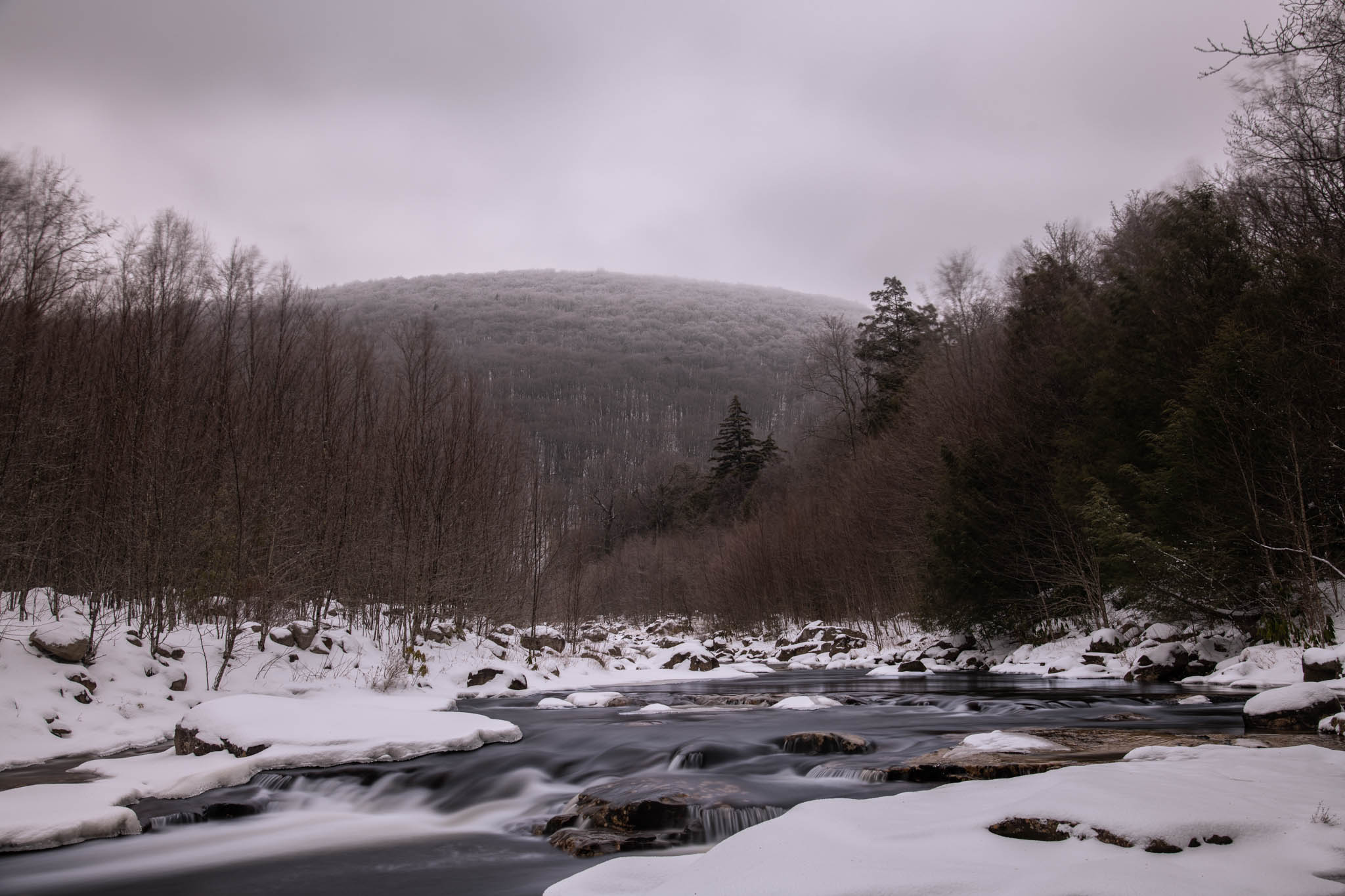
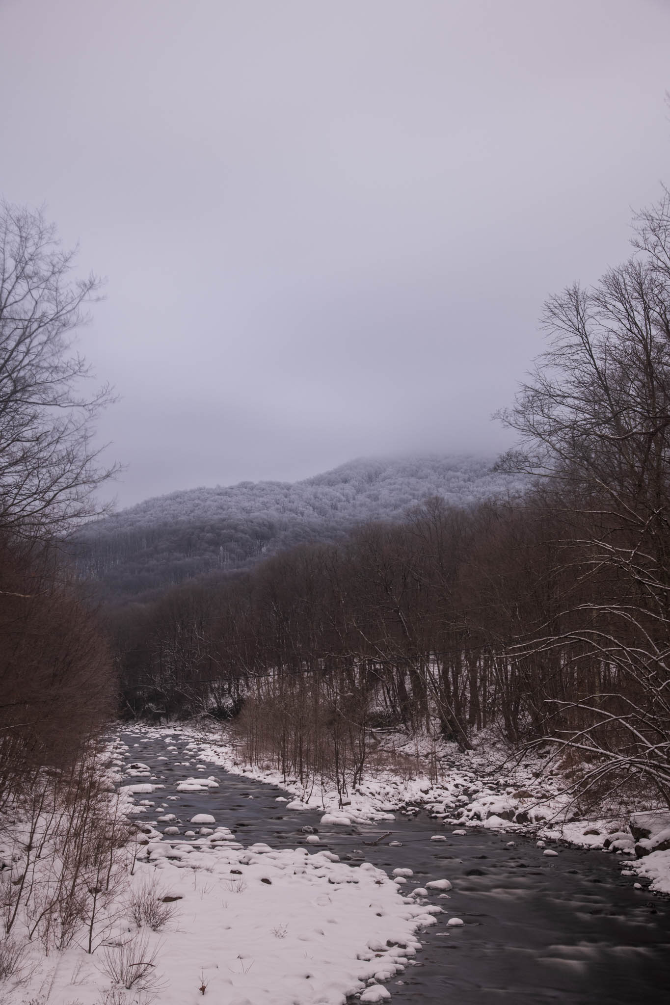
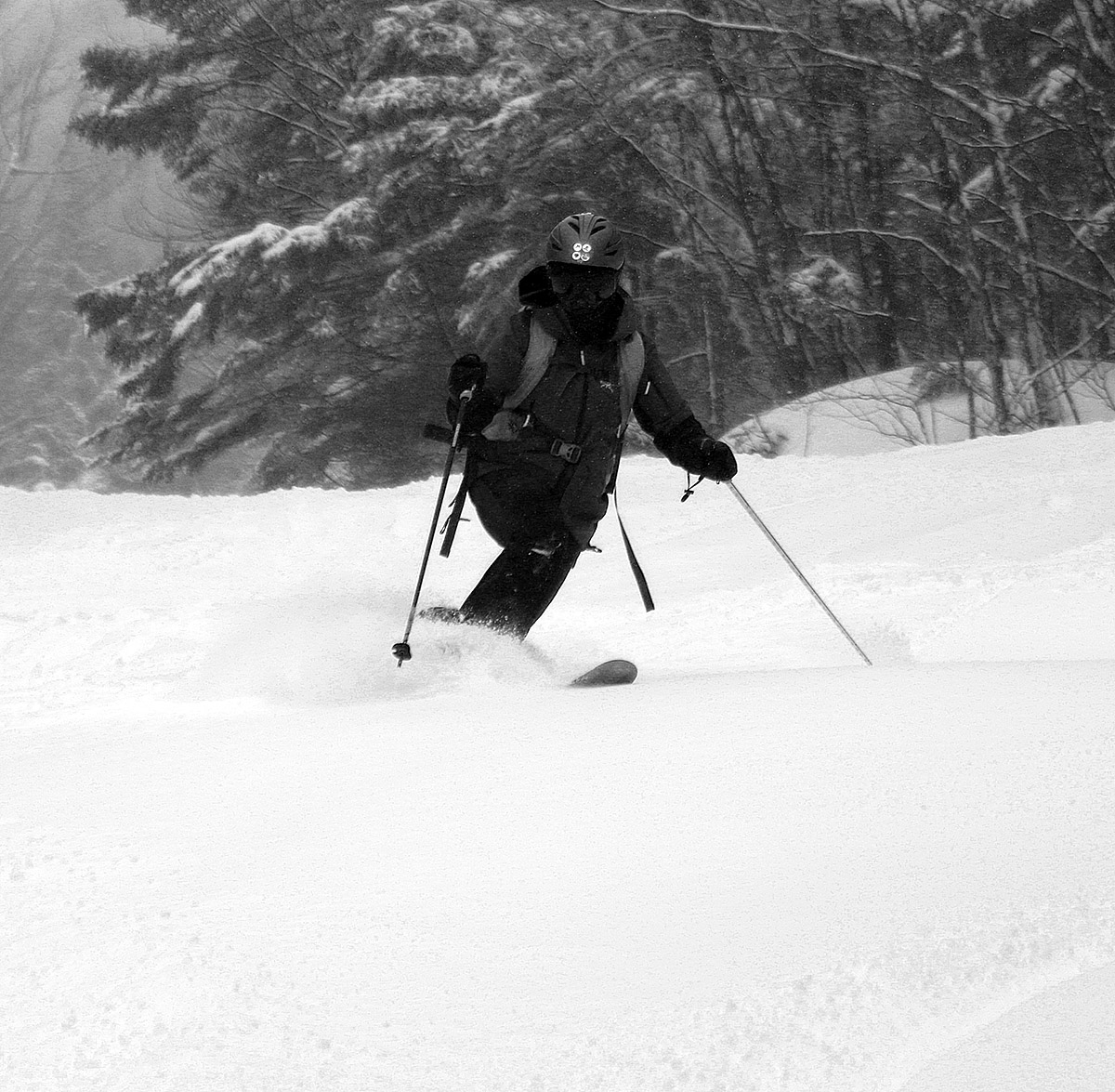
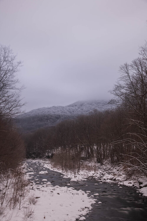
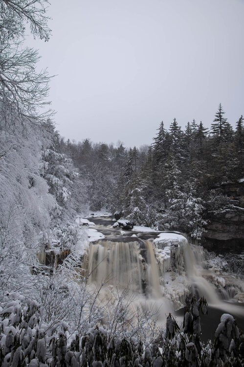
Pictures from out in WV today. Could really see the rime icing at higher altitudes, was a whole different microclimate then even 20 miles eastward over the ridge.

-

Digital Snow/Ice Thread 2025-2026
NorthHillsWx replied to WinstonSalemArlington's topic in Southeastern States
We might be setting a record for fewest digital inches in southeast history this year. It’s so bad we can’t even pop random CMC fantasy snows -
.thumb.png.4150b06c63a21f61052e47a612bf1818.png)
January 2026 regional war/obs/disco thread
HIPPYVALLEY replied to Baroclinic Zone's topic in New England
I got your reference. -
Yeah, I think mainly if there's split Flow. As you know, we have gotten many snowfalls with the STJ Trekking across southern call and across the southern States but generally the Polar Jet Trough is down into the Plains and East. They would tend to merge . If not, a wave riding the STJ would move up enough to produce Snow with HP to our North .
-

Occasional Thoughts on Climate Change
TheClimateChanger replied to donsutherland1's topic in Climate Change
The post was referring to CONUS temperatures. While Alaska is part of the US, Canada is a separate country and has not, in fact, been annexed as of 1/2/2026. If we are going to include other countries, might as well tack on Mexico, which has been scorching. Or just do the entire Northern Hemisphere, which has been consistently running more than 1C above the 1981-2010 mean. http://www.karstenhaustein.com/reanalysis/gfs0p5/ANOM2m_mollw/ANOM2m_f144_mollw.png -
Weeks 3-4 chart isn't horrible. If it's an average of some warm days and some cold.. Texas slider on colder days would drop snow at least north of I-40.
-
Hannibal has 33 inches already, its only about 5 south of Oswego on a straight line
-
Occasional Thoughts on Climate Change
TheClimateChanger replied to donsutherland1's topic in Climate Change
-

January 2026 regional war/obs/disco thread
The 4 Seasons replied to Baroclinic Zone's topic in New England
CT always wins -
The ACC is out here crushing schools in other conferences - maybe a bit more respect next season?
-
some how the NBA will find a way to screw them regardless. but I see your point.
-

2025-2026 ENSO
Daniel Boone replied to 40/70 Benchmark's topic in Weather Forecasting and Discussion
Agree with the south , central and West but further East in the upper South, South Central and SE Virginia, North and NE NC just had their earliest, snowiest start to Meteorological Winter in Many Year's with 3 back to back Snowfalls in early December. Some Area's in the Yukon hit -65 recently. Not saying Climate change is not real overall but, it's still exagerrated somewhat for now, imo. Northern Florida broke Snowfall Records last Winter with 10" in Milton, 7" in Pensacola. Much of Climate is Cyclical. Regardless of what the cause was or is. Greenland was once Farmland according to Archaelogical Findings and Scientific evidence. The cause is Hypothesis and Theories. We don't know for sure. We may continue on a warming Cycle for quite some time. May not. There's been warm periods and cold periods over the Years since recorded History. Some short duration, some long. The little Ice Age for Instance. There's speculation and Theories on the cause of it. In the Late '70's there was serious talk that we could be heading into another Ice Age. We just don't know really. Could be a Cycle to where we go so warm that Greenland is Farmland again. God forbid. Of course, we'll all probably be gone before that Extreme if it were to occur. -
I have always thought there is a correlation w/ rain in Los Angeles, and eventual snow here....almost as good as the thunder-in-the-mountains rule. The rain at the Rose Bowl made me think of that.
-
Like the title says, just one. If you could pick one wintry event (has to be in your own lifetime) to relive which would it be, and why? There's so many great events over the decade to choose from, but for me it's gotta be December 14-15 1987. To this day I've never seen so much lightning and thunder during a blizzard. It was truly remarkable. Winds gusting 60-70mph, the lightning, and the incredible bombing that system did the evening of the 14th was about as good as it gets. We even had bursts of heavy sleet mix in at times, but it didn't cut down on the snow accumulations too much. This event is probably one of the main reasons I got into the wintry side of weather. This would be incredible to watch unfold with today's technology.
-

2025-2026 ENSO
michsnowfreak replied to 40/70 Benchmark's topic in Weather Forecasting and Discussion
The warm, snowless start to the season in the West is remarkable and highly unusual. Though I do have to say...with a few exceptions, its very rare to have a "good" winter simultaneously in both the east and west. The term "good" being subjective and relative to one's climate of course. No matter what any given winter in southeast Michigan does relative to climo, it will always be a bad winter to a snow weenie in Marquette and a good winter to a snow weenie in DC. The trough/ridge alignment is a huge part of how weather works. I know very little about past winters in the west, but i read a story once about repeated blizzards in the winter of 1948-49. That was a horrid, mild, snowless winter here. -
Yes but if they keep winning their pick goes to The Knicks
-

Winter 2025-2026 Offers Return to Normalcy
40/70 Benchmark replied to 40/70 Benchmark's topic in New England
Pacific Trough Regime 1, January Winter Storm Threats 0 Forecast Early January Pacific Trough Regime Comes Into Focus Guidance Adjusts Accordingly Next Week Last week Eastern Mass Weather discussed how the uncoupling of the intensifying stratospheric polar vortex from the troposphere was allowing for the unanticipated development of a potent west-based negative NAO block. This was a crucial part of the forecast because it was instrumental in allowing forecast guidance to model a potential major east coast snow storm during a period in early January, which represented a deviation from the winter outlook issued last fall that called for a mild, Pacific trough type of pattern in place during this interval. However, guidance has since shifted rather dramatically towards the type of pattern favored for the first half of January, which replaces the storm threat with warm up. Thereafter, the forecast for the balance of January remains unchanged. Colder Turn Around Mid-Month The pattern should remain mild overall through at least the 10th, with any significant snow threats likely related to northern New England, as the MJO tries to emerge into the MC from the neutral circle. However, the pattern will beginning to enter a state of transition, as heights begin to build on the west coast. The MJO will begin to play more of a role towards mid-month, as it enters phase 7 and constructively interferes with strengthening west coast ridging. Note the support for the EPO and WPO to both return negative by mid month. Although support for the development of a +PNA is more tepid, this is likely to correct more aggressively over the course of the next week. Ultimately the culmination of these changes is a full-fledged +TNH pattern that should ensue by approximately January 20th, which will include a slew of moderate winter storms targeting the interior. It will be important not to allow the more active winter pattern to divert attention away from the stratosphere, which will likely take center stage in February. Please stay tuned for more updates this month- -
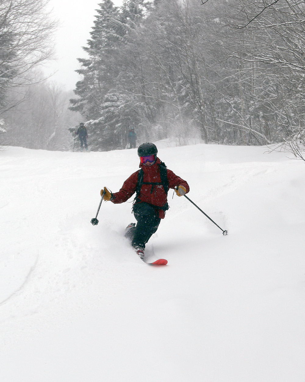
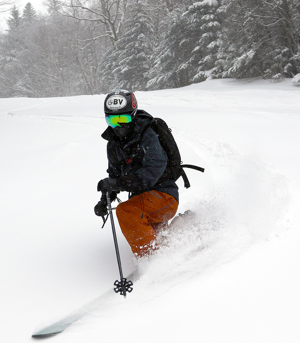
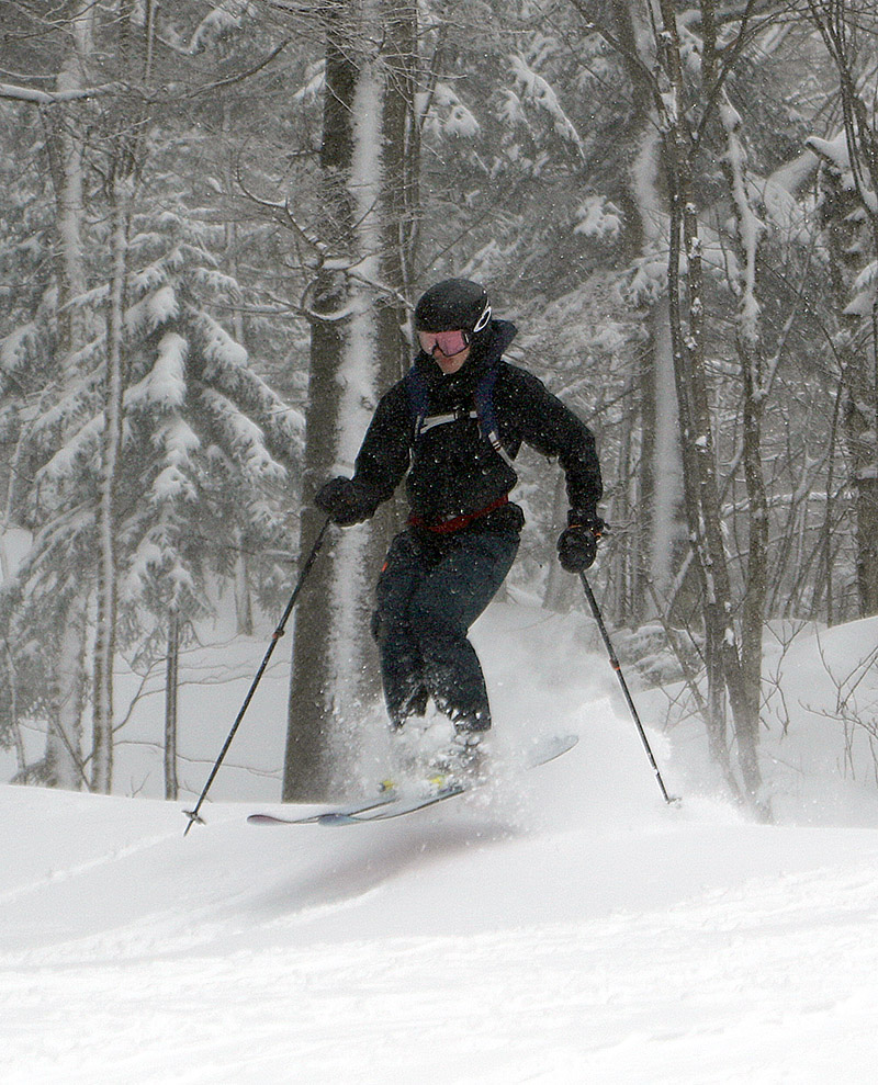
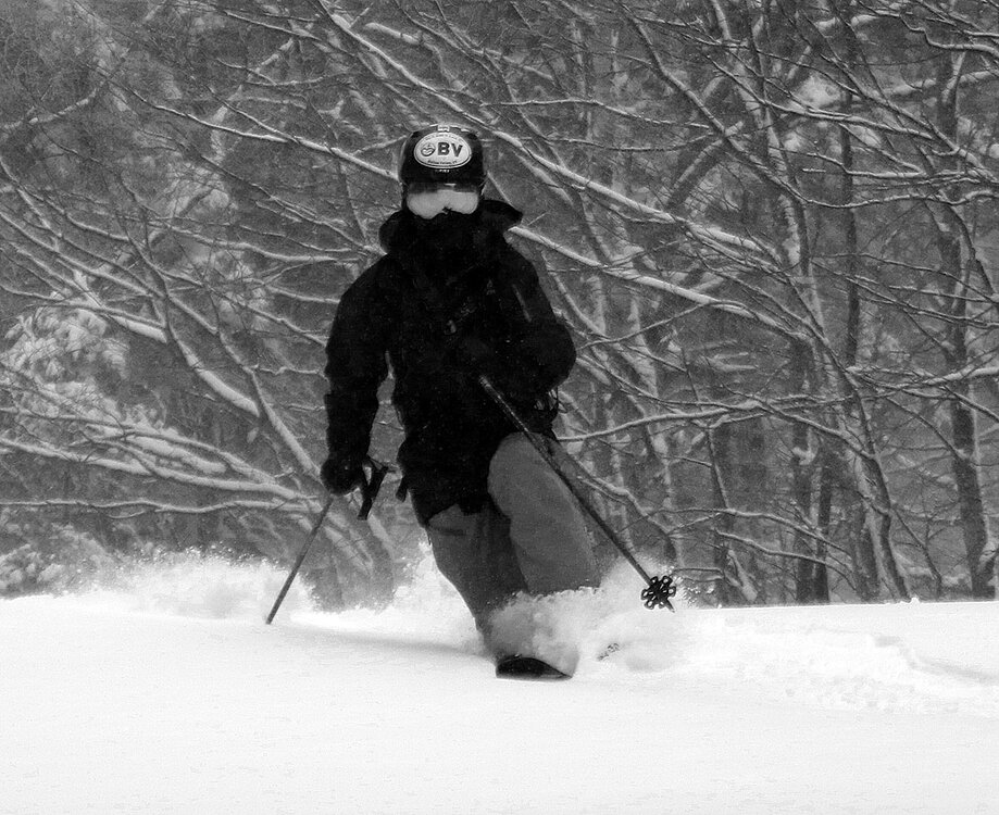
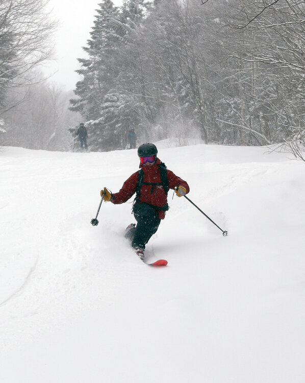
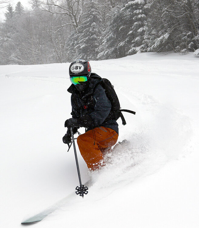
With the mountains picking up several inches of additional snow from our most recent clipper system, the family along with some friends headed up for some holiday season turns at Bolton Valley yesterday. Temperatures were cold – it was in the upper single digits F on the mountain for the start of the day, and it was only expected to get colder as the day went along. With that in mind, we decided to just head up for a quick tour in the morning via the Wilderness Uphill Route before the Wilderness Chair started loading. Up at the resort it was quite windy in exposed areas, and snow was still falling, so here was certainly a January feel. Based on my reconnaissance tour on Wednesday, I recommended we just stick to lower-angle terrain because even with the new snow, I didn’t think there were be enough liquid equivalent to support good turns on anything steeper than that. So the six of us toured up to ~2,700’ on Cougar and descended from there. Despite the additional snow for yesterday’s tour, I think that turns might have been a bit better on Wednesday. We were actually one of the first groups hitting that terrain for the day, so we had access to plenty of untracked snow, but the perceived slight drop in ski conditions might have been due to additional traffic on the earlier snow. Temperatures in the single digits F meant that the snow was somewhat slow as well, so that was kind of a knock against the skiing – you just didn’t glide that well, and that can be important on lower-angle terrain. After our tour, my younger son and his friends decided to hop on the Wilderness Chair for a lift-served run while the rest of us hit the base lodge, and they had fun, but the conditions weren’t good enough that it was worth hanging around to brave more of those cold temperatures and winds. Overall, it was great to get out for the tour, but even with the couple rounds of snow we’ve seen in the past few days, there’s just hasn’t been enough liquid equivalent set down yet to be anywhere near a real resurfacing. That, and the relatively cold temperatures mean that the skiing is there, but it’s just not back to anything great yet. The snowpack is quite robust though, so as soon as we get that resurfacing, the local resorts should be set up for some excellent skiing again.

-
2025-2026 ENSO
40/70 Benchmark replied to 40/70 Benchmark's topic in Weather Forecasting and Discussion
https://easternmassweather.blogspot.com/2026/01/pacific-trough-regime-1-january-winter.html -
January 2026 regional war/obs/disco thread
40/70 Benchmark replied to Baroclinic Zone's topic in New England
https://easternmassweather.blogspot.com/2026/01/pacific-trough-regime-1-january-winter.html -

January 2026 regional war/obs/disco thread
weathafella replied to Baroclinic Zone's topic in New England
Knives out…. -
Ice advancing quickly now. Erie more than 1/4 ice covered, as of today, which is 9% higher than the 53-year mean. The thaw next week should trim that back.
-
This fall/winter in Colorado so far reminds me a lot of 1976-77. That was another brutally dry winter here. One big difference I see is that the '76-77 dry spell did not go on and on. In fact the winter of 1979-80 was the snowiest recorded in Fort Collins. And the decades of the 1980's and '90's were pretty awesome for weather buffs on the front range. Once we hit the year 2000 it seems we've been in and out of drought frequently for 25 years. Anyway, sure hope we see some decent snow at some point this winter/spring - to get some semblance of a snow pack. At this point we're stuck in a weak La Nina and those are generally not good for Colorado and the surrounding region.