All Activity
- Past hour
-
There is one
-
Is Jim Cantore out there with his
-

“Cory’s in NYC! Let’s HECS!” Feb. 22-24 Disco
Baroclinic Zone replied to TheSnowman's topic in New England
lol, I haven’t even invested a nano second in the last few days looking beyond this storm. -

2/22-23 "There's no way..." Storm Part 2
AmericanWxFreak replied to Maestrobjwa's topic in Mid Atlantic
Solid map, I’m mostly in agreement. The hoco death band will not be happening with this one. -
The NBM ratios are likely too high as it usually runs on the higher side.
-
.thumb.png.4150b06c63a21f61052e47a612bf1818.png)
“Cory’s in NYC! Let’s HECS!” Feb. 22-24 Disco
HIPPYVALLEY replied to TheSnowman's topic in New England
I believe Greenfield had 22 inches in the February 2013 storm. Easily the biggest storm since I moved here in 2007. -
Im once again tempting fate and driving home tmrw. Last storm coming home from AC it took about 5 1/2. This time im coming from maryland. Should be much easier this time. I hope.
-

February 2026 OBS & Discussion
donsutherland1 replied to Stormlover74's topic in New York City Metro
Following a day when springlike warmth brought about a torrent of melting and hint that the worst of winter is now in the past, a major blizzard is poised to engulf the region in a blinding, swirling wall of white. Last Tuesday, the AIFS signaled a possible major storm. Afterward, when all the other guidance retreated, the GFS kept the torch burning. Now, the region is set to experience its most severe blizzard in perhaps a decade. A rapidly developing storm will bring heavy snow and high winds to the region later tomorrow into Monday. Any early snow or mixed precipitation during the morning will be light and inconsequential. At present, a 16"-22" snowfall appears likely in New York City and its nearby suburbs. Somewhat lesser amounts are likely north and west of New York City. A 18"-24" snowfall is likely across central New Jersey and part of Long Island. Blizzard conditions are likely at the height of the storm late Sunday night into Monday morning across much of the region. Winds will likely gust near 60 mph creating extremely low visibilities and large drifts. Final estimates: Allentown: 8"-12" Atlantic City: 8"-16" Baltimore: 4"-8" Binghamton: 2"-4" Boston: 18"-24" Bridgeport: 14"-20" Harrisburg: 4"-8" Hartford: 8"-12" Islip: 18"-24" New York City: 16"-22" Newark: 16"-22" Philadelphia: 12"-18" Providence: 18"-24" Scranton: 3"-6" Washington, DC: 3"-6" Wilmington: 12"-18" As a result, Winter 2025-2026 will become just the 10th winter with two 10" or above snowstorms in New York City. The others are 1895-1996, 1925-1926, 1960-1961, 1977-1978, 1995-1996, 2003-2004, 2009-2010 (3 such storms), 2010-2011, and 2013-2014. Even more impressive, Winter 2025-2026 will be on track to join Winters 1960-1961 and 1977-1978 as the only winters with two or more 10" snowstorms, a seasonal mean temperature of 32° or below and seasonal snowfall of 30.0" or above. The ENSO Region 1+2 anomaly was +0.7°C and the Region 3.4 anomaly was -0.2°C for the week centered around February 11. For the past six weeks, the ENSO Region 1+2 anomaly has averaged -0.03°C and the ENSO Region 3.4 anomaly has averaged -0.47°C. Neutral ENSO conditions are now developing. Neutral ENSO conditions will develop during the close of winter. The SOI was +3.70 today. The preliminary Arctic Oscillation (AO) was -0.601 today. Based on sensitivity analysis applied to the latest guidance, there is an implied near 100% probability that New York City will have a cooler than normal February (1991-2020 normal). February will likely finish with a mean temperature near 31.7° (4.2° below normal). Supplemental Information: The projected mean would be 3.6 below the 1981-2010 normal monthly value. Overall, Winter 2025-2026 is on track for a seasonal mean temperature of 32.0°. If a 32.0° or below seasonal mean temperature occurs, that would be the lowest winter mean temperature since Winter 2014-2015 when the mean temperature was 31.7°. Winter 2025-2026 would only become the fourth winter of the 21st century with a mean temperature of 32.0° or below. -
I think that data will be for the 00z models.
-
Remember to measure it about 20' from one's house so roof snow won't count in the total amount/accumulation. Check the snow depth on the ground before the storm starts. Just subtract that amount from whatever storm total one gets as a final. It should be fairly accurate to the best of one's ability.
-
This is definitely something I’ve been watching for our big total hopes. You need to rain on a decent portion of the eastern shore for at least part of the storm.
-
Adam's gets crazy even without an impending storm, I can't imagine trying to fight the crowds tonight or tomorrow morning
-

“Cory’s in NYC! Let’s HECS!” Feb. 22-24 Disco
RUNNAWAYICEBERG replied to TheSnowman's topic in New England
Be dirty. Embrace it. -
“Cory’s in NYC! Let’s HECS!” Feb. 22-24 Disco
Baroclinic Zone replied to TheSnowman's topic in New England
@EastonSN+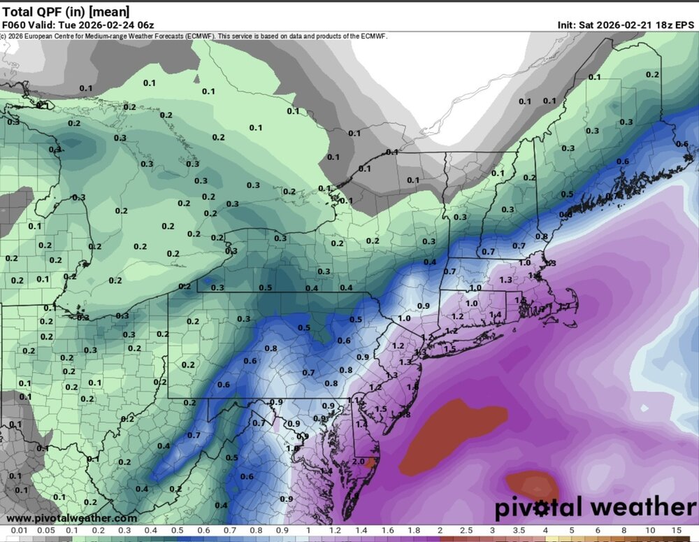
-
40" was common in eastern MA and RI, just did not have the degree of spotter/co-op observers back them. A fairly reliable measurement from someone I know got about 44" total in an open field in Woburn MA. Given the how the area between 128-495 NW of BOS tends to have a local precip max in many nor'easters, this is not unreasonable.
-

“Cory’s in NYC! Let’s HECS!” Feb. 22-24 Disco
WalpoleJoe replied to TheSnowman's topic in New England
So true! My neighbor was talking to me about the storm today and I told him we've been watching it for a week. Then I dropped Friday to him. -

Pittsburgh/Western PA WINTER ‘25/‘26
Ecanem replied to Burghblizz's topic in Upstate New York/Pennsylvania
So My brother flew to king of Prussia(Philly) for a pa school conference. It’s supposed to be tomorrow all day and leave Monday. I hate trying to make a call for him because he’s asking if he should just hop a morning flight back tomorrow but I feel like at this point. He won’t get out of these until Wednesday otherwise. -
I’m going with Mt Holly again 8-16” they have been dead on in Berks this season
-
Does this have a raw QPF output? I feel like ratios could be quite generous for this map.
-
Think I’ll see more than 4-6” but hey whatever happens happens
-
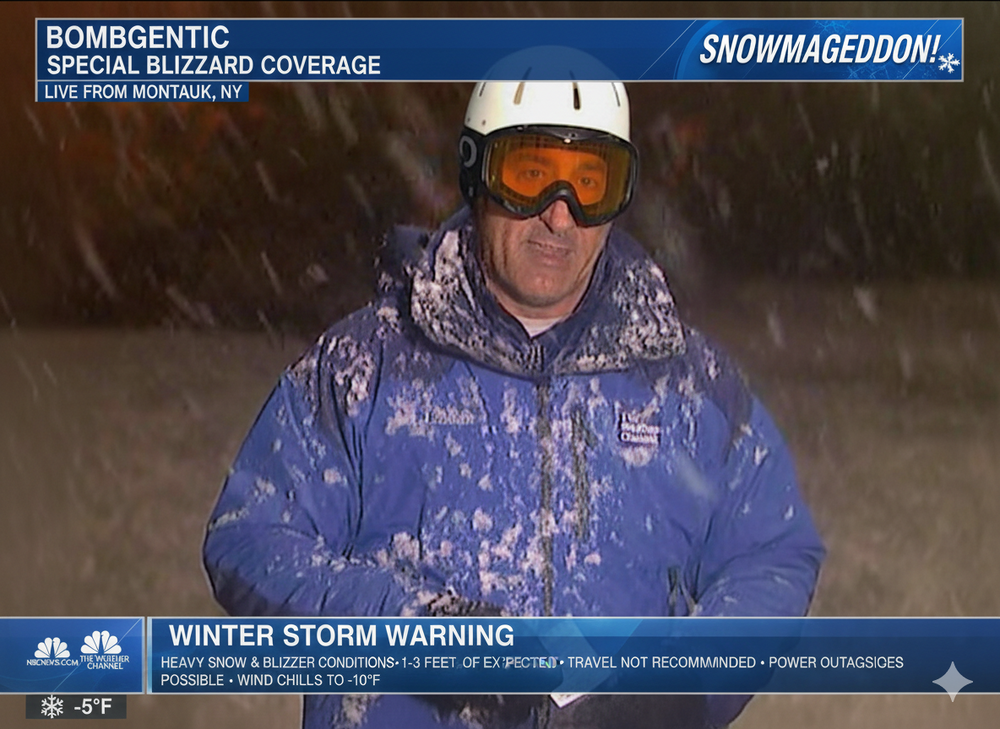
Looking forward to watching via my favorite cam there
-
Unreal how this just keeps trending NW.
-
Cool then stop tracking it.
-
I don't know if I've ever seen verification scores on the SREF. Anyone know?
-

2/22-23 "There's no way..." Storm Part 2
SomeguyfromTakomaPark replied to Maestrobjwa's topic in Mid Atlantic
45/28 waiting for my snowstorm


