All Activity
- Past hour
-
You put a piece of wood in for me! Thank you!
-
67 and very light drizzle/mist. Late afternoon fail. Was pretty nice for most of the day.
-
Even deserts get some rain. If you're supposed to get 10 inches a year and you only got 4 inches, that can really mess up all the animal and plant life in that environment. Even life adapted to dry conditions can only take so much. Add a few million people pulling water from the ground at the same time and you have a major issue.
-
Finally a good downpour here
-
Crazy to see droughts in the deserts, lol
-
Backdoor charging SW
-
Light (mostly) rain and low 50s all day.
-
57.3° +RA What a day
-
58F, had to close the windows. awful.
-

E PA/NJ/DE Spring 2025 Obs/Discussion
JTA66 replied to PhiEaglesfan712's topic in Philadelphia Region
384 hour GFS has snow from the finger lakes extending down into northern PA. Ralph told us to be patient. -
The afternoon turned out better than expected here at Deep Creek. Intermittent sun and 64/60. Got the deck furniture out and ready for summer.
-

E PA/NJ/DE Spring 2025 Obs/Discussion
MGorse replied to PhiEaglesfan712's topic in Philadelphia Region
A whopping 0.03 inches of rain so far. -
I got out early because I thought it was going to rain, but so far dry in CT. It looked like something was coming this way but then it went north.
-

Spring 2025 Medium/Long Range Discussion
Spartman replied to Chicago Storm's topic in Lakes/Ohio Valley
Mainly cool days for the upcoming week for sure Monday A chance of showers before 1pm, then a chance of showers and thunderstorms between 1pm and 2pm, then showers likely and possibly a thunderstorm after 2pm. Mostly cloudy, with a high near 62. Southeast wind around 8 mph. Chance of precipitation is 60%. New rainfall amounts of less than a tenth of an inch, except higher amounts possible in thunderstorms. Monday Night A chance of showers and thunderstorms. Mostly cloudy, with a low around 48. Southwest wind around 6 mph. Chance of precipitation is 40%. New precipitation amounts between a tenth and quarter of an inch, except higher amounts possible in thunderstorms. Tuesday A chance of showers, with thunderstorms also possible after 2pm. Mostly cloudy, with a high near 66. Southwest wind 6 to 10 mph. Chance of precipitation is 50%. New rainfall amounts between a tenth and quarter of an inch, except higher amounts possible in thunderstorms. Tuesday Night Partly cloudy, with a low around 50. Wednesday Partly sunny, with a high near 74. Wednesday Night Mostly cloudy, with a low around 52. Thursday Mostly sunny, with a high near 69. Thursday Night Mostly clear, with a low around 44. Friday Sunny, with a high near 70. Friday Night Partly cloudy, with a low around 47. Saturday Mostly sunny, with a high near 74. Saturday Night Partly cloudy, with a low around 52. Sunday Mostly sunny, with a high near 77. -
steady heavyish rain now, today has been a pretty rainy day and so will the next 2 days. This storm is not underperforming
-
Euro says just barely. 12z GFS keeps an upper low pretty much near to sea while 12z Euro has an upper low centered on Pennsylvania
-
It's like this rain is jyst splitting around nenj.
- Today
-
Edit. Some nice cells starting to wander in from the south but as of now it looks like they're going to be juuuuust to the east.
-
The I-95 corridor has been shafted so far. I have 0.19" today, only 0.01 yesterday.
-
100 degrees is what makes a summer memorable, if it has low dew points even better. I would love 101 degrees with a dew point of 60, we got a lot of that in 2010. There's also a nice correlation between hot summers and snowy winters. We had that in 1955, 1966, 1977, 1993, 1995, 2002, 2010, and 2013.
-
when you look at summers like 1983 and 2011 though, wasn't it went both before and after summer? 1982-83 was a very strong el nino so naturally it had a very wet winter and I remember spring was very wet too. It was only the summer months that had lower rainfall. It makes me think that it gives the soil time to dry out before peak heating season. 2010-11 was of course a very snowy winter and also very wet. I don't remember what spring was like that year except for all the severe weather outbreaks across the south and midwest.
-
Most people do NOT like 100 degree temps lol 80/65 temp split with low dews is perfect
-
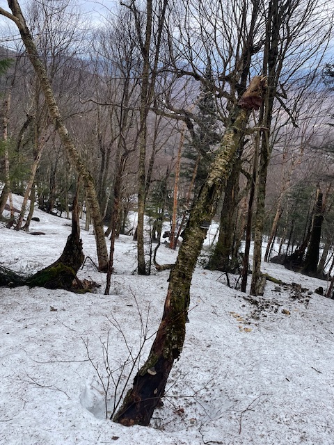
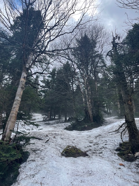
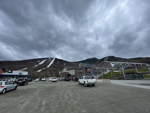
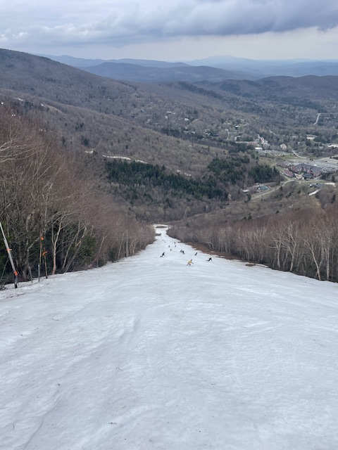
Great couple days at Jay Peak and Sugarbush. Rained the whole way north Friday, when I pulled in the lot it stopped. The rest of the day was a nice mix of sun and clouds. Skied in a light sweatshirt. Still plenty of coverage in the woods. Jay Peak Ski patrol even dropped a few ropes for me and the 10 other people who were out on the hill. Natural snow was really nice, manmade was ok. Sugarbush yesterday was super fun first thing in the morning. Sun was out briefly but by 10 the rain drops started falling. Did quite a few laps but the leg was getting a little sore due to my injury a few weeks back. Once the heavy fog rolled in and it started pouring it was time to go. All in all a nice quick but fun trip!
-
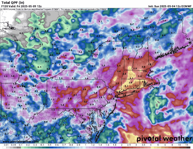
Everyone has their own personal preferences as to which type of weather they enjoy. So this part of the forum discussion is purely subjective. Drought feedback, summer rainfall, prevailing wind direction, and the main ridge axis are the key ingredients in determining how many 95°+ or 100°+ days we get around the area. The summers of 1983 and 2011 were very dry when we had all the record major heat around the area. Both summers only became wet once the heat was already finished. You are correct that flooding has produced a tremendous amount of damage in recent years across the entire country. Drought damage has mostly been located out West where the major wildfires have occurred. Currently, a large portion of the area has experienced drought conditions since last summer. It has been most pronounced from Eastern PA into portions of NJ. But D1 and D2 drought conditions also over to Orange and Rockland in NY. Models like the Euro would have drought improvement for the areas from NE PA across into SNE. But locations further south toward Philly and SNJ wouldn’t see much improvement. The Euro seasonal is out tomorrow for the summer. So we should get some hints as to where the drought is forecast to expand or contract and how much major heat will be possible. The most recent dry summer during peak heating was 2022. But onshore flow combined with drought feedback in NJ focused the major heat there with the 5+ days going over 100°. But the onshore flow kept points east of the Hudson cooler.
-
Humidity in the house forced me to turn on the ac.