All Activity
- Past hour
-
.thumb.gif.f92b16c631a1d15d405ed77b33f0710d.gif)
Augdewst 2026: Summer's Last Stand
Torch Tiger replied to Prismshine Productions's topic in New England
insane live feeds of this. -
Sheesh. No wonder they just tornado warned the whole line
-
Ahh, yeah that would make sense considering the scope of the state down there. IL doing it is absolutely nuts.
-
kind of like the Holocaust, right?
-
Don't look now folks but you have a couple more blobs coming in from the Midwest. It's going to be rain blob after rain blob, especially once that Nino really starts exerting on the 500 millibar pressure layer in the United States. Washington DC is right in the right front quadrant so to speak of the Nino's rain shield. You guys are going to get really tired of rainfall soon. Right now you are getting missed and people are eyeing the ledges because of rain hunger, but this is a 6C Nino and it means serious, serious bisnass. It will not spare and it will have absolutely no mercy at all. Flooding for some communities will become a way of life. Just ask Asheville, North Carolina. Damnit Indiana, Pennsylvania is catching up to Buda. We have actually been leading the Nation in so far this year rainfall tallies, with 35.7 inches, but Penn is catching up quick. At one point we were 9 inches ahead of them. Soon the Nino will have that place and the DMV in the 180s of inches while Buda will be STUCK in the middle 30s because we are way too far west in an incredibly record east-based Nino. This late summer, autumn, winter and Spring 2027, if you don't like rain, DON'T BE IN THE DMV, THE SOUTHEASTERN STATES OR THE MID-SOUTH GULF STATES (excluding Texas) Or in Missouri, Tennessee, Kentucky, places like that. East Texas will whiff cirrus on this nino.
-
Texas has surpassed 200 a few times. But, IL will be the only other state to have.
-
hey, i said wait until morning.
-
Just message him directly @zwyts or better yet text him. I’d rather you all sort this out elsewhere
-
Not at home for this one. Garbage day so cans are probably a mile down the road by now. My poor dogs
-
Summer wants to make it clear that although it doesn't want to see us all completely parched and dying of thirst, that doesn't mean it suddenly likes us.
-
(002).thumb.png.6e3d9d46bca5fe41aab7a74871dd8af8.png) Back to the NCEI adjustments Station Breaks Code 1 (documented move) Code 2 (gap) Code 3 (documented TOB) Code 4 (no documentation) Coatesville 1SW 14 0 0 0 14 West Chester 2NW 10 2 0 1 7 Phoenixville 1E 9 0 1 0 8 Devault 1W 5 0 0 0 5 West Chester 1W (Hadley) 5 0 1 0 4 Kennett Square 4 0 1 0 3 Coatesville 2W 2 1 0 0 1 Morgantown 2 0 0 0 2 Sadsburyville 0 — — — — West Grove 1SE 0 — — — — TOTAL 51 3 3 1 44 Four of 51 breaks (8%) have a documented physical cause. Forty-four (86%) are statistically inferred with no documentation. And yes — the two systems agree at r = 0.9986, mean difference 0.030 °C/decade across the five stations NCEI adjusted. That's the bridge I failed to draw last message. Put together, the argument runs: NCEI's files publish no breakpoint information at all — I checked every field; there's no changepoint list, no dates, no reasons. But NCEI's adjustments are near-identical to Berkeley's, and Berkeley does publish the reasons. So Berkeley's inventory is a defensible proxy for what the PHA is doing to the same stations. And that inventory says: overwhelmingly undocumented, statistically inferred corrections. Coatesville 1SW is the clearest case — fourteen breakpoints, every one empirical, against six documented relocations in HOMR. The algorithm found fourteen discontinuities and matched none of them to a known event. Meanwhile at West Chester it did the reverse error: classified the April 1921 and Nov/Dec 1927 documented observer-and-site changes as empirical, and produced no breakpoint at the documented March 1936 relocation. So the metadata is being used badly in both directions — real events missed or mislabelled, inferred events unsupported. Now "undocumented" is not the same as "wrong" — we know the PHA is designed to catch undocumented changes, and station histories are genuinely incomplete. But the specific issue at Coatesville 1SW remains that 86% is a high proportion on which to rest a correction that reverses the sign of Coatesville's trend, and it's a fair thing to put in front of them: on what basis were fourteen breakpoints identified at a station with six documented relocations, none of which they coincide with? I have drafted an email that I have sent to them this AM see below and I will keep you updated. Jared -Thank you again for the QCU and QCF files — they were exactly what I needed. Working through them raised a question I don't think the distributed product can answer, and I'm hoping you can point me to whoever handles PHA methodology. The GHCN-M v4 records carry ID, YEAR, ELEMENT and twelve repetitions of VALUE/DMFLAG/QCFLAG/DSFLAG. As far as I can tell there is no changepoint list, no adjustment magnitudes, and no indication of what supports any given correction. For USC00369464 (West Chester 2NW) the QCF series applies roughly -2.37 C to the 1855-1869 period — a stretch covered by a single observer at a single site, per WB Form 530-1, Index No. 36-9464-3. For USC00361589 (Coatesville 1SW) and USC00369464 (West Chester 2NW), could I request for the entire POR: 1. The changepoint dates the PHA identified for each station. 2. The adjustment magnitude applied at each changepoint. 3. Whether each was supported by documented station-history metadata or detected statistically from neighbor comparison and if so what station(s) were used for this neighbor comparison? I understand the PHA is designed to detect undocumented discontinuities, so I'm not assuming documentation exists for every break — I'd simply like to know which are which. Berkeley Earth publishes exactly this per station (a per-month code distinguishing documented moves, time-of-observation changes, gaps, and empirical detections), which is what prompted the question. If this is better directed elsewhere within NCEI, I'd be grateful for the referral. Thanks very much, Paul
Back to the NCEI adjustments Station Breaks Code 1 (documented move) Code 2 (gap) Code 3 (documented TOB) Code 4 (no documentation) Coatesville 1SW 14 0 0 0 14 West Chester 2NW 10 2 0 1 7 Phoenixville 1E 9 0 1 0 8 Devault 1W 5 0 0 0 5 West Chester 1W (Hadley) 5 0 1 0 4 Kennett Square 4 0 1 0 3 Coatesville 2W 2 1 0 0 1 Morgantown 2 0 0 0 2 Sadsburyville 0 — — — — West Grove 1SE 0 — — — — TOTAL 51 3 3 1 44 Four of 51 breaks (8%) have a documented physical cause. Forty-four (86%) are statistically inferred with no documentation. And yes — the two systems agree at r = 0.9986, mean difference 0.030 °C/decade across the five stations NCEI adjusted. That's the bridge I failed to draw last message. Put together, the argument runs: NCEI's files publish no breakpoint information at all — I checked every field; there's no changepoint list, no dates, no reasons. But NCEI's adjustments are near-identical to Berkeley's, and Berkeley does publish the reasons. So Berkeley's inventory is a defensible proxy for what the PHA is doing to the same stations. And that inventory says: overwhelmingly undocumented, statistically inferred corrections. Coatesville 1SW is the clearest case — fourteen breakpoints, every one empirical, against six documented relocations in HOMR. The algorithm found fourteen discontinuities and matched none of them to a known event. Meanwhile at West Chester it did the reverse error: classified the April 1921 and Nov/Dec 1927 documented observer-and-site changes as empirical, and produced no breakpoint at the documented March 1936 relocation. So the metadata is being used badly in both directions — real events missed or mislabelled, inferred events unsupported. Now "undocumented" is not the same as "wrong" — we know the PHA is designed to catch undocumented changes, and station histories are genuinely incomplete. But the specific issue at Coatesville 1SW remains that 86% is a high proportion on which to rest a correction that reverses the sign of Coatesville's trend, and it's a fair thing to put in front of them: on what basis were fourteen breakpoints identified at a station with six documented relocations, none of which they coincide with? I have drafted an email that I have sent to them this AM see below and I will keep you updated. Jared -Thank you again for the QCU and QCF files — they were exactly what I needed. Working through them raised a question I don't think the distributed product can answer, and I'm hoping you can point me to whoever handles PHA methodology. The GHCN-M v4 records carry ID, YEAR, ELEMENT and twelve repetitions of VALUE/DMFLAG/QCFLAG/DSFLAG. As far as I can tell there is no changepoint list, no adjustment magnitudes, and no indication of what supports any given correction. For USC00369464 (West Chester 2NW) the QCF series applies roughly -2.37 C to the 1855-1869 period — a stretch covered by a single observer at a single site, per WB Form 530-1, Index No. 36-9464-3. For USC00361589 (Coatesville 1SW) and USC00369464 (West Chester 2NW), could I request for the entire POR: 1. The changepoint dates the PHA identified for each station. 2. The adjustment magnitude applied at each changepoint. 3. Whether each was supported by documented station-history metadata or detected statistically from neighbor comparison and if so what station(s) were used for this neighbor comparison? I understand the PHA is designed to detect undocumented discontinuities, so I'm not assuming documentation exists for every break — I'd simply like to know which are which. Berkeley Earth publishes exactly this per station (a per-month code distinguishing documented moves, time-of-observation changes, gaps, and empirical detections), which is what prompted the question. If this is better directed elsewhere within NCEI, I'd be grateful for the referral. Thanks very much, Paul -
Northern Kankakee county into Indiana has been ground zero this year.
-

2026-2027 Record-breaking El Nino
rclab replied to Stormchaserchuck1's topic in Weather Forecasting and Discussion
ALL HAIL THE …… well you know …… as always ….
-
This will push the state past 200, which I believe is a first for any state.
-
...A SEVERE THUNDERSTORM WARNING REMAINS IN EFFECT UNTIL 1145 AM CDT FOR SOUTHEASTERN WILL...NORTHEASTERN KANKAKEE...NORTHERN NEWTON AND LAKE COUNTIES... At 1054 AM CDT, severe thunderstorms were located along a line extending from Markham to near Crete to near Bradley, moving east at 75 mph. THESE ARE DESTRUCTIVE STORMS producing measured winds gusts of 90 to over 100 mph. HAZARD...100 mph wind gusts. Literally the same areas smoked last week.
-
IL stat padding the tor numbers again
-

Augdewst 2026: Summer's Last Stand
weatherwiz replied to Prismshine Productions's topic in New England
Some serious wind on the south end of Chicago and headed into northern IN. 70-80+ knots ~1500 ft off the ground!!! -
Also confirmed tor near Flossmoor.
-
Forgot your footwear my friend…

-
* Severe Thunderstorm Warning for... Southeastern Will County in northeastern Illinois... Northeastern Kankakee County in northeastern Illinois... Northern Newton County in northwestern Indiana... Lake County in northwestern Indiana... * Until 1145 AM CDT. * At 1048 AM CDT, severe thunderstorms were located along a line extending from Western Springs to Frankfort to near Lakewood Shores, moving east at 50 mph. THESE ARE DESTRUCTIVE STORMS producing measured winds gusts of 80 to over 90 mph. HAZARD...90 mph wind gusts. Big warning for southside, some bins over 100mph down there.
-

-
Just tied my tomatoes up extra tight in the garden, husband is out moving the car away from our neighbors half-dead tree… hoping we don’t get the worst of it. Sometimes I really hate being the grown up and not getting to just enjoy storms anymore [emoji28] .
-
2026-2027 Record-breaking El Nino
zwyts replied to Stormchaserchuck1's topic in Weather Forecasting and Discussion
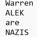
There are two legit NAZIS on the board. @A-L-E-K and @warywarren -

Central PA Summer 2026 Discussion/Obs Thread
WmsptWx replied to Voyager's topic in Upstate New York/Pennsylvania
Tower at Midway abandoned due to weather. That's insane. -

2026 Mid-Atlantic Severe Storm General Discussion
Eskimo Joe replied to Kmlwx's topic in Mid Atlantic
Obvious derecho ongoing in northern Illinois. Multiple 80mph+ wind gusts.