All Activity
- Past hour
-
@The 4 SeasonsAre those maps for 25-26 incorporating every snowfall? I assume so given the amounts less than 1" plotted. If so, plymouth county is crushing it. WTF.
-
Euro AI says a cold dump is imminent before the end of March methinks. The SSW is flooding the Pole with high pressure and warm air. If I'm not mistaken, that anomalous High Pressure over the Black Sea region on this map is related to the SSW.
.thumb.png.650c9cc7dd49e7a9d23e6cf73e0d0517.png)
-
2.4 inches here. Creek is at a winter high today.
-
Ensembles are slowly coming around to the idea of one last hurrah pattern starting sometime near mid-month and we'll see how long it can hold on against climo that turns hostile pretty quickly.
-

Winter cancelled/uncancelled banter 25/26
donsutherland1 replied to Rjay's topic in New York City Metro
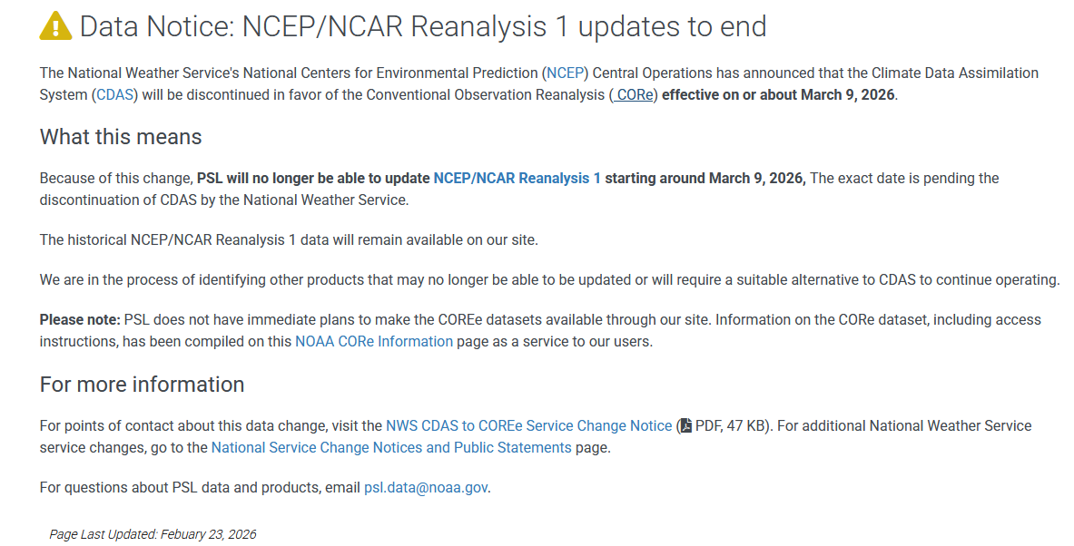
FYI, NCEP's ongoing retreat from broad data access is poised to continue. On or around March 9th, the daily or monthly composite maps will no longer contain updated data. https://psl.noaa.gov/news/2026/r1datanotice.html Below is one of the products that won't be updated.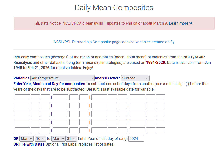
-
WTH is causing that heavy band from martinsburg, frederick to Towson??
-
I haven't seen snow melt this fast since Feb 2006...lol! Much of this weekend's gains have been wiped out, exposing the crusty underlayer from January's storm that remain.
-

2/26 - Follow-up Hopium Battlezone Storm
midatlanticweather replied to DDweatherman's topic in Mid Atlantic
Rain/snow mix in northern Loudoun. -
Drizzle.
-

"Don’t do it" 2026 Blizzard obs, updates and pictures.
TheSnowman replied to Ginx snewx's topic in New England
It's a Pocket One Genius, Given to me by our Senator at his DC office years ago. Asshat. Not a freaking Parchment Paper from the 18th Century. You guys Absolutely Suck. And for F's Sake WHAT was a Joke in the video? That I couldn't find ONE Single Measurement over 18.5" even though I went to 24 spots over 12 towns Less than 15 hours after the storm ended? -
People in Northern Loudoun have sent me video of rain/snow mix in that heavy band.
-
Oh it'll be true in 200 years... heh, whence the Boston and NY City skylines are sticking out of the ocean like old mooring poles of an ancient abandoned harbor.
-

E PA/NJ/DE Spring 2026 Obs/Discussion
RedSky replied to PhiEaglesfan712's topic in Philadelphia Region
12z euro hints at 80F on March 11th -
1000%.
-
2025-2026 ENSO
donsutherland1 replied to 40/70 Benchmark's topic in Weather Forecasting and Discussion
I don't disagree that there will be a cooldown following the burst of warmth after the first week in March. The cooldown doesn't necessarily mean a return to Arctic air masses or the threat of big snowstorms. A lot more evidence is needed before one builds a case for a 1956- or 2018-style close to winter. His calls almost always concern stratospheric warming events, favorable MJO phases, and/or blocking etc., to make a case that winter will continue to around Easter. The issue with making essentially the same call is that that when things verify, verification may simply have been a more matter of his making the same call year after year than insight into some unique factors. The 10 mb maps may be illustrating nothing more than a precursor to a final warming event. Even if the event materializes and propagates, the lag would bring one to late March or early April before its impacts would be felt. As X isn't really a searchable, I can't pull up his posts from spring 2025. But I found this in the banter thread related to his spring 2024 call: -
yup. It is ridiculous though how the media tries to hype and tie everything into climate change...not every single sensible weather event is product of cc or can even be tied into cc. Anytime there is a flood, drought, tornadoes...the media says "CC is causing it"...that is ridiculous
-
This used to be pushed a lot more in the mainstream years ago versus now. I think there was a study like 8-9 years ago that went viral in mainstream about decreasing snow averages from CC....it projected something like a 40% reduction in mean snowfall by 2035 for cities like BOS and ORH. The study didn't pass the smell test to anyone who knows anything about snowfall climo or how it relates to temperatures/QPF combo....but it didn't stop the narrative being spread far and wide. All this does is create misconceptions and distorted expectations....which then can be used cynically to discredit the idea of CC even existing. Some of CC's most enthusiastic proponents do the most to destroy its credibility in a twist of irony.
-
Everything is cc…excellent. We have a thread. Moving on. Nice EPS signal again for next week.
-
Thank Al Gore for that.
-
Select scenes from the Blizzard over 24 hours. Full album here: https://imgur.com/a/blizzard-2026-jersey-city-hoboken-negJG61 Early Afternoon Sunday 2/22/26: ~5:00 PM 2/22/26: ~8:00PM - 10:00PM 2/22/26: After Midnight 2/23/26: Late morning early afternoon 2/23/26:
-
Models can’t even get rain right 6hrs out. Had it dry up jere today and it’s been raining for over an hour.
-

Outta gas and Outta Time: Early March Winter Storm finale
TSSN+ replied to Ji's topic in Mid Atlantic
Ya it’s raining when most models said no precip. Def not snow though lol -
There's still a balance in play it's just that warmth will win out in most cases. And occasionally you get very anomalous events like the freezing temps in South Florida.
-

Outta gas and Outta Time: Early March Winter Storm finale
mitchnick replied to Ji's topic in Mid Atlantic
-
yup. there is a misconception that climate change means no more snow or no more cold...that is totally untrue.

.png.8240e6df28b444768fa98786efdd6673.png)