All Activity
- Past hour
-
Right, I mix it up with the event that hit the Suncook Valley the year before. Where we lived at the time, the 2006 event was a close second to the 2008 ice storm in terms of impact. Before WFH, couldn't commute to work without risking water crossings and road washouts along the route or drive two hours to find a clear path.
-
Latest from WPC has shifted max totals northward (vs. 12Z issuance) from VA Piedmont northward into PA, southern tier of NY and into NJ. This is through 00Z, Thurs. 5/8. Will all depend on placement of upper low and speed at which it exits. Needless to say I would be thrilled with half these totals. Possible southeast fetch lifted into the higher terrain of PA, NJ, NYS could deliver heavy totals but still subject to how upper low evolves.
-

E PA/NJ/DE Spring 2025 Obs/Discussion
RedSky replied to PhiEaglesfan712's topic in Philadelphia Region
CMC also wants to rain buckets Two against one -
Imagine if we had that look in August or September
-
Hit 71 earlier, now 61..but soooo much nicer than yesterday with barely any wind. Yesterday felt chilly here
-
Made it to 70 ..
-

E PA/NJ/DE Spring 2025 Obs/Discussion
Mikeymac5306 replied to PhiEaglesfan712's topic in Philadelphia Region
Euro wants to rain for days and GFS says Nope. -
Yeah I could see 1-2" out east with 4" and lollis to 5 Tolland west. soaker!
-
Just showing what the models have. We know every time a model shows rain you will disagree, but overall the data points to a wet period. Maybe it’ll revert back to your Stein fetish.
-
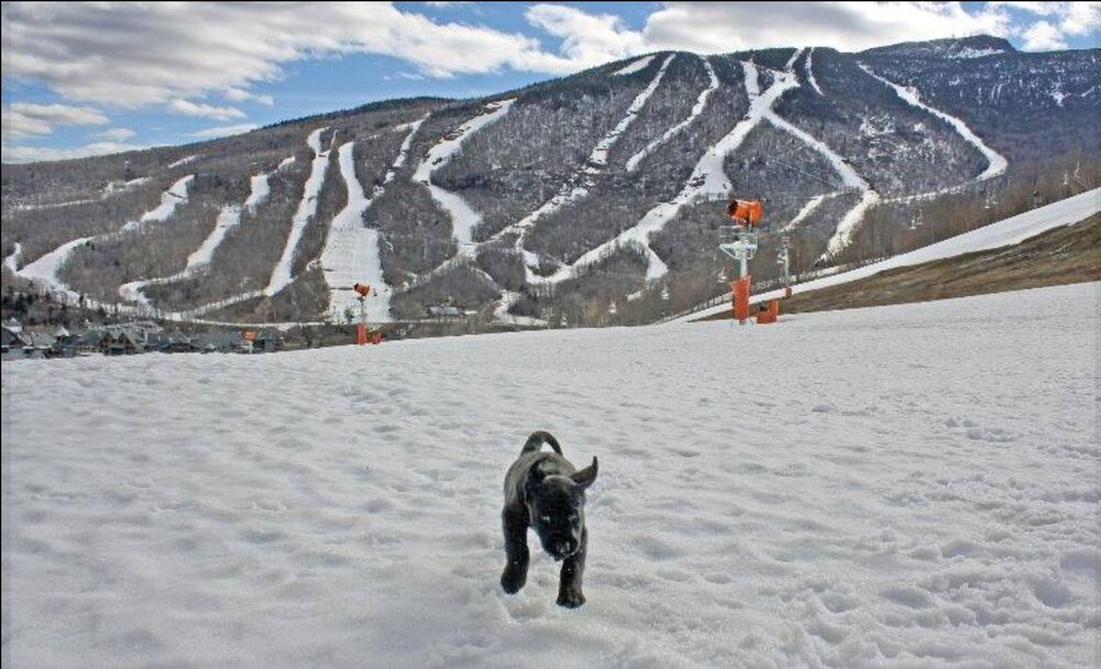
Scott, this picture came up on my Facebook "remember" feed. 10 years ago this week. I remember that this picture made me happy. How time flies! Gene
-
Might be one of those deals where BDR to river west are soaked for 24+hrs while it steins east of there before the whole thing migrates east.
-
I'd be willing to sacrifice some days now, for the UKMET to verify ... so that the word stein is never again floated this summer and/or can be set to ignore
-
EPS, GEPS, and Ukie a total disaster Sunday through Wednesday. Lock it in
-
2006
-
through hr 360 but thats a wet EPS run

-
starting to.. but give it a few more runs.. we might have a very wet period coming up
- Today
-
A few posters sure are
-
A GFS blend with the globals may be more likely...not buying the May 2005 redux.
-
Gorgeous. 75 this afternoon right down to the beaches.
-
Ah darn it...okay thanks.
-
I'm done, lol Ain't no way this is random luck repeating all these times. Something in the atmosphere changed or some quirk this year has made some weird uh...block? I'm not satisfied with no explanation for this
-
Monitoring for 5-7 Day drought buster Fri May 2-Fri May May 9... no thread from myself as yet but if it looks more likely that there will be 20% areal coverage 5+ in NYC subforum (Poconos-Catskills , to the Ct River and north of I-195, would then thread.
-
Holy shit
-
ukie
.thumb.png.2e422a1fa547c7530702fc470db0a7b1.png)
-
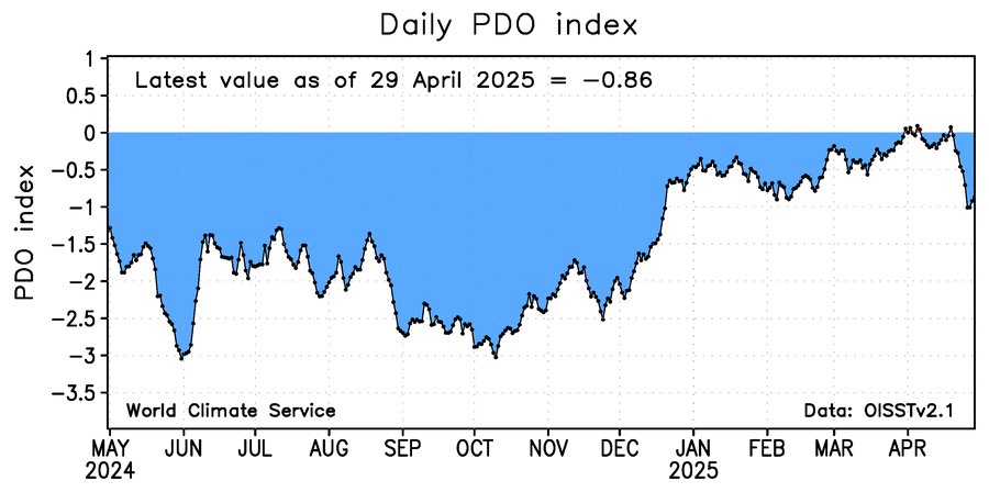
The image below of daily WCS PDO shows it has recently fallen and is at -0.86 as of yesterday. The corresponding NOAA PDO is likely ~~-1.75.


.png.fb6b39827c6934844ee41d3cff7574e6.png)
