All Activity
- Past hour
-
Plenty of pack here still, but it’s definitely receding.
-
Ya any bit of salt in the piles vaporizes it with the sun out.
-
Did anyone record anything this morning? I measured 0.3. 60.2 now on the season.
-

Central PA Spring 2026 Discussion/Obs Thread
canderson replied to Voyager's topic in Upstate New York/Pennsylvania
February at MDT ended 4.4 below normal in temp and 5.8” below normal in snowfall. -

Occasional Thoughts on Climate Change
TheClimateChanger replied to donsutherland1's topic in Climate Change
Some more information on that one... -
@The 4 Seasons60.2 inches through March 1. Highland Mills NY Orange County.
-

Central PA Spring 2026 Discussion/Obs Thread
Itstrainingtime replied to Voyager's topic in Upstate New York/Pennsylvania
Who gave their final grade? I do think it will turn cold but I think it's premature to say there's lots of winter left. I certainly wouldn't be surprised if we got more snow but I don't think that's a given. -
Same here. Only snow left on grass is where it is shaded or drifted. Even the piles are gone in spots. That late winter/early spring sun really goes to work especially once you have any bit of exposed ground to soak up the sun's rays.
-
BDCF season baby
- Yesterday
-
Crazy, pack is non existent along the shore out of the shade. Down to 3-6” here with grass showing up in spots.
-
How low do we drop tomorrow am, single digits?
-
Best chance for a real torch is if that cutter early next week (around 3/9-3/10) can cleanly warm sector us. Models have been off and on with that. If it’s a clean warm sector, we def would get 70F. I remember we got one in 1990 where we spiked over 80F and then I think we got a warning snow event a week later or less. Of course, we pulled something similar in 2007. It was very warm a couple days before the St Pattys day eve event. Not sure we hit 70 but it was close.
-

Central PA Spring 2026 Discussion/Obs Thread
Blizzard of 93 replied to Voyager's topic in Upstate New York/Pennsylvania
Well, like I said, lots of Winter to go…lol! People should wait until April 10th to give a final Winter grade in my opinion. I have enjoyed the couple of warm days that we’ve had in the last week or so & I’ll enjoy the warm up later this week, all while tracking the chance of every last flake until the true end of possibilities next month. -

Outta gas and Outta Time: Early March Winter Storm finale
DDweatherman replied to Ji's topic in Mid Atlantic
Just looked at the 18z euro and gfs AI suite, both are a bit north and more juicy than 12z and that seems to be the trend the last several cycles. I could see this providing a last minute surprise especially in the higher elevations. The rain a few days ago ended up a lot more substantial than models had it and the qpf axis ended up 50-75 miles north of the modeling from the night before. -
Haha that’s 12 days away - I’m sure it won’t change. Let’s enjoy all the warmth until then.
-
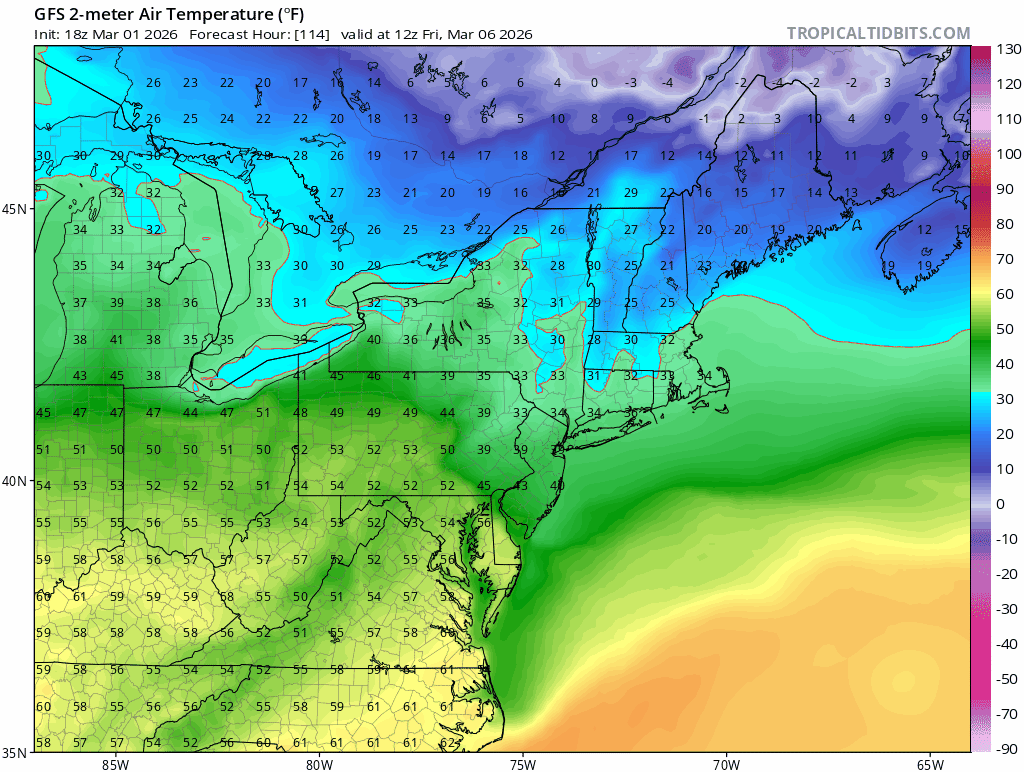
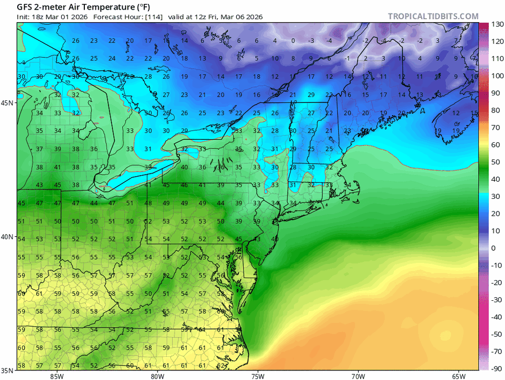
Highs EWR: 44 NYC: 43
-
Warmer temps ahead/before and during / after, no protection of a layer of sleet and the sun have eaten 85% of the snowfall here.
-
Do you have the same for EWR any chance?
-
Outta gas and Outta Time: Early March Winter Storm finale
DDweatherman replied to Ji's topic in Mid Atlantic
Definitely beefed up nicely vs previous runs. Ai had been a lot more bullish for a while. I’d love to sneak into 1-2” even if Winchester east got a Jack. Maybe tonight’s runs will keep the juicing going. wonder if the RAP is juiced up? lol -
-
Grass is so disheartening.
-

Outta gas and Outta Time: Early March Winter Storm finale
NorthArlington101 replied to Ji's topic in Mid Atlantic
Nice improvement from 12z. Seeing a wetter trend for sure. Also norther. Could be a “congrats Parkton” if it continues but it’s been a while so that’s okay. Would appreciate any and all snow TV on tap -
My backyard has a few inches in places that get a lot of sun and 7-8” or so in places that don’t. I think we’re getting into the snow from late Jan and that’s solid ice.
-
Going with 52” in Huntington Station. I’ll go with 0.1” today also, there was a minor coating on colder surfaces.
-
Clearly some errors on that map. A trace in Northport? Not.