All Activity
- Past hour
-
Sleet bombs can be fun. Especially with an arctic outbreak following it. Literal glacier situation.
-

Possible Record Breaking Cold + Snow 1/25 - 1/26
NEG NAO replied to TriPol's topic in New York City Metro
It wasn't JB and I should have mentioned they only said it was a possibility not definite - I think 15:1 is reasonable considering this air mass coming in from the north is quite unusually cold for this area during a snow event. -
Yeah in general that’s it. Technically in this scenario they are actually both slowing down and phasing later timing wise, but further west nonetheless. I think if we are going to have a phase, a quicker one is the better of the two evils cause at least the TPV and HP won’t be retreating by then.
-
Good catch that was meant to be a 20 (2/12/2012) I will update
-
Yes we greatly appreciate you being here Michelle. Thank you.
-
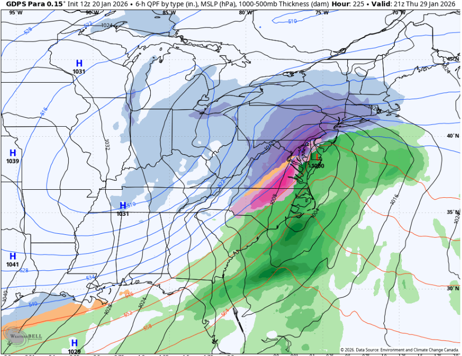
GDPS Para smokes the entire 95 corridor. Pretty much best case scenario. Probably 16-18” using 10-12:1
-
I could see this being one of those where the local mets go 4-8. Then up it to 6-10. Then up it again to 10-14. I used to love watching Bob Ryan constantly upping the totals. Always made me chuckle. He was the original DC snow weenie.
-

Possible Record Breaking Cold + Snow 1/25 - 1/26
North and West replied to TriPol's topic in New York City Metro
. -

Possible Record Breaking Cold + Snow 1/25 - 1/26
SnowGoose69 replied to TriPol's topic in New York City Metro
20:1 is tough here outside of maybe a clipper in a very cold setup. Coastal lows usually its either too warm or too windy for ratios that good. PD2 is a case though where I think ratios may have been close to that and 2016 -
I really hope that does not pan out for the SE. That could be devestation.
-

Possible Record Breaking Cold + Snow 1/25 - 1/26
MANDA replied to TriPol's topic in New York City Metro
No way in hell at this point to determine where best snow growth will be, banding and lift etc. We're still trying to figure out the synoptic situation much less pull apart soundings 120 hours out. Surface temperatures alone do not determine ratios. A gusty wind can reduce ratios. Not to mention how much against climo 20:1 would be for the metro. JB is a great one for pushing 20:1 / 30:1 ratios and I can't think of ONCE when he was right on that during a moderate or major storm. -
Having done forecasts there for years the wedge often times tends to be deeper in NE Ga so they end up more sleety in this storms. I think if this trends more to FZRA they'd probably see much less precip and just get like 0.25 FZRA and that is all. There is a narrow setup for them to see monster ice totals there. The wedge tends to save them or the system just usually cuts more north and they are drier.
-
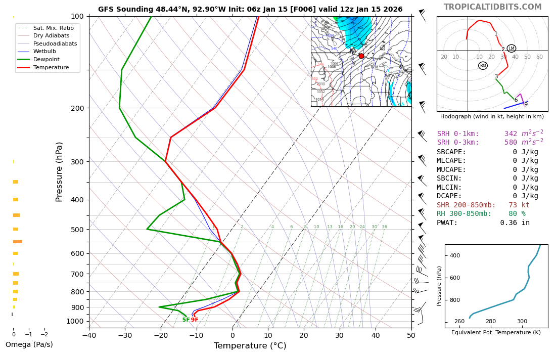
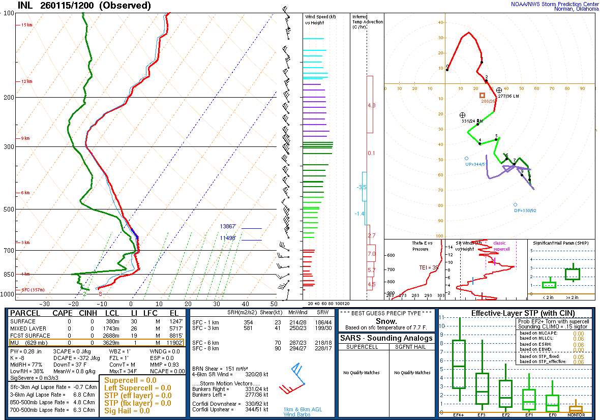
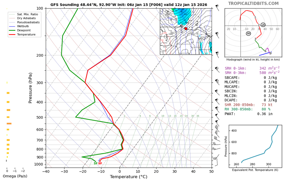
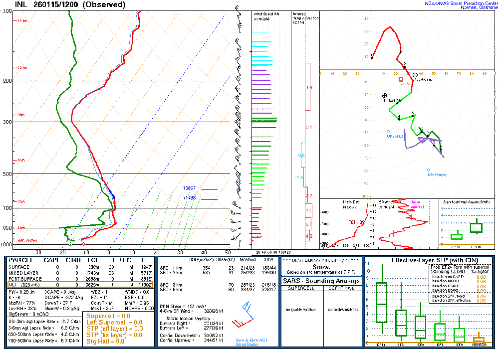
Found NOAA's sounding page. Notice the difference in temps from what was on the Wyoming site. Strange. Yet this mornings sounding looks good. https://www.spc.noaa.gov/exper/soundings/
-
Crippling ice storm. Gas stations will be closed for days as well. Trees and power lines down. Hard pass.
-
The 2 in Feb 2012 has to be a mistake. I don't ever remember it getting anywhere near that cold at any point during that winter.
-
Damn.
-
No power Flo
-

2025-2026 Fall/Winter Mountain Thread
buckeyefan1 replied to Buckethead's topic in Southeastern States
Thank you Steve, I appreciate you I’ll admit it’s really tough without him. We made the best team -
Even 1/4-1/2 of those totals is disastrous.
-
-

January 2026 regional war/obs/disco thread
CCHurricane replied to Baroclinic Zone's topic in New England
Ah, understood -
Yes, this should be interesting!
-

January 2026 regional war/obs/disco thread
vortex95 replied to Baroclinic Zone's topic in New England
And it was quick hitter in much of MA/RI. I got about 15" in 8 hr in Woburn Snow began not long after midnight and it was clearing out by 9am! -
I mean it really is the only reasonable call living in this area. Never go big this far out...and for us 6 to 10 is MECS
-
@Ji are you following your rule and going with the least snowy model, ie the gfs? Or does that not apply with this system?