All Activity
- Past hour
-
Dry weekend here so far. Today was nice for planting, I'm another who did that. Maybe some hope on radar.
-
Parr's Ridge is a force. It could be dry on my commute to Columbia and then a sprinklefest as I pass Mt. Airy.
-
Starting to see this on radar. Wonder if it's southeast flow interacting with Parrs Ridge?
-
Misery mist city.
-
Still pouring, yellows and oranges just rotating across NoVA.
-
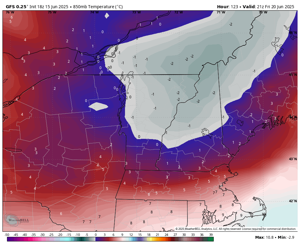
What is the gfs bringing through nne fri afternoon?
-
And more to come. Starting in July policy will be for the forecast to be populated with the NBM and largely left alone except for the near term. But we are wasting human resources generating dewpoint grids on day 7 given the current staffing situation.
-
a number of recent HRRR runs break out an area of heavy precip over north-central and northern Maryland later this evening. It doesn't appear to be a northward propagation of the existing rainfall. Curious to see whether the HRRR is onto something.
-
Major heat wave odds are increasing for the Mid Atlantic between June 22 nd and June 25 th.
-
Still raining

-
.05 total over the weekend.
- Today
-
Brief mild up.
-
Hold everything with this heatwave malarkey. Ineedsnow have you seen 18z GFS? Moves a little southeast and we're in business!

-
1.62” since about 5pm today, still going at a moderate clip.
-

June 2025 discussion-obs: Summerlike
LongBeachSurfFreak replied to wdrag's topic in New York City Metro
Raining again. Froze at the beach today. Has to be the coldest day at the beach so late in the season I have had it in 27 years of life guarding. It’s that damp east wind. -
Got 1.5 inches of rain last night and then already at an additional .75 from this batch and still raining. FFW up too.
-
Radar makes me think this could last awhile
-

2025-2026 ENSO
Stormchaserchuck1 replied to 40/70 Benchmark's topic in Weather Forecasting and Discussion
Really nice cold 500mb +NAO Days 8-15 on the 18z GEFS. This is a pattern that also developed last Spring/Summer after the active solar flares. -
Day to watch would be late day/evening on this Thursday. Mount Holly AFD snippet below A strong cold front will approach and pass through the region late Thursday and Thursday night. This will spark off afternoon and evening showers and thunderstorms, some of which may be strong to severe. The Storm Prediction Center has a 15% risk for severe weather across portions of the Northeast and Mid- Atlantic on Thursday.
-
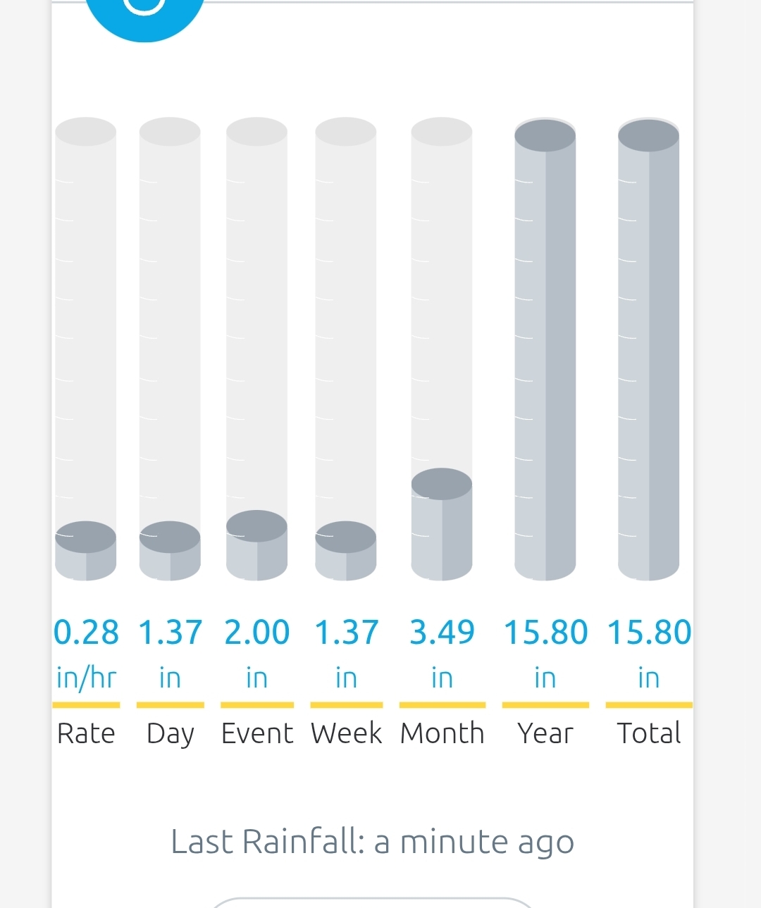
Finally getting some of the goods. Have picked up 1.37" which is more than 7x what I had month-to-date combined. Would love to have more tomorrow and Tuesday to stock up the soil before the big heat arrives.
-
1.10 rain this weekend. 3.24 for the month so far. Please no more for at least a week.
-
Put a bunch of perennials in this afternoon to cap off a growing flower garden. Really could use a steady, soaking rain overnight.
-
Friday may be interesting. Storm Prediction Center Jun 15, 2025 Day 4-8 Severe Weather Outlook