All Activity
- Past hour
-
.thumb.jpg.6a4895b2a43f87359e4e7d04a6fa0d14.jpg)
Central PA Spring 2026 Discussion/Obs Thread
Yardstickgozinya replied to Voyager's topic in Upstate New York/Pennsylvania
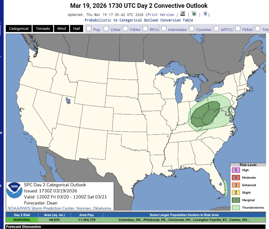
This might be of particular interest for those of you that have plans tomorrow. As mentioned nothing severe this far East at this point, but some isolated week convection is apparently possible. 913 PM EDT Thu Mar 19 2026 .WHAT HAS CHANGED... *SPC has introduced a MRGL risk for severe thunderstorms across the Laurel Highlands and SW PA valid Friday afternoon and evening && .KEY MESSAGES... 1) A broken line of thunderstorms across central and western PA is likely late Friday afternoon and into Friday evening, following a widespread light to moderate rain earlier in the day. 2) Cold frontal passage Sunday should make widespread rain showers perhaps ending as a brief period of snow across the north, followed by windy and colder temps on Monday. && .DISCUSSION... 1) A broken line of thunderstorms across central and western PA is likely late Friday afternoon and into Friday evening, following a more widespread light rain earlier in the day. A Clipper system embedded within strong mid and upper level flow will cross through the Great Lakes and into New York State on Friday. Isentropic ascent with PW values rising to near 0.75 inch will likely result in an area of stratiform light to moderate rain moving from NW to SE during the afternoon. As a cold front approaches during the evening hours, a broken line of showers (east) and thunderstorms (west) is expected to form on the back edge of the precip area, perhaps with a dry break between the two areas of rainfall. With 850 hPa flow between 30 and 40 kts and a few hundred Joules of MLCAPE, isolated severe wind gusts can not be ruled out particularly across the Laurels and points southwest. Total QPF is progged between 0.25 and 0.50 inch. High temps will end up about 10F milder than the previous day (49-63F across the CWA fm N to S) -
80s in April. F that. Plenty of time for heat. Let's do 50s and 60s for about 4 weeks
-
Central PA Spring 2026 Discussion/Obs Thread
Yardstickgozinya replied to Voyager's topic in Upstate New York/Pennsylvania
SPC is advertising the slight chance of garden variety, thunderstorms in our area tomorrow, and some limited severe activity from the ohio valley into southwestern pennsylvania. They even had mention of a very slight tornado risk out that way. https://www.spc.noaa.gov/products/outlook/day2otlk.html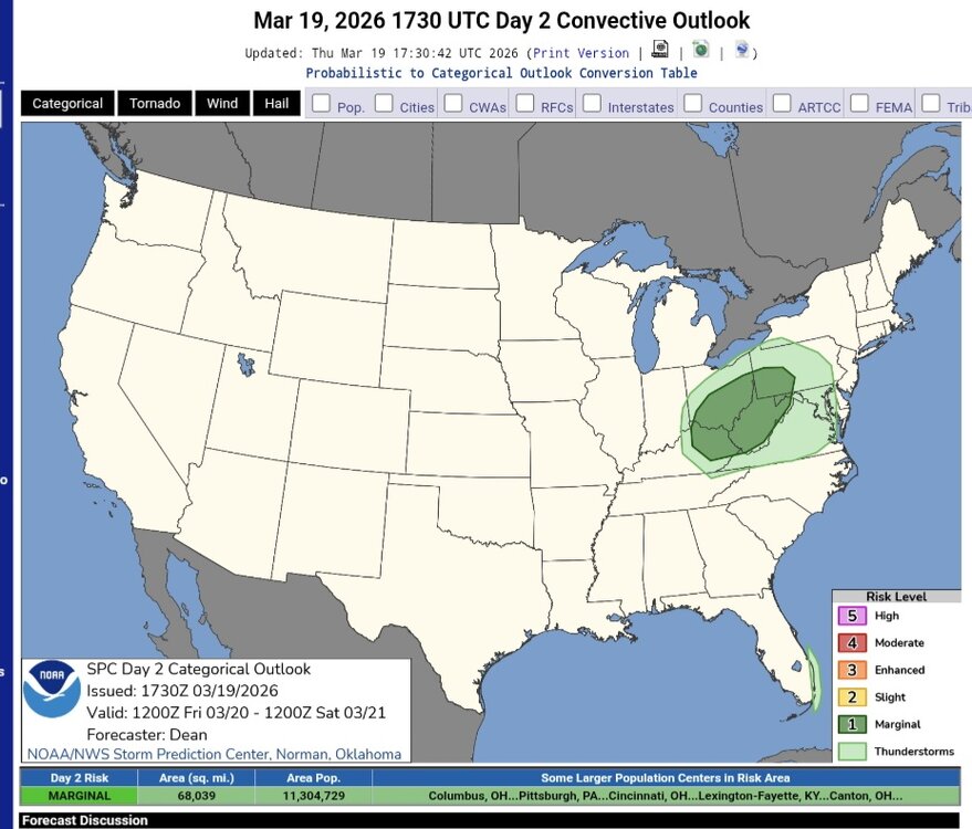
-
April is Spring. Fucking 80s? GTFOH. But ofc we will , because we do premature heat better than anything. Okay, 80s and humid with a Bermuda High in April it is. Then 5+ months more of heat. Sure, bring it, I guess.
-
MLI tagged 70. The 7 inches there from Monday is toast.
-
This UNC/VCU game is amazing
-

2026 Atlantic Hurricane Season
Chinook replied to Stormchaserchuck1's topic in Tropical Headquarters
First ever March hurricane upcoming -
It.Better.Not
-

80 Degrees to Ripping Snow: March 12th
EastCoast NPZ replied to SnowenOutThere's topic in Mid Atlantic
Ask Aldie how that worked out for him. Lol. Welcome to the area, man. -
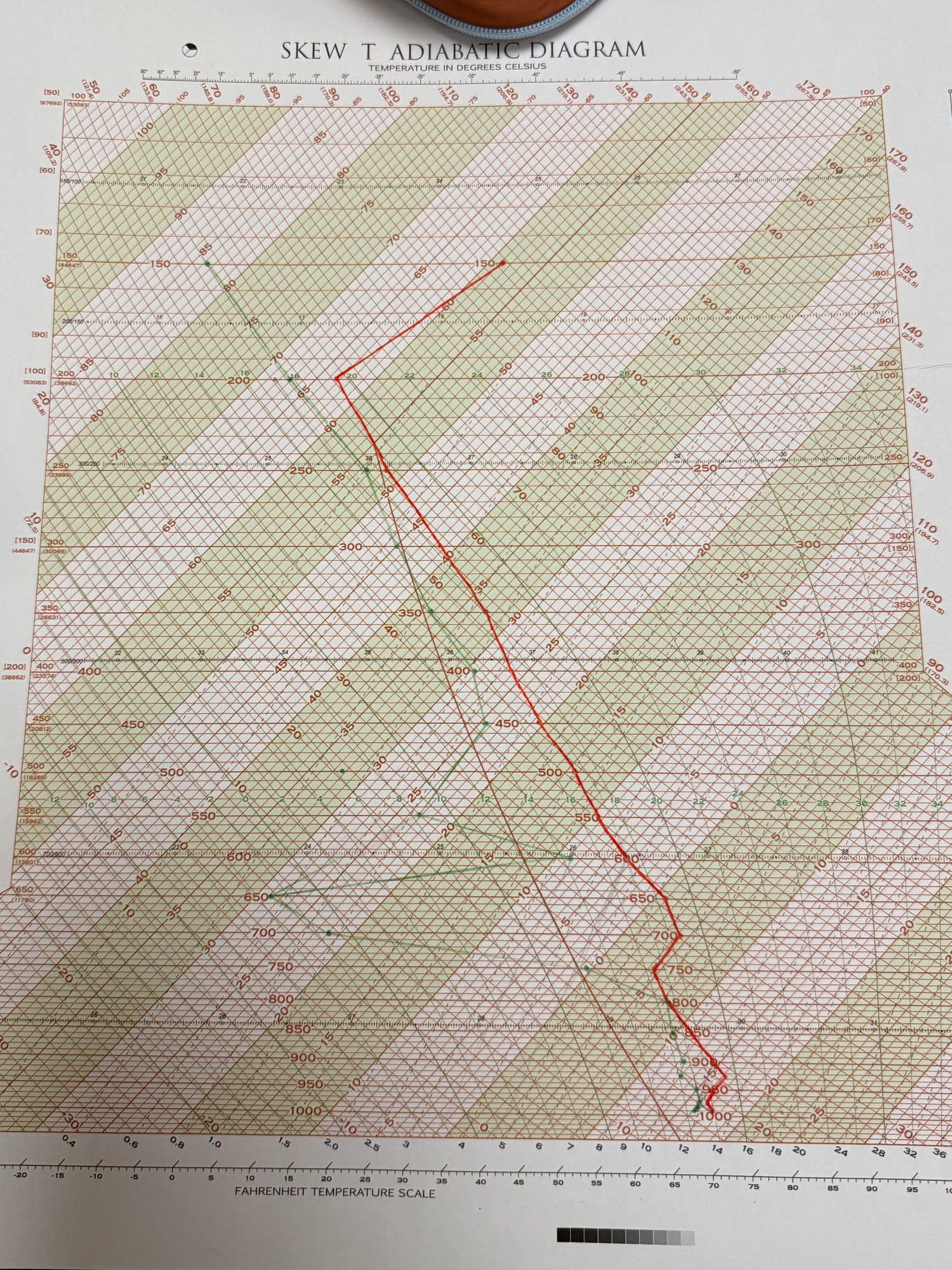
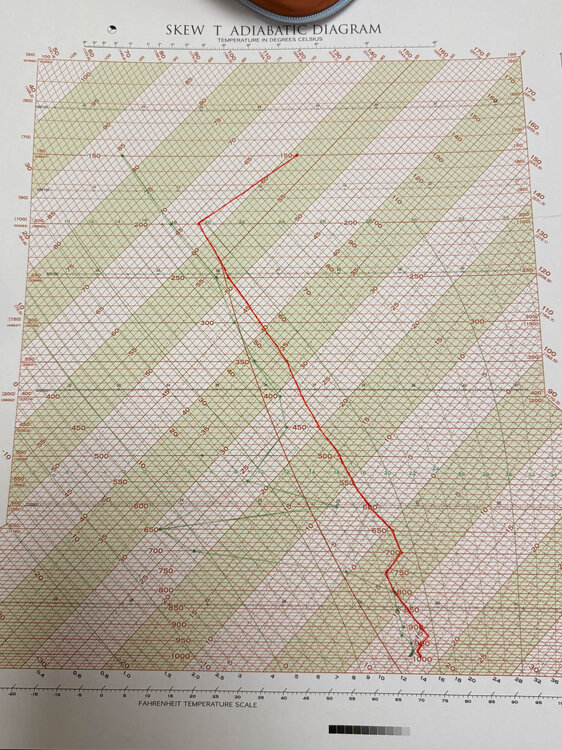
This is why hand analysis is so vital, especially for potentially significant setuos.
-
@snywx @CPcantmeasuresnow
-
I figured id get some comments from orange county folks. I had to almost completely guess over there as there were hardly any reports. I can add your 0.4 and if I could get more from the other Orange country posters that would help
-
Yeah, when you see the sounding from Monday without any of the wind profiles it becomes painfully clear that we were cooked with our thermal profile if we wanted severe. Had two different CIN areas and horrific lapse rates with next to no CAPE. Also hope this pen-paper diagram brought back some memories for our mets.
-
I wouldn't bring in the closer just yet.
-

Mountain West Discussion
gallopinggertie replied to mayjawintastawm's topic in Central/Western States
Looks like Flagstaff had a high of 84 today, which is 4 degrees above the April record high. -
Always hope for a rare April snow event
-
Typical
- Today
-
Codfish must have had a bow line hit his head with that comment.
- Yesterday
-
41 today. Awful. Next 2 weeks looks pretty bad. 45-50 and dreary. Fucking March
-
Where was the zr?
-
Let’s have this go underneath us, and get a last event…cuz there is certainly no nice weather ahead that’s for sure…F it.
-
Was really surprised to wind up with the snow this morning--about 4" or so. Surprise for many given the number of cars off the turnpike.
-
might be more sleet here on the Euro AI but we take.. this could still go anywhere though from CNE to SNE
-
18z Euro AI