All Activity
- Past hour
-
Thank you for learning from me and contributing meaningfully, we greatly appreciate that.
-

Richmond Metro/Hampton Roads Area Discussion
chris624wx replied to RIC Airport's topic in Mid Atlantic
ORF is saturated at 33.8F. We're going to need the low to deepen to draw down some drier air from the north so we can wet bulb down to freezing. Hopefully that corresponds to the coastal enhancement shown on the models for later this afternoon/evening. -
3 pm numbers. 3.3 inches OTG, temp dropping, down to 27.9/25.0. Decent moderate snow falling now.
-
Down to 31
-
A bit more than an inch here. Enough left to get to 2.5
-

December 2025 regional war/obs/disco thread
DavisStraight replied to Torch Tiger's topic in New England
Maybe, the cold did come in over night. -
Really? Maybe it was referring to midnight high? Because we had one.
-

December 2025 regional war/obs/disco thread
DavisStraight replied to Torch Tiger's topic in New England
P and C had me at a high of 31, 23 was high, 21 now. -
Definitely some wet flakes mixing in now in Newton.
-
-
From 1958 thru 1971, the core of most of my childhood, the ponds froze most every winter, we skated and sledded plenty. I can remember only two winters that did not deliver like that.
-
It’s like a 980 low going west. Ain’t stopping that.
-

December 2025 regional war/obs/disco thread
Damage In Tolland replied to Torch Tiger's topic in New England
It’s still freaking annoying and frustrating . That was my point. Not that it was same setup -
Check that! We have a few orphan flakes floating down now! You have to wait 10 seconds in between flakes, but they are present. Nice! (It's amazing with what poor snowfall rates will create excitement when you have been snow-starved for so long...)
-
Had it been a night hit there would have been at least 4-6 where I was.
-
.thumb.png.4150b06c63a21f61052e47a612bf1818.png)
December 2025 regional war/obs/disco thread
HIPPYVALLEY replied to Torch Tiger's topic in New England
Based on temperatures, folks will probably be out on ponds across southern New England next week. If he wants to. -
Boom
-

December 2025 Short/Medium Range Forecast Thread
Daniel Boone replied to John1122's topic in Tennessee Valley
Yeah. I had noticed that vort in the GOA last Week and thought that typically hurts us but, was weak at the time and looked like was going to be shunted eastward and then maybe travel down the Jet SEward. Some Model's are indicating a gradual +TNH developing as the Aleutians Alaskan Ridge moves over Alaska and expands over the Arctic Domain. Sooner the better for us if you want the real Cold and much higher Snow Probability. -
we need a really wound up system to get a tone of snow it's cold so i don't think we'll worry about mid unless we are overhead
-
High 34 today, currently 30/6.
-
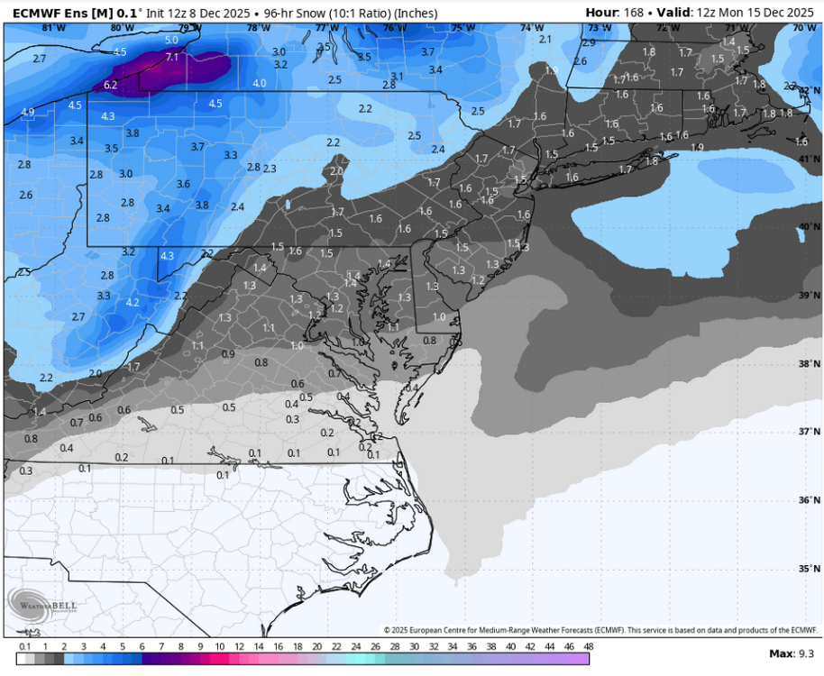
12z eps with notable colder shift in second week vs 0z
-
Still nary a flake in Hickory. The radar returns evaporate as soon as they approach the Catawba River (marking the boundary between Caldwell and Catawba counties).
-
In summary, we had snow for about 3 hours with a burst of heavier snow at the end - between 2 and 2:30 pm. Nothing stuck to the ground or even elevated surfaces. Still technically snowing very lightly now. Better than nothing though...
-
Love to see the pics, enjoy the snow day and keep 'em coming
-

Richmond Metro/Hampton Roads Area Discussion
Conway7305 replied to RIC Airport's topic in Mid Atlantic
Might be trying to lighten up W of us. Hopefully will fill in w/ Heavier bands later


