All Activity
- Past hour
-

December 2025 regional war/obs/disco thread
WinterWolf replied to Torch Tiger's topic in New England
You said cold season lol…it’s been frieken cold as a bastard. And it ain’t even winter…but whatever. I don’t really let it bother me anymore. I lived this 40 years ago…it sucked and used to infuriate me then. Not so much now. I don’t like it…but just like everything else, it too will eventually change. -

December 2025 Short/Medium Range Forecast Thread
TellicoWx replied to John1122's topic in Tennessee Valley
Thought same thing but sometimes modeling will show nothing if the precipitation is virga -
32, I suspect virga aswell. Precip seems south of modeling
-

December 11th - 12th clipper potential
Holston_River_Rambler replied to Holston_River_Rambler's topic in Tennessee Valley
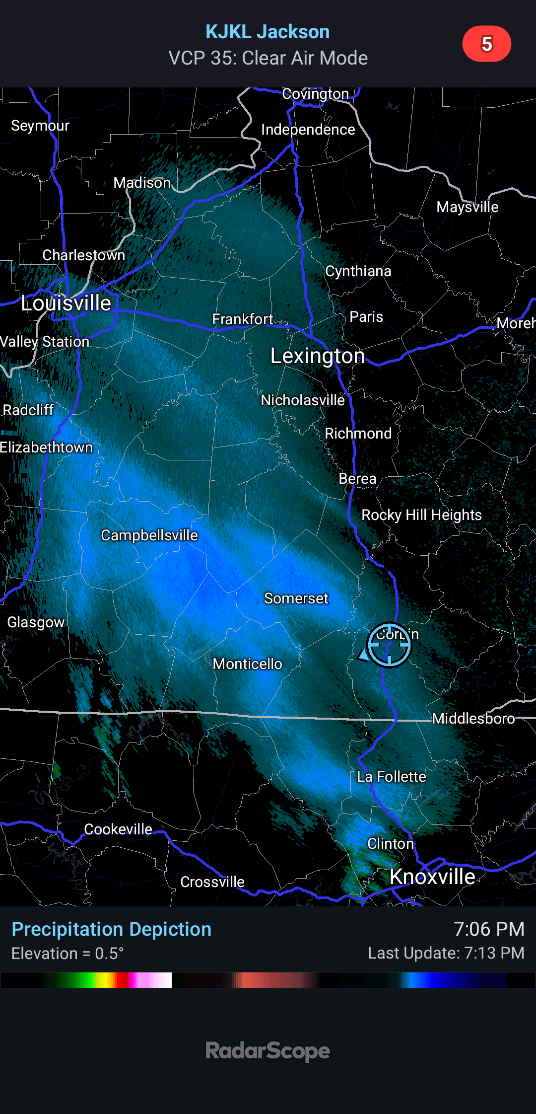
Fine looking radar upstream: -
Noticed that on radar...presume it's virga or short range models slightly off to the north on precipitation maps.
-
Let's see what happens.
-

Central PA Winter 25/26 Discussion and Obs
NepaJames8602 replied to MAG5035's topic in Upstate New York/Pennsylvania
Incredible, just got home from work and just finished cleaning up the driveway and steps. 3.0" inches of lake effect from this tiny streamer sitting over my area of the Poconos this evening. Roads are horrendous. This is very localized stuff around here this evening. Season total now 15.0".

-

Return of the Holiday GTG Saturday 12/13 3pm @ Funky Murphy's in ORH
Fozz replied to 40/70 Benchmark's topic in New England
I’ll try to make it -
Oh yeah, what a winter to show for it so far. Pretty awesome Mansfield stake is killing it and 1K Tolland is at a coating with -10 departures.
-
I remember when happy hour used to be… happy
-

Central PA Winter 25/26 Discussion and Obs
Blizzard of 93 replied to MAG5035's topic in Upstate New York/Pennsylvania
CTP thoughts on our weekend snow chance. To the south of the main upper low center near Lake Superior, another fast moving system will streak around the southern periphery of the upper trough from the Northern Plains through the Ohio Valley and into the Central Appalachians and Mid Atlantic Saturday night through Sunday morning. The upper trough is fcst to dig/amplify as it pivots eastward and should drive coastal low development while dragging a pocket of -20C air at 850mb into southwest PA/WV by Sunday afternoon. Odds are rising for a broad area of expanding/accumulating snow Saturday night through early Sunday across CPA. NBM probs for >3" are highest over the southern Laurels and southeast portion of the Lower Susquehanna Valley. The arrival of arctic air ensures snow character will be very dry and fluffy. -

2025-2026 Fall/Winter Mountain Thread
Maggie Valley Steve replied to Buckethead's topic in Southeastern States
Looking like we actually have a true clipper system heading our way overnight. I expect Buckethead will report an inch or two overnight. Perhaps flurries here in Haywood County overnight. The fast flow continues into the coming weekend! -
December 2025 regional war/obs/disco thread
WinterWolf replied to Torch Tiger's topic in New England
Not too short this season…we started very early bro. But ya, no stress. First world problem. -
I’m always here for a threat, but I’ve embraced the Sandbar Scooter side of things where summer is happiness and stress free. Hopefully others catch that as well as the cold season shortens with every passing year.
- Yesterday
-
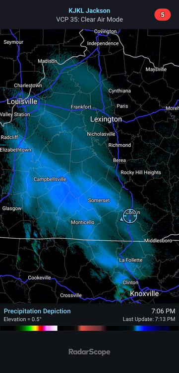
34 with returns approaching. I suspect it may be virga.
-
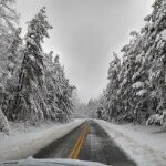
Big sky. Might as well be in Taunton.

-
Go back to catching bad guys .
-

December 2025 regional war/obs/disco thread
Baroclinic Zone replied to Torch Tiger's topic in New England
Sticking with 1-3” here. -
Partly cloudy. Occasional light flurries. 21.6
-

December 2025 regional war/obs/disco thread
TauntonBlizzard2013 replied to Torch Tiger's topic in New England
-
December 2025 regional war/obs/disco thread
TauntonBlizzard2013 replied to Torch Tiger's topic in New England
just saw elsewhere. It’s definitely a bit worse. This threat is cooked. I’ll pass on the coating -
It sure doesn't, when it's 60 degrees he wears a ski cap. Oh boy.
-

12/14: Sunday funday? Will the south win again?
SomeguyfromTakomaPark replied to TSSN+'s topic in Mid Atlantic
This is mostly overnight anyway, just hoping to wake up to white ground with arctic temps coming in. -
Bumped slightly north
-
Maybe a tad SE.