Kentucky
-
Posts
409 -
Joined
-
Last visited
About Kentucky

Recent Profile Visitors
2,471 profile views


-
 Kentucky changed their profile photo
 -
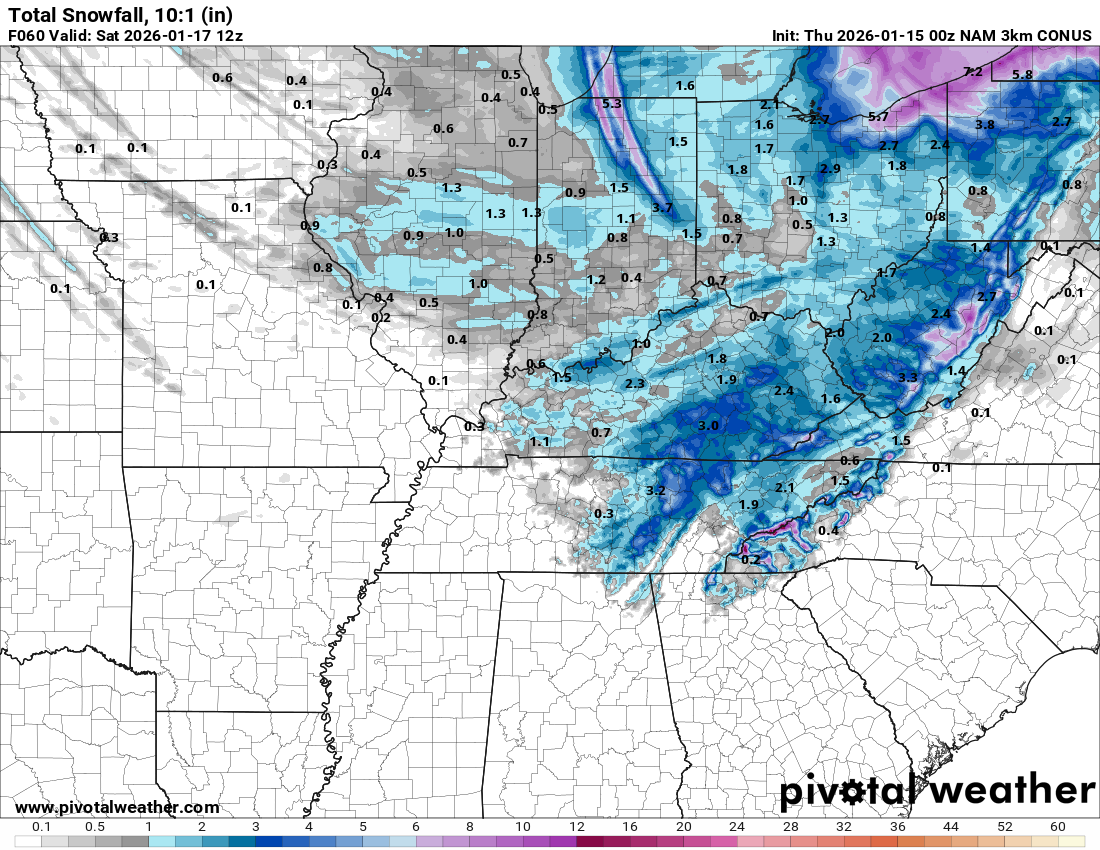
3K NAM appears to be headed towards a rain but timing works out and trys to salvage something. here's what it shows at 00z

-
RGEM coming in with rain, that's probably a wrap on this event. Believe East TN totally still in the game for Sunday.
-
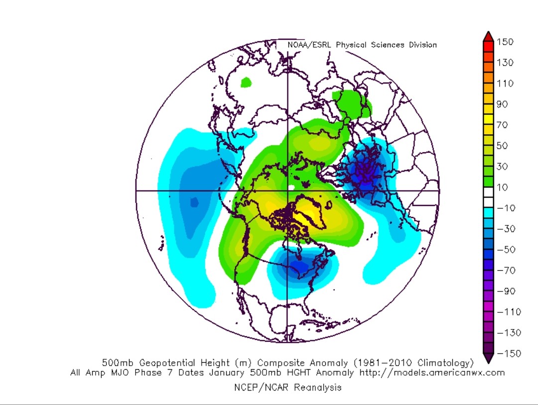
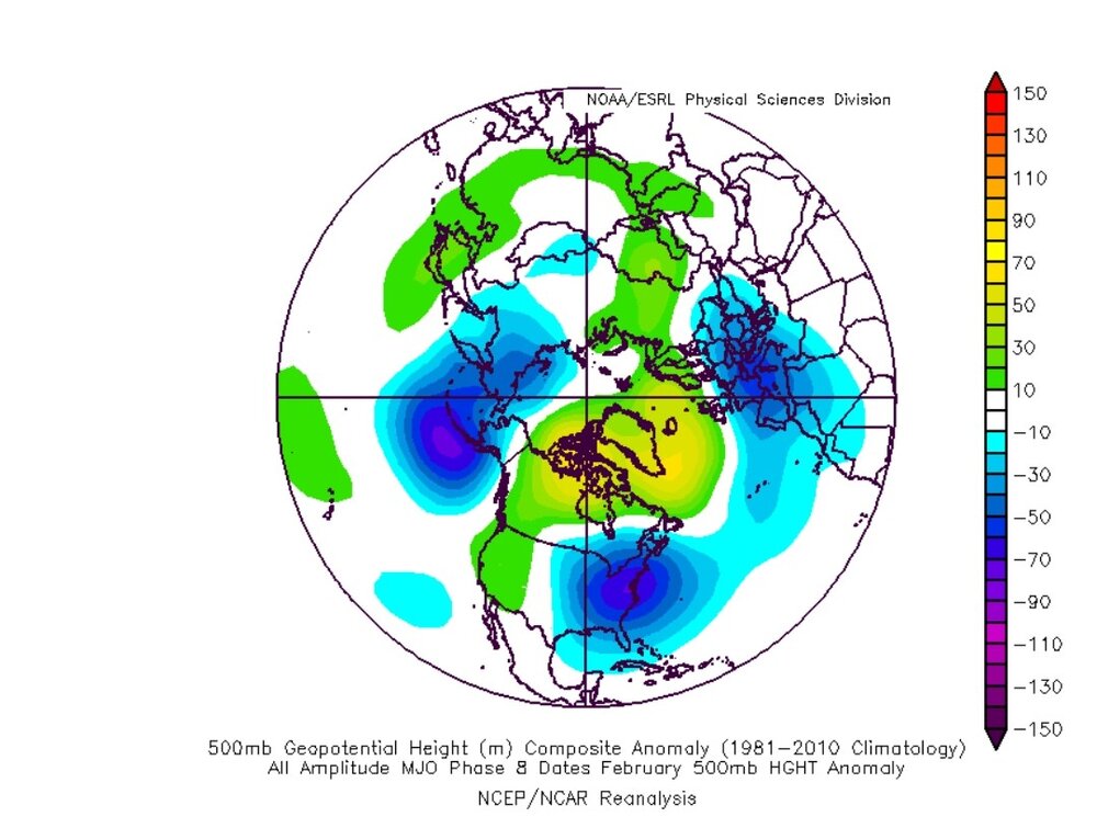
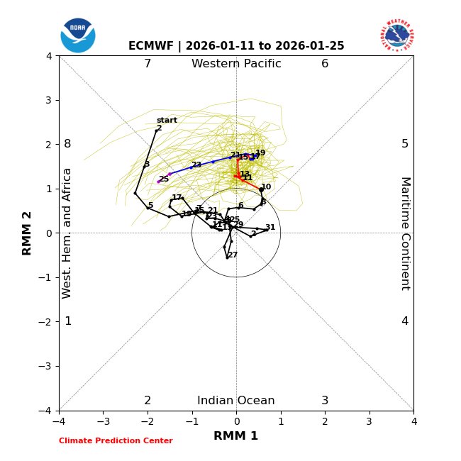
MJO phase 7-8, January analogs

-
awesome, yeah I've always wanted to experience/document one of those as well. I had no idea at the time how rare 93,96, and thought for sure we'd have another by now. I remember them well, just didn't get to document any of it.
-
I'm not throwing in the towel on winter just yet, but I have come to the conclusion that I may like snow a little too much to live here N and mostly East of Corbin usually do really well on these flow events, Corbin not so much, sharp cut off in London
-
Some kind of weird restriction here on AmericanWX seems they give each user so much storage and it's not a lot at all. Believe most on here embed@Carvers Gap@Holston_River_Rambler among others can probably point you in the write direction. Congratulations on the new addition btw
-
December 2025 Short/Medium Range Forecast Thread
Kentucky replied to John1122's topic in Tennessee Valley
Eric has indeed backtracked today, Merry Christmas to all. https://x.com/i/status/2003487195450286581 -
December 2025 Short/Medium Range Forecast Thread
Kentucky replied to John1122's topic in Tennessee Valley
I did notice Eric says compared to normal. Whatever normal is for us anymore. I suspect he'll be backtracking within days -
December 2025 Short/Medium Range Forecast Thread
Kentucky replied to John1122's topic in Tennessee Valley
Yeah, I'm not ready to throw in the towel on the first day of winter & Eric has definitely been wrong before. He seems to be a little more unhinged this year. -
December 2025 Short/Medium Range Forecast Thread
Kentucky replied to John1122's topic in Tennessee Valley
I really respect Eric and if he's going to be wrong he'll be backtracking on Twitter soon. -
December 11th - 12th clipper potential
Kentucky replied to Holston_River_Rambler's topic in Tennessee Valley
Some weird restriction AmericanWX has, You'll need to compress it or embed it. Maybe someone else can share on how to embed via link because I have never really figured how to embed. -
December 11th - 12th clipper potential
Kentucky replied to Holston_River_Rambler's topic in Tennessee Valley
About 1/2" here in Corbin, JKL expanded the WWA and the second snow band promptly died. Most has already melted off Laurel County (about 10 miles north) received about 3-4 inches. -
December 11th - 12th clipper potential
Kentucky replied to Holston_River_Rambler's topic in Tennessee Valley
-
December 11th - 12th clipper potential
Kentucky replied to Holston_River_Rambler's topic in Tennessee Valley
I'd lean moderate to heavy snow here, still no wwa issued by JKL. -
December 11th - 12th clipper potential
Kentucky replied to Holston_River_Rambler's topic in Tennessee Valley
29 and light snow