All Activity
- Past hour
-
Clouds splitting the area in half angled
-

2026-2027 Strong El Nino
snowman19 replied to Stormchaserchuck1's topic in Weather Forecasting and Discussion
Wow…. -

E PA/NJ/DE Spring 2026 Obs/Discussion
RedSky replied to PhiEaglesfan712's topic in Philadelphia Region
The big warm spikes raised the average for March and April above normal but strangely the northeast trough still persisted. If you know anything about growing late April through May is the key growth period for crops everything is being stunted by this cold. -
Stein holding here. Not sure it will last though. Wish we had yesterday’s weather today.
-

2026-2027 Strong El Nino
GaWx replied to Stormchaserchuck1's topic in Weather Forecasting and Discussion
We could debate the GW component of OHC when comparing to past Nino events. But regardless, the current 5 month rate of warming of 180-100W OHC is the fastest on record (2.69) back to ‘79: https://www.cpc.ncep.noaa.gov/products/analysis_monitoring/ocean/index/heat_content_index.txt So, the avg. steepness of the rise in this graph since Nov is a record for a 5 mo. period: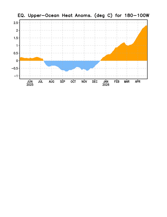
-
very chilly today..
-
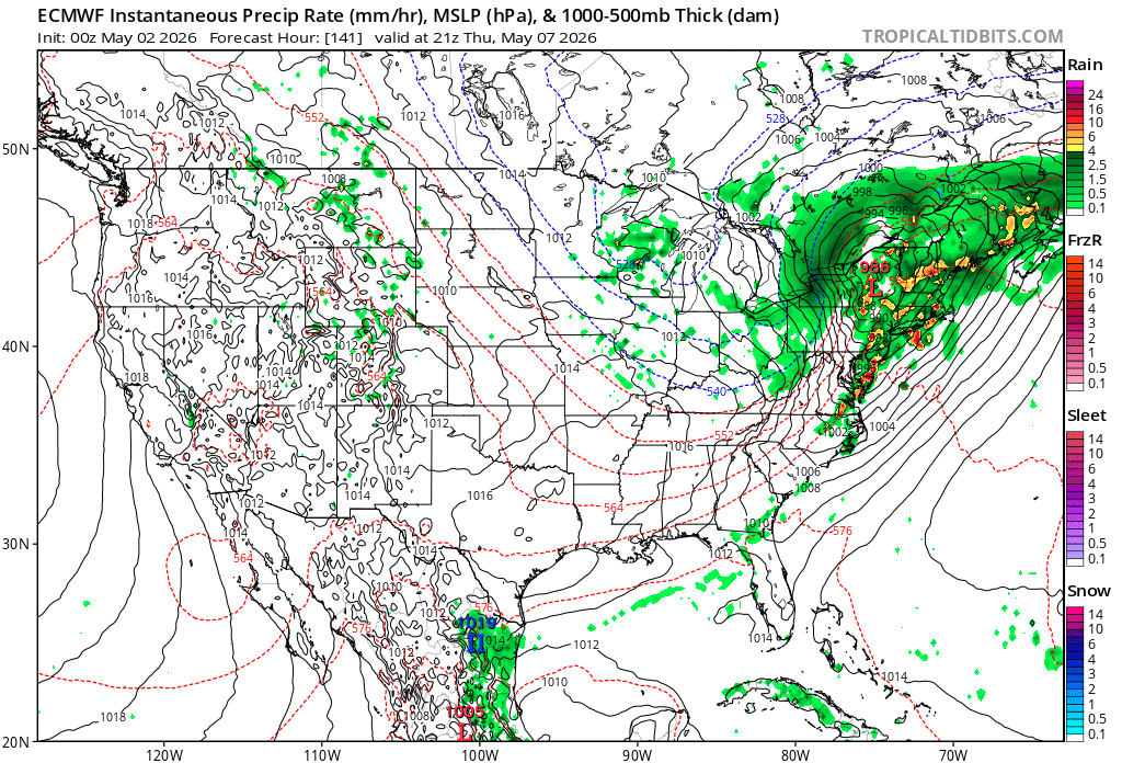
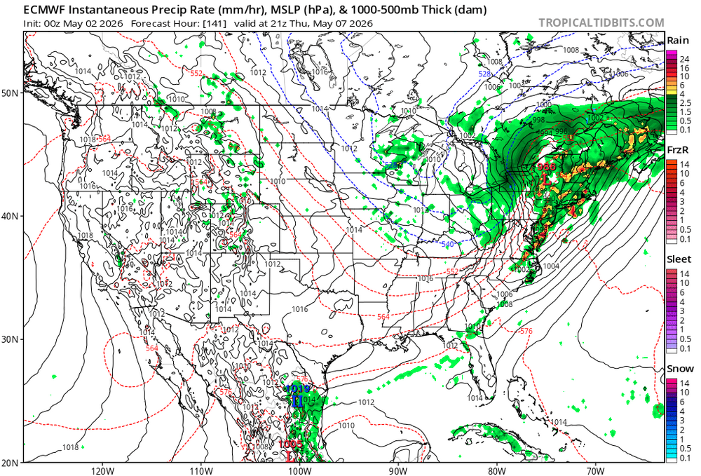
GFS keeps pumping out hefty totals in true GFS form.
-
2026-2027 Strong El Nino
snowman19 replied to Stormchaserchuck1's topic in Weather Forecasting and Discussion
This latest MJO forecast propagation we just saw was actually stellar weeks in advance. Spot on actually -
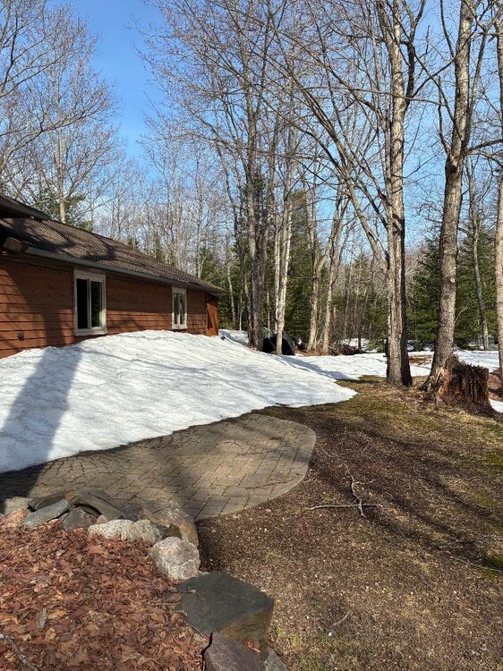
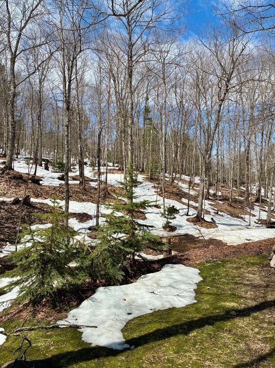
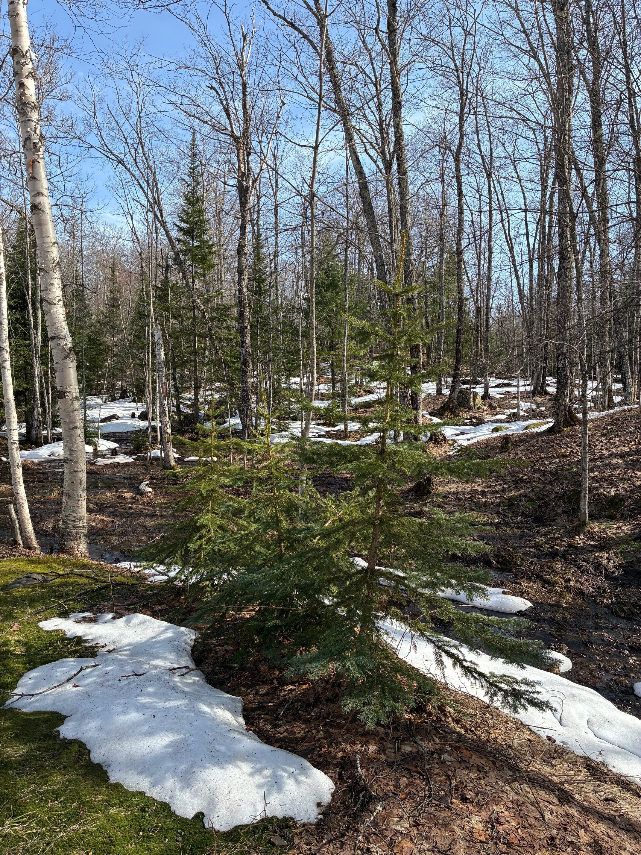
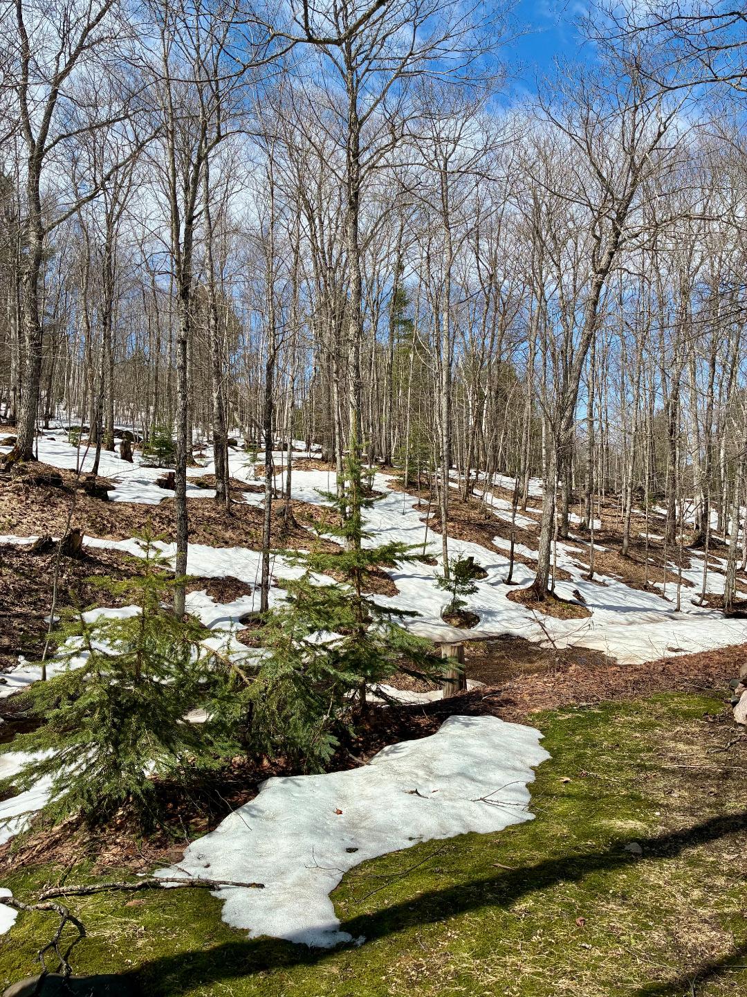
Mid 20's last night should rebound into the upper 40's today. I'll take it. Snowpack becoming patchy with the swamps and north facing areas still holding deeper snow. Will probably have areas of snow for another week, ending 6 months of snow cover.

-

2026-2027 Strong El Nino
roardog replied to Stormchaserchuck1's topic in Weather Forecasting and Discussion
Meh. We'll see. I've seen plenty of mjo forecasts for a month or more into the future fail miserably. I was talking about the next couple of weeks originally anyway. -
2026-2027 Strong El Nino
snowman19 replied to Stormchaserchuck1's topic in Weather Forecasting and Discussion
Incorrect -
2026-2027 Strong El Nino
GaWx replied to Stormchaserchuck1's topic in Weather Forecasting and Discussion
Thanks, Chris To remind all of the obvious, 2026 has the advantage of the warmest merely due to GW, which of course should be taken into account when comparing the strength of the upcoming Nino to others. How much has it warmed since 2015? 1997? 1982? Haven’t oceans warmed at least ~0.5C since ‘82? The GW component of the tropical oceans should essentially be taken out when comparing strengths of ENSO, which is what RONI does. Even after taking this into account though, 2026 is in contention for the strongest Nino on record. This is also the case for OHC comparisons. -
2026-2027 Strong El Nino
roardog replied to Stormchaserchuck1's topic in Weather Forecasting and Discussion
The latest MJO plots don't really look like this is happening. Some of the GEFS members are actually taking into the maritime continent now. - Today
-
Ha! Just posted where/whence the is in the cards
-
Just been a tedious stretch. Need to reshuffle the deck. Does look promising for sustained warmer anomalies by mid month.
-

2026 Spring/Summer Mountain Thread
franklin NCwx replied to Buckethead's topic in Southeastern States
Feels like a late October day out. Im loving this weather! -
Thanks for the kind words.
-
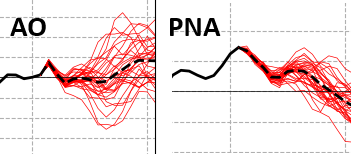
Improving odds for a hemispheric switch to a warm signal for mid month. Which isn't saying a lot at still 13 days away, but improving nonetheless. Emerging collapse in the PNA coming from all extended guidance for that index. Meanwhile, the the AO is pulled back (finally). And, if it helps...the climate composite on the MJO wave space in 8 for May is actually a modest over the top warming signal.. Indeed, the MJO is forecast to re-emerge on the left side of the RMM with perhaps nearly the same momentum as this most recent propagation. It's not hurting a warmer cause So we'll see... if you're a warm enthusiasts, it's a light at a the end of a tunnel for deeper more foundational looking warm pattern. In the meantime, Tuesday may approach 80...HA! So, it's not like we can't get by in the meantime. I just wish we'd time one of these warm bursts on the weekend. Weird look in total, really. Stationary front from IND-BTV like that is odd at this time of year. So we get late winter on the W side and early summer on the E for a couple of days... massive gradient The other aspect to consider is that the index correlation to pattern orientation is different in May than January. So have to consider two aspects, seasonal wave space changes. Also that there's a season -D(x) component where that is in the process of changing weaker. That's the seasonality signal. Putting all this together ... mm I'd say between modest and moderate signal for a warmer pattern change, mid month.
-
Coastalwx?
-
My experience of many years in the foothills - early May storms excite me. But that is a foothills perspective and setups like this in May usually have a steep accumulation gradient. All or nothing usually within 10 miles.
-
coastal
-
May 2 2013: A historic snowstorm dumps up to 18 inches of snow in southeast Minnesota and west central Wisconsin. Blooming Prairie receives 18 inches from this storm, and Eau Claire gets 9.3 inches. For Saturday, May 2, 2026 1899 - A storm buried Havre, MT, under 24.8 inches of snow, an all-time record for that location. The water equivalent of 2.48 inches was a record 24 hour total for the month of May. (The Weather Channel) 1920 - A swarm of tornadoes in Rogers, Mayes and Cherokee Counties in Oklahoma killed 64 persons. (David Ludlum) 1929 - Virginia's worst tornado disaster occurred. Six tornadoes, two of which were west of the Blue Mountains, killed 22 people. Twelve children and a teacher were killed at Rye Cove, in Scott County. Four schools were destroyed by the storms. (The Weather Channel) 1983 - Severe thunderstorms spawned twenty tornadoes across Michigan, Ohio, Pennsylvania and New York State. The tornadoes caused five deaths. (The Weather Channel) 1987 - Thunderstorms in the Lower Mississippi Valley produced golf ball size hail in northern Louisiana, and wind gusts to 77 mph at Lake Providence LA. Thunderstorms in Arkansas produced 4.20 inches of rain at Arkadelphia and 4.00 inches at Bismarck. (Storm Data) (The National Weather Summary) 1988 - A powerful storm produced snow and high winds in the Central Rockies and the Central High Plains Region. Snowfall totals in Colorado ranged up to 12 inches at Strasburg, and winds in southeastern Colorado gusted to 87 mph at Lamar. Snow and high winds created blizzard conditions in eastern Colorado and southeastern Wyoming. (The National Weather Summary) (Storm Data) 1989 - Thunderstorms developing to the north of a warm front produced severe weather in Oklahoma and Texas. There were 93 reports of severe weather. Thunderstorm winds gusted to 80 mph at Beattie, and baseball size hail was reported at Ranger and Breckenridge. Juneau AK reported a record high temperature of 72 degrees while Honolulu equaled their record low for the month of May with a reading of 60 degrees. (The National Weather Summary) (Storm Data) 1990 - Fourteen cities in Florida, Georgia and South Carolina reported record high temperatures for the date as readings soared into the 90s. Tampa FL reported a record high of 97 degrees, and Fort Stewart GA was the hot spot in the nation with a reading of 100 degrees. 1990 - Thunderstorms produced severe weather from northeastern Texas to western Arkansas during the evening and early nighttime hours. Thunderstorms spawned a tornado which injured thirteen persons at Paris TX, and produced baseball size hail at Rio Vista TX. Thunderstorm rains of four to seven inches caused flash flooding in west central Arkansas, southern and eastern Oklahoma, and northern Texas. (The National Weather Summary) (Storm Data)
-

Central PA Spring 2026 Discussion/Obs Thread
Itstrainingtime replied to Voyager's topic in Upstate New York/Pennsylvania
Finished with .1" of rain overnight. -
A nice cold morning so far with a current temp of 46 degrees
-
Chilly morning with temps in the upper 10's/20's. Yesterday was a cool one in the lower 40's. Warmer today in the 50's/60's. Only for the weekend as temps head back into the 40's for next week.


.thumb.gif.f92b16c631a1d15d405ed77b33f0710d.gif)