All Activity
- Past hour
-

January 2026 regional war/obs/disco thread
weatherwiz replied to Baroclinic Zone's topic in New England
@40/70 Benchmark getting back to the end of last weeks discussion regarding that fast flow stuff...I retract what I had stated and I will also add that anything blaming fast flow is also voodoo...to a degree -
100% probably one of the better model suites of the winter thus far. Bottom line: there's potential next week, but no one should be spiking the ball. I fully expect swings with each run, hoping to at least see a trend at 18z where things are still there.
-
I think what a lot of people here forget that you need everything to come together perfectly to get a big snowstorm for the coastal corridor. Cold air in place, storm diving down to the gulf of mexico, picking up moisture, coming up the coast. Or energy from Canada merging with a coastal system to throw snow back in to the big cities (eg Miller A or Miller B systems) It is not easy to get all the pieces in place for a 12"+ system. More likely we are going to get clipper type systems with light amounts, or that might get energized a bit as they approach the coast to give us systems that give us 2" - 8" of snow. Not to mention that all of the models have greater degree of error the further out they try to predict. You get a model showing a huge coastal system on one run, and on the next it is suppressed way to the south.
-

January 2026 regional war/obs/disco thread
moneypitmike replied to Baroclinic Zone's topic in New England
What a beautiful day it’s been today being outside and raking up leaves at the new pit. Lawn cleanup in January. Can’t beat it. -
Yeah, those trying to use flooding pics in Miami as an example of sea level rise and climate change are being completely dishonest and/or patently doomers. And yes, if some in this thread want to label us "deniers", I'm going to label them doomers. Fair is fair.
-
Welcome back Mitch, i have been waiting for you.
-
Yes, and as I pointed out, it wasn't just comparing the magnitude of the extremes on both sides, it was the geographic extent as well. Most of Canada, a huge country, was well below normal last month.
-

January 2026 regional war/obs/disco thread
Ginx snewx replied to Baroclinic Zone's topic in New England
First problem is relying on the GEFS GFS products for anything past day4 -

January 2026 regional war/obs/disco thread
Typhoon Tip replied to Baroclinic Zone's topic in New England
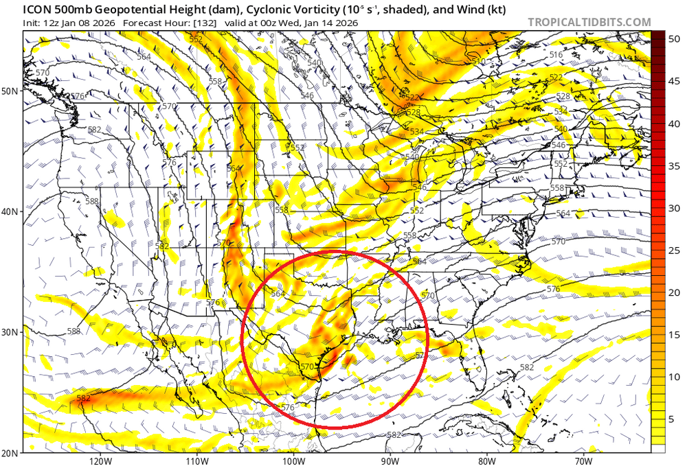
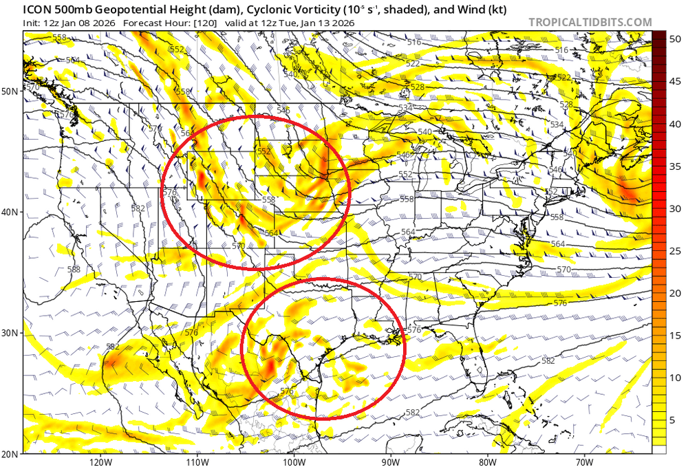
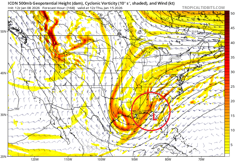
yup, Euro ridge more eclipsing the WC and we see some improvements aloft ( 500 mb evolution) downstream. -
If we waste that look around MLK Day on the euro, we suck. - Extremely tall west coast ridge - deep deep eastern trough - a little bit of ridging in west Atlantic - SER nowhere in sight - troughing east of Hawaii If you showed me the 500mb look with no context, I’d assume you’re showing me an analog for a memorable storm.
-

E PA/NJ/DE Winter 2025-26 Obs/Discussion
PhiEaglesfan712 replied to LVblizzard's topic in Philadelphia Region
For the first time since November, I'm using my fan. I can feel it getting warmer... -
I have a “work” beer tasting in 6 minutes. Probably 18 beers plus. So when I get back in here, please forgive me now, but let’s get that winter white gold while we can!
-
Was a very cold morning as the storm moved in. Temps rose from the single digits into the teens when the snow started. Then rose into the 20s at the height of the storm.
-
January 2026 regional war/obs/disco thread
Ginx snewx replied to Baroclinic Zone's topic in New England
In Jan 94 had a midnight high of 49 and still finished BN with midnight low of 2 lol -
Yeah it wasn’t looking that good yesterday and the day before, but good trends today.
-

January 2026 regional war/obs/disco thread
tamarack replied to Baroclinic Zone's topic in New England
January here is usually snowy - 22% of season total - but doesn't have all that many big events. After 27 winters: 10"+(47) 15"+(18) NOV 1 0 DEC 10 4 JAN 6 1 FEB 11 5 MAR 15 6 APR 4 2 -
"Winter Nor'Easters and benchmark storms have gone the way of the dinosaurs." I have to admit.... I agree. Call it what you will - global warming, climate change, etc. However, here in northern Baltimore County, 2016 was the last BECS - let alone MECS. It has been 10 years with no end in sight. We used to get hit every 3 years. I am starting to think the dream is over and we may not get hit again outside of a fluke chance storm every 10-15 years - - if that.
-
.
-

Occasional Thoughts on Climate Change
WolfStock1 replied to donsutherland1's topic in Climate Change
Funny thing about Miami flooding - here's a shocker - it's not a new thing: https://www.biscaynetimes.com/viewpoint/flooding-has-been-a-miami-constant-from-time-immemorial/ Here's another shocker - Miami/Dade population: 2000: 2.259M 2010: 2.507M 2020: 2.696M 2024: 2.838M Funny how people seem to want to move *to* this area that supposedly has all these flood problems. They apparently haven't gotten the news about the sky falling. (BTW - I used to live in the area, and visit Florida regularly - I know what it's like. The sky is not falling.) I wouldn't propose that flooding won't be more frequent there - it will. I'm just saying it's not some kind of life-threatening - or even lifestyle-threatening - thing. It just means that over time (we're talking centuries here, not years or even decades) new things need to be built on slightly higher ground and/or with more sea walls in low-lying historic areas. It's not that hard. Dealing with it will certainly be a lot less disruptive than the sudden loss of fossil fuels required to prevent it.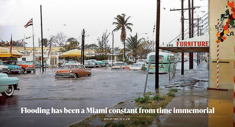
-
The models seem to all be coming into agreement that the warm front is going to set up to our south on Saturday. The good news: this puts most of our area in a really good location for overrunning, and we should get a fairly decent widespread soaking. The bad news: this will keep the warm sector south the DC/Baltimore metro, and you can kiss a warm Saturday goodbye. Areas well south of DC might still get warm, and *maybe* we all break into the warm air briefly during the evening, but it right now looks like most of us will have a much chillier Saturday daytime than we were expecting.
-
The 12z GEFS ensembles now lock the EPO ridge in place - that is a one day map, but the 5d for the end of the run looks very similar. It retrogrades the first EPO as we thought it would, and then almost immediately forms a new one. Does this pattern have more staying power than originally thought? Maybe. Some deterministic runs are portraying that scenario now. The EPO can be very difficult to break down once it forms. The 12z GEFS also has the NAO in place as well. Here are the comparison from 6z to 12z. The 12z Euro deterministic looks super similar to the 12z GEFS. That would mean that Larry is about to score the coup if it holds. He called that from November w/ analog forecasting and ENSO climatology. He was adamant. He might be within 7 days of that predicted pattern unfolding and hopefully holding. That look has precedent w/ previous Nina winters...just dig back through our threads. It looks the same as our recent Nina winters but the trough is nudged slightly eastward w/ more cold on the SE portion. That fits the cluster w/ -QBO reading and weak Nina winters. The QBO fell again during December to -26.92, and is a very low reading for that index. This could be a blip, or it could be a shift...but that is a pretty big move. Addendum: The 12z GEPS builds the EPO as well, but is a tad slower w/ the move. But the EPO rebuilding after the first cycle looks like a trend now at 12z. Even the EPS has moved AN height into the EPO region late in the run.
-
Heard you the first time champ
-
We do want phasing between what's left of the southern stream (ULL) and the northern stream (shortwaves embedded in the longwave trof) in the South. That initiates SLP formation along the Gulf and keeps the trof from progressively collapsing. This is more important for the mid-Atlantic, but also important for a bigger east coast event overall.
-
Good trends across guidance for the 15-16th period. Storm signal is there
-
2025-2026 ENSO
PhiEaglesfan712 replied to 40/70 Benchmark's topic in Weather Forecasting and Discussion
16-17 and 22-23 were my favored analogs at the beginning of the season. I always felt that December was going to be on the cooler side (this verified), but January and February were going to be warmer (looks like that's what's happening). [As I'm typing this, I'm using my fan for the first time since November. It's getting warm already!]