All Activity
- Today
-

2025-2026 ENSO
so_whats_happening replied to 40/70 Benchmark's topic in Weather Forecasting and Discussion
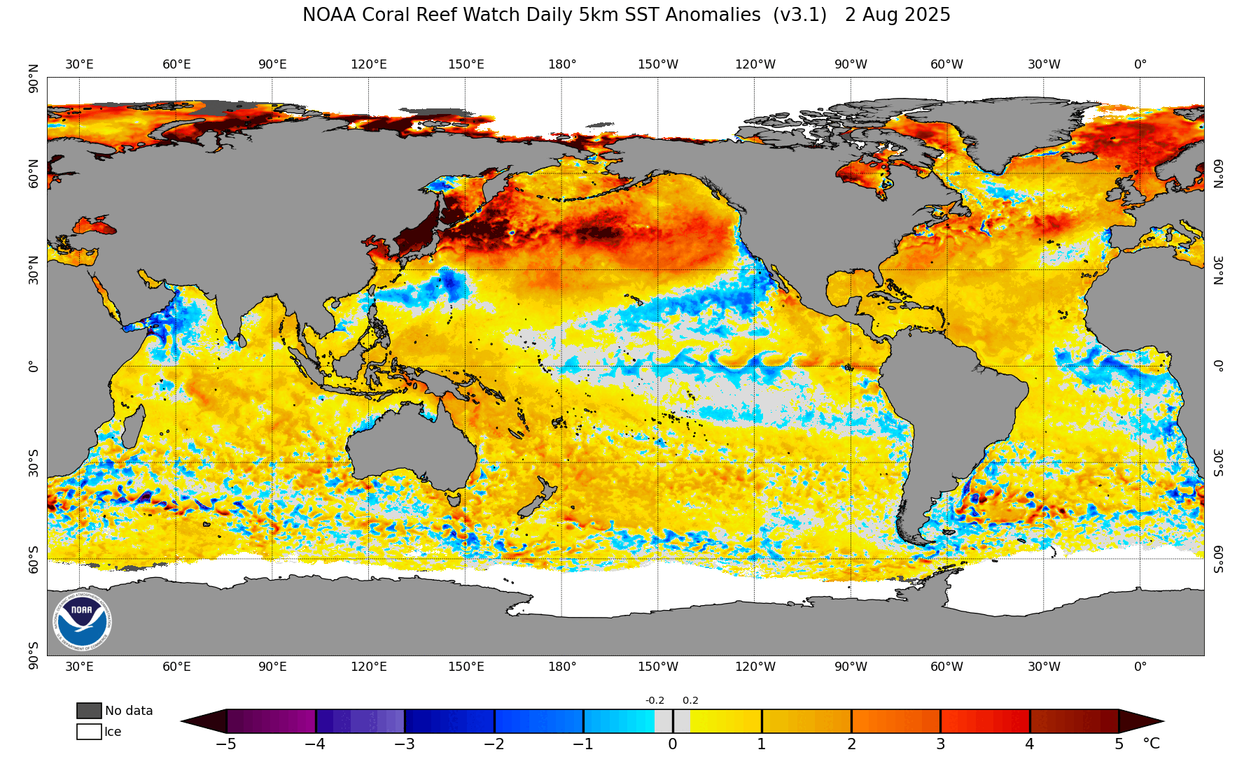
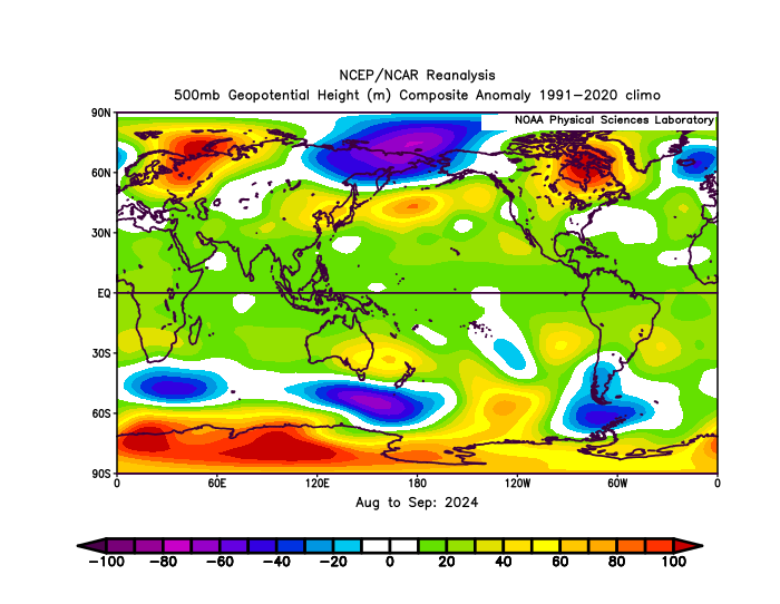
Never said it was going to warm back up only said the pattern is still well entrenched, but we are continuing to see changes occur (slowly). The storm track was much further north last year than this year. Here is the first 25 days of August last year and this year. (Can't get to the end of the month because it has not updated) Here is August and September last year storm track significantly further north and toward the Bering sea with a strong low.
-
-
Last year there was a parade of storms, tropical and extratropical, this year, nothing. Like you said, that’s going to warm right back up quickly
-
Yes it was crazy hot here and will be for several more days. Also in eastern WA, Spokane had a record high of 99F (previous 97F 1988) and on the regional roundup it was 101 at CDA and 100 at Colville WA which is just south of my location. A lot of small fires in that area too, nothing really close to my location. Quite a lot of forest fire smoke developing across Alberta now from fires in the Rockies and north central BC. Some of that smoke could appear in parts of the central U.S. soon.
-
Very interesting video. I liked they way he went through his reasoning. Now we wait...
-
2025-2026 ENSO
so_whats_happening replied to 40/70 Benchmark's topic in Weather Forecasting and Discussion
Nice little storm took place in the north Pacific this past week. Wiped a out some of the warmer waters, but still very much entrenched though. Need quite a few more larger systems to really knock it out. The most noticeable change from last year to this year is the cool pool is not set up in the Bering sea or gulf of Alaska.
-

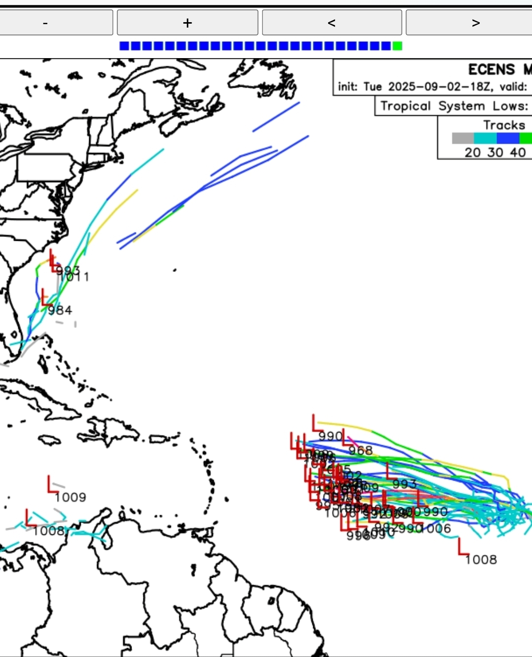
Eastern Tropical Atlantic Wave - 30/70
GaWx replied to BarryStantonGBP's topic in Tropical Headquarters
0Z UKMET: This run is back to a TD. Once formed, it remains the same strength. It is significantly further S than the prior run with a TD (24 hrs ago). At 168, it’s on a trajectory toward the Leewards only 150 miles away: NEW TROPICAL CYCLONE FORECAST TO DEVELOP AFTER 132 HOURS FORECAST POSITION AT T+132 : 13.3N 51.7W LEAD CENTRAL MAXIMUM WIND VERIFYING TIME TIME POSITION PRESSURE (MB) SPEED (KNOTS) -------------- ---- -------- ------------- ------------- 1200UTC 08.09.2025 132 13.3N 51.7W 1011 27 0000UTC 09.09.2025 144 14.1N 54.6W 1010 29 1200UTC 09.09.2025 156 15.0N 57.4W 1011 31 0000UTC 10.09.2025 168 16.0N 59.5W 1010 31 -
Yes i agree... I know it was a above normal year for most places in the Mid Atlantic up until about 5 weeks ago but the moisture has completely shut off since then ... Even most of the wettest areas probably barely hit 2 inches since ... Most areas likely between 0.25 - 1.50...
-

September 2025 OBS-Discussion centered NYC subforum
jm1220 replied to wdrag's topic in New York City Metro
Yawn. That is all. -

2025-2026 ENSO
PhiEaglesfan712 replied to 40/70 Benchmark's topic in Weather Forecasting and Discussion
The big difference is in 1+2. Last year was never going to behave like a la nina with that east-based el nino. -
Antilles notwithstanding, this looks like fish food to me.
-
I should probably know better, but I'm hopeful that a number of us will see a couple of tenths Thursday. It won't be a widespread soaker, and there will be some big losers, but the pre-frontal trough should initiate convection with some degree of organization Thursday afternoon.
-
My air conditioner hasn't ran for 9 straight days to close August and begin September. That's unheard of. I just leave the windows open at night and the house has dropped down into the mid-60s. The highest it's gotten inside in that time frame is 73. Looks like I will be able to keep the a/c off the rest of the week as well, as long as we can keep getting into the 50s at night.
-

Eastern Tropical Atlantic Wave - 30/70
cptcatz replied to BarryStantonGBP's topic in Tropical Headquarters
18z euro ensembles are quite interesting
-

September 2025 OBS-Discussion centered NYC subforum
Sundog replied to wdrag's topic in New York City Metro
When I mean dry sucks I don't mean I want 75 degree dewpoints and thunderstorms. I want cool, all day light to moderate rain events mixed in. If it's too dry it ruins the fall color. -

September 2025 OBS-Discussion centered NYC subforum
Irishmick9 replied to wdrag's topic in New York City Metro
Pretty smoky here in Vernon all of a sudden. Must be the fire in W Milford on Clinton Road that is new. Hope we don’t have a repeat of last fall. . -
Eastern Tropical Atlantic Wave - 30/70
cptcatz replied to BarryStantonGBP's topic in Tropical Headquarters
18z Euro: significantly weaker, slower, and further south than 12z. Maybe a trend? -

September 2025 OBS-Discussion centered NYC subforum
anthonymm replied to wdrag's topic in New York City Metro
Agreed, fall foliage sucked last year cause of the drought. If we don't get a drought buster soon it's gonna get bad -
Can't believe drought monitor only shows D0: https://droughtmonitor.unl.edu/ Seems a few days behind though.
-
I think it is both, but cooler nights with warm days (sorta like doing maple syrup in spring!) is supposed to make better color. I've had lows in the 40's for 8 mornings in a row now, that breaks the 7 nights in 40's for 8/18-8/24 of 1981. A couple times I've had 4 days in a row in August into early Sept in 2008, 1998 and 1983.
-

September 2025 OBS-Discussion centered NYC subforum
the_other_guy replied to wdrag's topic in New York City Metro
If we are doing opinions, I think its great. The drier summers and the somewhat normal sept temps last year (and so far this year) are a nice change from Florida humidity and Septembers of +5 -

September 2025 OBS-Discussion centered NYC subforum
Roger Smith replied to wdrag's topic in New York City Metro
Don, as you were saying a few days ago, records are tumbling in the western interior regions and I think it's close to certain that in Canada we would break the monthly record of 38+ C you mentioned (from Ontario in 1881) ... where I live it feels very close to 40 C today, waiting to see what records were broken when they do the weather segment on our local news (they are pretty diligent at reporting records). I will post any that I see although I know you have sources for them. It was hot like this at the opening of Sept 2016 also, and eventually I think that spread east. -
This pattern reminds me of living in San Diego. Blessed the weather has been so perfect and comfortable, but damn it I’m getting bored with the lack of variety too lol
-
It’s crazy how the dry air really allows temps to take off during the day and of course, drop off just as fast in the evening when the sun sets. Reminds me of the first half of April.
-