All Activity
- Past hour
-
 The good news with that set up is you pump humid air out ahead of it with good pwats and it won’t take much to tally up some quick appreciable rainfall in New England as the front lifts NEward.
 - Yesterday
-
Agree with you.... 1.48 here for the entire month... Northern Waynesboro across the SNP into the western / northwestern areas of Albemarle is extremely dry and dusty now... Very very low water levels in the Moormans / Doyles river basins in north western Albemarle.... Not surprising thats where the extreme drought is still showing on the drought monitor... Loud thunder outside with zero rain again from a storm south of town where there have been repeated deluges this month...
-

2026-2027 Super El Nino
LakePaste25 replied to Stormchaserchuck1's topic in Weather Forecasting and Discussion
I don’t think it’s a cop out. If it statistically argues so (which is absolutely does for the mid Atlantic) there’s no reason to pretend that it doesn’t. -
Future's bleak
-
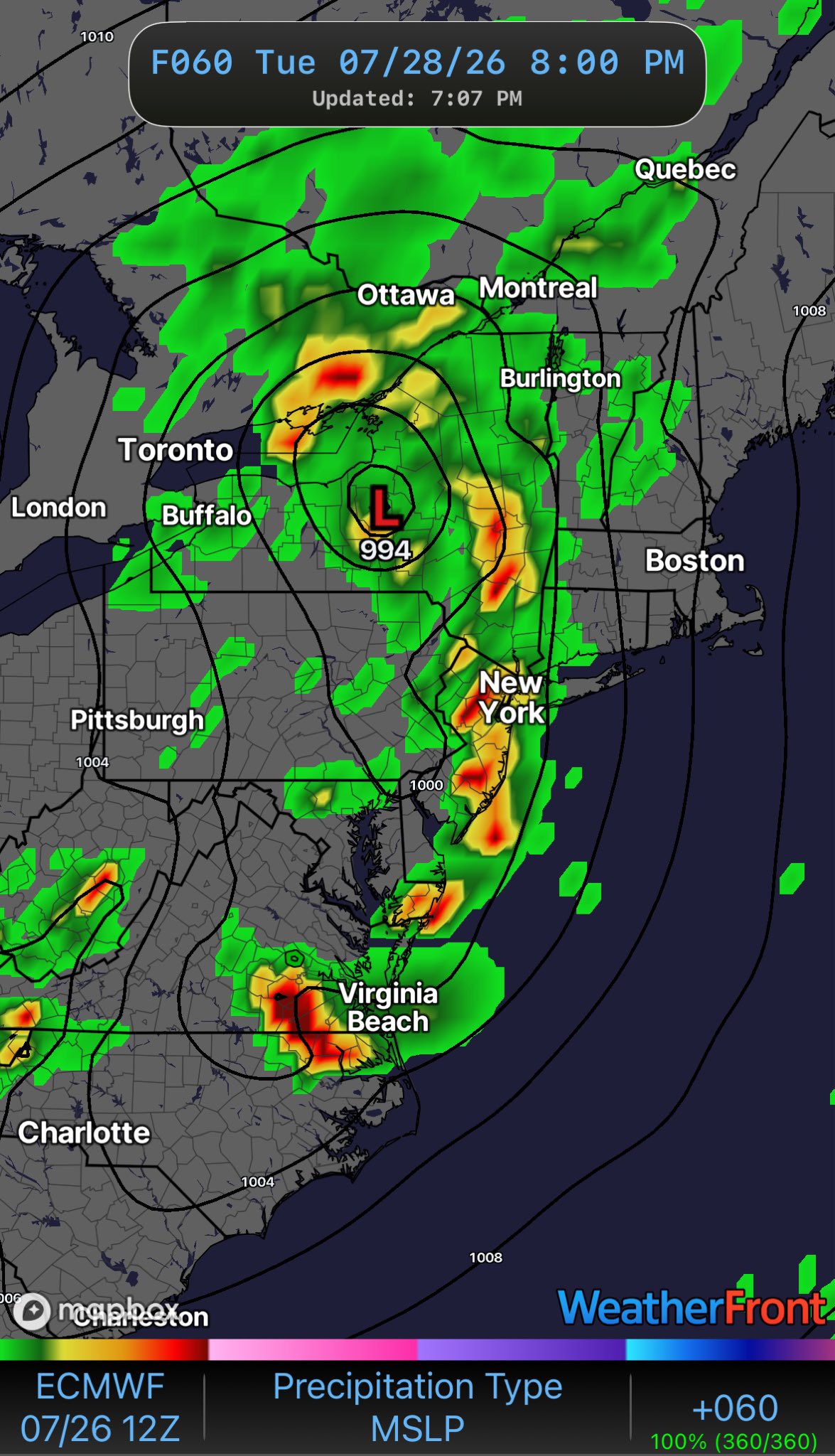
 Wagons NW
-
No . You are thinking about early month . Nailed the last one as well
-
 Agreed
 -
Fundamentals are killing this team. That's 3 games this week alone a lack of fundamentals cost the O's a win. Today in extras, why is Alonso even moving off the bag? The ball is in the air, it's either a base hit, in which the winning run scores from 3rd, or a line out. You don't run on contact in that situation either way!
-
The Orioles Still Cannot Hit Offspeed Pitches. Mike Elias Is Only Making The Problem Worse The Orioles growing list of failed prospects have too much in common and are symptoms of an organizational disease https://www.si.com/mlb/orioles/onsi/the-orioles-still-cannot-hit-offspeed-pitches-mike-elias-is-only-making-the-problem-worse-01ky8djg6v54?page_source=v_recirc
-
Continuation of the summer theme. Same winners and losers over and over again.
-

2026-2027 Super El Nino
snowman19 replied to Stormchaserchuck1's topic in Weather Forecasting and Discussion
We are breaking a bunch of 1997’s records. We are on the verge of easily surpassing 1997’s subsurface warmth. The OHC has broken 1997’s record, which was +2.5C, we are at +2.8C, this ongoing WWB is record-breaking, much stronger than the one that occurred around the same time in 1997, the associated DWKW is also stronger. This -SOI run is breaking 1997’s record. We are warmer in both region 3.4 and region 3 and we are virtually neck and neck in region 1+2: WWB: Region 3 is forecasted to go off the charts: The 30C isotherm is further east than 1997 (east of the dateline) and still going: “2026 for the win! Part of the present advantage is the ongoing westerly wind burst timed later than the corresponding one in 1997 (which was late May/early June). This year's summer wind event was longer and ultimately stronger. The 30C isotherm east of the dateline continues to support the extreme potential for this event.” -
it’s tentative but we may be seeing a spring 2023-like global thermal surge beginning. Air and sea presently lurching in tandem.
-
Hopefully Lake Ontario with be bath water when the some strong arctic airmass flows over it. A wicket LES band with insane rates along with snownados (happens) hitting the Upper Tug would make my day.
-
 The models seem overly sensitive/bad physics somehow in these feathery weak gradients/higher thickness synopsis. I mean look at the NAM. All protestations aside … still, it takes a thunderstorm complex over Milwaukee, turns it in a small low then counties evolve it from these spontaneous looking origins as it carries it to the Del Marva … where uses it to generate -2 relative to season SD 990mb coastal gale … I guess I dunno part of me just wonders if we’re getting a reality check fake out when we’re on top of the thing … something less “engineered” By the way … it’s tentative but we may be seeing a spring 2023-like global thermal surge. Air and sea presently lurching … we’ll see
 -
 Yep that be you.
 -
Burlington is 92/85/120 Ames is 92/86/123 This is as high as the dew point ever gets around here. It's only 83 here.
-
Dewpoint mixed out into the mid 60s so we had easy today even with a high of 98.
-
Not for nothing but weren't you the fella who called for a half inch during the last gully washer?
-
.thumb.gif.f92b16c631a1d15d405ed77b33f0710d.gif) Some will get 1-3", some will get more, some will get less (Stein). That's not a difficult forecast
Some will get 1-3", some will get more, some will get less (Stein). That's not a difficult forecast -

2026 Spring/Summer Mountain Thread
Maggie Valley Steve replied to Buckethead's topic in Southeastern States
The SW Mountains and NE Georgia might want to keep eye out for overnight thunderstorms moving in.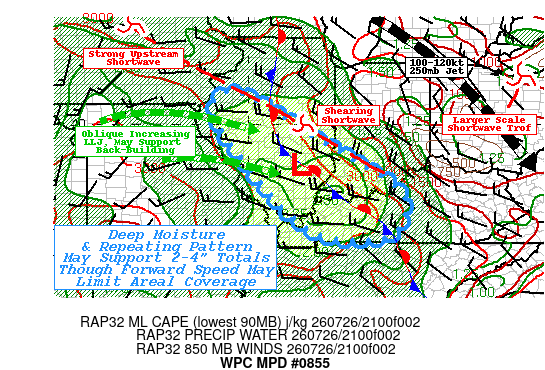
-
 I think there’s pretty good potential for a good 1-3” over a widespread area. Someone will get much more where it pivots. You have instability working in over high theta e converging on a warm front.
 -
The whole thing went from SNE Jack to mainly NY state . You haven’t been looking daily while on vaca . We will get some rain obviously but wagons west for 1-5”+ etc .Pretty evident today
-
People still drinking in here
-

2026-2027 Super El Nino
Stormchaserchuck1 replied to Stormchaserchuck1's topic in Weather Forecasting and Discussion
Everyone was saying 1998-2025 SOI was such that it is probably biased positive now. This is about as respectable as a downward drop as you will see. Here's the last 2 days.. 90-day and 30-day are both below -20 now. 26 Jul 2026 1011.41 1015.60 -31.64 -25.66 -20.20 25 Jul 2026 1011.59 1015.45 -29.61 -25.54 -20.06 This is turning into a top-5 -SOI event since the 1800s, so yeah it's probably not biased positive with AGW. -
It's an interesting coincidence. There's really no close comparison. I also doubt that the coming winter will be a close comparison.