All Activity
- Past hour
-
August 21 1918: Minnesota's third deadliest tornado strikes Tyler and destroys the downtown area, leaving 36 dead. 1886: High winds hit Northfield with winds blowing at 60 mph for 20 minutes. Peak gusts up to 75-80 mph are recorded. 1883: The 4th deadliest tornado in Minnesota history hits Rochester. The tornado kills 31 residents and injures 100 more. Appalled by the lack of medical care received by the tornado's victims, Mother Alfred Moes, founder of the Sisters of St. Francis, proposes to build and staff a hospital if Dr. W.W. Mayo will provide medical care. St. Marys Hospital opens in 1889 with 27 beds and eventually grows into the Mayo Clinic. For Friday, August 21, 2026 1856 - The Charter Oak was an unusually large white oak tree growing from around the 12th or 13th century until it fell during a windstorm on this day in 1856. According to tradition, Connecticut's Royal Charter of 1662 was hidden within the hollow of the tree to thwart its confiscation by the English governor-general. The oak became a symbol of American independence and is commemorated on the Connecticut State Quarter. 1883 - An estimated F5 tornado caused extensive damage to Rochester Minnesota on this day. The enormous roar was said to have warned most Rochester residents, as the massive funnel cut through the north side of town. Over 135 homes were destroyed, and another 200 damaged. Many of the 200 plus injuries were severe, and other deaths probably occurred but not listed as part of the 37 total mentioned. This damaging tornado eventually led to the formation of the Mayo Clinic. 1888 - A tornado swarm occurred in Maryland and Delaware. Many waterspouts were seen over Chesapeake Bay. (Sandra and TI Richard Sanders - 1987) 1893 - Four hurricanes are observed in the Atlantic Ocean at the same time. Over a century would pass, 1998 before four hurricanes would again rage together in the Atlantic. 1918 - A tornado struck Tyler, MN, killing 36 persons and destroying most of the business section of the town resulting in a million dollars damage. (David Ludlum) 1983 - The temperature at Fayetteville, NC, soared to 110 degrees to establish a state record. (The Weather Channel) 1987 - Early morning thunderstorms produced severe weather in eastern Iowa and west central Illinois. Thunderstorms produced wind gusts to 82 mph at Moline IL, and tennis ball size hail at Independence IA. Rock Island IL was drenched with 3.70 inches of rain. Total damage for the seven county area of west central Illinois was estimated at twelve million dollars. (National Weather Summary) (Storm Data) 1988 - Thunderstorms spawned several tornadoes in Iowa, produced wind gusts to 63 mph in the Council Bluffs area, and drenched Sioux Center IA with up to 6.61 inches of rain. (Storm Data) (The National Weather Summary) 1989 - Afternoon and evening thunderstorms produced severe weather from Kansas to Minnesota and North Dakota. Thunderstorms in Minnesota produced baseball size hail from Correll to north of Appleton. Thunderstorms in north central Kansas produced wind gusts higher than 100 mph at Wilson Dam. Thunderstorms around Lincoln NE produced baseball size hail and up to five inches of rain, and Boone NE was deluged with five inches of rain in an hour and a half. (The National Weather Summary) (Storm Data) 1994 - Hurricane John, about 345 miles south of Hilo, Hawaii had winds of 175 mph and pressure at 920 millibars or 27.17 inches of mercury, making it one of the strongest hurricanes ever in the Central Pacific. The 31-day existence made John the longest-lasting tropical cyclone recorded in both the Pacific Ocean and worldwide, surpassing both Hurricane Tina's previous record in the Pacific of 24 days in the 1992 season and the 1899 San Ciriaco hurricane's previous world record of 28 days in the 1899 Atlantic season. John was also the farthest-traveling tropical cyclone in both Pacific Ocean and worldwide, with distance traveled of 7,165 miles, out-distancing previous record holders Hurricane Fico in the Pacific of 4,700 miles in the 1978 season and Hurricane Faith worldwide of 6,850 miles in the 1966 Atlantic season. Observances: 21 Fri Senior Citizens Day 21 Fri International Day of Remembrance and Tribute to the Victims of Terrorism 21 Fri National Spumoni Day 21 Fri Hawaii Statehood Day 21 Fri Internet Self-Care Day 21 Fri National Brazilian Blowout Day 21 Fri National Report Upcoding Fraud Day 21 Fri National Senior Citizens Day
-

Augdewst 2026: Summer's Last Stand
Snowedin replied to Prismshine Productions's topic in New England
Getting a few pretty intense showers here atm..nothing too heavy but it really has that mid April look outside with the sky and intermittent rains along the coast. Def gotta feel for those who’ve planned cape vacations this weekend too. Hopefully many sweatshirts and buckets of popcorn are on hand! -
.75" for yesterday
-
 http://primemensrx.com/# Cheap generic Viagra
 -
I drove home from my son’s swim around 8pm from patchogue back to west babylon. The rain was so heavy people were pulling over. Intense stuff then my mother in law who was in Atlantic beach when the tornado hit land texted us she saw all the activity because they were a half mile from it
-
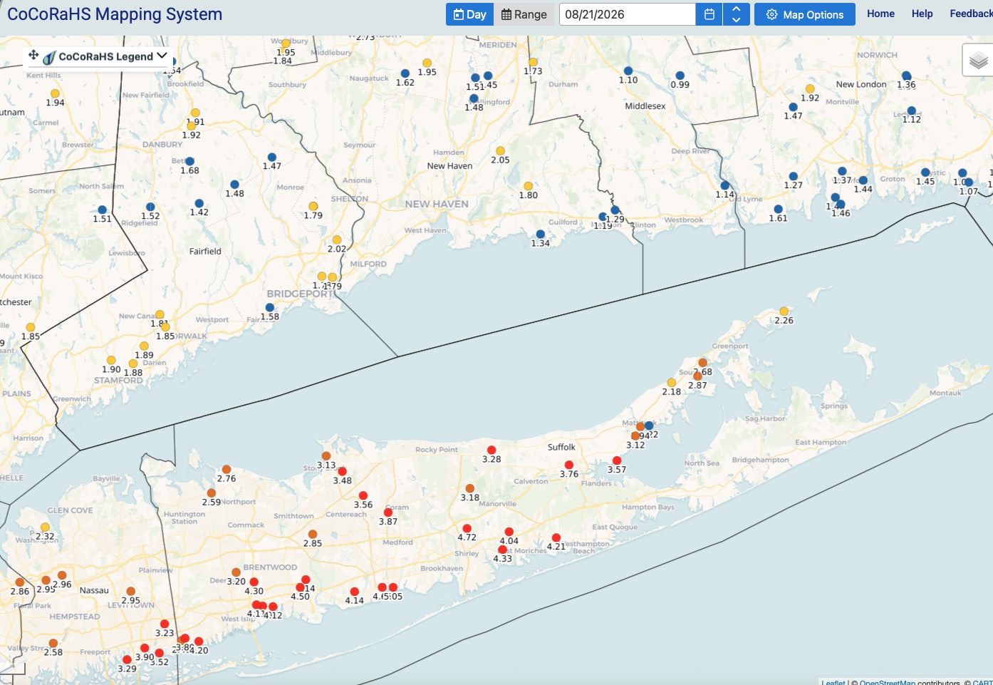
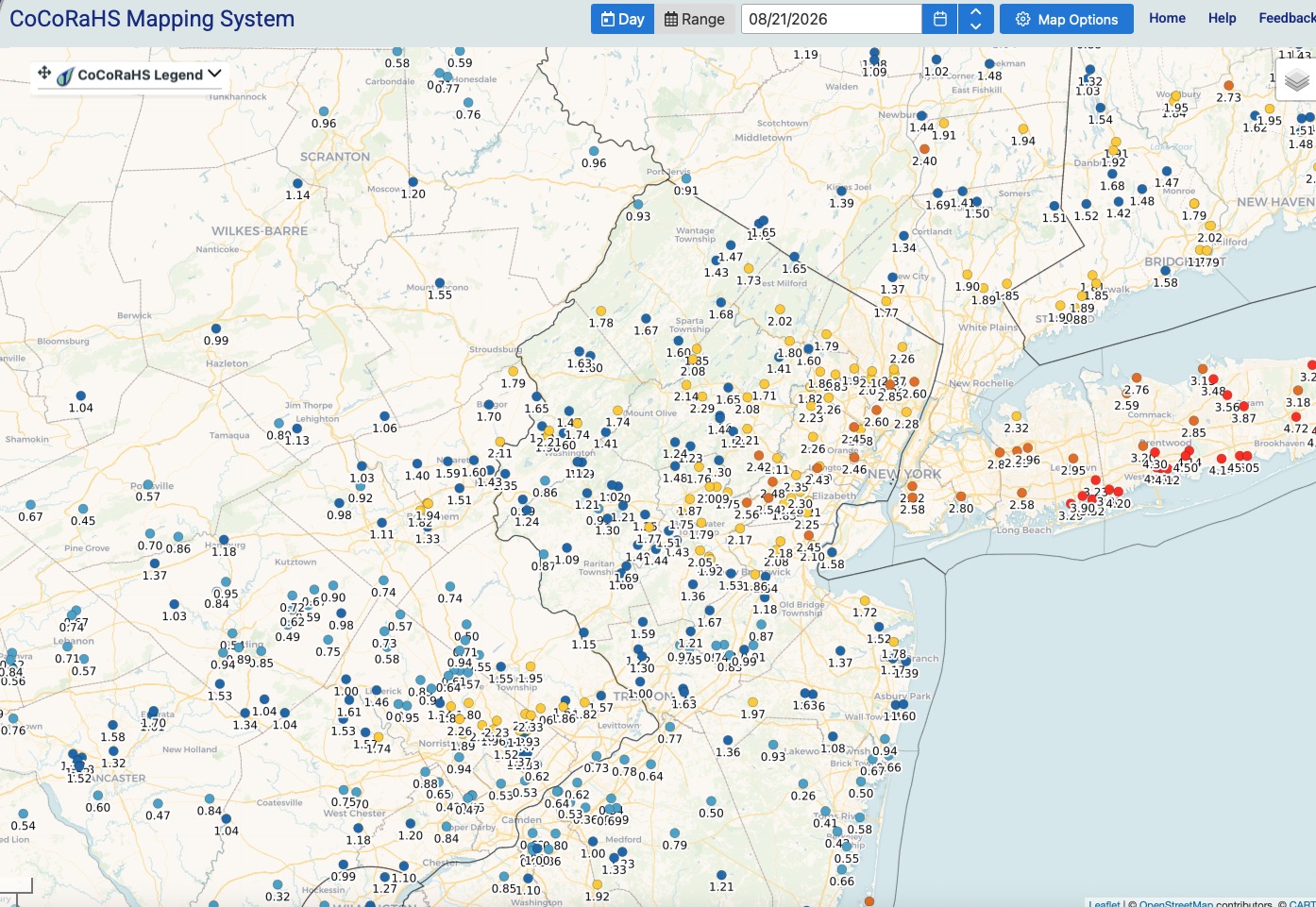
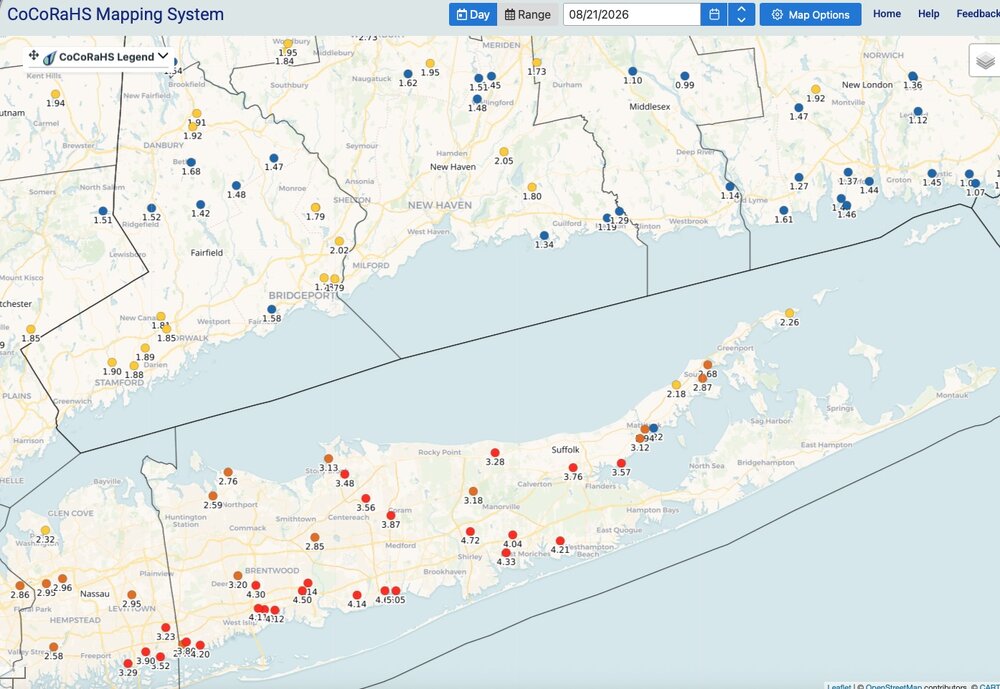
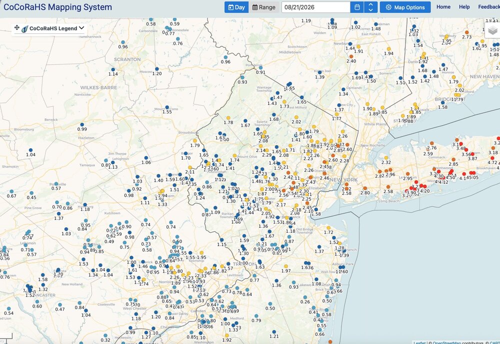
Solid soaking for everyone. Most guidance did well showing where the max area of rainfall would end up from NYC on east. Was expecting 1-2" here and ended up with 2.14". Lesser amounts just NW of here up into Sussex County with generally 1 to 1.5" up that way. Either way everyone has had enough rain lately! Meteorological Summer which has 10 days left to go has been wet. In some places VERY WET.
-

Augdewst 2026: Summer's Last Stand
WxWatcher007 replied to Prismshine Productions's topic in New England
Low of 46 here at WXW2. Low of 37 at SLK. We cleared out last night and the temp fell like a rock. -
some events they have to make in advance for vendors etc...but sucks when you cancel then it ends up ok.
-
Excellent shots!
-
Another Flooder for the South Coast. 8/20/26
WxWatcher007 replied to Sey-Mour Snow's topic in New England
1.31” -
Thanks for the context. It makes sense now!
-

Augdewst 2026: Summer's Last Stand
weatherwiz replied to Prismshine Productions's topic in New England
I feel like September is going to be quite the interesting month. There is still potential for us to get another surge of upper 80's and 90's for many but some signals too we could start seeing some stronger troughs sliding across Canada and northern tier of the country. That should yield some interesting weather chances -
Order Viagra 50 mg online [url=http://primemensrx.com/#]PrimeMenRx[/url] Cheapest Sildenafil online
-
Yeah. Looks like a decent day.

-
Yeah and I saw so many cancellations 3 and 4 days out
-
So much for the big torch to end the month. No idea what they were looking at.
-
Nice little lake in Riverside Park this morning. Dogs were swimming in it.

-
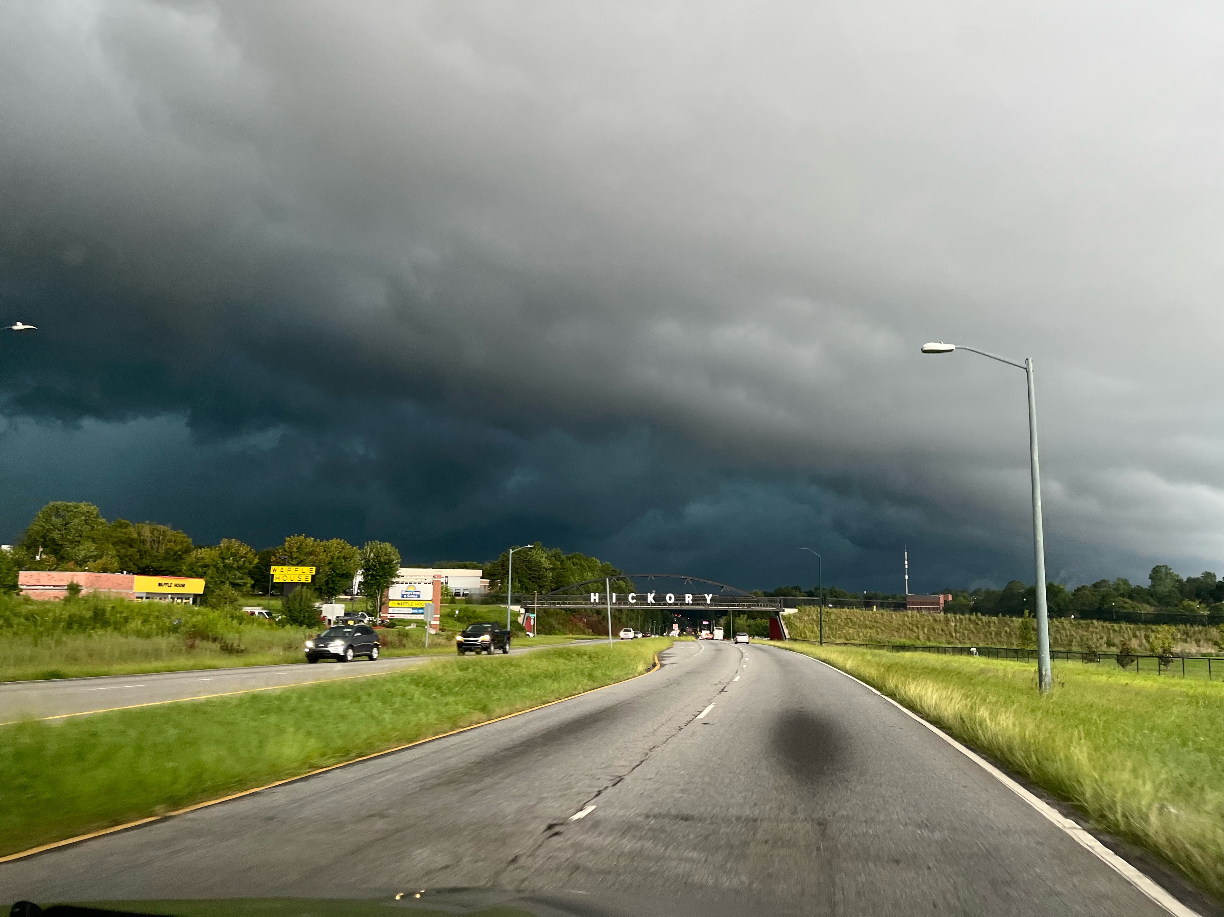
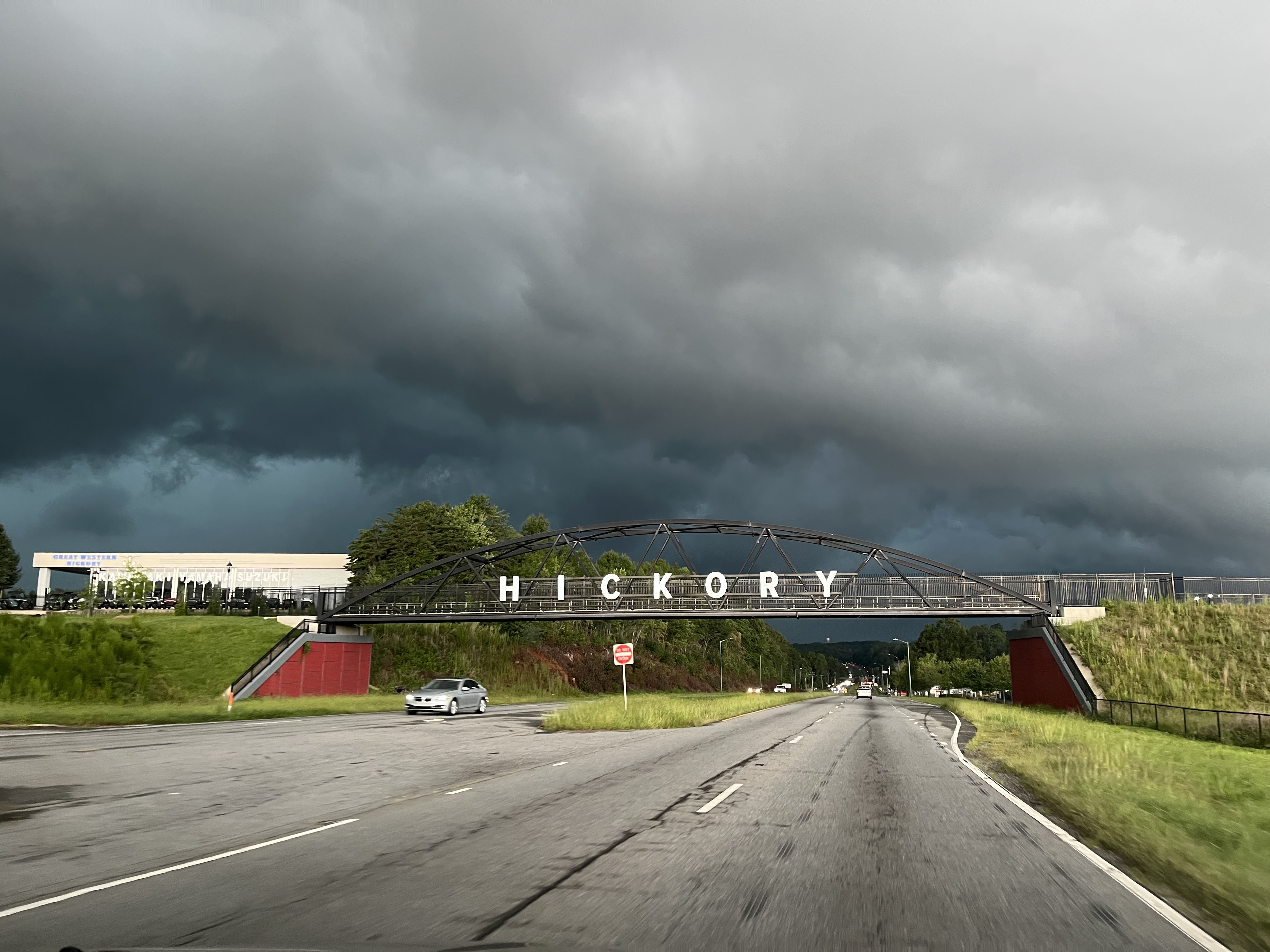
Amazing looking storm. Insane rain once it hit, too. Here’s a couple pics I took.
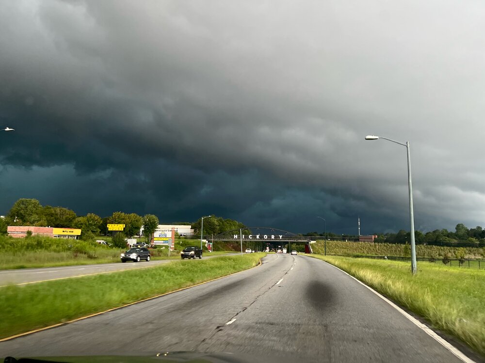
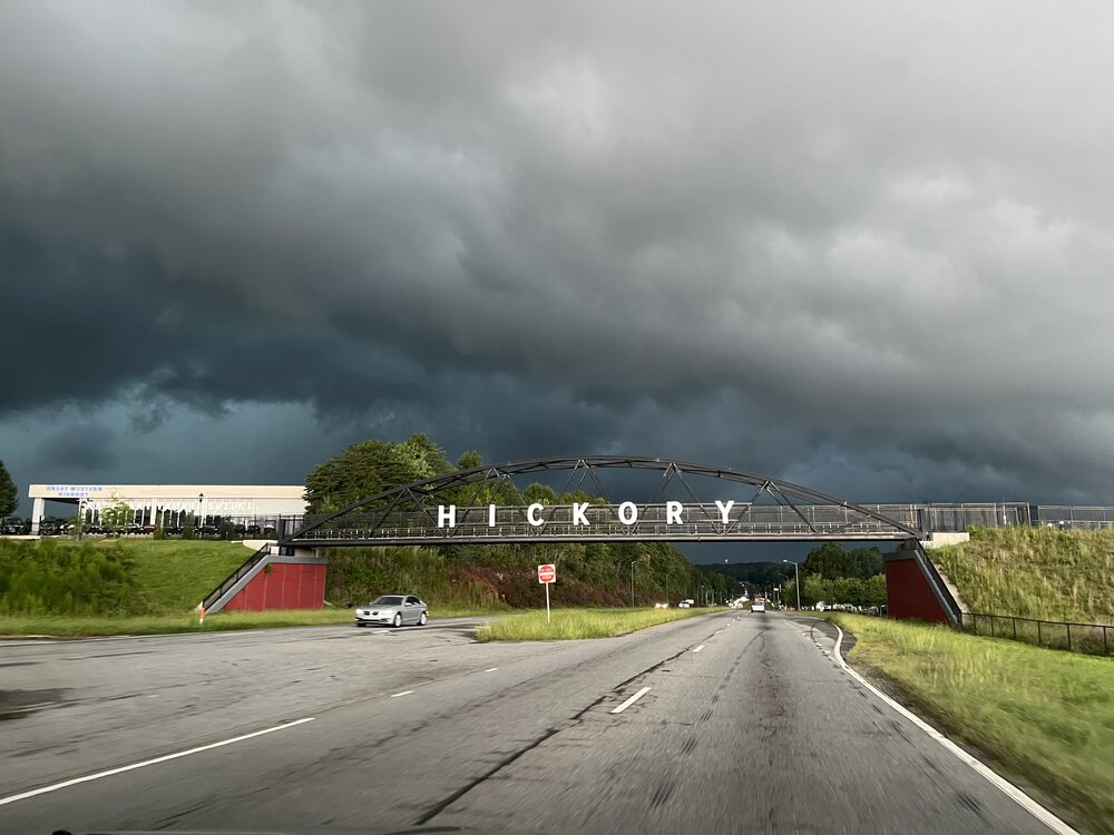
- Today
-
Kick this shit out of here so we can beach.
-

Augdewst 2026: Summer's Last Stand
Brian5671 replied to Prismshine Productions's topic in New England
looks dry western sections for sure tomorrow. Cloudy and cool but I'll take it. -
I wasn't home but it looks like 1.8 around my hill. Of course, I got a UPS delivery a few hours before the rain and it's still sitting there because the neighbor forgot to grab it
-
Didn't realize how blessed I was yesterday
-

Central PA Summer 2026 Discussion/Obs Thread
Mount Joy Snowman replied to Voyager's topic in Upstate New York/Pennsylvania
Low of 58 to go along with 1.28" of rainfall. I expect the NWS to confirm a tornado touchdown near the Wrightsville/Columbia area today. Even over my way the low clouds had some serious rotation to them. Impressive event. -
We nearly had a repeat of the August 2025 flash flood last night. It hit Ringgold and Catoosa county instead. 6" of rain in less than 3 hours.
-
Augdewst 2026: Summer's Last Stand
weatherwiz replied to Prismshine Productions's topic in New England
maybe we net some small hailers Sunday