All Activity
- Past hour
-

December 2025 Short/Medium Range Forecast Thread
Holston_River_Rambler replied to John1122's topic in Tennessee Valley
No worries at all. I've been trying to think of some way to contribute, but I'm kind of burned out on looking at tropical convection, lol. -
December 2025 Short/Medium Range Forecast Thread
Holston_River_Rambler replied to John1122's topic in Tennessee Valley
I've been thinking about weighing in on the MJO stuff, but I'm not really sure what I make of it. This sort of mess is new to me: For what seems like most years lately, its been doing this loop d loop mess between 5 and 6. When I look at the Maritime Continent region, it basically looks how it has looked to me for most of the times I've looked at it over the past few years: Sahara satellite just because it is so fun: So what are we looking for wrt tropical convection and why? I can look at the RMMs as well as anyone and see where it is, but I'd like to start to dig deeper. I'm going to poke around in this article for a while and see if I can come up with a useful summary: https://journals.ametsoc.org/view/journals/wefo/29/1/waf-d-13-00102_1.xml -

December 14th - Snow showers or Plowable snow?
CCHurricane replied to Sey-Mour Snow's topic in New England
A parting view on the ride out of town last night.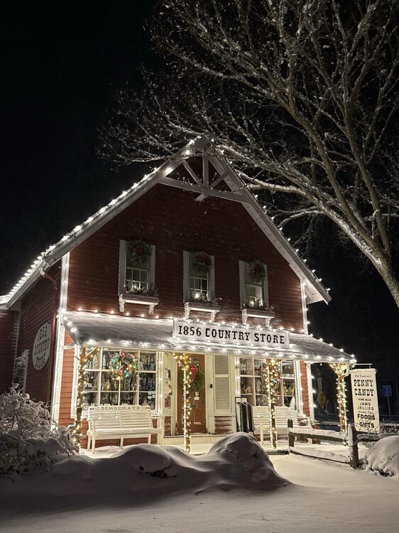
-
(002).thumb.png.6e3d9d46bca5fe41aab7a74871dd8af8.png)
E PA/NJ/DE Winter 2025-26 Obs/Discussion
ChescoWx replied to LVblizzard's topic in Philadelphia Region
Mood flakes here in East Nantmeal 19.9 degrees....light dusting on all surfaces -

December 2025 Short/Medium Range Forecast Thread
Matthew70 replied to John1122's topic in Tennessee Valley
No reason to apologize, sir. You are a wealth of information and fun to learn. -
December 2025 Short/Medium Range Forecast Thread
Matthew70 replied to John1122's topic in Tennessee Valley
True. -AO are known to make this area cold. Just curious how the -WPO affects us. Add with that a MJO in phase 8. Good gracious all these teleconnections. Was nice years ago when it never was even discussed. Seems today’s times are so confusing. Simple days of forecasting are long past. -
Genuinely curious--could you provide some examples?
-
Most of us on here describe lows which track to our west as a cutter. Sometimes they ride north of the Great Lakes traveling from west to east. Other times they start out near the Gulf or Southeastern States and lift up through the Eastern Lakes anywhere from Cleveland to Eastern PA into Canada. Either way parts of the region at least make into at least the 50s with mostly rain for our area. The strongest cutter that I experienced since the 1990s was 11-11-95. A deep low rode north near the APPS into Canada and a secondary developed just to our west. This delivered 70-75 mph gusts in Long Beach which the western half of town losing power for nearly 24hrs. The worst flood cutter I remember here was later in January 1996 with a deep snowpack. All the roads were like rivers in Long Beach as the giant snow piles on the side of the road blocked the storm drains. The most recent damaging flood cutter upstate was 12-25-20. The 40” +record snow pack rapidly melted and lead to serious flash flooding with 1.50” of rain and landslides damaging the ski resorts.
-

December 2025 Short/Medium Range Forecast Thread
Golf757075 replied to John1122's topic in Tennessee Valley
A -nao with a -ao would be ideal for us. I don't mind a pattern reset, as long as we can get back to cold thereafter. -

Central PA Winter 25/26 Discussion and Obs
AccuChris replied to MAG5035's topic in Upstate New York/Pennsylvania
Picked up about 1/3” here in Lebanon and it covered everything quickly. Temp down to 20° . -
15.8 this morning. But looks like a mild trend coming up for the 2nd half of December.
-

December 2025 regional war/obs/disco thread
Great Snow 1717 replied to Torch Tiger's topic in New England
Page hits.. -
lol why ask? Sometimes you need to consider the source and just move on.
-

2025-2026 ENSO
michsnowfreak replied to 40/70 Benchmark's topic in Weather Forecasting and Discussion
December can be the coldest month in la nina, but doesn't mean the other 2 months "torch". Also, this December has been more than "cool" so far. -
No. Wrong BAM.
-

Central PA Winter 25/26 Discussion and Obs
CarlislePaWx replied to MAG5035's topic in Upstate New York/Pennsylvania
Near 7:00pm the temp is holding near 21 degrees. The snow flurries/showers is still continuing. That makes 3 hours with it still snowing, just very light. My meltdown will be forethcoming. - Yesterday
-
They did all they could to let the giants win but got the W
-

Central PA Winter 25/26 Discussion and Obs
canderson replied to MAG5035's topic in Upstate New York/Pennsylvania
Used my new leaf blower for this .5” of powder - how fun! -
December 2025 Short/Medium Range Forecast Thread
Holston_River_Rambler replied to John1122's topic in Tennessee Valley
Heck if I know a good answer for either of the above. Sorry. That could be interesting. There has been some on again, off again talk about a potential -NAO across the boards, depending on your source based on either wave breaks in the N. Atlantic or strat. stuff from around a month ago. Could be a little bit of both. If an Greenland block kisses an Aleutian block we might get some fun as suggested in fantasy land on the 18z GFS: 500mb: The surface has fine looking Canadian high dripping down into the CONUS: One thing about this pattern is that it's blocky is some spots in the N. Hemisphere, not just the Aleutians. I have some family in Europe right now, so I have been watching there a little more than usual and they have some intersting patterns progged by the Euro and GFS: Could you imagine if we had a pattern like that in the US? Highs over top and a series of meandering lows to the south. -
I made my family open presents yesterday. White Christmas accomplished.
-
Awesome stuff brother! When you have a chance it would be interesting to see the top 5 least snowy periods in the foothills over the last 75 years with the snow drought we have going on now. Great data here! Thanks buddy!
-

Central PA Winter 25/26 Discussion and Obs
Blizzard of 93 replied to MAG5035's topic in Upstate New York/Pennsylvania
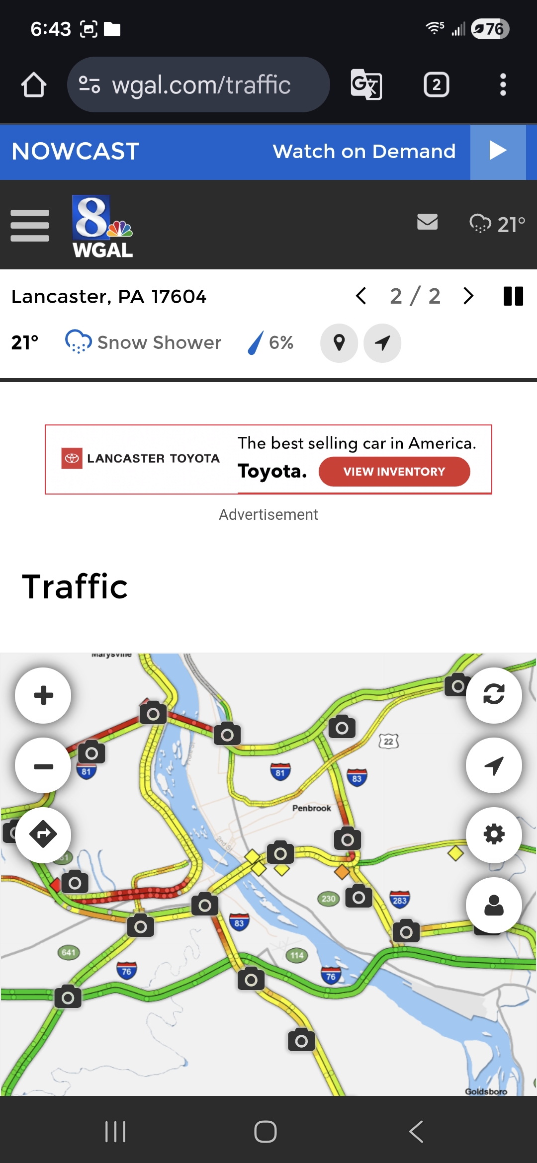
The Euro is the only model that I could find that had it at 12z just as @mitchnick mentioned a little earlier. CTP had a 20% chance of a snow shower. Even a special weather statement for the LSV would have been nice especially with it hitting at rush hour. I-81 was crawling & road conditions were not great. My normal 15 minute commute was more than doubled.
-
I was thinking 69 and 44 lol
-
.thumb.jpg.6a4895b2a43f87359e4e7d04a6fa0d14.jpg)
Central PA Winter 25/26 Discussion and Obs
Yardstickgozinya replied to MAG5035's topic in Upstate New York/Pennsylvania
as I said earlier roads are pretty bad.Probably best for people to stay home. Things aren't a whole lot better yet. Probably no reason to go out and make things harder for first responders.
-
Central PA Winter 25/26 Discussion and Obs
Blizzard of 93 replied to MAG5035's topic in Upstate New York/Pennsylvania
I just measured .4” in Marysville! Beatuful surprise snow to freshen up the snow pack.