All Activity
- Past hour
-
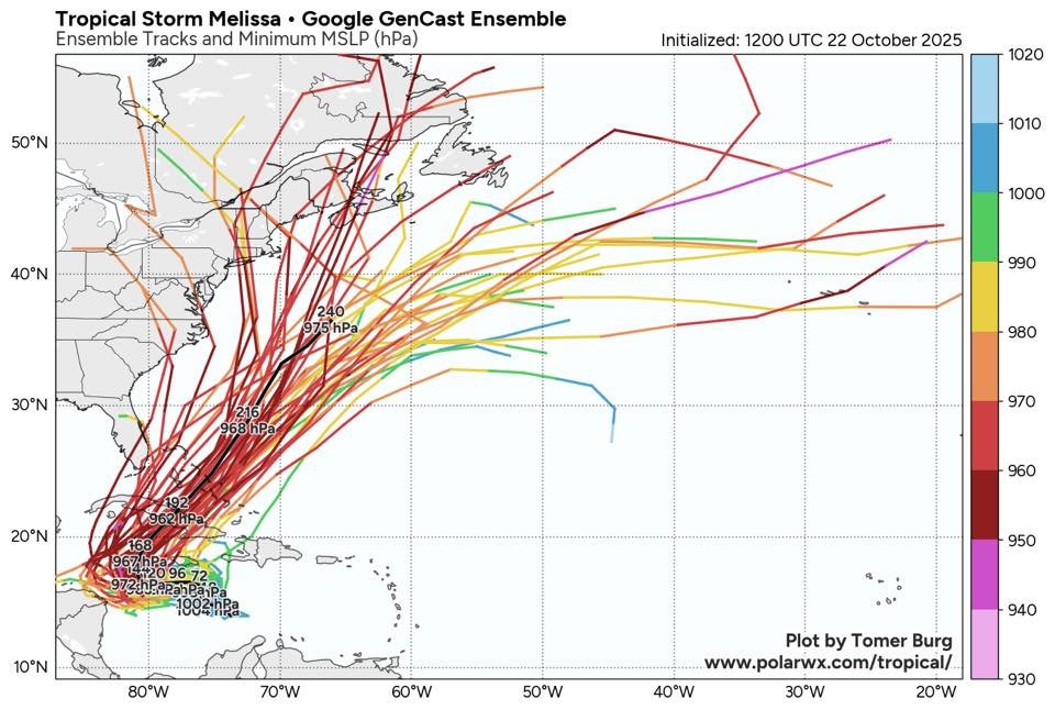
18Z Euro gives much of Jamaica near or just over 20” qpf with heavy rain still likely continuing for a few more hours with the storm still centered over SW Jamaica and SLP way down at 943 mb; it’s then moving slowly NNE while SSE of a strong upper trough that’s then over the E US.
-
Because us moderators dont have the ability to 5 post, and banning certain ppl just makes our jobs harder because ip banning makes no difference. Plus i cant immediately respond to every time he posts nonsense. I try to keep up on days im around more.
-
Verified much cooler than model guidance again this morning. MRX low forecast was 40, it was 35 and frosty.
-

E PA/NJ/DE Autumn 2025 Obs/Discussion
Birds~69 replied to PhiEaglesfan712's topic in Philadelphia Region
I wasn't really expecting anything but maybe a quick shower. Looked at the radar at 9:00 p.m. and said that's going to be more than a shower. If cold that would have been a nice little snow surprise...1-2" with a little more in some areas. .. . -
65 today. Slip sliding away into deep autumn
-
Got through 2 minutes and fell asleep
-
The rest of the mountains will get there's tomorrow night.
-
Avery-Yancey-Mitchell- Including the cities of Busick, Poplar, Celo, Newland, Spruce Pine, Burnsville, Ramseytown, Ingalls, Micaville, Banner Elk, and Swiss 153 PM EDT Wed Oct 22 2025 ...FREEZE WATCH IN EFFECT FROM LATE THURSDAY NIGHT THROUGH FRIDAY MORNING... * WHAT...Sub-freezing temperatures as low as 28 possible. * WHERE...The northern mountains of North Carolina. * WHEN...From late Thursday night through Friday
-
I think the 12z GGEM might have been listening in.
-
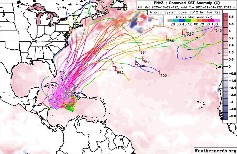
I really hope it doesn't get that bad, with stalling, for Jamaica.
-
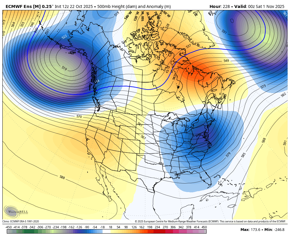
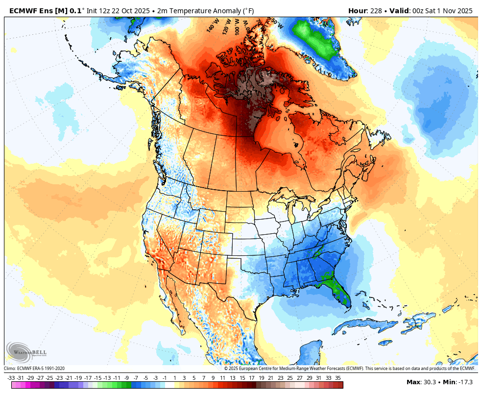
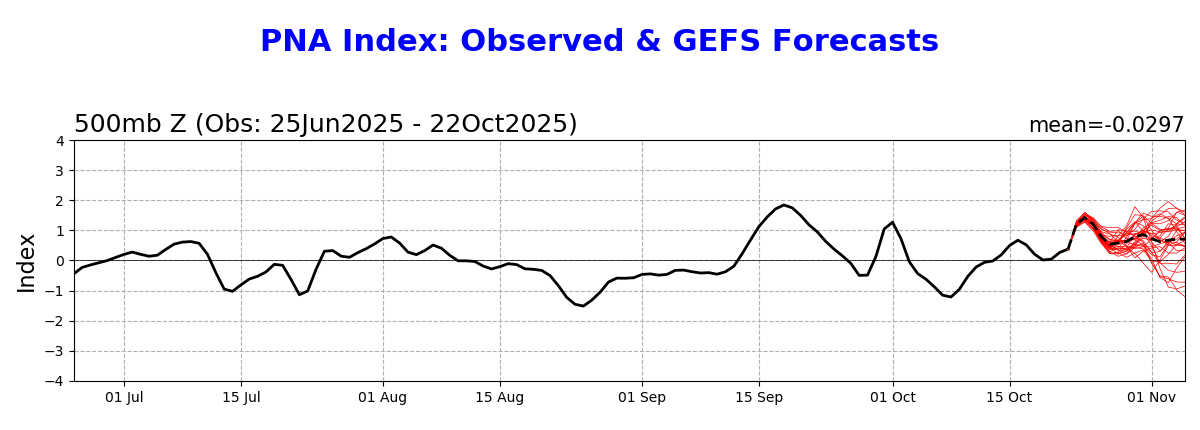
I love this look for Halloween with quite a chilly one in much of the E US! Nice +PNA:


-

Spooky Season (October Disco Thread)
bkviking replied to Prismshine Productions's topic in New England
October 21, 2012 CMC forecast.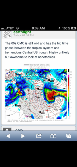
-

Spooky Season (October Disco Thread)
ineedsnow replied to Prismshine Productions's topic in New England
hopefully next week -
Another thing to keep in mind too is late October is the only real window for these hybrid storms to form with the perfect conditions. The only two storms we have recorded Sandy and The Perfect Storm in 1991 both happened at the very end of October. So it's interesting given the time period we're in and that the overall setup is very similar. Maybe once the GFS stops being absolutely useless and figures things out we'll have a clearer picture of what will happen. Definitely worth keeping an eye on.
-
Lol... Sooner or later there has to be a major bust in our favor... I love Kevin... He goes all in and one of these days he will be able to spit in our faces...
- Today
-
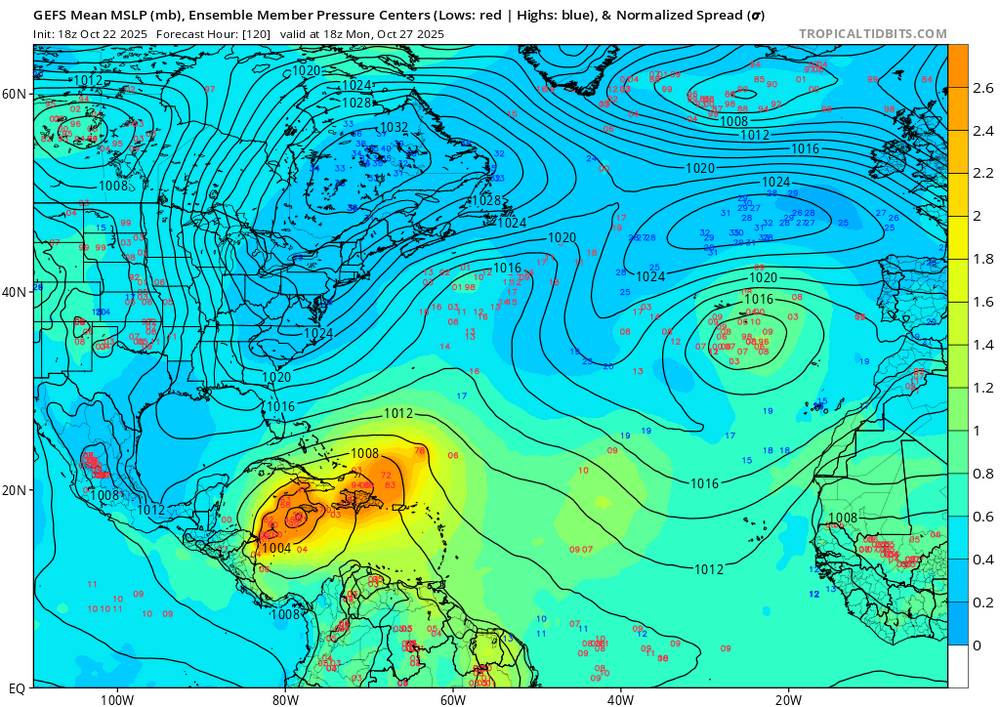
Still way east of every model Gefs has 2 camps
-

Spooky Season (October Disco Thread)
CoastalWx replied to Prismshine Productions's topic in New England
GEFS have two camps. Icon and gfs op in the east camp. -
Agree... And yes! Would love to track a one in every 20 - 30 year storm...
-
Actually amazing how useless the GFS has been for this storm lol
-
Spooky Season (October Disco Thread)
ineedsnow replied to Prismshine Productions's topic in New England
either its going to be king or one of these runs its going to flop.. GEFS are mostly west of the op -

Central PA Fall Discussions and Obs
Mount Joy Snowman replied to ChescoWx's topic in Upstate New York/Pennsylvania
My wife. I’m sorry I’ll see myself out. -

Pittsburgh PA Fall 2025 Thread
ChalkHillSnowNut replied to TheClimateChanger's topic in Upstate New York/Pennsylvania
Forecast lows here the next 4 nights: 40-37-34-34. This is what I’m talking about! Been a long time waiting-reluctantly turned furnace on this morning. -
Central PA Fall Discussions and Obs
Mount Joy Snowman replied to ChescoWx's topic in Upstate New York/Pennsylvania
Even with that, I think we have a tendency to underestimate just how bad the wind is in other areas. Anyone from the Midwest will tell you how it blows relentlessly. The lack of friction makes even meager pressure gradients gustily perform. My best friend lived in western Ohio for many years and to this day talks all the time about how nonstop and annoying the wind was. But I hear ya, when our winter winds kick up it can be hard to imagine anything worse haha. -

Spooky Season (October Disco Thread)
MJO812 replied to Prismshine Productions's topic in New England
Jeez gfs is way different than the other models -

Spooky Season (October Disco Thread)
Damage In Tolland replied to Prismshine Productions's topic in New England
Who cares