All Activity
- Past hour
-

Central PA Summer 2026 Discussion/Obs Thread
Mount Joy Snowman replied to Voyager's topic in Upstate New York/Pennsylvania
A nice classic gusty summertime storm just went through here and dropped close to a half inch. No lightning though. -

E PA/NJ/DE Summer 2026 Obs/Discussion
RedSky replied to PhiEaglesfan712's topic in Philadelphia Region
0.0 -
 Ensembles which should only be used at this lead time are nothing like that
 -
Up in Harford county at a baseball game and getting stormed. Not too munch thunder or wind. That outflow produced more wind
-

E PA/NJ/DE Summer 2026 Obs/Discussion
Hurricane Agnes replied to PhiEaglesfan712's topic in Philadelphia Region
Ended up with 0.14" where the heaviest hit SW of me. I have 3.95" for the month so far, so it was not a desperate need for now. Currently overcast and 77 with dp 73. Heard someone on Accuwx earlier today mention triple digits again for later next week . -

2026-2027 Super El Nino
Maxim replied to Stormchaserchuck1's topic in Weather Forecasting and Discussion
I hope you’re trolling. Otherwise you’re just mentally challenged if you can’t realize the destruction a +5°c super nino would have on the planet, unless if you’re cool with widespread crop failures, ecosystem damage, major economic destruction, lives being lost etc. -
Looks like no rain chances for at least a week
-
True, that is why I mentioned the area further upstream in PA. Yeah, its a considerable distance from you, but moving on a trajectory to head South and be on the Eastern Shore. Currently that area is warned with a STW and a FFW. ( More than likely that area may dissapate looking at the lastest trends. ) Storms that were headed towards me went poof.
-
 Yeah.. the part of I left out about that - because few people in here read anything longer than a blurb anyway - is that the surrounding medium is very warm. Comparing to your example, 582 to 584-ish non-hydrostats over Colorado is lot different than trying to run a 542 dm core up there when there's heights nearing 600 just west of Chicago like what the GFS was selling as near-by as 120 hours. The gradient is unusual for mid summer - mechanically contributing to why there is a such a long wave lengths ( also, highly unusual at this time of year) between eastern Canada and the Urals of eastern Europe - another point I was making. Under the radar bigger anomalies because they don't affect people directly - perhaps - but they're there nonetheless. May all be a moot conversation anyway... I suspect the GFS is over amplified with the dipole between Iowa and N QUE. I would bet on the 597 dm hgts in IA before I would bet on the <545 dm heights up there. I just check the euro and it's backing off that idea up there on this 12z so we'll see but it's likely it was a bs. I've been watching the GFS for year do this. I think it's too efficient or something with the pseudo adiabatic machinery ( physically). Because it over produces height falls ivo troughs and then ends up with surpluss depth.. It then tends to accumulate ( talking about the operational version) out in time such that by D10 ... ( when it doesn't matter anyway hahaha), it's consummately deeper than every other guidance since incense burners sniffed glue.
 -
Warmed up nicely once clouds cleared. A tad humid. Got start the fungus treatments on lawn with this weather.
-
Yeah most of the activity firing behind this boundary is staying east in DE.
-
E PA/NJ/DE Summer 2026 Obs/Discussion
Albedoman replied to PhiEaglesfan712's topic in Philadelphia Region
Last chance for a t storm following the ne turnpike. It all or nothing for the LV in the next few hours. -
I hope you get nailed pretty good later. Would be great if the energy /storms near Lancaster, PA settled over you area later this evening.
-
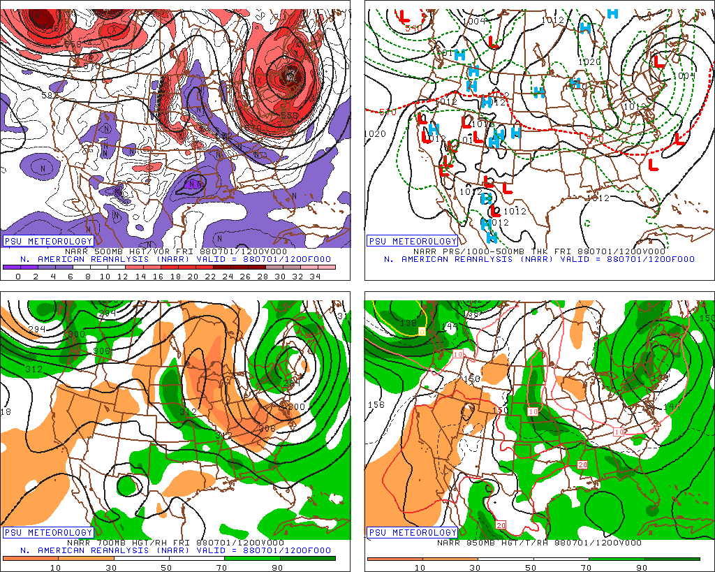
 7/1/1988. 546 low over NNE. 4" of snow on MWN for its largest summer snowfall on record. 34 for a low at Barre Falls MA this day. And this occurred during one of most brutal summers for heat and drought in the CONUS on record. WxWiz is probably wondering..."I bet there were tons of low-topped tstms this day w/ hail!" Yes, there were!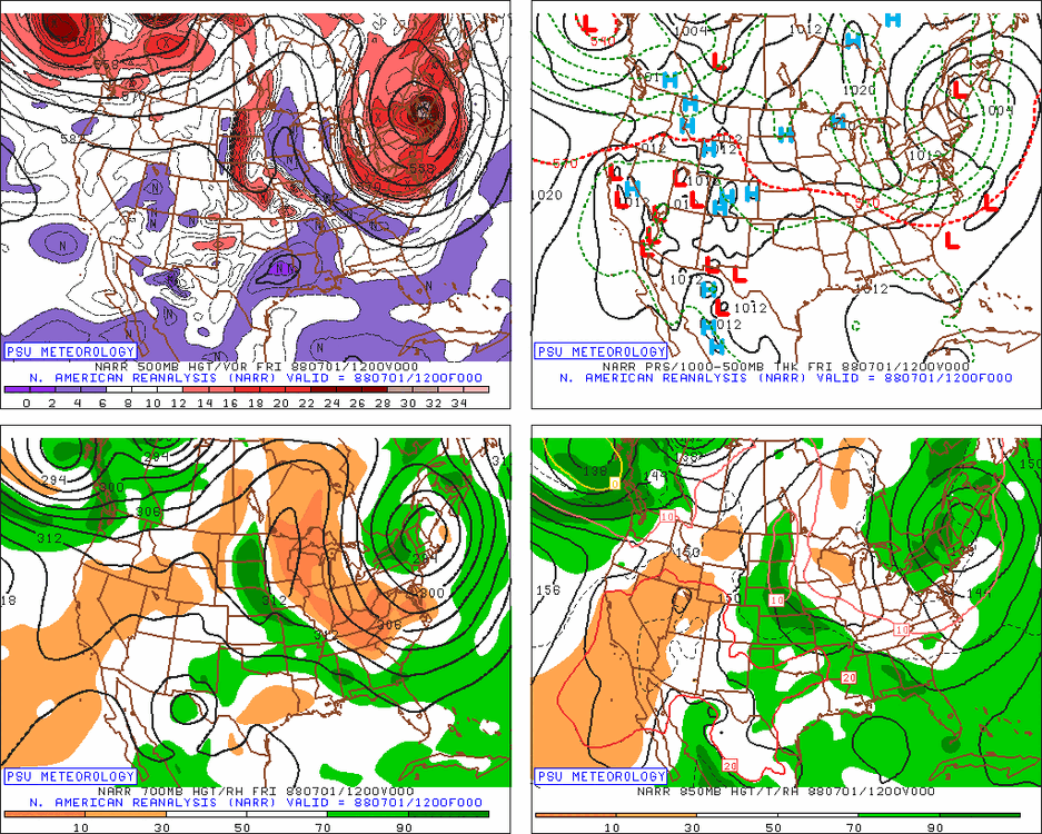
-
I'm sure they will miss my yard lol. 7.3" here for A-M-J and so far in July. Thus the extreme drought.
- Today
-
Happy Birthday!!!
-
Carol and Edna were only 10 days apart.
-
1.23 event - monthly total.. 8 days of storms just couldn't get a flush hit...
-
Bad/poor land/water management is a factor, more than it is ever said! It is the same for wildfires. When you have/had a policy to put all fires out as much and quick as possible, that has short-term gain, but the long-term issue is that available fuel builds up over time, and eventually, you end up w/ far worse wildfires. This the primary reason why we have seen so many massive wildfires in the U.S. and Canada in the last 10-15 years. Decades of fire suppression has lead to this situation.
-
Without question storms are certainly firing up. When looking at the hi res radar you can see it perfectly. Pretty cool !
-

E PA/NJ/DE Summer 2026 Obs/Discussion
BBasile replied to PhiEaglesfan712's topic in Philadelphia Region
1.40" today. Puts July at 6.92" of rain. In 11 days... But mostly in 5 days. -
That's b/c what "may" happen these days is all too often promoted as "WILL" happen! Low probably events are teased as a done deal. Also, we don't have many very strong El Ninos in the reliable period of record (since the sat era), so no way have we seen the full variance of what can happen w/ sensible wx in X or Y region.
-
He forget to mention BOS temp is running warm...
-
Yeah I mentioned that outflow boundary in the other thread.
- 1,006 replies
-
- 1
-

-
- severe
- thunderstorms
- (and 7 more)
-
I am not a fan of the US Drought Monitor. I've seen a number of learned mets point out many times how mdt-svr drought conditions can exist when rainfall, soil moisture, reservoir levels, and the CMI/PMI are all solid, but *one* thing will be not good, such as snowpack, and that "ruins" it all. Seen this in WA/OR a number of times the last few years. I have little doubt there are political/social/economic factors that mess w/ the objectivity in some areas of the country. Havig drought conditions (a "problem") is a way to funnel/siphon $$. Declare a drought emergency, and that frees up state/federal funds, as one example. In some regards, it has become racket IMHO.