All Activity
- Past hour
-
Matt Leach (WxMatt21 here) posted this on his 21 Facebook a couple of days ago. It's quite an interesting pattern.

-

Snow Potential Dec 26-27
coastalplainsnowman replied to WeatherGeek2025's topic in New York City Metro
In which "snow weenies", to the general public, and especially to the wives and girlfriends of everyone on this weatherboard, is everyone on this weatherboard. -

December 2025 Short/Medium Range Forecast Thread
Jed33 replied to John1122's topic in Tennessee Valley
Yeah I saw that earlier. I don’t know about that. Seems a little strange for him to say that. I remember times in the 80’s and 90’s where Alaska hit -70 and lower. I remember one instance where it was even closer to -80! I can remember talk about how airplanes couldn’t function when the temp was lower than -70. So, -60F is not unprecedented at all. I’m not sure where he’s getting the 1000 yr event talk. To me if it was going to be 1000yr event we’d be talking -100 or more. Akin to the lowest temps ever observed on the planet, which happens to be on the other side of the globe in Antarctica. -

Central PA Winter 25/26 Discussion and Obs
Blizzard of 93 replied to MAG5035's topic in Upstate New York/Pennsylvania
With that dew point you should drop to near 30 when precipitation arrives. Tonight is a light event, but it doesn’t take much frozen to cause road issues. -

White Christmas Miracle? December 23-24th
HoarfrostHubb replied to Baroclinic Zone's topic in New England
He is in a dark place right now…thoughts and prayers -
-
Happy hour weenie run. What torch? Looks like the models are going to ruin another Christmas day with my family.
-
Hey-if that holds we’re good to go. Hopefully that’s real.
-

White Christmas Miracle? December 23-24th
8611Blizz replied to Baroclinic Zone's topic in New England
That's been the case for at least the last 5 or 6 years on the coast. I can't remember a period of poor snow growth during daylight hours as bad as this. Epic sublimation. -

December 2025 Short/Medium Range Forecast Thread
Golf757075 replied to John1122's topic in Tennessee Valley
Ryan maue said that there is cold air we haven't seen in over 1,000 years developing in nw Canada and Alaska. Bold statement lol. There are subtle hints of it getting unleashed, but it's still early. Hope it does come down and further west for better chance at winter weather down the line instead of dry nw flow -
I don't know. I think we'd still find a way to argue about it!
-

December 2025 regional war/obs/disco thread
Damage In Tolland replied to Torch Tiger's topic in New England
He seems to be . Think he’s young but he’s well respected in the industry . Lots of great Mets on Twitter if you know who to follow. -
8" of sleet on 18z GFS. lol
-
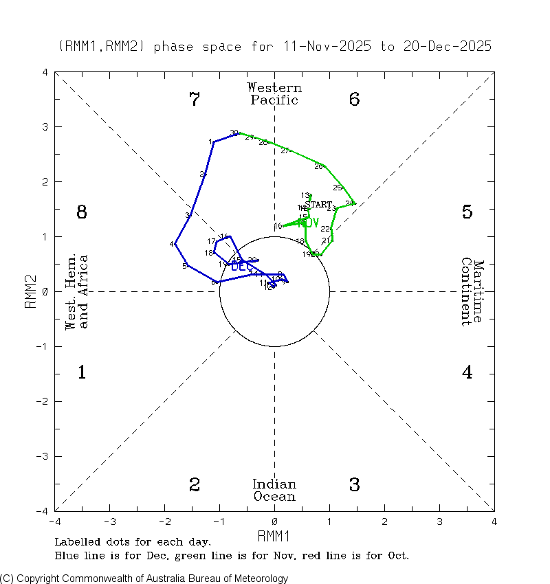
The MJO’s 3rd phase 8 period of the month ended on 12/20, when it went into phase 7. So far this month there have been three phase 8 periods: - Dec 3-7 - Dec 15 - Dec 17-19 Will there be more?

-
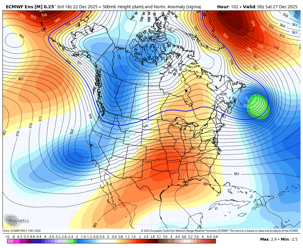
there is a nearly 3 sigma -NAO developing as this system moves in, so I would argue that blocking is indeed very strong

-

White Christmas Miracle? December 23-24th
WxWatcher007 replied to Baroclinic Zone's topic in New England
Especially after the Grinch tried and almost was successful in stealing our forum joy a few days ago -

Central PA Winter 25/26 Discussion and Obs
HBGCPA10 replied to MAG5035's topic in Upstate New York/Pennsylvania
36 degrees with 22 dew point in West Hanover Township. Not expecting much. -
Central PA Winter 25/26 Discussion and Obs
Blizzard of 93 replied to MAG5035's topic in Upstate New York/Pennsylvania
How did the 18z Euro AI & GFS AI trend for us for Friday? -
December 2025 regional war/obs/disco thread
WxWatcher007 replied to Torch Tiger's topic in New England
He’s one of the best. That’s a great thread. -
Central PA Winter 25/26 Discussion and Obs
Blizzard of 93 replied to MAG5035's topic in Upstate New York/Pennsylvania
Thankfully Mt. Holly has a very good discussion for the Friday potential… LONG TERM /FRIDAY THROUGH MONDAY/... Beyond Christmas Day, forecast uncertainty becomes very high. Guidance indicates there will be a high over eastern or southeastern Canada with low pressure moving eastward across the Great Lakes and toward the Northeast or Mid Atlantic. This setup will likely bring widespread precipitation to our area. The more recent trends over the last few runs from guidance has resulted in significant changes to the forecast. The main reason is a much stronger high that suppresses a weaker low. This trend keeps much of our area in a setup for colder air to remain in place thanks to the stronger high to the north. A more suppressed and southern track of this low keeps widespread precipitation for the area but also prevents a lot of the warm air advection from getting into the region. The updated forecast now has highs on Friday in the mid to upper 30s for the I- 95 corridor and west with mid to upper 20s in the Poconos. Areas south and east of the I-95 corridor have highs in the low to mid 40s. Wintry precipitation is now the result for much of the area for at least part of the timeframe from daybreak Friday into Saturday. Mixed precipitation may make it as far south as parts of Delmarva. -
.thumb.png.4150b06c63a21f61052e47a612bf1818.png)
White Christmas Miracle? December 23-24th
HIPPYVALLEY replied to Baroclinic Zone's topic in New England
If there is a general 1”-2” across most of SNE folks should count their blessings. At least it will look festive and maybe we can cash in over the next 10 days after that. -

December 2025 regional war/obs/disco thread
TauntonBlizzard2013 replied to Torch Tiger's topic in New England
I’d much rather be in your hood for this. Truthfully -
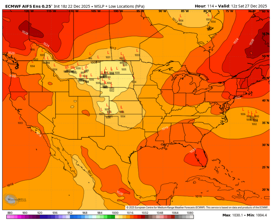
Why do you think the models trended south with this? Blocking. AI Euro Ensembles suggest a suppression risk .
-

Central PA Winter 25/26 Discussion and Obs
mitchnick replied to MAG5035's topic in Upstate New York/Pennsylvania
Fwiw, Nam is the coldest of it, the Euro and Gfs. Euro is a little cooler than half way between the other 2. That's as of 84hrs on the 18z runs. -
Central PA Winter 25/26 Discussion and Obs
Blizzard of 93 replied to MAG5035's topic in Upstate New York/Pennsylvania
I’m not sure what CTP is thinking for Friday, but they have not updated their forecast discussion at all in the long range portion. They updated their point & click grids this afternoon as a few folks mentioned, but they still aren’t addressing the growing concern for Wintry weather on Friday, which again will be a major travel day for many.