All Activity
- Past hour
-
Is it just me that worries about the pattern flipping to a torch around Christmas week? Trauma from years past I reckon.
-
I’ll be the hater here: Why would we have such a big snowstorm down to the shore in an early part of the season (first week of December) when we usually don’t? (I’m aware that it’s snowed during this time in the past, et. al.) The universe usually aligns against it. Ok, I’d enjoy being wrong, but interested in knowing why it would occur. Thank you and safe travels today! .
-
Well... it is chock full of stuff to watch, at least this run LOL. My gut says next Wednesday WILL happen, simply because I'm covering my buds snowplow route and I REALLY don't want to!
-
After today not much sign of any warmth. Skating by mid December?
-
40mph gusts all night making it impossible to measure but it looks like guidance was to bullish on snow totals. Seems like a 1-3” type event eyeballing from my kitchen.
-
Sure would like to know your definition of southern edge lol
-

Central PA Fall Discussions and Obs
Mount Joy Snowman replied to ChescoWx's topic in Upstate New York/Pennsylvania
Low of 44 with .58” of rain and dense fog this morning. Looks like I’ll have to start dialing in a bit more on mid next week. -

November 2025 general discussions and probable topic derailings ...
UnitedWx replied to Typhoon Tip's topic in New England
48 both locations here with some pretty thick fog on the way in to the office... and idiot drivers running high beams -
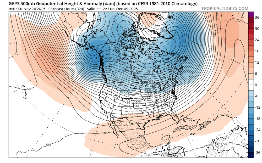
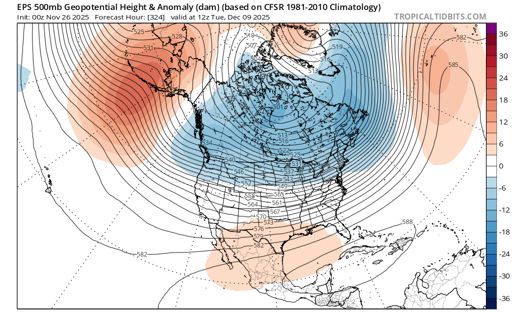
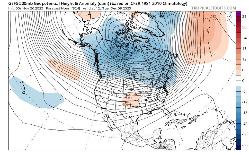
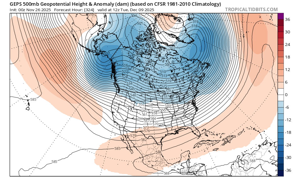
These long range OP runs can be very pretty. You can see a very broad -PNA trough developing in the ensemble means. Ongoing tug of war between the competing forcing influences On one hand you have the forcing near the Maritime Continent causing the -PNA trough. The 2nd factor is the forcing over the Western Hemisphere trying to build a ridge bridge over the top from Northern Greenland to the -WPO ridge. I suspect this split forcing is why we are getting a composite blend very long range between a Phase 6-7-8 look. The RMMS may try to slow the progression on the 7-8 border in response to split forcing. So at this point I would say early December will feature a broad gradient type pattern with cold across the Northern tier. Mid month will depend on the progression of the forcing. if the ridge bridge over the top wins out, then we will know a phase 8 is trying to take hold. If the -PNA and +EPO become more dominant and the trough pulls back to the west, then we will know the forcing near the Maritime Continent is having a greater influence. Recent experience has favored the 2nd option of a relaxation of the pattern mid to late month. If this doesn’t happen, then we’ll know something new is taking place which we haven’t seen in a while.


-

Central PA Fall Discussions and Obs
mahantango#1 replied to ChescoWx's topic in Upstate New York/Pennsylvania
Hazardous Weather Outlook National Weather Service State College PA 417 AM EST Wed Nov 26 2025 PAZ012-018-019-026>028-037-041-042-045-046-049>053-056-270930- Northern Clinton-Northern Centre-Southern Centre-Huntingdon-Mifflin- Juniata-Tioga-Northern Lycoming-Sullivan-Southern Clinton- Southern Lycoming-Union-Snyder-Montour-Northumberland-Columbia-Perry- 417 AM EST Wed Nov 26 2025 This Hazardous Weather Outlook is for central Pennsylvania. .DAY ONE...Today and tonight. Becoming windy and turning much colder tonight with westerly wind gusts of 40 to 45 mph. .DAYS TWO THROUGH SEVEN...Thursday through Tuesday. Windy and much colder weather is expected from Wednesday night through Friday. Wind gusts potentially exceeding 45 mph could blow around unsecured objects and result in difficult driving conditions especially for high profile vehicles. Scattered heavy snow showers are possible on Friday, which may result in slippery driving conditions and reduced visibility. .SPOTTER INFORMATION STATEMENT... Spotters are encouraged to report significant hazardous weather. -
I84 corridor next Tuesday: A snow and ice event is modeled with uncertain amounts but may cause hazardous conditions. If you need to travel next Tuesday please monitor future forecasts. I95 corridor-LI: probably worth a pause before taking the bait.
-
In southern CT, that much snow is referred to as "a season."
-
Your chances are better than many. Maybe it will be remembered as the Scooter storm.
-

Nov 28-30th Post Turkey Day Wintry Potential
Baum replied to Chicago Storm's topic in Lakes/Ohio Valley
That would be a great start to this cold season based on recent winters. -
Def makes sense to Deb over one model run
-
Total flakes sighted? 28 here seems accurate.
-
lol kid stayed home from school yesterday and missed Berk being at her school. I think he comes back next year to talk to 7th graders (my kid). I’ll be sure to send her with questions to ask
-
Hell I’ll take 1/3 of that. I’m not falling into the trap! We will see come this weekend before getting excited.
-
No wind thread for Friday, yet. I think something stronger follows next week but for now will wait to see how Thanksgiving winds develop/and or any NWS issuance.
-

December 2025 regional war/obs/disco thread
mahk_webstah replied to Torch Tiger's topic in New England
It was a massacre -
When you are on the southern edge of a big snow, the reality usually is not the best... I am just saying.

-
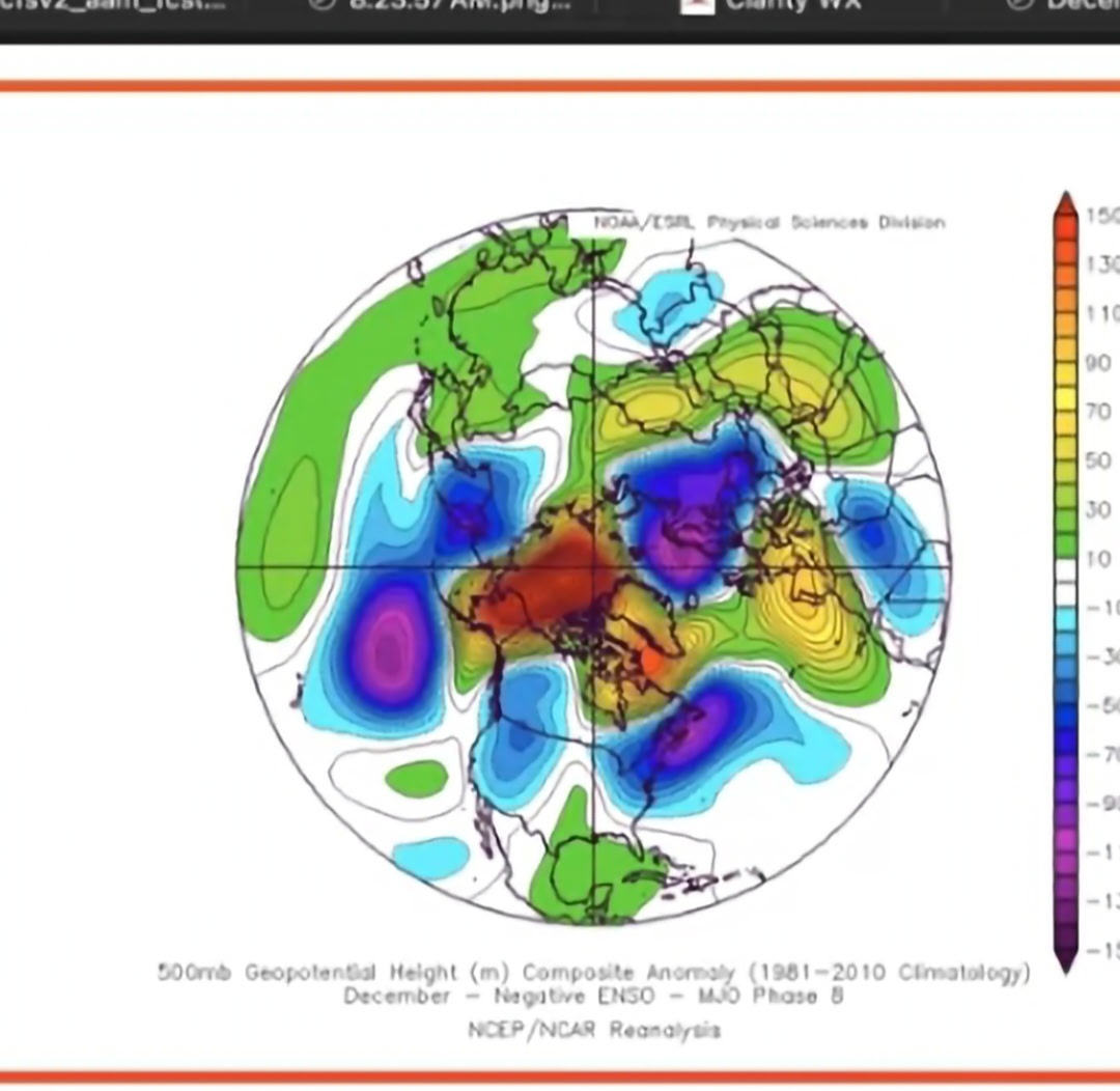
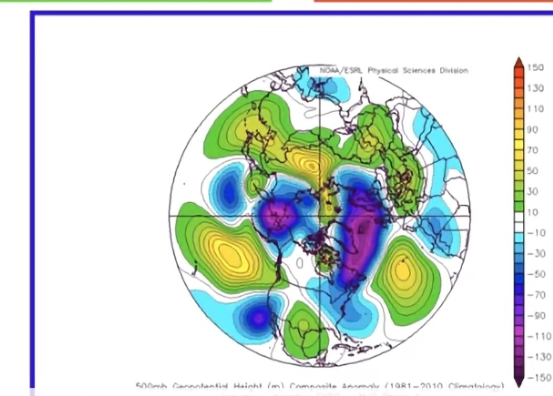
Phase 8 and Phase 1 are cold in negative enso years.

-
.39" brings me to 2.13" for the month, temp up to 50 now.
-
6z Gfs total run....lol
.thumb.png.3f880a9e3104cb7618b818c92cd56752.png)
-
The clickbait crowd will be going into overdrive. Imagine all the weather segments that will lead with this…


.png.ec300f5c0895e5a5a4ef8765059773e2.png)
