All Activity
- Past hour
-
 Another nice day in Vermont, under that Mount Mansfield glacier.
-
My records go back to 2005.
-
Don't have any information on rainfall rates here. My period of record here is just about 9 years. Will have to go back and look to see what my wettest month was. Good question.
-
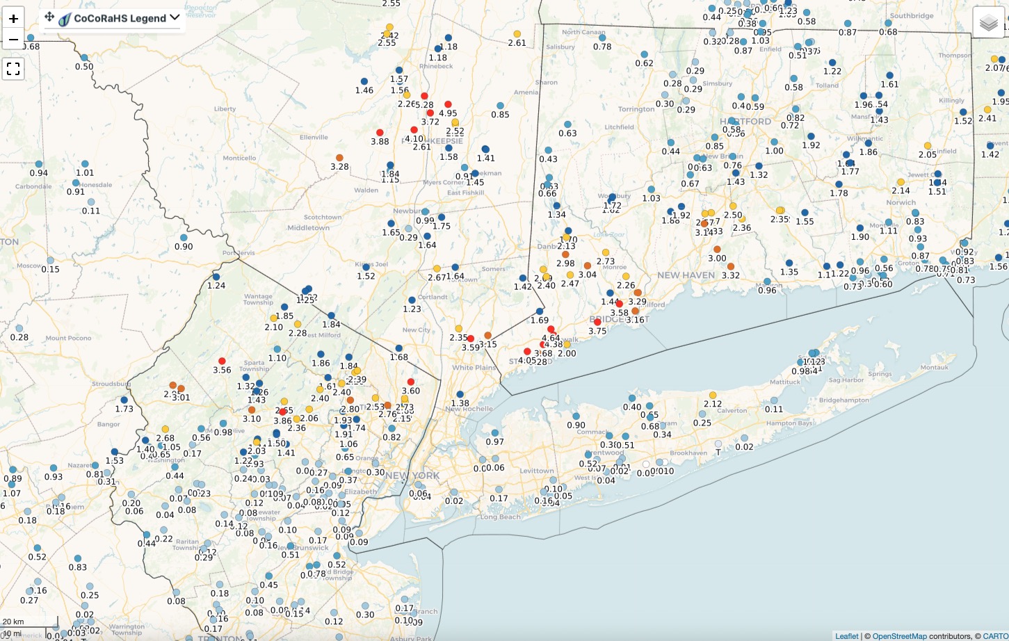
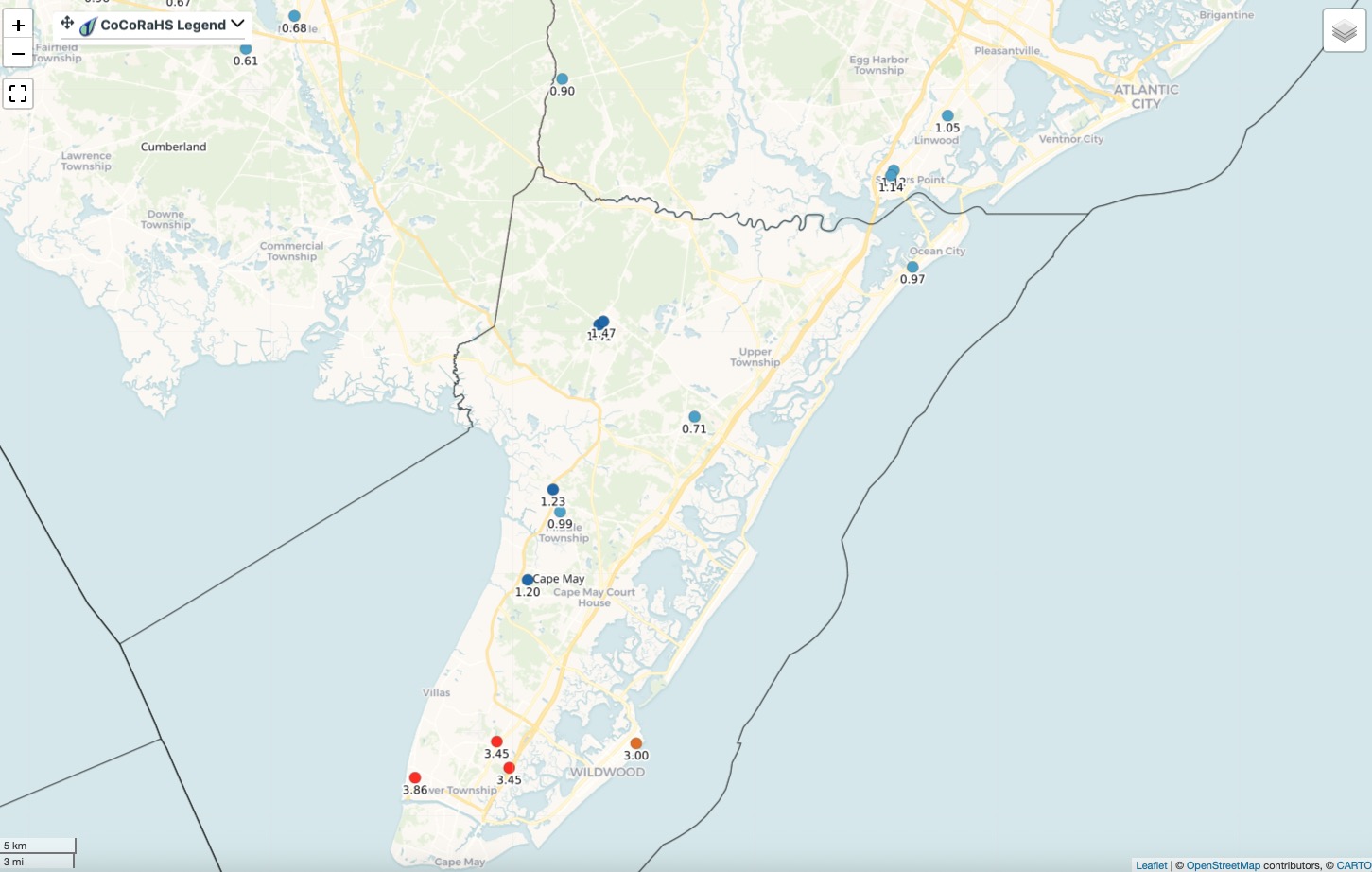
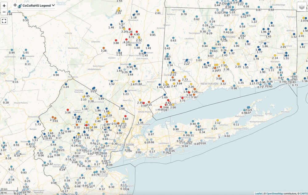
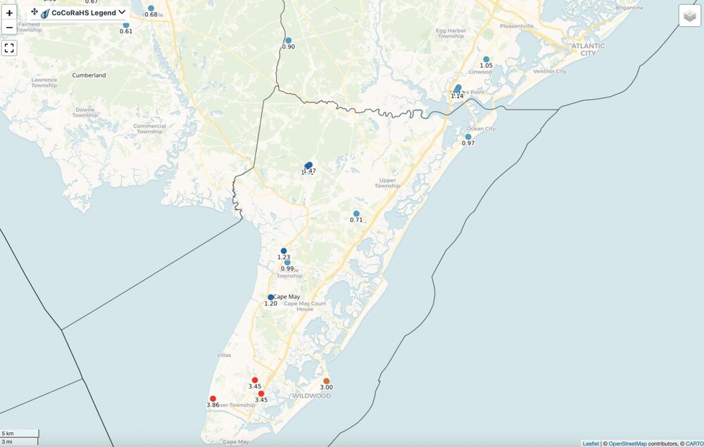
Rainfall totals yesterday. You either got in on it or you didn't. Click map to enlarge.
-

Spring/Summer 2026 Pattern Discussion Thread
Carvers Gap replied to Carvers Gap's topic in Tennessee Valley
One thing which is nice about this in NE TN(not relief for everyone as has been shared), the drought is getting busted up here. We aren’t there yet, but much better off than during spring and winter. -
Do you happen to have any rainfall rate information from your station? I'm at 9.74" for the month making it the second wettest July for me, only topped by 2023 with 13.95". My average is 4.85". Interesting to note that I had .08" more in the Stratus than in the Davis which had to be due to splash out from the Davis in the 12.52" per hour rate for five minutes followed by a 11.76" rate for five minutes around 9:30pm last night.
-
Spring/Summer 2026 Pattern Discussion Thread
Carvers Gap replied to Carvers Gap's topic in Tennessee Valley
As Jeff noted, that stalled frontal boundary has reared its ugly head this AM. Bean Station is seeing a lot of heavy rain. -
you are the target audience
-
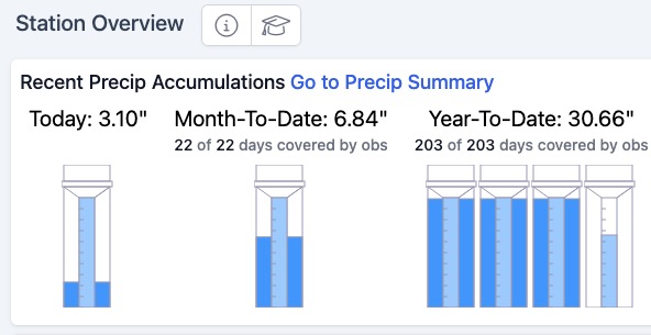
Total for yesterday 3.10". Two rounds. Early morning 1.72" in about 45 minutes. Second round with tornado warned storm early afternoon dropped 1.37" in about 15 minutes. Finished with .01" during the evening in a quick moving light shower. I'm good with rain for a while. Need some time for the ground to dry out. No need to water here anytime soon. Everything is as green as it could possibly be. @bluewave posted above the next big ridge looks to be centered more west over the western plains or Rockies. Watch for weak downstream trof over the east. Depending on placement that could signal another round of wet weather. A trof axis over the Ohio Valley or along the Appalachians would make for a wetter go around here.
-
 The forester with whom we contracted in 2011 for forest inventory and modeling once commented, "All models are wrong, but some are useful." When Maine Public Lands contracted an inventory in 1999 (different contractor), the DOD had yet to remove the GPS scramble for non-military users. We had the foresters run their GPS units for 30 minutes on both the first and last of the 12-point cruise lines, with the goal of having the hundreds of scrambled hits averaging close to true location. We assumed the hits were truly random rather than biased.
 -

2026-2027 Super El Nino
40/70 Benchmark replied to Stormchaserchuck1's topic in Weather Forecasting and Discussion
I hate the heat, but the humidity is no prize, either....but I expect that in August...by far the most humid month, while July is hottest. It's the inverse of the winter, when January is coldest, but February is snowiest. at least here on the east coast. -
.thumb.gif.f92b16c631a1d15d405ed77b33f0710d.gif) 2% tor hatch for ME today ...New England... A shortwave trough/moderately strong mid-level jet streak will be favorably timed with diurnal destabilization during the afternoon, particularly for New Hampshire into Maine. As the cold front progresses eastward, scattered storms are expected to develop. Effective shear of 30-40 kt and strong upper-level winds will support the possibility of some supercells aside from organized multicells. Damaging winds, marginally severe hail, and perhaps a tornado are all possible this afternoon until around sunset.
2% tor hatch for ME today ...New England... A shortwave trough/moderately strong mid-level jet streak will be favorably timed with diurnal destabilization during the afternoon, particularly for New Hampshire into Maine. As the cold front progresses eastward, scattered storms are expected to develop. Effective shear of 30-40 kt and strong upper-level winds will support the possibility of some supercells aside from organized multicells. Damaging winds, marginally severe hail, and perhaps a tornado are all possible this afternoon until around sunset. -
6Z UKMET: weaker than 0Z’s 999 mb with 1005 mb when near GLV (hour 39). Most of rainfall S of GLV, where <1” falls, and Houston, where <0.5” falls. Peak of ~4” Matagorda Bay.
-
 Do you know what our annual average is?
 -
C'mon Sun, heat that ground!
-
-

2026-2027 Super El Nino
Typhoon Tip replied to Stormchaserchuck1's topic in Weather Forecasting and Discussion
I'm suspecting that we're heading for a troughy/humid end game myself. If so ... that would lower the "big heat" transport circumstances, blocked by ongoing synoptic balancing. Doesn't mean it can't happen... talking 'tendency' here ( sorry, not you per se but the common reader tends to formulate extremes in their interpretation .. failing idiosyncratic nuance and/or 'lean' ) We'll see... but there's a leitmotif in the major ensemble sources to pin a trough here regardless of the Pacific. Ex, over the next 7 days the eastern Pac passes through an impressive -PNA for mid summer... but we don't see heights rising much E of Chicago. Proooobably this is owing to the shortened wave lengths of summer in general - how that gets away with that. But here's the rub... that positive anomaly over the N-NE Pac decays, and the pattern moves ends up with trough anyway. So we're fucked either way, is what the modeling argues. Okay - Altho some folks have a more toxic relationship with heat expectations so for them, this is probably the opposite of fucked intimation haha -
 Havent said this in a couple years but no more rain for awhile please-10 inches+ this month here with 9 days to go
 -
The 9.74" makes it the second wettest July for me, only topped by 2023 with 13.95". My average is 4.85". Interesting to note that I had .08" more in the Stratus than in the Davis which had to be due to splash out from the Davis in the 12.52" per hour rate for five minutes followed by a 11.76" rate for five minutes around 9:30pm last night.
-

E PA/NJ/DE Summer 2026 Obs/Discussion
BBasile replied to PhiEaglesfan712's topic in Philadelphia Region
They said it's gonna be virtual. I saw a video of when it came onshore. It looked very weak by that point. -
yes, not as much thunder as the other day, but deeper and more crashing. was up past midnight calming down my dog
-
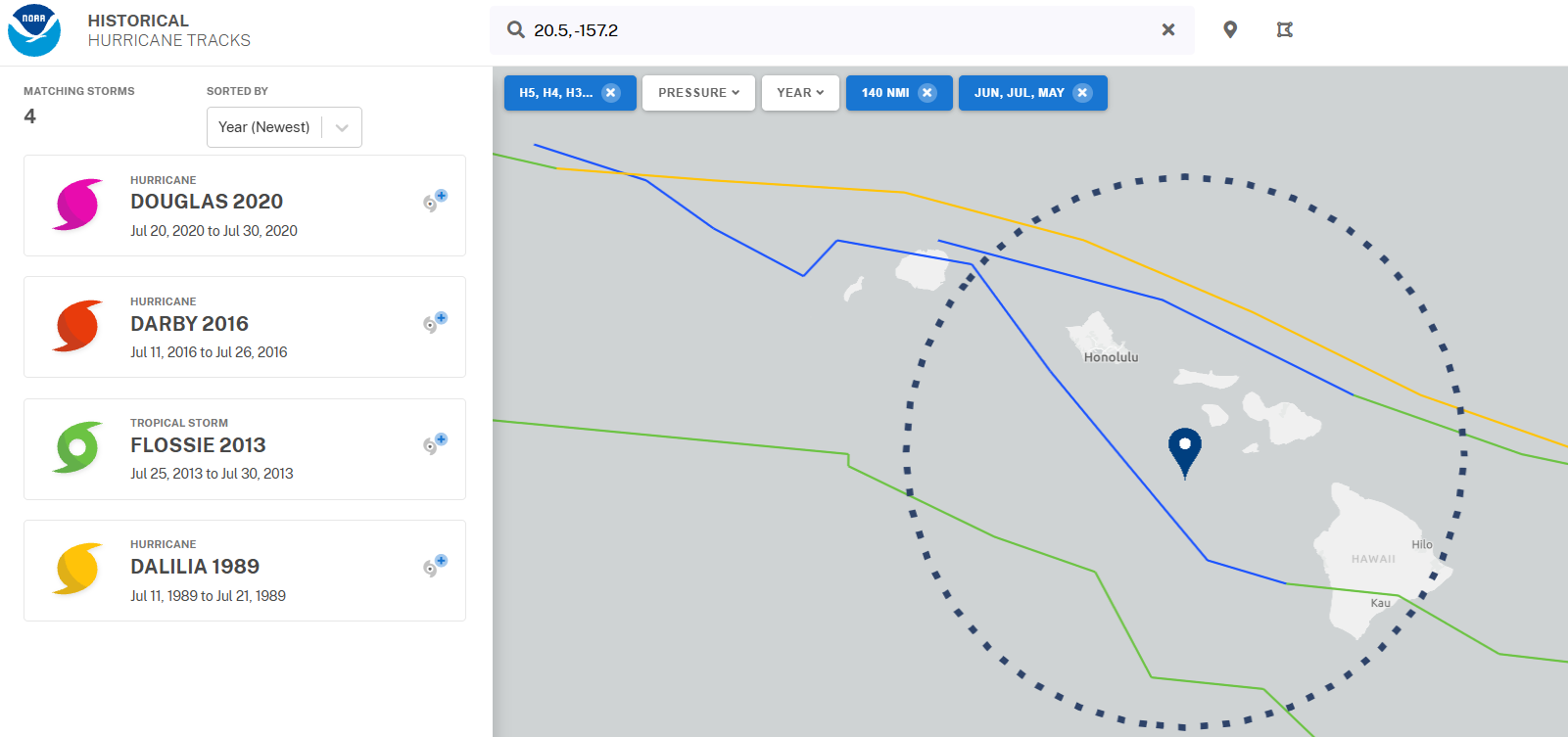
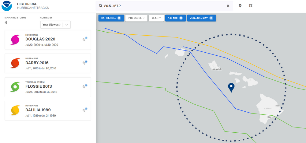
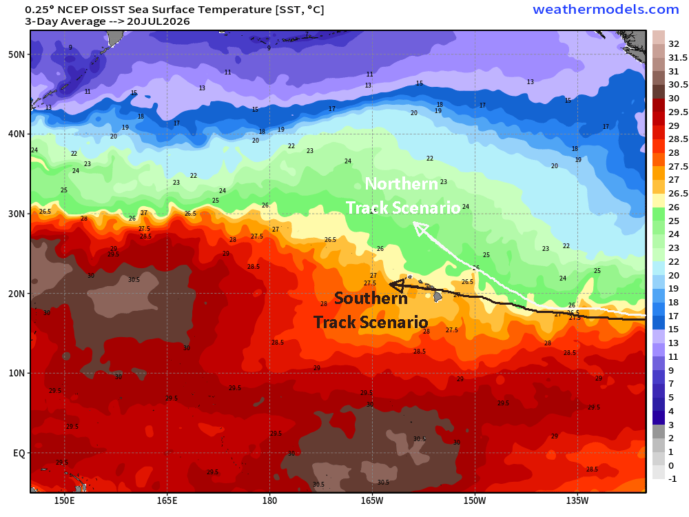
Our next US hurricane threat comes from an unlikely place so early in the season - the eastern/central Pacific! Fausto is expected to track west in general direction of Hawaii by mid next week, but big questions remain on whether it turns more NW and weakens (a la EPS) or continues westward and threatens Hawaii. Even a tropical storm strength system passing near Hawaii so early in the season would be in rare company. Check out my latest blog with more details: https://hurricanehacker.substack.com/p/eastern-pacific-stealing-tropical (Note - while my blog is mainly Atlantic focused, when there is a land threat in the eastern or central Pacific I will cover it. The subsequent posts on Fausto will be more in-depth than this one... please follow the blog on Substack for updates.)
-
Bertha has been a rather confounding/challenging TC to forecast. I'd be wary of being fooled by its current appearance (LLC decoupled from convection). Posted in-depth thoughts on Bertha's future here at my blog: https://hurricanehacker.substack.com/p/bertha-gaining-strength-heading-for
-
Yes, was actually pretty happy not to get the bigger rains after Saturday. 4.35" for the month is pretty nice