All Activity
- Past hour
-
73 yesterday. Mid 50s this morning. Excellent break from the heat. Can’t beat sleeping with the windows open.
-

2026-2027 Super El Nino
40/70 Benchmark replied to Stormchaserchuck1's topic in Weather Forecasting and Discussion
Another -PDO season. -
2026-2027 Super El Nino
40/70 Benchmark replied to Stormchaserchuck1's topic in Weather Forecasting and Discussion
Yea, all I need to see. This is what ultimately matters, so IMHO, you (collective) can shove all of the OLR, VP and MJO plots......we are having a cool ENSO July. Not what I want, but it is what it is. -
 00z MAV for tomorrow morn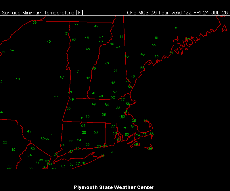
-
Beautiful morning out. On ffx county parkway where it overpasses 50 could finally see past the blue ridge way to the distant mountains. Otherwise, mid 60s and low humidity means I get to wear a jacket today to coach!
-

If you could re-experience ONE winter event....
A-L-E-K replied to cyclone77's topic in Lakes/Ohio Valley
mega nino, everyone should get ready -
 Noticed you didn’t post this . Wonder why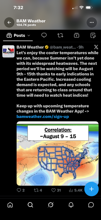
-

Occasional Thoughts on Climate Change
donsutherland1 replied to donsutherland1's topic in Climate Change
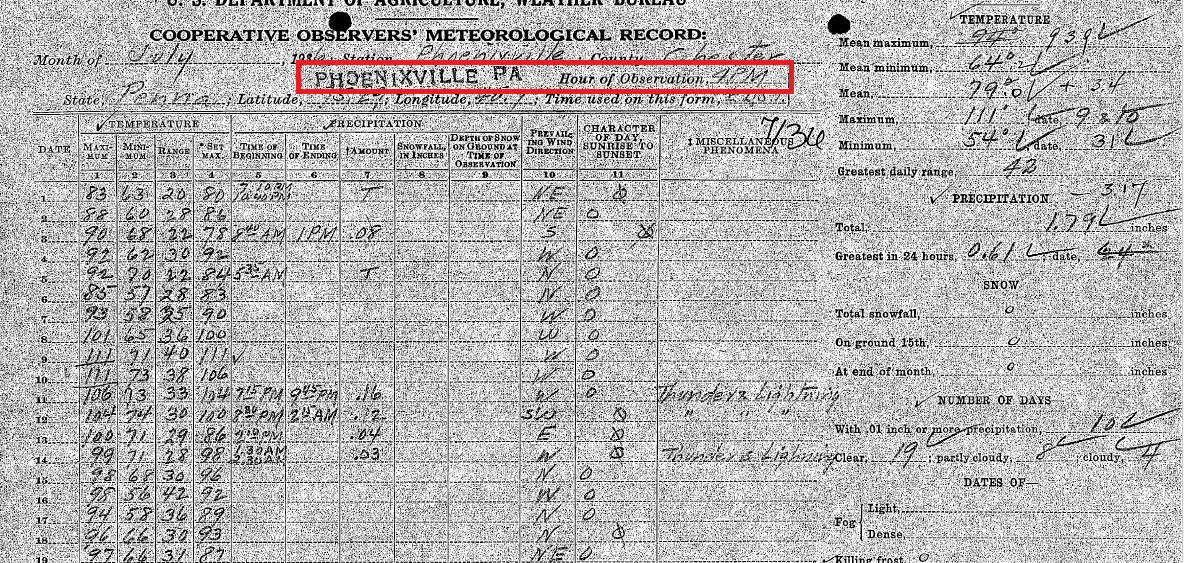
Yes, Phoenixville had a 4 pm time of observation: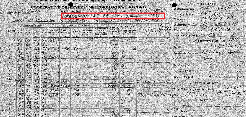
-
Min 52.0° Maybe cooler tonight
-
Coldest of our lifetime according to some
-
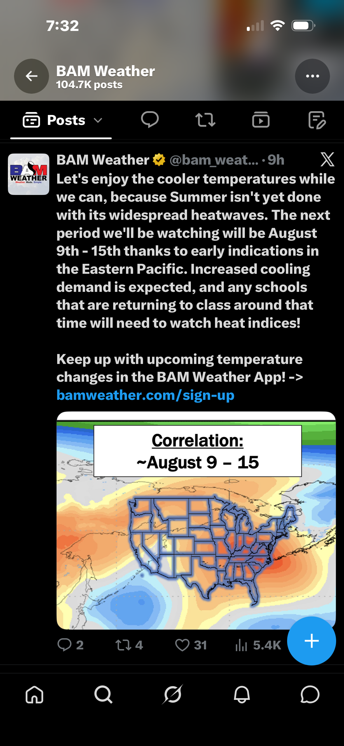
Philadelphia has actually had 14 years with 0 90° days in August. The most recent such year was 2013. Some of the guidance suggests that 90° heat could return late in the first week of August and continue during at least part of the second week of the month.
-
1.04 inches since midnight. We’re back baby
-

2026-2027 Super El Nino
GaWx replied to Stormchaserchuck1's topic in Weather Forecasting and Discussion
Chris, June-July 1991 also didn’t get the memo (Also, May of 1991 was very warm): In addition, June-July of 1877 wasn’t cool.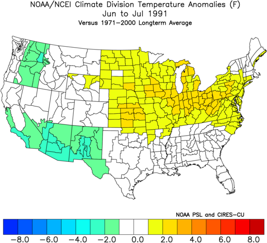
-

Central PA Summer 2026 Discussion/Obs Thread
mahantango#1 replied to Voyager's topic in Upstate New York/Pennsylvania
Please refrain from using the heater in your vehicle in July. One must not use the heater in a vehicle until late September. Don't give in to temptation. -
3.95”
-
Central PA Summer 2026 Discussion/Obs Thread
mahantango#1 replied to Voyager's topic in Upstate New York/Pennsylvania
US National Weather Service State College PA Favorites ·steprnoSdo396f351052g6h810cug4346m98517t4a4310t48287lm7208lu · Next 3 days: Doesn't get much better for late July Humidity and rain risk ramp up for early next week 7/23/26|638am - Today
-

Central PA Summer 2026 Discussion/Obs Thread
Blizzard of 93 replied to Voyager's topic in Upstate New York/Pennsylvania
57 for the low in Marysville. Should be a beautiful late July day. -
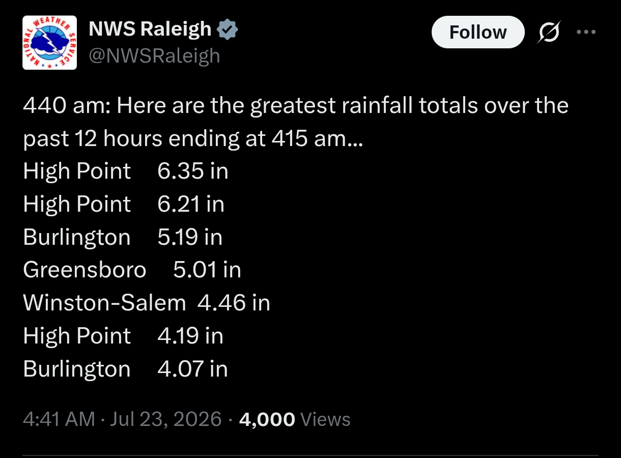
Wow there are some insane totals around Greensboro. We’re at around an inch here
-

2026-2027 Super El Nino
bluewave replied to Stormchaserchuck1's topic in Weather Forecasting and Discussion
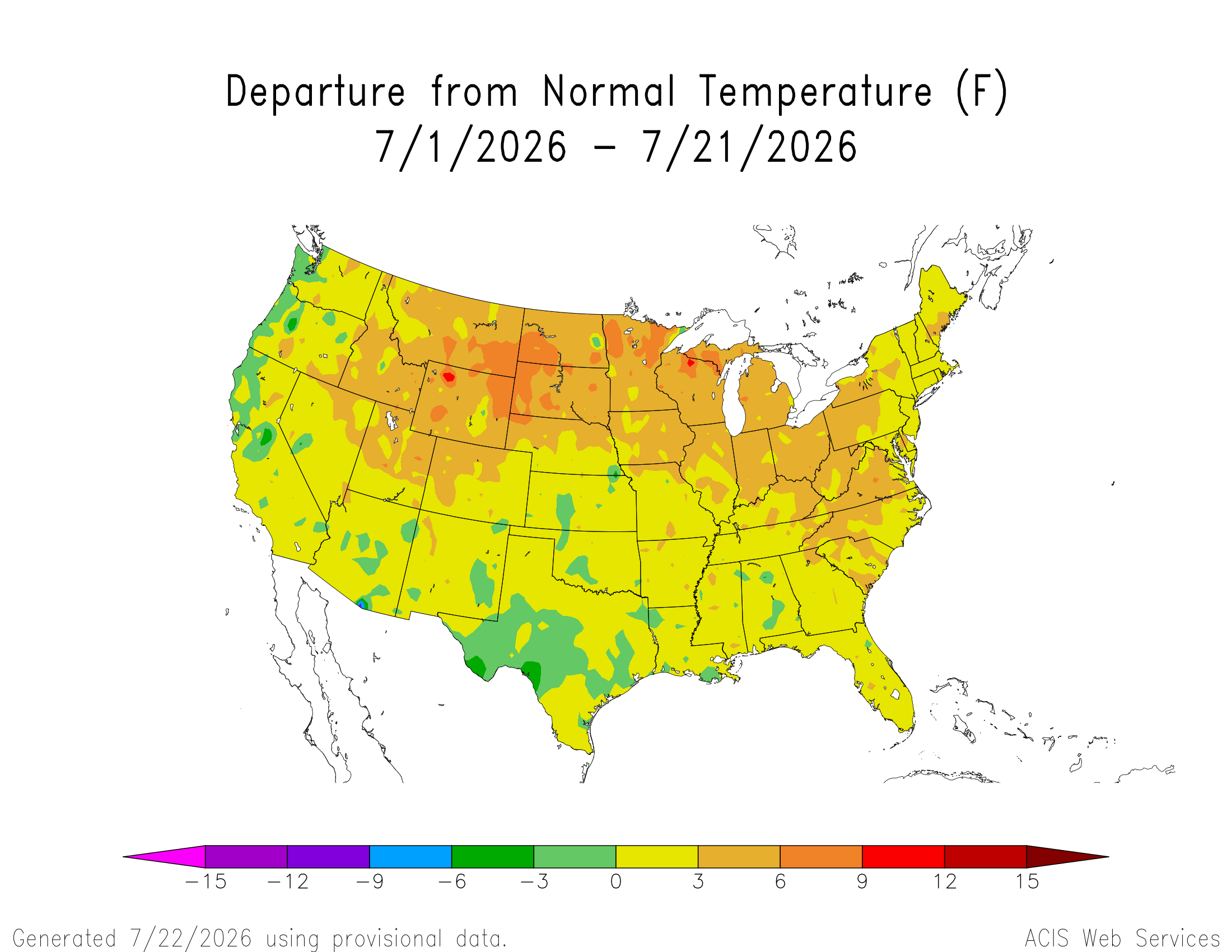
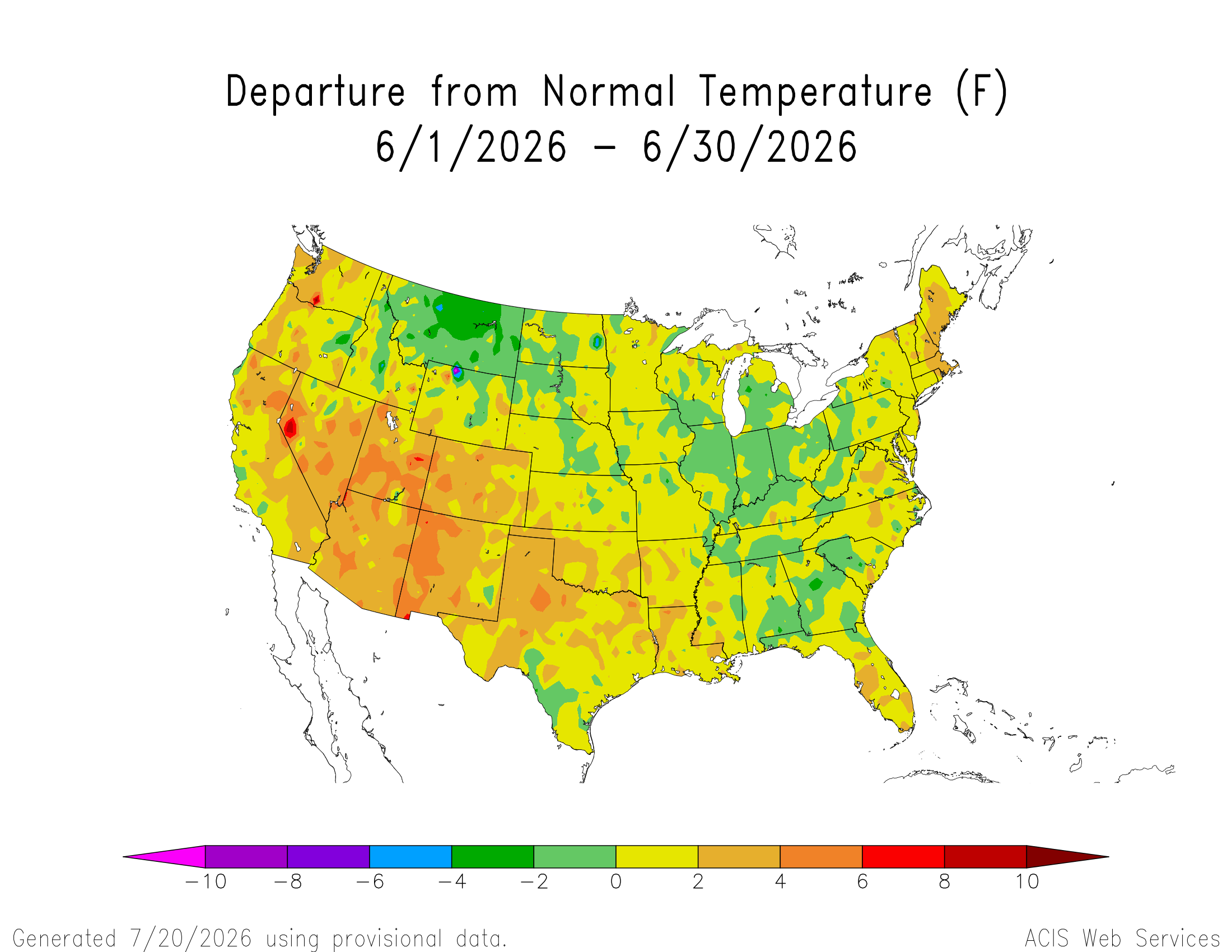
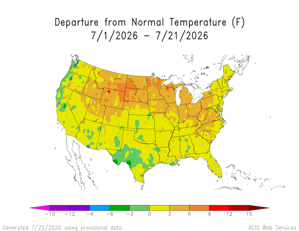
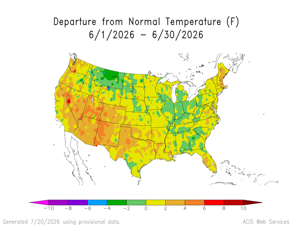
The CONUS didn’t get the memo that it’s supposed to be having a cooler super El Niño summer. We knew something was going to be different with the record heat that began to emerge back in May. What if anything this says about the rest of the event remains to be seen.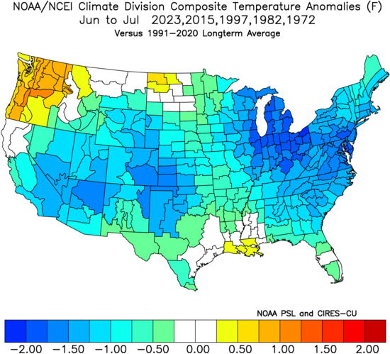
-
Got lucky with some training showers last night and picked up 0.75 for a total of 2.10 for the event. Best rainfall since I moved here in March. Now I'm looking forward to gorgeous weather the next four days.
-

2026-2027 Super El Nino
snowman19 replied to Stormchaserchuck1's topic in Weather Forecasting and Discussion
The 30C isotherm continues to be pushed further east of the dateline by the constant WWBs. It’s extremely likely that it gets pushed all the way to 140W by November like the models are showing, which would be record-breaking. The developing parade of typhoons are only going to enhance the westerlies/WWBs going forward. The warm pool east of the dateline has moved the downwelling Kelvin wave generation area to around the dateline to 165W. This means it will take less time for warm water to be transported into the EPAC, thus El Nino will grow very quickly from here on out. A record-breaking historic event is guaranteed at this point. I think we see forcing possibly set up the furthest east on record by late fall/winter. Here is a taste of what is to come on this side of the hemisphere with the STJ…… -

Central PA Summer 2026 Discussion/Obs Thread
Voyager replied to Voyager's topic in Upstate New York/Pennsylvania
53 this morning here. I'd be wearing jeans today for work if I had an earlier start than 8am. By the time I load the first tank of the day, the sun is starting to warm things up. Gonna need the heat in the car, though, for starters. -
Wow! This rain has been training over Hickory since about 6 PM last night. I have over 3 inches of rainfall so far.