All Activity
- Past hour
-
Should I keep my speedos out just in case ?
-
 п»їinternational drug mart: Hydrochlorothiazide - top online pharmacy
 -
Highest winds were well NW of the center due to the strong SE shear
-
strange 850mb chart for the transition/landfall last night
-
1.5 inches of rain so far from the system, temp is 55 degrees. Oddly, no wind to speak of.
-

2026-2027 Fall/Winter Mountain Thread
ncjoaquin replied to BlueRidgeFolklore's topic in Southeastern States
Up to 1.74 inches. -
House temp got down to 66° at the lowest point so far this month. we heat off
-
And yet people are clogging 93N another Columbus Day weekend to see mostly sticks.
-
Yeah, this has been underwhelming so far. I have one third of an inch of rainfall, and an occasional breeze here and there. It is chilly, though. Remaining under 60 degrees. Perhaps the heavier rain will come in this evening, but that’s not what just a bare analysis of the current radar image would make you think.
-
Damage in the Pensacola area looks much more significant than areas further east. Definitely structural damage in line with high-end category 2 winds.
-

2026-2027 Fall/Winter Mountain Thread
Met1985 replied to BlueRidgeFolklore's topic in Southeastern States
Yeah that's what I was thinking as well. -

2026-2027 Fall/Winter Mountain Thread
Moonhowl replied to BlueRidgeFolklore's topic in Southeastern States
Had that about 20 minutes ago here in Avl, crazy to be getting chilly tropical rain. -
Eyeing tonight for some aurora potential, though clouds from Isaias' remnants may limit the visibility in most of MI
-
That'll make for a crappy Columbus Day weekend for many in the Midwest and East, for sure
-
2026-2027 Fall/Winter Mountain Thread
Met1985 replied to BlueRidgeFolklore's topic in Southeastern States
Winds gusting to around 25 to 30 mph. -
2026-2027 Fall/Winter Mountain Thread
Met1985 replied to BlueRidgeFolklore's topic in Southeastern States
Tropical downpours now. Coming in sideways. -
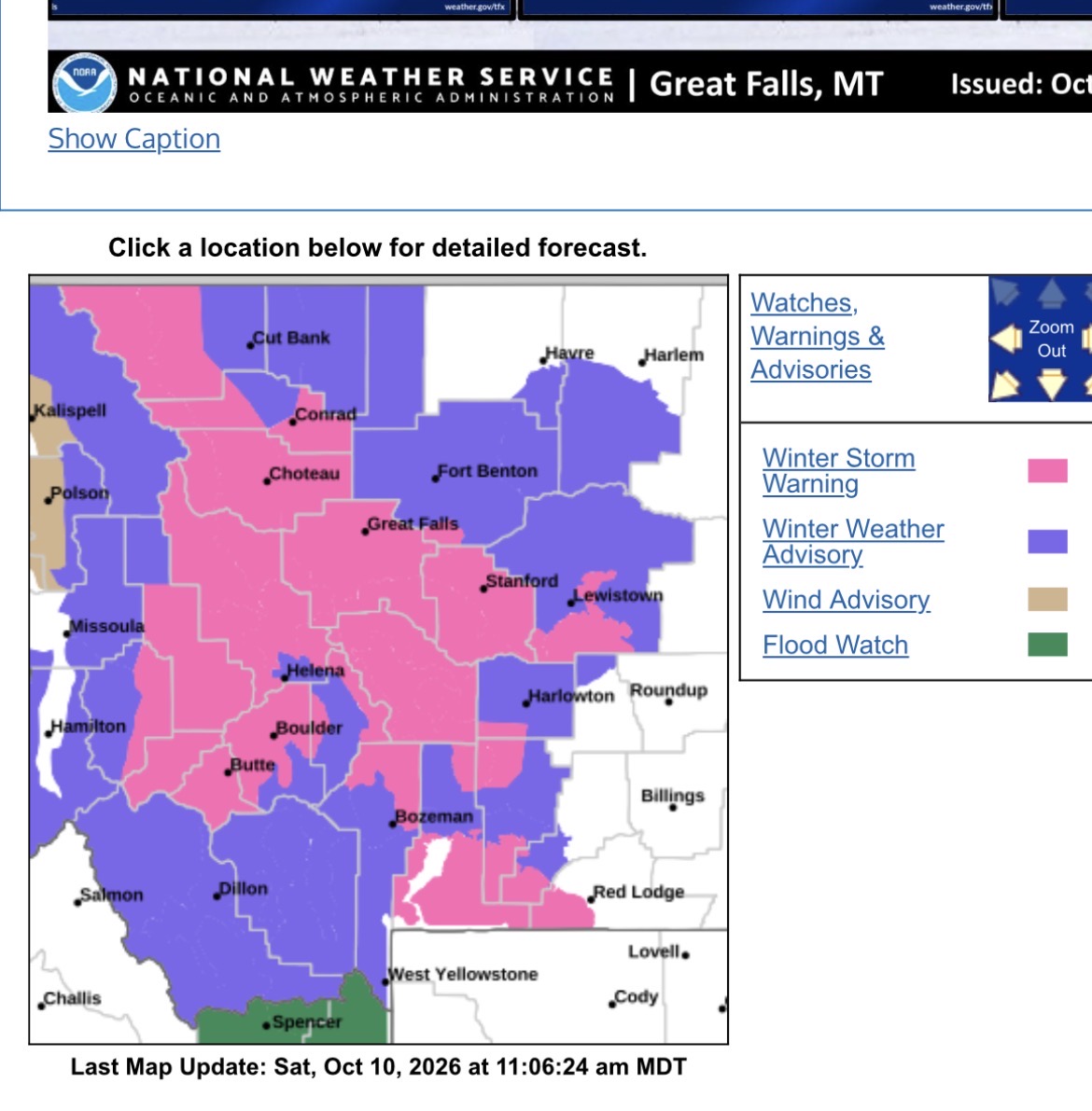
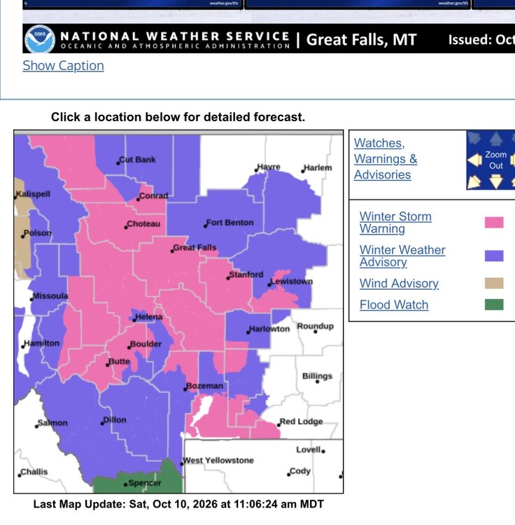
Winter Storm Warning URGENT - WINTER WEATHER MESSAGE National Weather Service Great Falls MT 1056 AM MDT Sat Oct 10 2026 MTZ309-312-313-321-111200- /O.CON.KTFX.WS.W.0008.261011T0000Z-261012T1200Z/ Eastern Pondera and Eastern Teton-Cascade County below 5000ft- Judith Basin County and Judith Gap-Meagher County Valleys- Including the cities of Raynesford, Great Falls, Ledger, Checkerboard, Benchland, Martinsdale, Geyser, Stanford, White Sulphur Springs, Hobson, Ringling, Conrad, Moccasin, Windham, and Brady 1056 AM MDT Sat Oct 10 2026 ...WINTER STORM WARNING REMAINS IN EFFECT FROM 6 PM THIS EVENING TO 6 AM MDT MONDAY... * WHAT...Heavy, wet snow expected. Total snow accumulations between 7 and 14 inches. Winds gusting as high as 35 mph. * WHERE...Meagher County Valleys, Cascade County below 5000ft, Eastern Pondera and Eastern Teton, and Judith Basin County and Judith Gap. * WHEN...From 6 PM this evening to 6 AM MDT Monday. * IMPACTS...Travel could be very difficult. Gusty winds combined with the wet and heavy nature of the snow could bring down tree branches. Isolated power outages are possible. * ADDITIONAL DETAILS...Snowfall amounts will vary drastically from grassy surfaces to roadways, most notably at lower elevations, with accumulations on non-grassy surfaces being confined mainly to between the evening through late morning hours.
-
.08" here this day so far. I'm glad I kept my expectations low. This area really does suck for weather.
-
2026-2027 Fall/Winter Mountain Thread
Met1985 replied to BlueRidgeFolklore's topic in Southeastern States
Moderate rain, windy, and cold with the temp of 52 degrees. -
Winter weather is already on its way to Montana this weekend!
-

2026-2027 Fall/Winter Mountain Thread
Tyler Penland replied to BlueRidgeFolklore's topic in Southeastern States
Been pretty calm here in Blowing Rock so far. Only about 1/3" and winds not more than 15-20 m.p.h. -
Hopefully your Texas Longhorns win today to help your spirits!
-
Fantastic forecast, Ray, that was spot on other than being slightly too slow!
-
Me, I badly wanted the shear from the Pacific storm to tear it apart and keep it from getting to TD status. I wanted a whole year without a hurricane, especially without one that hit land.
- Today
-
I get it. Its a fine line to walk for the State. Not sure they really want to say "We think this is going to rapidly decay as it hits the mainland". Were there any mandatory evacuations? I think the "disgust" with this storm is more form those wanting chaos than those wanting the best outcome possible imho. Edit: should have used the google machine before posting. There were mandatory evacs.











.thumb.jpg.ad3a2e31d30aff035044689b311a0540.jpg)