All Activity
- Past hour
-
-
Snow TV per surface temps but wouldn’t complain
-

Meltdown's R Us. What's Buried Is Seen Again...
JACKASS replied to Cold Miser's topic in New England
Substantial. Gonna need daily updates this week. -
Hit 57F here today… mostly sunny afternoon was glorious. Spring skiing at its finest. Taking the sunny torch award up here.
-
Working on a weather analysis for the late Feb to early March 2023... Checked out your site, but did not see a map for a Feb. 27-28, 2023 event; appears to have been widespread 4 to 6 inch amounts across FF and NH counties in CT...
-
High of 47.7°, wild gradient today. Currently 43°.
-
Fog rolled about an hour and a half ago. Thickens every time I look outside.
-

Central PA Spring 2026 Discussion/Obs Thread
Voyager replied to Voyager's topic in Upstate New York/Pennsylvania
Bet it does the Tamaqua split... No lightning detected from my station yet. -

Central PA Spring 2026 Discussion/Obs Thread
mahantango#1 replied to Voyager's topic in Upstate New York/Pennsylvania
Heavy thunder the house shook from it and very bright lightning here -
No one did. Reminds me of the November 2002 Van Wert, OH tornado, the environment in no way seemed supportive of that sort of twister yesterday. The ice on the lake caps it off
-
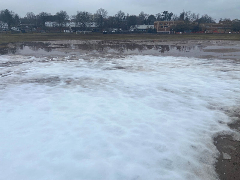
Snow eating fog overnight. Holding strong in about 60% of my backyard but by morning most of it might be gone.
-

Meltdown's R Us. What's Buried Is Seen Again...
Cold Miser replied to Cold Miser's topic in New England
Today's loss...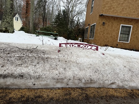
-

2025-2026 Fall/Winter Mountain Thread
Maggie Valley Steve replied to Buckethead's topic in Southeastern States
It looks like the line has broken up. Hopefully we'll get some beneficial rain before the strong cold front arrives next Thursday night or Friday. -
We all know you’re losing it…the only question is whether it gets down into this area too.
-

Winter 2025-26 Medium/Long Range Discussion
RogueWaves replied to michsnowfreak's topic in Lakes/Ohio Valley
All signs from nature are screaming real winter's over. Couple counties south this morning have greening grass and worms out. I've got summer birds here even. Sucky cold spells are typical spring thing for NMI so I'm hardly saying last flakes have flown but this and last winter have closely paralleled one another and I expect that will be the case as we continue. Just hoping the crap 3rd week of May doesn't repeat. Worst in a century so the odds are against ofc. I'm just 0.9" ahead of last season's total, and that difference is the 1" bigger largest storm vs last winter. Would be wild if I can go without more measurable snow. -
-
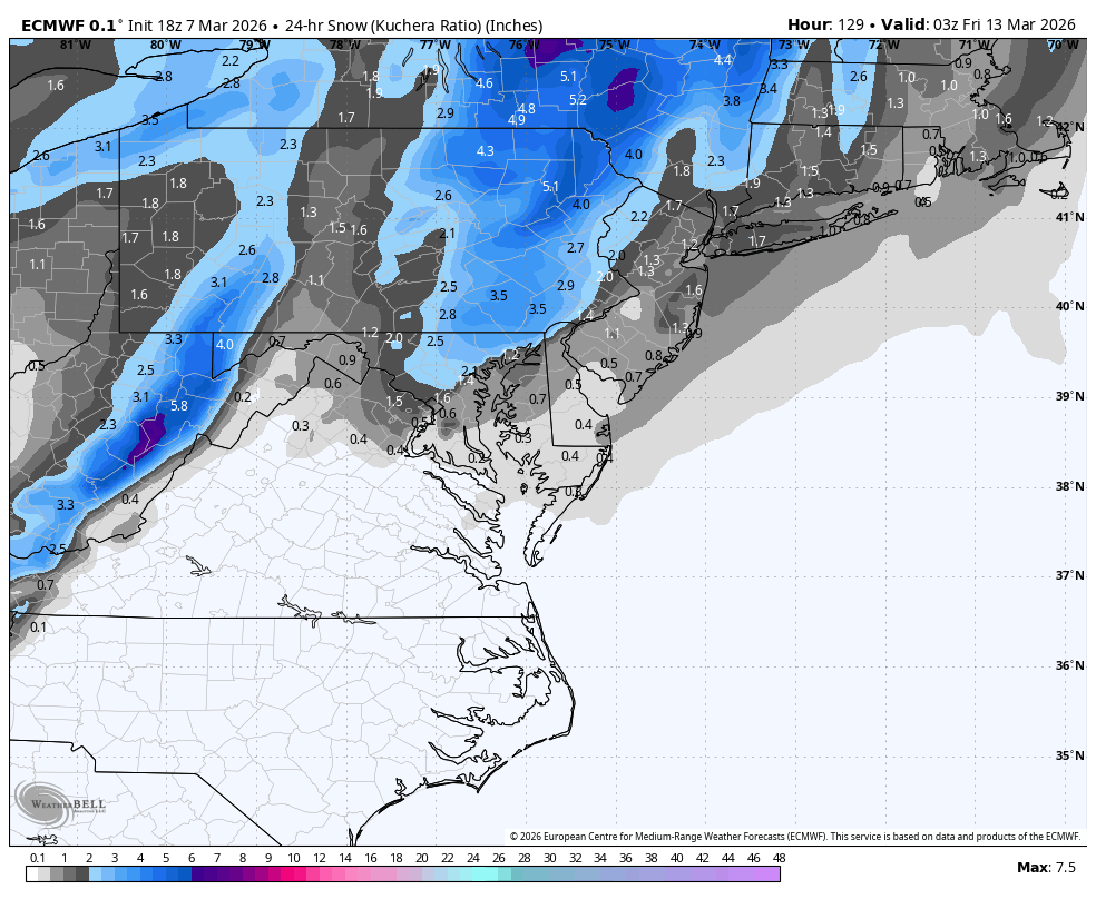
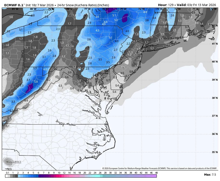
back end snow action on the euro for march 12
-
After a cold March 12th-13th and then a couple of days of mild, the EW are still showing ~7-8 days of BN dominant cold in the E US that ends ~Mar 23rd. After that, they show back and forth averaging NN into early April.
-
Models are also showing waves along cold fronts ( rain to snow) Active pattern coming

-


-
Nice. Wish I had a pool.
-
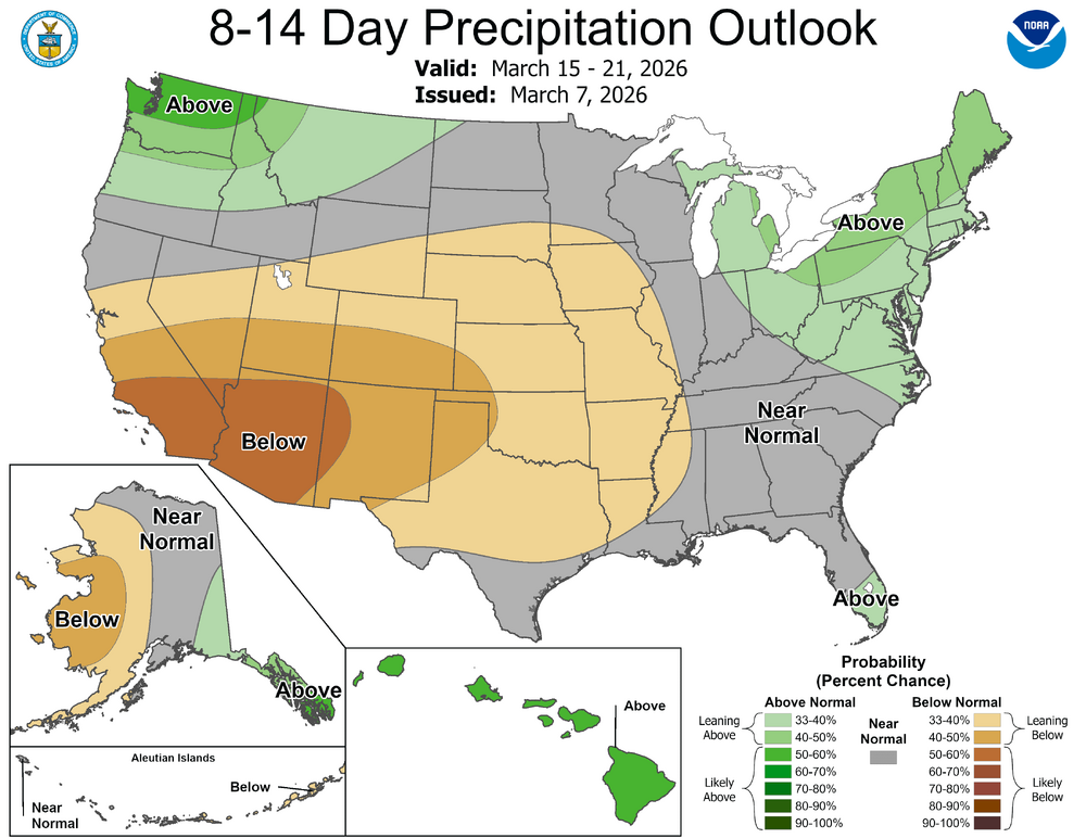
Fast retreating snow cover:
-

Central PA Spring 2026 Discussion/Obs Thread
Ruin replied to Voyager's topic in Upstate New York/Pennsylvania
in time they will all loose it then the ghost of the storm will show for a run or 2 then vanish its how it works -
Central PA Spring 2026 Discussion/Obs Thread
Ruin replied to Voyager's topic in Upstate New York/Pennsylvania
I have seen a ton of talk about this all the time if we are just a inch down they talk about this on the local news weather. infact last spring was very wet we were up like 4.00 inches for the year it didnt rain for a week and we were down like -1 inch for the year? they honestly havent relaly stopped talking about it even during the cold snap -
That usually works out well for us. having the pool fully renovated starting Monday. Turn the page.