
All Activity
- Past hour
-

2026-2027 Super El Nino
Keith Central PA replied to Stormchaserchuck1's topic in Weather Forecasting and Discussion
Here's your 4 analogs 72-73,82-83,97-98 and 15-16..all had above normal temps..72-73 and 97-98 was virtually a shutout..82-83 and 15-16 had a historic blizzard. That's a good rundown of what you might expect. -

2026-2027 Super El Nino
FPizz replied to Stormchaserchuck1's topic in Weather Forecasting and Discussion
It is the opposite of end of the spectrum from half all the clowns you post 24/7 as if you work for them -
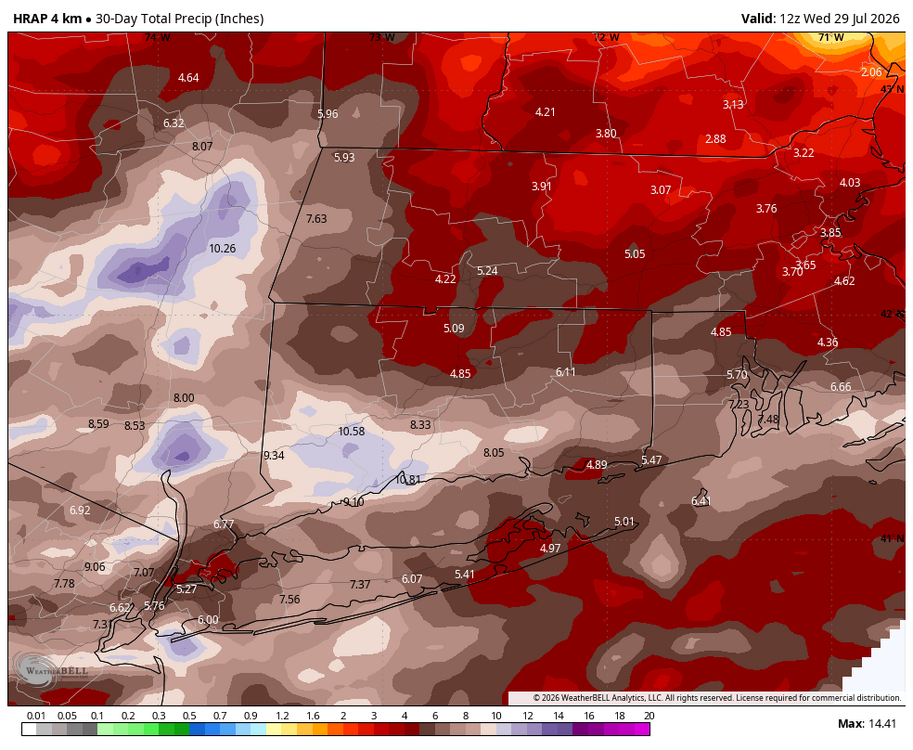
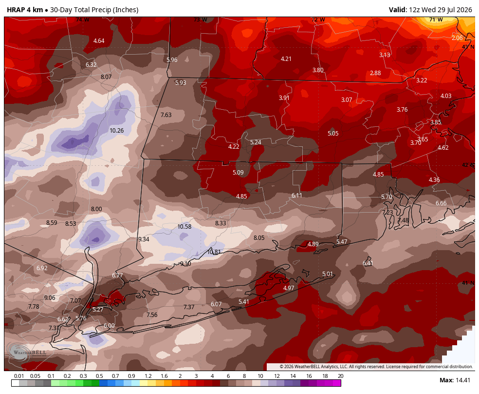
 hard to get another inch out of this last lighter batch...but still crazy almost a foot of rain without a tropical storm setup
 -
Boring. Hopefully a cat 3 comes up the bay in September bringing a tornado swarm and big river flooding to make up for this historically boring pattern we've been stuck in since sleet fest in January.
-
Day 3 marginal risk issued for middle TN and south ky north Alabama .
-
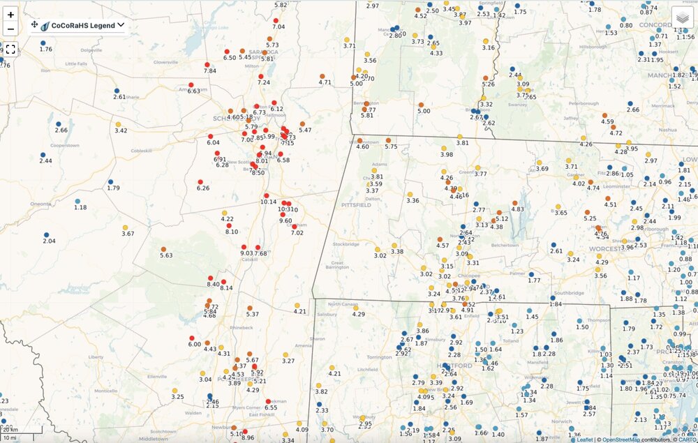
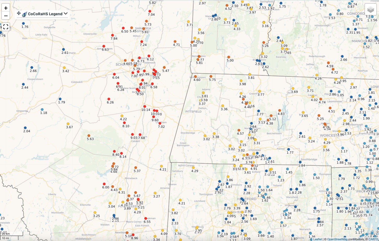
 6.09” just this morning in Yawgoog ,RI that no one has ever heard of ( even people that live there)
 -
The 10.31 in North Chatham is intense.
-
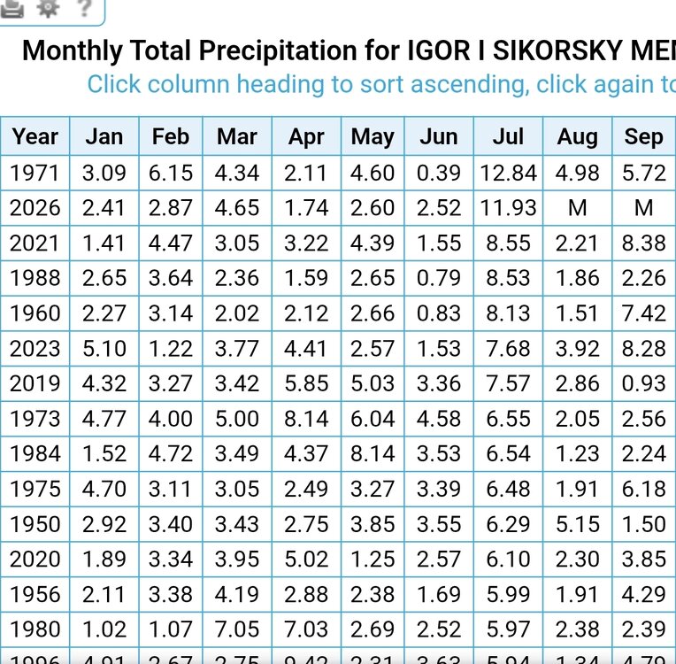
 More rain coming in for BDR. Hopefully they will pull of the wettest July on record.
.thumb.png.61e7c250ce1b71291c143de39b88b6f8.png)
-
 Through 8am yesterday
 -
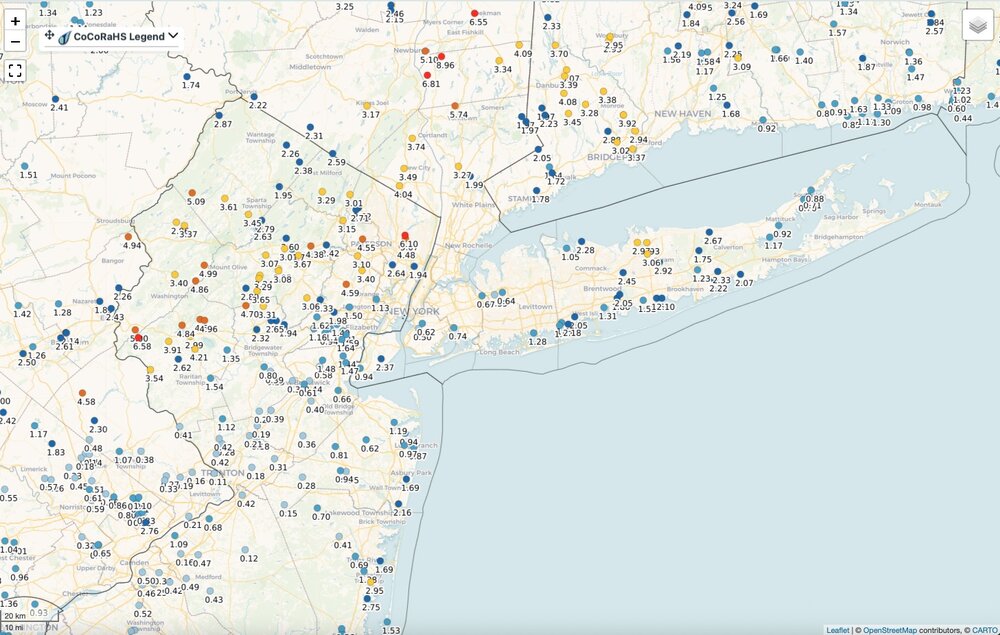
 Is that updated? I think Hubbdave had more yesterday alone than that map is showing. And that 5.09 near BDL seems low. They've had over 4" just from this storm.
 -
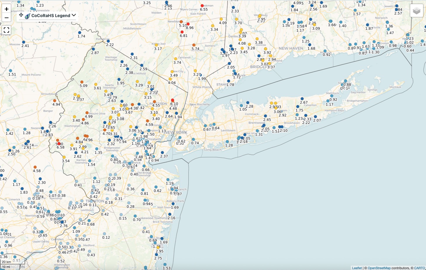
Rainfall totals covering the entire event. Surprised the totals over the western third of Massachusetts are not higher given the radar over that area most of yesterday. Click to enlarge.
-
clouds clinging like glue as they always do in these setups - again Wildwood and Cape May look like the winners with mostly sunny
-
 This whole thing has largely missed my area. I don't mind at all!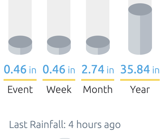
-
 Trust me it was tempting to drive right into it
 -
Not that 5-6” is Stein by any means. But definitely has the right idea around here
-
I was hoping it was done, but no... It's been a thick, heavy mist for a while now and it looks like another slug of rain incoming.
- Today
-
Insane month here starting with the 7/4 severe event and then 4 events of excessive rainfalls
-
Congrats DC
-
Purple jack over Seymour . Home wether station is 16.7” with more heavy rain moving in wild. August promises to start wet too maybe we remove all drough from southern CT.
-
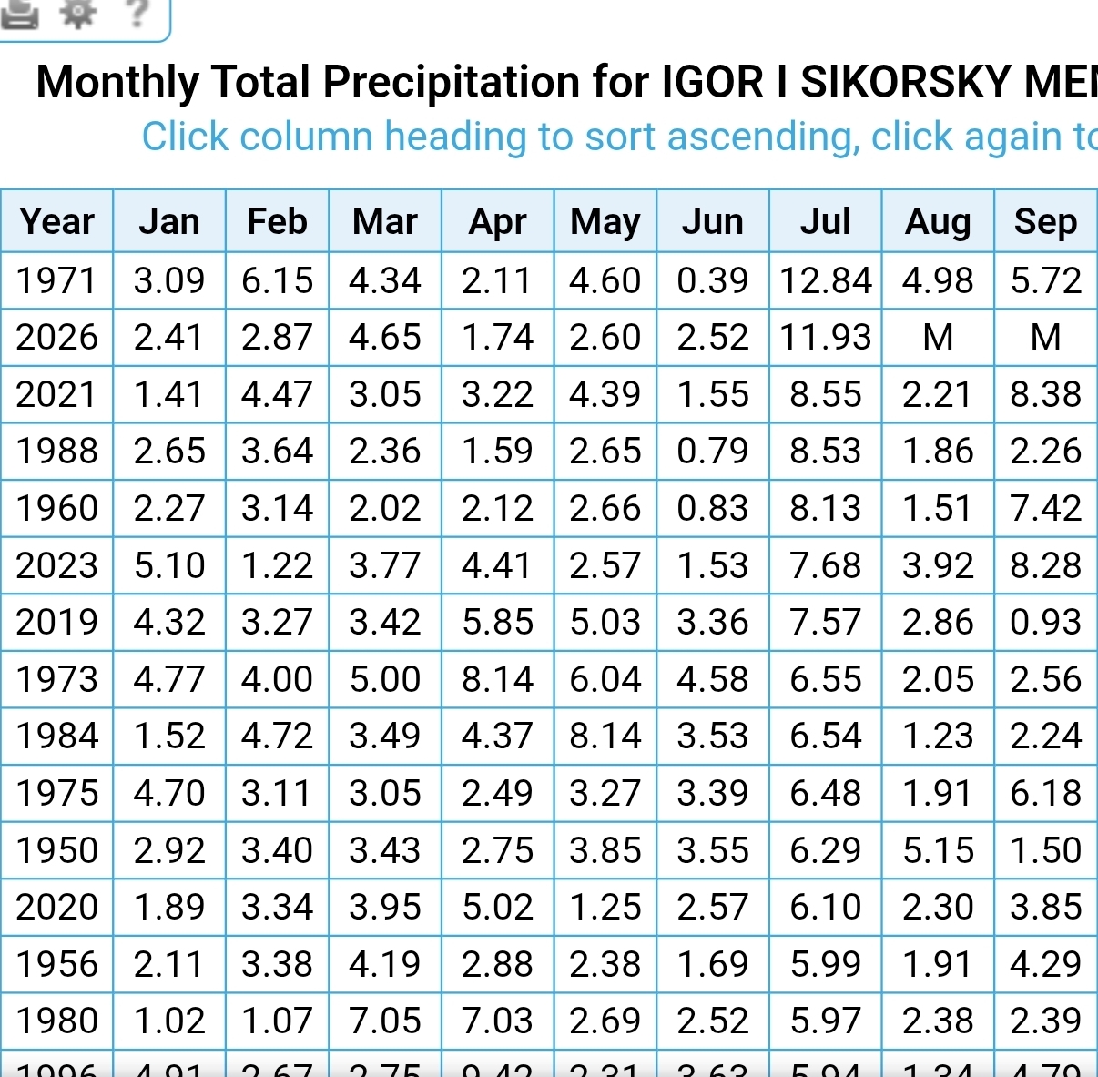
After some more showers last evening and this morning I'm at 11.73" for July.
-
(002).thumb.png.6e3d9d46bca5fe41aab7a74871dd8af8.png)
Central PA Summer 2026 Discussion/Obs Thread
ChescoWx replied to Voyager's topic in Upstate New York/Pennsylvania
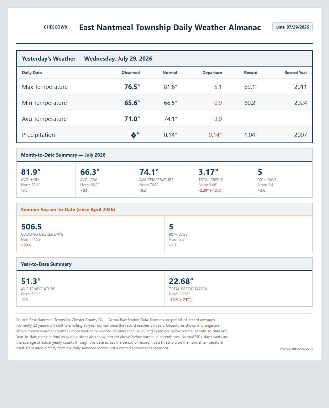
Our great weather continues with temperatures not far from normal as we close out July and move into August. Our next rain chances start to increase by Sunday.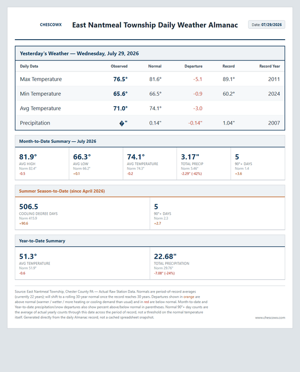
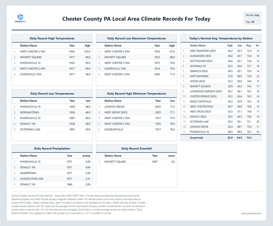
-
E PA/NJ/DE Summer 2026 Obs/Discussion
ChescoWx replied to PhiEaglesfan712's topic in Philadelphia Region
Our great weather continues with temperatures not far from normal as we close out July and move into August. Our next rain chances start to increase by Sunday.
-
.35 in the bucket today. Not sure how much more we get.
-
Yesterday held in the 60s for all 24 hours. That had to be close to a record low max for a day without precipitation, even out here. Hope you have a fun weekend!
-
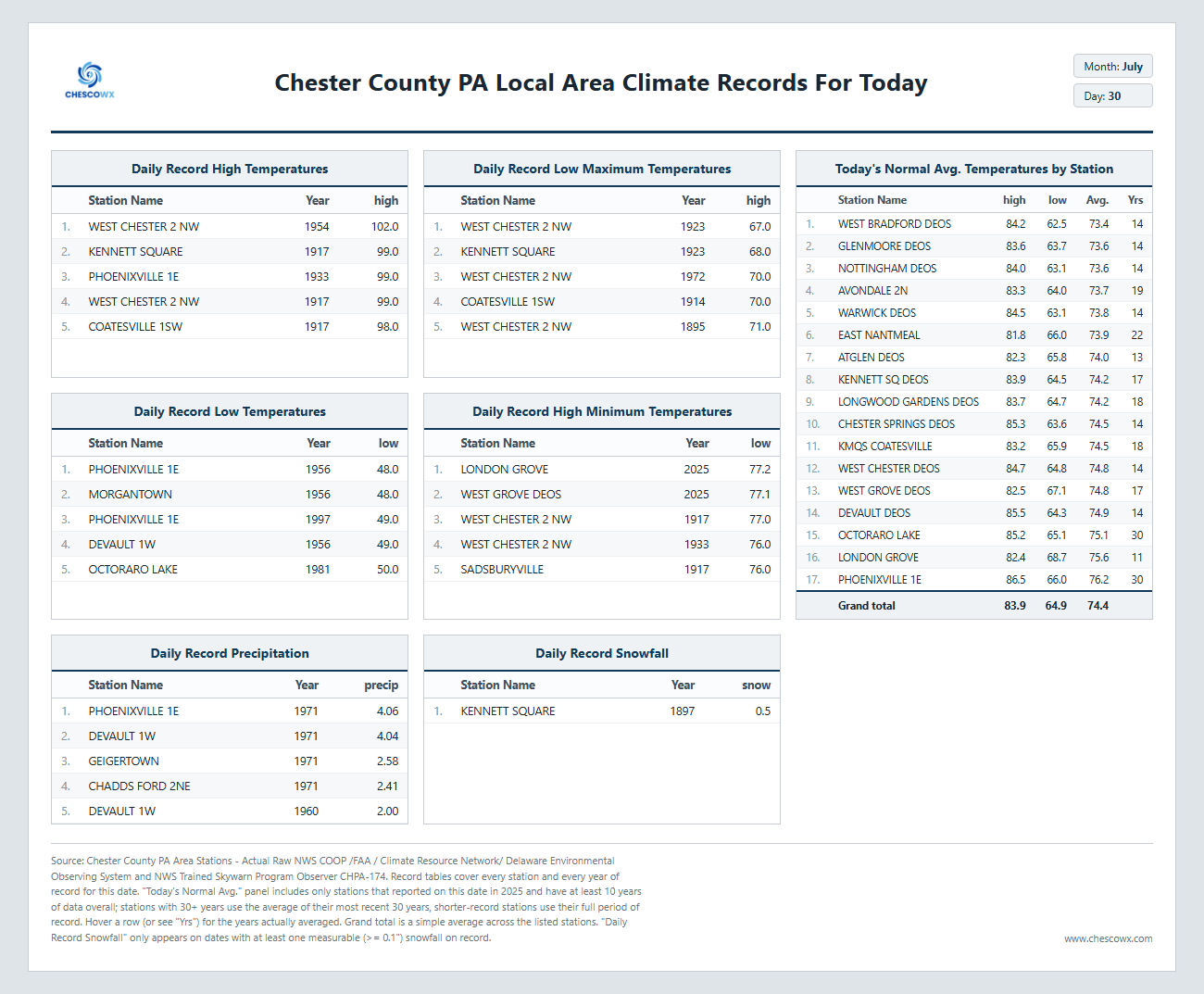
July 30 1971: A cool spell across Minnesota brings frost to northern Minnesota. Freezing temperatures are reported as far south as Pipestone. For Thursday, July 30, 2026 1949 - The state record for Connecticut was established when the town of Greenville registered an afternoon high of 102 degrees. (The Weather Channel) 1965 - The temperature at Portland, OR, reached 107 degrees to equal their all-time record high. (The Weather Channel) 1979 - A forty-minute hailstorm bombed Fort Collins, CO, with baseball to softball size hail. Two thousand homes and 2500 automobiles were damaged, and about 25 persons were injured, mainly when hit on the head by the huge stones. A three month old baby died later of injuries. (The Weather Channel) 1987 - Afternoon highs of 105 degrees at Aberdeen SD, 102 degrees at Bismarck, ND, and 102 degrees at Pueblo, CO, were records for the date. Pueblo, CO, reported just .09 inch of rain for the first thirty days of the month. (The National Weather Summary) 1988 - A dozen cities in the north central and northeastern U.S. reported record high temperatures for the date. Downtown Baltimore, MD, hit 103 degrees, marking a record eight days of 100 degree heat for the month, and ten for the year. The high of 101 degrees at Billings, MT, marked a record seventeen days of 100 degree heat for the year. Thunderstorms produced severe weather in the northeast, with nearly fifty reports of large hail or damaging winds in Pennsylvania and New York State. A tree fell on a car at Erie, PA, injuring four persons. (The National Weather Summary) (Storm Data) 1989 - Morning thunderstorms over central Missouri deluged Columbia with 5.98 inches of rain causing flash flooding. Daytime thunderstorms in Kentucky drenched Paducah with 1.73 inches of rain in less than half an hour. Evening thunderstorms in the north central U.S. produced wind gusts to 78 mph east of Moccasin, MT. (The National Weather Summary) (Storm Data) Observances: 30 Thu National Cheesecake Day 30 Thu National Father-in-Law Day 30 Thu World Day Against Trafficking in Persons 30 Thu International Friendship Day 30 Thu National Intern Day 30 Thu International Day of Friendship 30 Thu National Support Public Education Day 30 Thu National Whistleblower Day 30 Thu Paperback Book Day 30 Thu Share a Hug Day 30 Thu World Snorkeling Day



.png.dbd7b694529b0d420363801948e746b1.png)








.thumb.JPG.418e8a9a2902ae687ec35ff4bc0e038e.JPG)
